A journey through underground lava caves, enormous balancing rocks, and breathtaking canyons.
A Guide to Arizona’s Most Striking Natural Wonders

Arizona has some of the most beautiful and surprising landscapes the American West has to offer. The geography of this northeastern stretch of the Sonoran desert can be incredibly dramatic. And while we’ve all heard of—or seen—the majesty of the Grand Canyon, there are a number of lesser-known natural wonders that will take you off the beaten path in this gorgeous state.
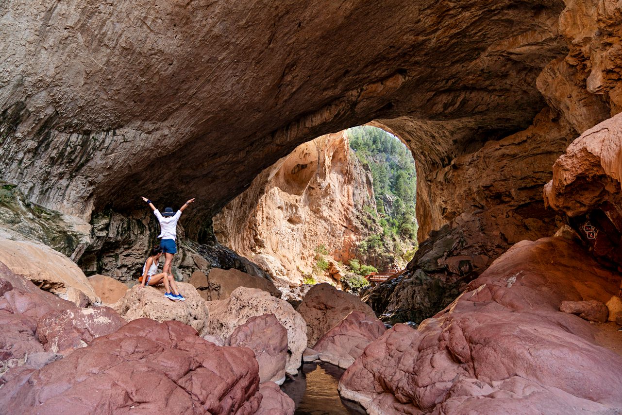
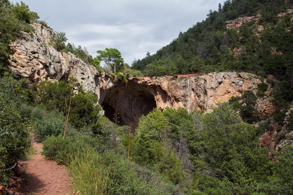
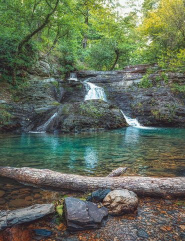
1. Tonto Natural Bridge
Walking beneath Tonto Natural Bridge in central Arizona feels like walking through a portal to another world. The bridge is believed to be the largest “travertine” bridge of its kind, meaning it’s made from limestone deposited around mineral springs. There are pools at its feet, and a verdant coat of greenery above it, making for a striking vista. The bridge was authorized as a state park in the late 1960s, and is reachable by trail. There’s a more accessible paved trail that accommodates all sorts of hikers, and a rougher unpaved trail that follows the nearby riverbed. On a hill above the bridge also sits the historic Goodfellow Lodge, which is beautiful to look at but not currently open for reservations.
Nf-583A, Pine, AZ 85544
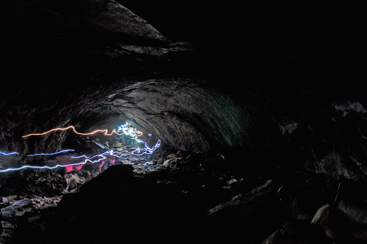
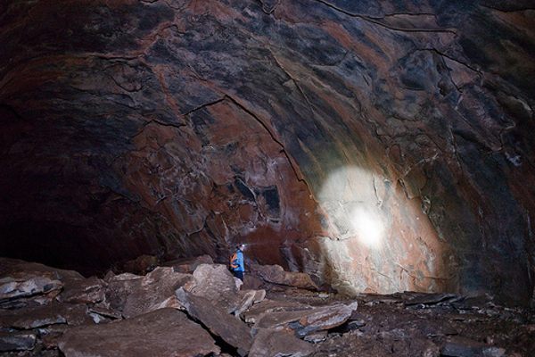
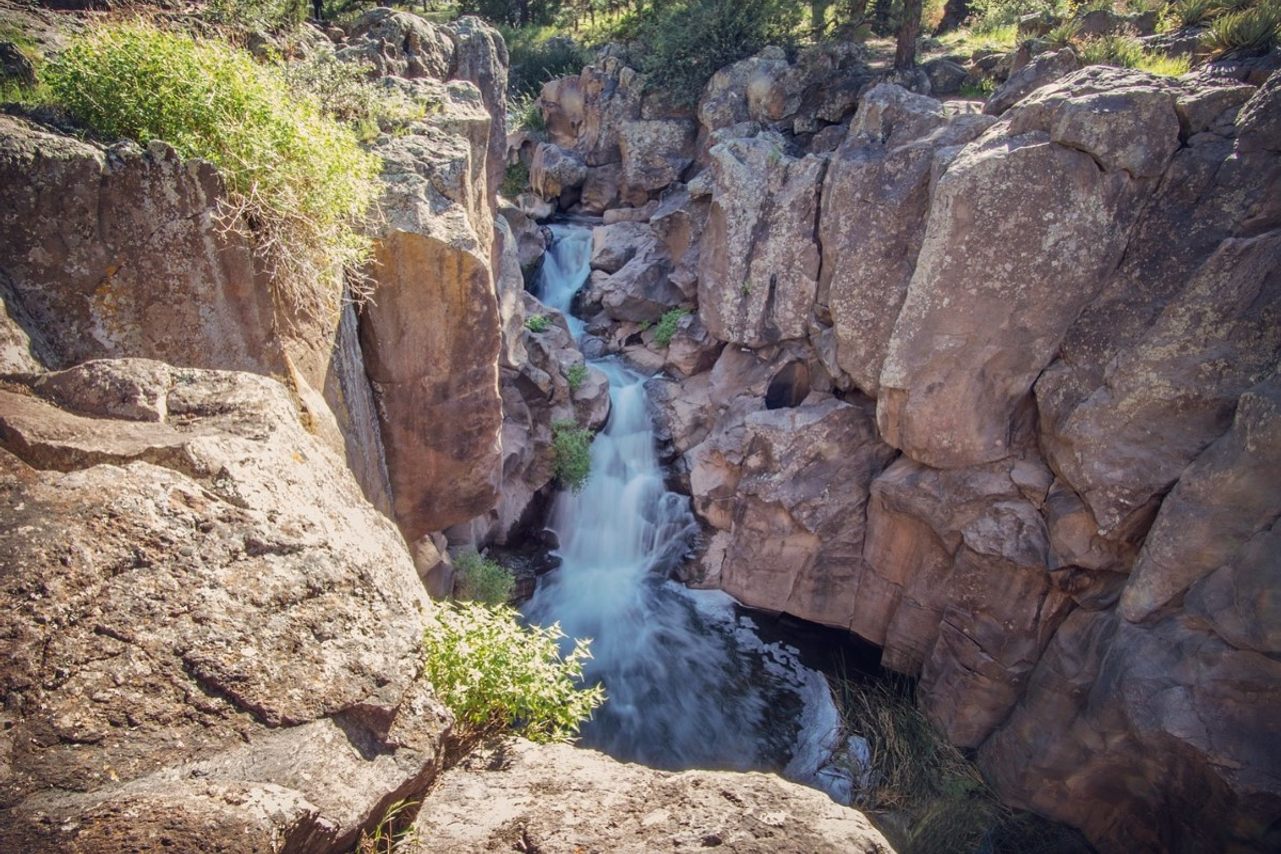
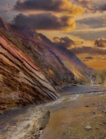
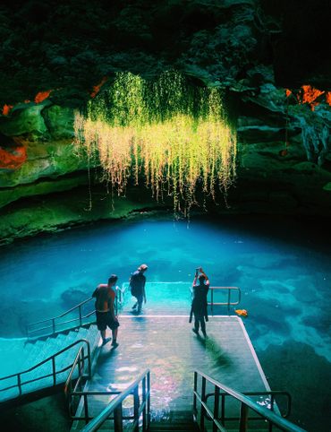
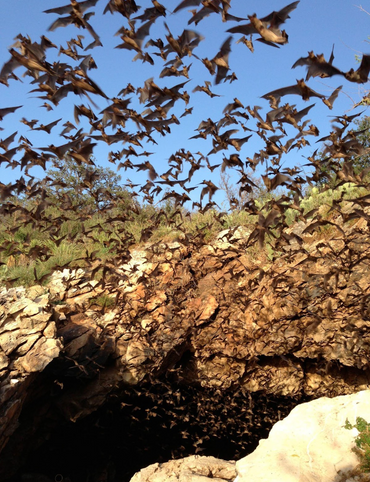
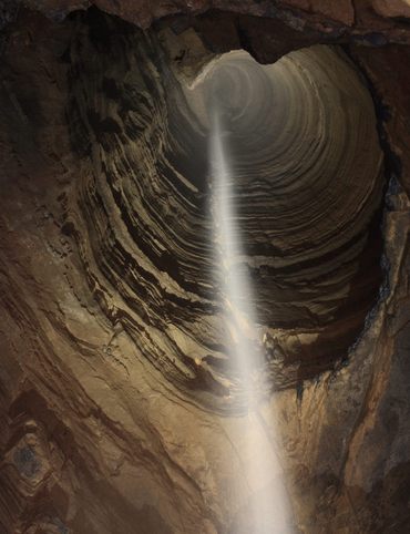
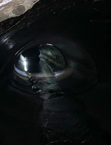
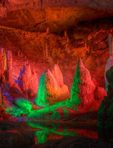
2. Coconino Lava River Cave
While Arizona is known for its many above-ground wonders, it also offers special underground marvels, too. This massive cave in the Coconino National Forest near Flagstaff is staggering; at its highest point, the cave walls reach 30 feet, and it’s all thanks to lava. Unlike other caves, where you’ll find stalagmites and stalactites hanging above and below you, this cave has smooth walls: it was formed from a giant lava flow whose exterior hardened but whose interior stayed molten, creating an underground tube. While other lava tube caves exist in the world, this one is notable for a Y-shaped intersection deep inside, which implies two tubes of lava flowing into one. If you’ve ever dreamed of spelunking, don’t miss it.
171B Forest Rd, Flagstaff, AZ 86001
3. Picture Canyon
Between 700 and 1300 B.C. what is now Flagstaff, AZ was inhabited by the Sinagua people, whose petroglyphs still decorate this canyon that lies inside the city’s borders. These petroglyphs depict geometric shapes and scenes of tribal life, including archers, and local animals like deer, elk, bighorn sheep, and water birds.
For a long time, as the city of Flagstaff expanded, few people knew about these petroglyphs. The area was damaged in the 20th century by looters, trash heaps, and a gas line. Eventually, local residents advocated for a cleanup of the area, and the canyon preserve was added to the National Register of Historic Places in 2008.
Today, the preserve includes three trails of varying lengths as well as a waterfall accessible from the Tom Moody trail. The petroglyphs are visible throughout the park, a striking bit of art history within the city of Flagstaff.
Flagstaff, AZ 86004
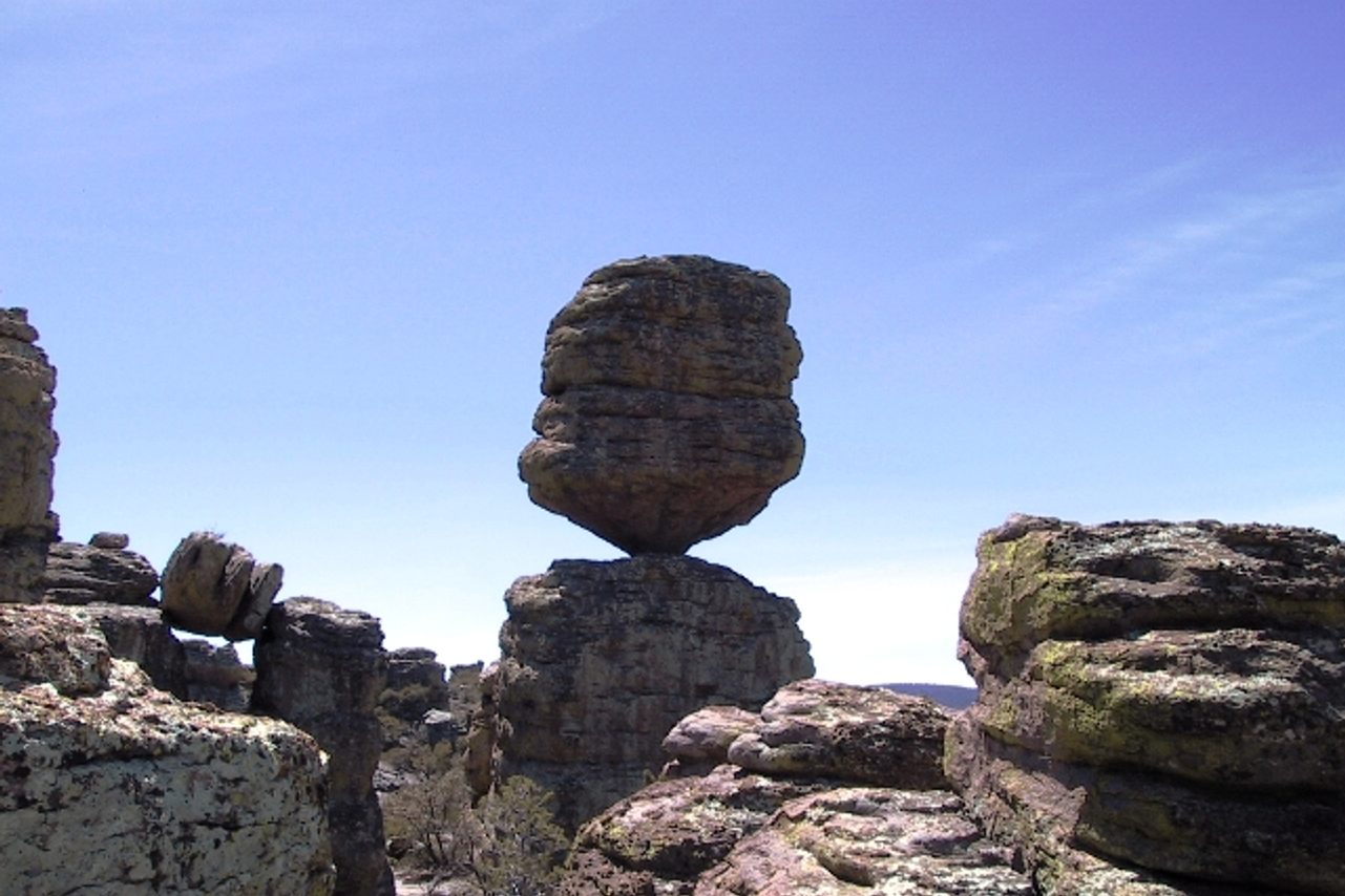
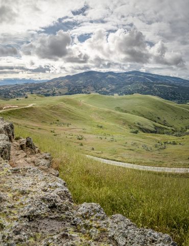
4. Heart of Rocks Loop
This trail shows you some of the greatest, most dramatic rock formations in the state of Arizona. The stars of the show are “hoodoos,” or pinnacles of the Chiricahua National Monument, formations that the Apaches called “standing up rocks”. These tall rock spires are formed by erosion, when a soft rock like mudstone is covered by a thin layer of hard rock like limestone; cracks in the outer layer allow the interior soft rock to erode. These hoodoos are made from small caps of harder rock, which protect what’s left of the interior layer from erosion.
There are a few particularly famous rock formations among these hoodoos: Totem Pole Rock is impressively tall and even, like its namesake; Big Balanced Rock connects to its supportive base by an improbably narrow neck, like an hourglass; Mushroom Rock has a tiny base and an enormous head, and looks like something dropped down to earth. Among the rocks are also a wide range of plants, like prickly pear cactus. These sights make for one of the most scenic and undersung hiking routes in the state.
Balanced Rock Trl, Willcox, AZ 85643
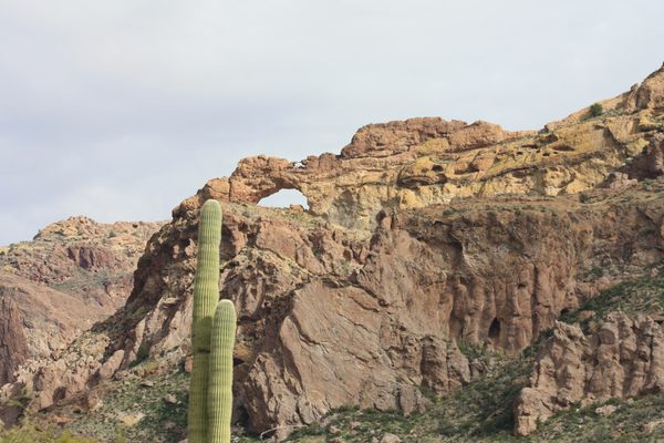
5. Arch Canyon Trail
Just 14 miles north of the US-Mexico border, Arch Canyon Trail lies within Organ Pipe Cactus National Monument. The monument, which is also a UNESCO biosphere, was designated to protect its namesake cactus, and is the only place in the country where the senita and organ pipe cacti grow wild. While hundreds of miles of trails wind through the park, Arch Canyon Trail offers some of the most spectacular vistas.
The trail is deceptively strenuous: while the official trail is an easy 1.2 miles, adventurous climbers have designated a scramble of a trail up 2.4 more miles of hiking-slash-climbing that ends at a pair of natural arches and breathtaking views of the park; you can easily see into Mexico, and far across the state, from that vantage point. Just be very careful when you’re climbing.
Ajo Mountain Dr, Ajo, AZ 85321
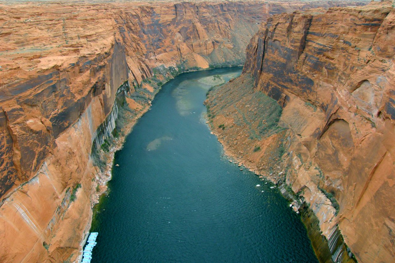
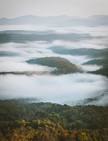
6. Glen Canyon
From above, Glen Canyon looks like a picturesque, pre-programmed laptop screensaver. The green-tinged, man-made Lake Powell weaves through what was once a canyon. In the late 1960s, the United States Bureau of Reclamation built a dam on the Colorado river to create the lake, and filled the canyon to the dismay of many environmentalists. Edward Abbey, the crotchety poet laureate of the American West, likened the canyon’s beauty to that of the Taj Mahal after rafting through it in the pre-dam days.
Now, thanks to climate change, drought and decreasing water levels, Glen Canyon and its wind-smoothed walls are becoming more visible. Certain areas once reachable by boat are now reachable by hike. The Glen Canyon National Recreation Area is enormous: it spans over 1.25 million acres. All of this makes it an excellent place for leisure tourists in boats and intrepid hikers alike.
4304 Bullfrog, Lake Powell, UT 84533
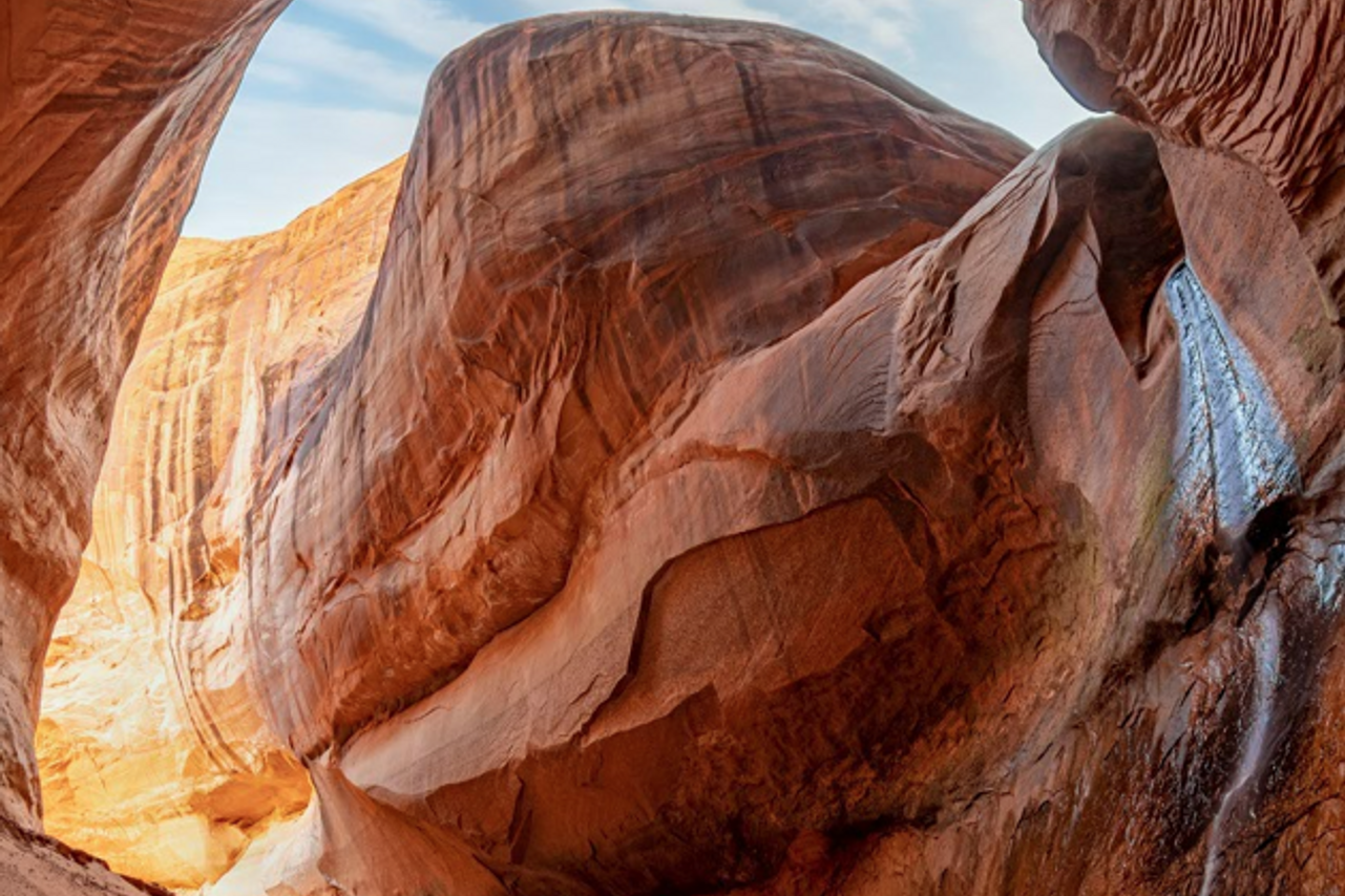
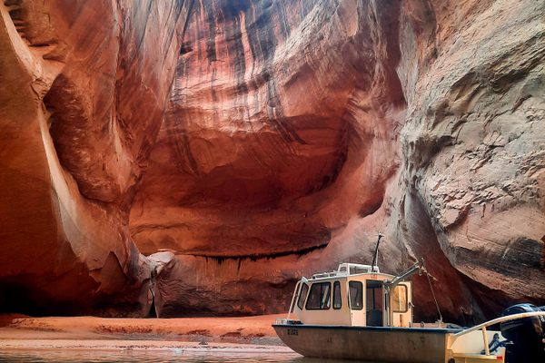
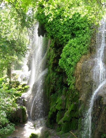
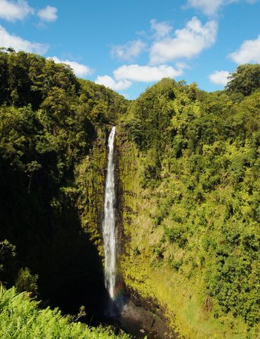
7. Cathedral in the Desert
If you’re already in Glen Canyon, you can’t miss Cathedral in the Desert. This natural wonder has been exposed in recent years, given decreasing water levels; now it’s possible to hike in to see this awe-inspiring monument. In wetter years, this natural “amphitheater” lies 100 feet below the surface of Lake Powell. When the water drops low enough, you can see the canyon formation that mimics a cathedral: the sandstone canyon walls feature projections that resemble a church’s spires. At one end, a 60-foot waterfall pours into the canyon. Whether or not you’re interested in “holy” places, this is one you won’t forget.
Lake Powell, Utah United States
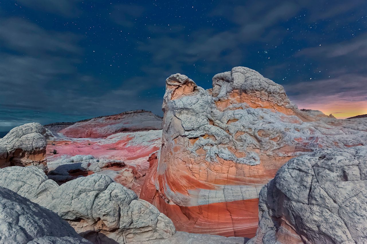
8. White Pocket
This is another geological wonder that seems to have been plucked from a screen saver, or land art catalog, or big-budget science fiction film. White Pocket forms part of the Paria Plateau in the Vermillion Cliffs National Monument; it constitutes a collection of white-capped domes and ridges beneath a large mesa. It’s called a “pocket” because it’s a small bit of land that’s notably different from its surroundings—here, those surroundings are unassuming plains, sandy and spotted with bushes. Among them appears the pocket, with its variegated, swooping patterns that at times look like a wide, flat waterslide sloping towards a nearby pond. Accessing White Pocket can be tricky: a four-wheeler is mandatory, so your best bet is to hire a local guide.
Arizona 86036
This post is sponsored by Visit Arizona. Click here to explore more.

Gastro Obscura’s 11 Essential Places to Eat and Drink in Bangkok

Gastro Obscura’s 10 Essential Places to Eat and Drink in Rome

The Explorer’s Guide to Road Tripping Around the Great Lakes
10 National Parks That Are Perfect for a Road Trip
10 Out-of-This-World Places You Can Reach in Your Car
The Explorer’s Guide to Road Tripping Around Appalachia

The Explorer’s Guide to Road Tripping Down Highway 61

Gastro Obscura’s 10 Essential Stops on an Alternative London Pub Crawl
The Explorer’s Guide to Joshua Tree National Park

The Explorer’s Guide to the Great Smoky Mountains National Park
Cosmic Colorado: A Stargazer’s Guide to the Centennial State
The Explorer’s Guide to Banff National Park
10 Wild Places That Define West Virginia’s Landscape
The Ultimate Guide to Hidden Red Rocks: 10 Secret Passageways, Artifacts, and Ghost Stories

The Explorer’s Guide to Williamsburg, Virginia

The Explorer’s Guide to the British Virgin Islands

Gastro Obscura’s 10 Essential Places to Eat, Drink, and Shop in Hong Kong

A Denver Guide for National Park Lovers

Gastro Obscura’s 10 Essential Places to Eat and Drink in Oaxaca

A Gastro Obscura Guide to Family-Friendly Dining in San Diego
The Explorer’s Guide to Outdoor Wonders In Maryland

The Secret Lives of Cities: Ljubljana

From Cigar Boom to Culinary Gem: 10 Essential Spots in Ybor City
The Explorer’s Guide to Wyoming’s Captivating History

A Nature Lover’s Guide to Sarasota: 9 Wild & Tranquil Spots
California’s Unbelievable Landscapes: A Guide to Nature’s Masterpieces

The Ultimate California Guide to Tide Pools and Coastal Marine Life
Explore California on Foot: Nature’s Year-Round Playground

Mardi Gras 9 Ways: Parades, Cajun Music, And Courirs Across Louisiana

The Explorer’s Guide to Winter in Germany
Ancient California: A Journey Through Time and Prehistoric Places
The Wildest West: Explore California’s Ghost Towns and Gold Fever Legacy

Sweet California: A Culinary Guide to Tasty Treats Across the State
Sea of Wonders: An Itinerary Through California’s Stunning Shoreline

10 Places to Taste Catalonia’s Gastronomic Treasures
Atlas Obscura’s Guide to Palm Springs
Atlas Obscura’s Guide to the 10 Most Mystifying Places in Illinois
10 Fascinating Sites That Bring Idaho History to Life

North Carolina's Paranormal Places, Scary Stories, & Local Haunts
Exploring Missouri’s Legends: Unveiling the Stories Behind the State’s Iconic Figures

These Restaurants Are Dishing Out Alabama’s Most Distinctive Food

A Gastro Obscura Guide to Los Cabos
9 Watery Wonders on Florida’s Gulf Coast
Discover the Surprising and Hidden History of Monterey County

Gastro Obscura’s Guide to Eating Your Way Through Charlotte
Talimena Scenic Byway: 6 Essential Stops for Your Arkansas Road Trip
9 Amazing Arkansas Adventures Along the Scenic 7 Byway
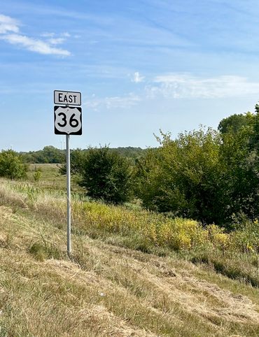
The Explorer's Guide to Highway 36: The Way of American Genius

A Behind-the-Scenes Guide to DC’s Art and Music

9 Places Near Las Vegas For a Different Kind of Tailgate

10 Places to See Amazing Art on Florida's Gulf Coast

8 Reasons Why You Should Visit the Bradenton Area

A Music Lover’s Guide to New Orleans

Gastro Obscura’s Guide to Sipping Wine in Catalonia

9 Hidden Wonders in the Heart of Kansas City
10 Unexpected Delights of Vermont's Arts and Culture Scene

Gastro Obscura’s Guide to Eating Through Maine

The Gastro Obscura Guide to Asheville Area Eats

Gastro Obscura’s Guide to St. Pete/Clearwater
9 Hidden Wonders in Eastern Colorado
7 Places to Experience Big Wonder in Texas

8 Out-There Art Destinations in Texas
6 Ways To See Texas Below the Surface
9 Places to Dive Into Fresh Texas Waters

7 Ways to Explore Music (and History) in Texas

8 Ways to Discover Texas’ Rich History
The Explorer’s Guide to the Northern Territory, Australia

The Explorer's Guide to U Street Corridor

Gastro Obscura Guide to Southern Eats

Only In Delaware

The Secret History & Hidden Wonders of Charlotte, North Carolina
Exploring Colorado's Historic Hot Springs Loop
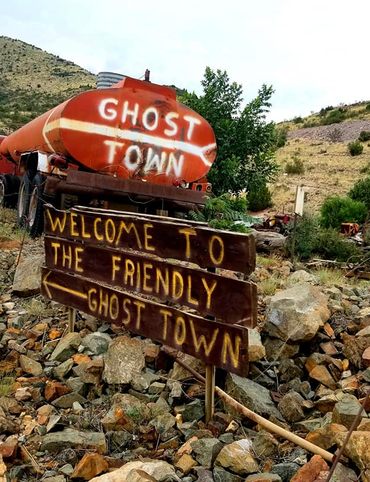
These 8 Arizona Ghost Towns Will Transport You to the Wild West

The Explorer's Guide to Hudson Valley, New York
Discover the Endless Beauty of the Pine Tree State
Travel to New Heights Around the Pine Tree State
8 Historical Must-Sees in Granbury, Texas
7 Creative Ways to Take in San Antonio’s Culture
Eat Across the Blue Ridge Parkway

6 Ways to Absorb Addison, Texas’ Arts and Culture

6 Ways to Take in the History of Mesquite, Texas

6 Ways to Soak Up Plano’s Art and Culture
9 Dallas Spots for Unique Art and Culture

7 Sites of Small-Town History in Waxahachie, Texas

6 Natural Wonders to Discover in Austin, Texas
Discover the Secrets of Colorado’s Mountains and Valleys
A Road Trip Into Colorado’s Prehistoric Past

A Feminist Road Trip Across the U.S.

All Points South
Asheville: Off the Beaten Path

Restless Spirits of Louisiana

Eat Across Route 66

18 Mini Golf Courses You Should Go Out of Your Way to Play

4 Underwater Wonders of Florida

6 Spots Where the World Comes to Delaware

Study Guide: Road Trip from Knoxville to Nashville

6 Wondrous Places to Get Tipsy in Missouri
Rogue Routes: The Road to Pikes Peak

Rogue Routes: The Road to Carhenge

4 Pop-Culture Marvels in Iowa
7 Stone Spectacles in Georgia
6 Stone-Cold Stunners in Idaho
8 Historic Spots to Stop Along Mississippi's Most Famous River
5 Incredible Trees You Can Find Only in Indiana

5 Famous and Delightfully Obscure Folks Buried in Kentucky
4 Wacky Wooden Buildings in Wyoming
7 Spots to Explore New Jersey’s Horrors, Hauntings, and Hoaxes

4 Out-There Exhibits Found Only in Nebraska

6 Sweet and Savory Snacks Concocted in Utah

12 Places in Massachusetts Where Literature Comes to Life

8 Places to Get Musical in Minnesota

8 Buildings That Prove Oklahoma's an Eclectic Art Paradise

9 Stunning Scientific Sites in Illinois

5 Strange and Satanic Spots in New Hampshire
8 Historic Military Relics in Maryland

5 of Colorado's Least-Natural Wonders
Rogue Routes: The Road to Sky’s the Limit
6 Hallowed Grounds in South Carolina
9 Rocking Places in Vermont

Knoxville Study Guide

Nashville Study Guide
Rogue Routes: The Road to Camp Colton

Black Apples and 6 Other Southern Specialties Thriving in Arkansas

4 Monuments to Alabama’s Beloved Animals
The Dark History of West Virginia in 9 Sites
11 Zany Collections That Prove Wisconsin's Quirkiness
7 Inexplicably Huge Animals in South Dakota

6 Fascinating Medical Marvels in Pennsylvania

8 Places in Virginia That Aren’t What They Seem
7 Cool, Creepy, and Unusual Graves Found in North Carolina
7 of Montana's Spellbinding Stone Structures
9 of Oregon’s Most Fascinating Holes and Hollows

Take to the Skies With These 9 Gravity-Defying Sites in Ohio
9 Strange and Surreal Spots in Washington State
8 Watery Wonders in Hawaiʻi, Without Setting Foot in the Ocean

6 Unusual Eats Curiously Cooked Up in Connecticut

11 Close Encounters With Aliens and Explosions in New Mexico

10 Places to Trip Way Out in Kansas

The Resilience of New York in 10 Remarkable Sites

7 Very Tall Things in Very Flat North Dakota
8 Blissfully Shady Spots to Escape the Arizona Sun

On the Run: NYC

On the Run: Los Angeles
9 Surprisingly Ancient Marvels in Modern California

10 Art Installations That Prove Everything's Bigger in Texas

6 Huge Things in Tiny Rhode Island
7 Underground Thrills Only Found in Tennessee
Sink Into 7 of Louisiana's Swampiest Secrets

7 Mechanical Marvels in Michigan
11 Wholesome Spots in Nevada

7 Places to Glimpse Maine's Rich Railroad History

11 Places Where Alaska Bursts Into Color

9 Places in D.C. That You're Probably Never Allowed to Go

2 Perfect Days in Pensacola
Rogue Routes: The Road to the Ice Castles

Taste of Tucson
North Iceland’s Untamed Coast

Hidden Edinburgh

Hidden Haight-Ashbury

The Many Flavors of NYC’s Five Boroughs

Hidden French Quarter

The Metropolitan Museum of Art

Motown to Music City Road Trip
Gulf Coast Road Trip
Hidden Coachella Valley

Highland Park

Venice

L.A.’s Downtown Arts District

Hidden Trafalgar Square

Secrets of NYC’s Five Boroughs

Mexico City's Centro Histórico

Hidden Hollywood

Hidden Times Square
Summer Radio Road-Trip

Amsterdam

Buenos Aires

Chicago

Detroit

Lisbon

Miami

Queens

San Diego