


About
The Little Truckee River originates as the outflow from Webber Lake, a natural lake, in the Sierra Nevada north of Donner Summit.
It is a substantial stream by the area's standards and even has a couple of reservoirs in its lower reaches. In particular, it is the largest tributary to the main stem of the Truckee River. The Truckee in turn flows east into Nevada and is the primary water source for Reno and much of western Nevada. The Truckee itself ends at Pyramid Lake.
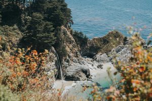
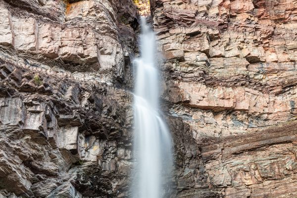
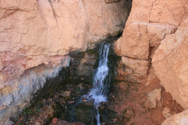
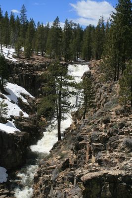
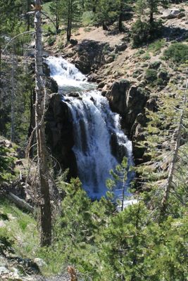
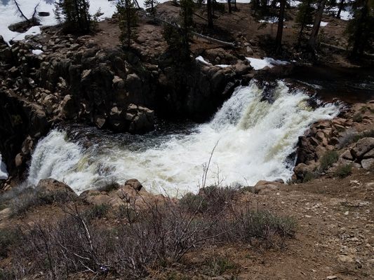
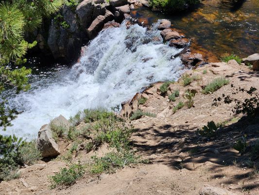
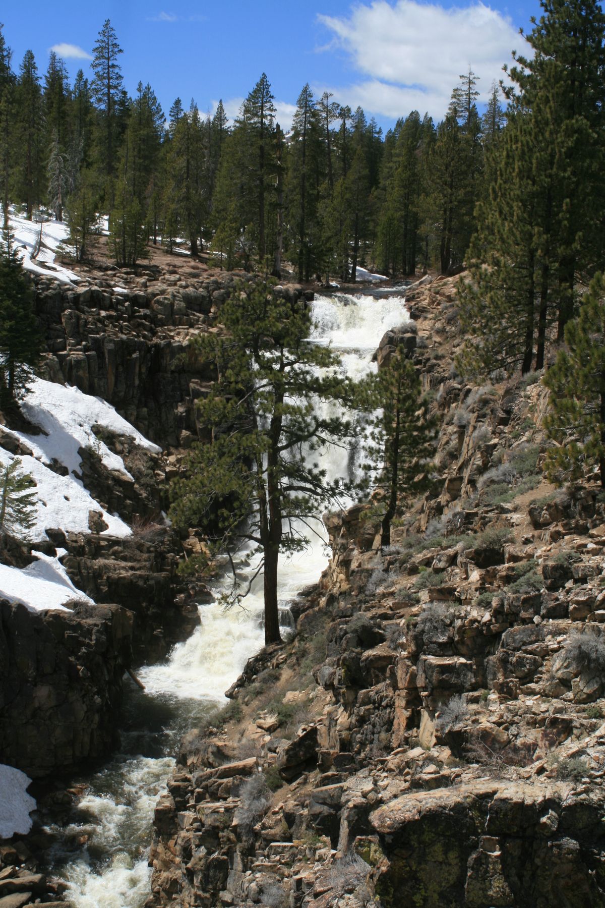
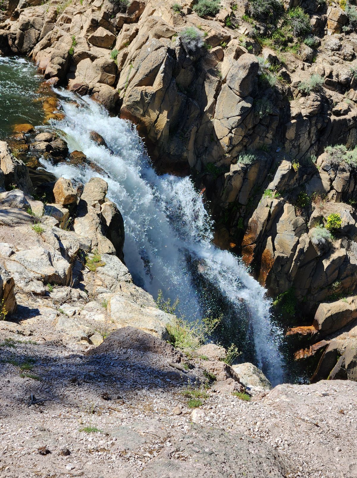
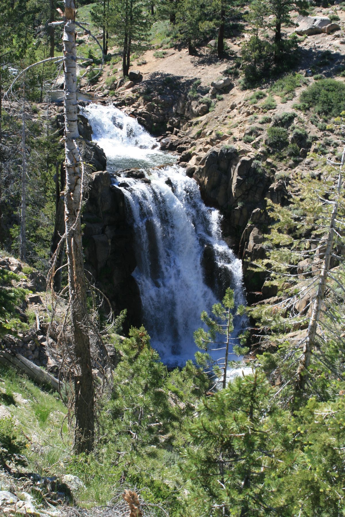
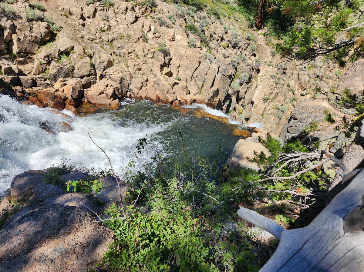
It's less than a mile below its start at the outflow from Webber Lake, and the Little Truckee drops into a narrow canyon over Webber Falls. The falls are about 100 feet high but consist of several steps, of which the lowermost and most significant is about 50 feet tall. They can be spectacular, especially during the spring runoff.
Related Tags
Know Before You Go
Take California State Route 89 14.5 miles north from its intersection with Interstate 80 to County/US Forest Service Road 07, called Fiberboard Road or Jackson Meadows Reservoir Road. Turn left (west) here. This road is narrow but paved. Follow the Fiberboard Road about 6.7 miles to a small, poorly marked parking area on the left. The parking area is about 400 feet beyond the turnoff to Lake of the Woods, which will be on the right.
Drop down on foot from the parking area into the canyon of the Little Truckee. In about 130 feet, you will cross a graded road, the Dog Valley Road or old Henness Pass road. The falls are in the canyon below. There is no developed overlook area or "official" path but just a welter of use paths. The slopes of the canyon are steep with poor footing and lots of loose rock; care is needed, particularly with children and pets.
The Webber Falls trails could be accessed from Dog Valley Road, but the road is very steep and rough east of the falls and would require high clearance and possibly 4WD.
The falls can also be accessed from the south side of the canyon but the route is not as straightforward. Backtrack 1.3 miles along Fiberboard Road from the parking area and make a sharp right onto Dog Valley Road (USFS 07-20), which is a large graded road. You will cross a graded road in 0.7 miles; keep going straight across.
The road becomes USFS road 07-30; continue south 0.3 miles to a concrete bridge over the Little Truckee. About 0.6 miles from the bridge USFS road 07-3010 comes in from the right. Park here. This road makes a hairpin bend, climbing up the flank of the slope back toward the Little Truckee, and is gated but open to non-motorized traffic. About 1,000 feet after the road tops out and bends to the west you can cut cross-country back to the Little Truckee and the falls. A GPS and/or a topographic map will be useful, and experience in cross-country hiking is obviously also a plus.
The USFS writeup in the website is out of date in that Webber Lake is no longer private. It was acquired by Truckee Donner Land Trust some years ago and is now open to the public. It makes a worthwhile side trip while in the area.
The Fiberboard Road, as well as all the graded roads, are not open in the winter except locally to snowmobiles.
Community Contributors
Added By
Published
October 5, 2023