Pine Grove and Rockland
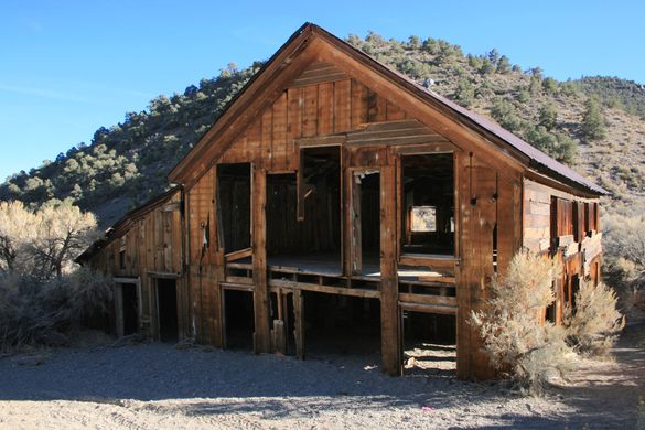
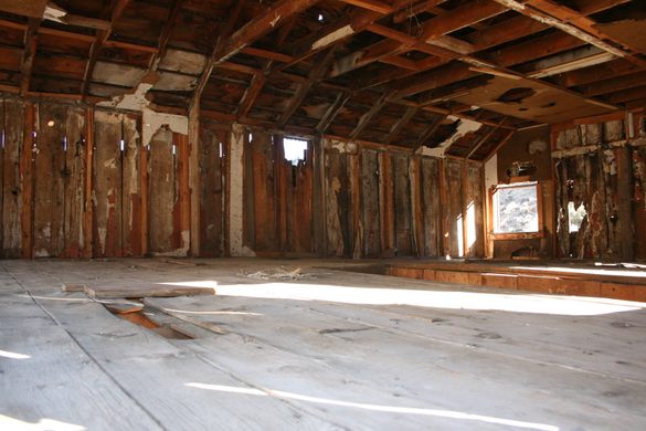
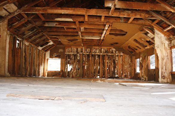
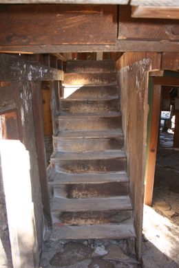
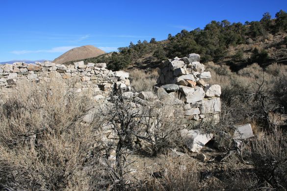
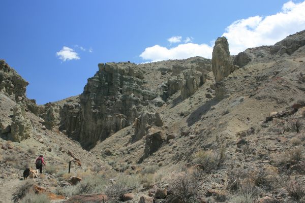
Well-preserved ruins in the Pine Grove Hills of western Nevada.


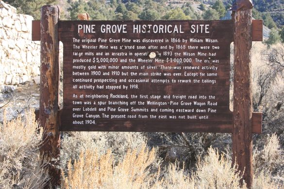

Gold was discovered here in June 1866 by William Wilson, one of the brothers for whom Wilson Canyon is named. A camp, initially named Wilsonville, sprang up, and under the name Pine Grove had a newspaper and post office within two years. The population peaked at around 600 by the early 1870s, and the town became a regional supply center for local ranchers even as production from the two main mines, the Wilson and the Wheeler, began to decline in the 1880s.
The Panic of 1893 was a further blow, and although some further production occurred in the early 20th century, the last residents left in the 1930s. There were some later 20th-century attempts at revival, but although desultory exploration continues even today, no mining is taking place.
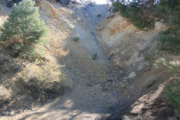
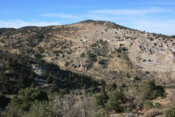
Shortly after the discovery in Pine Grove, in 1868, gold was discovered at Rockland, in the next big canyon a few miles to the south. Production began soon after that, but the company ran into cash-flow problems. This resulted in the mill being burned to the ground in 1871 by a disgruntled (and unpaid) miner.
Despite this, the mill was rebuilt and production was restored. The mines in Rockland outlasted those in Pine Grove, with active production, especially during World War I. Gold production shut down in 1934, but mines just to the west produced tungsten in World War II. As late as 1963 some lead-silver ore was shipped. As at Pine Grove, however, only desultory activity has occurred since.
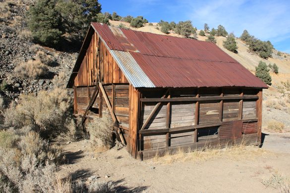
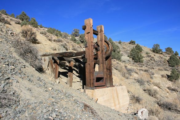
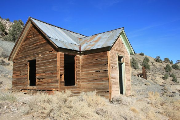
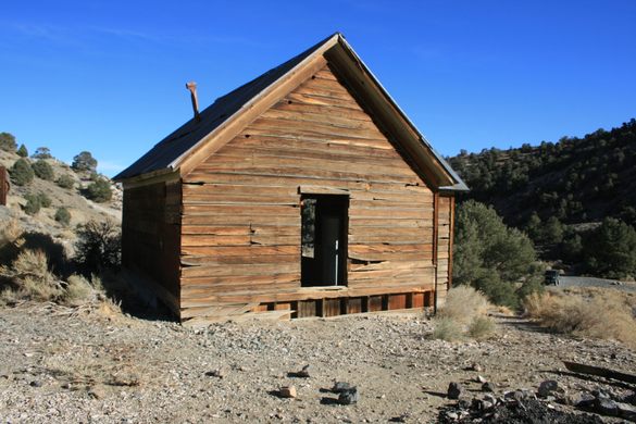
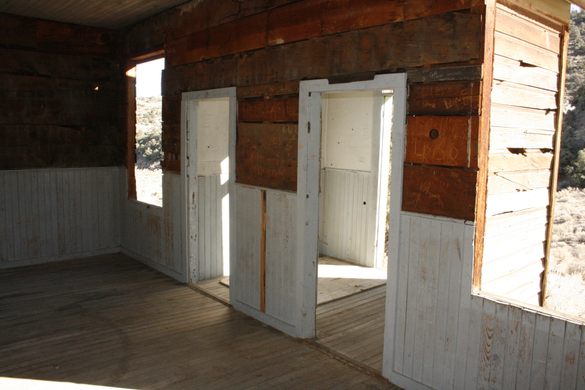
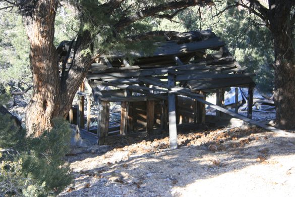
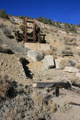
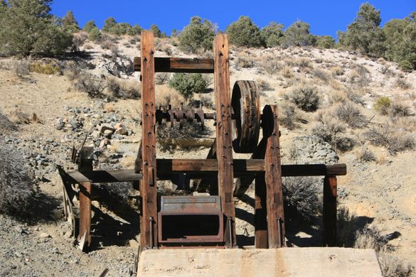
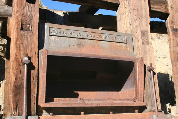
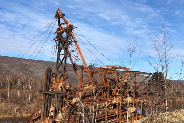
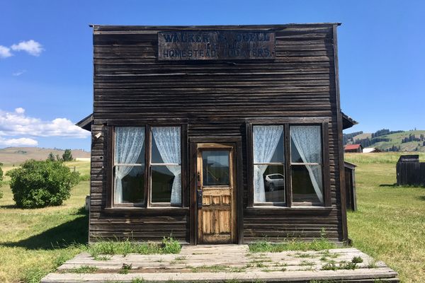
Some nearly intact wooden buildings, including the old hotel, remain in Pine Grove, and a well-preserved stamp mill on a mill foundation. A cemetery is to the south of the old hotel, on the canyon rim above.
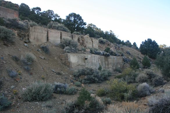
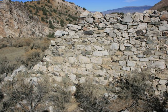
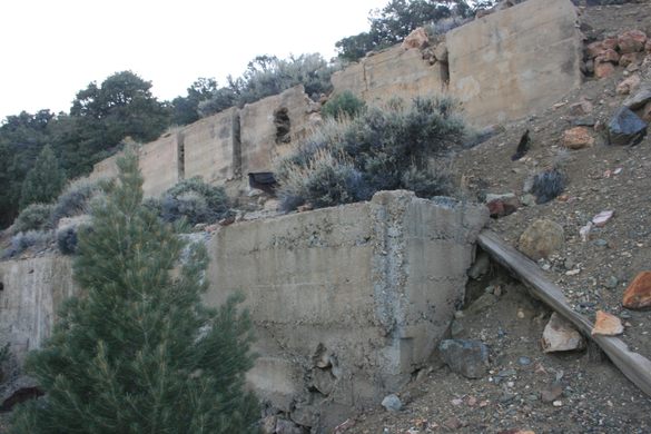
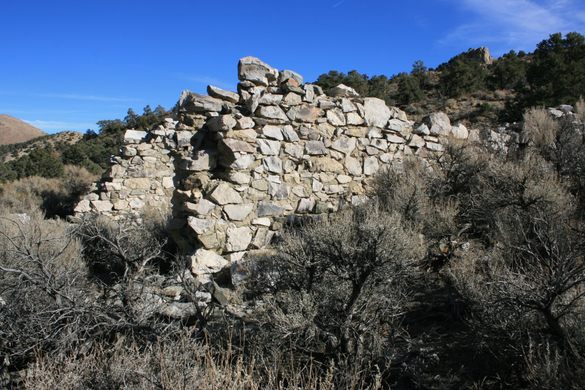
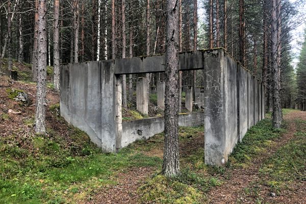
Buildings in Rockland haven’t fared so well, mostly collapsed, but the foundations of a mill are visible there too.
Know Before You Go
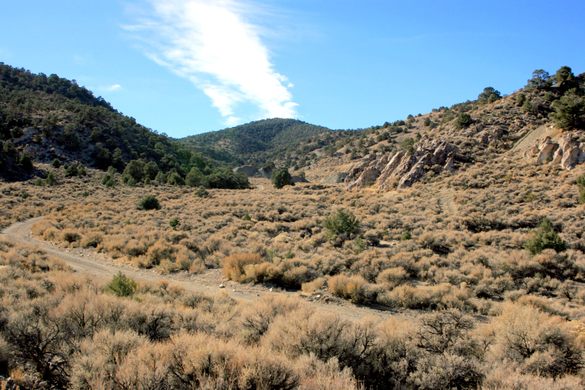
To get to Pine Grove and Rockland take the Westside Branch of the East Walker Road (also known as the Pine Grove Road) south.
This road has a junction at a right-angle bend on State Route 208, located about 38.83823 N, 119.14539 W at the south end of Mason Valley. Follow it 10.2 miles to a junction on the right (west) with US Forest Service Road 059 at about 38.71365, 119.05404. Drive 4.5 miles in to the eastern edge of Pine Grove.
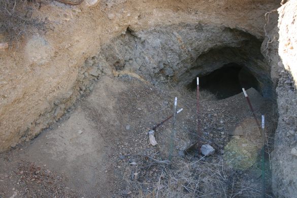
The road to Rockland takes off USFS Road 059 to the left in about 1.1 miles, onto USFS 193 at about 38.70337 N, 119.06570 W. In about 4.4 miles you will start to see ruins, spoil heaps, adits and other mining residua from Rockland.
East Walker Road is a wide-graded road that should be passable to passenger cars in dry weather, but the roads into Pine Grove and (especially) Rockland will require high clearance. Both these roads also continue up and over the Pine Grove Hills to Pine Grove Summit; however, going on to the summit will require 4WD and in any case, the roads are impassible in winter.
As in any old mining area, be especially careful with children and pets.

Plan Your Trip
The Atlas Obscura Podcast is Back!


Follow us on Twitter to get the latest on the world's hidden wonders.
Like us on Facebook to get the latest on the world's hidden wonders.
Follow us on Twitter Like us on Facebook