


About
With an area of 34 square miles, the Caribbean island of St. Maarten / St. Martin has the unique distinction of being the smallest inhabited island that is split between two countries. The northern portion is Saint-Martin, an overseas collectivity of France, while the southern portion is Sint Maarten, a constituent country of the Kingdom of the Netherlands.
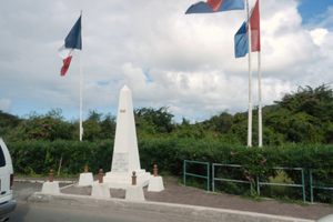
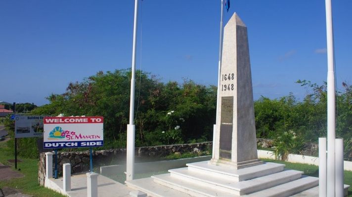
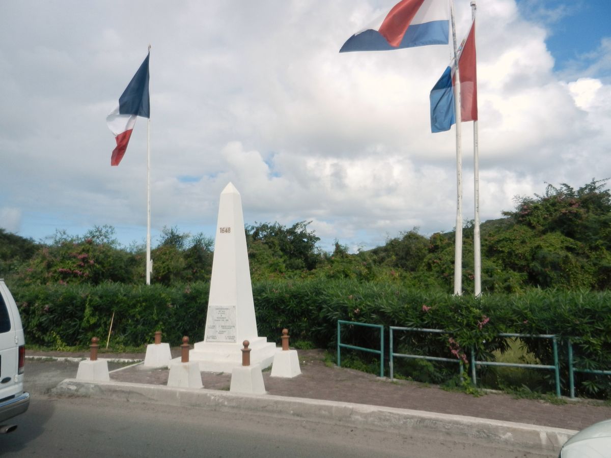
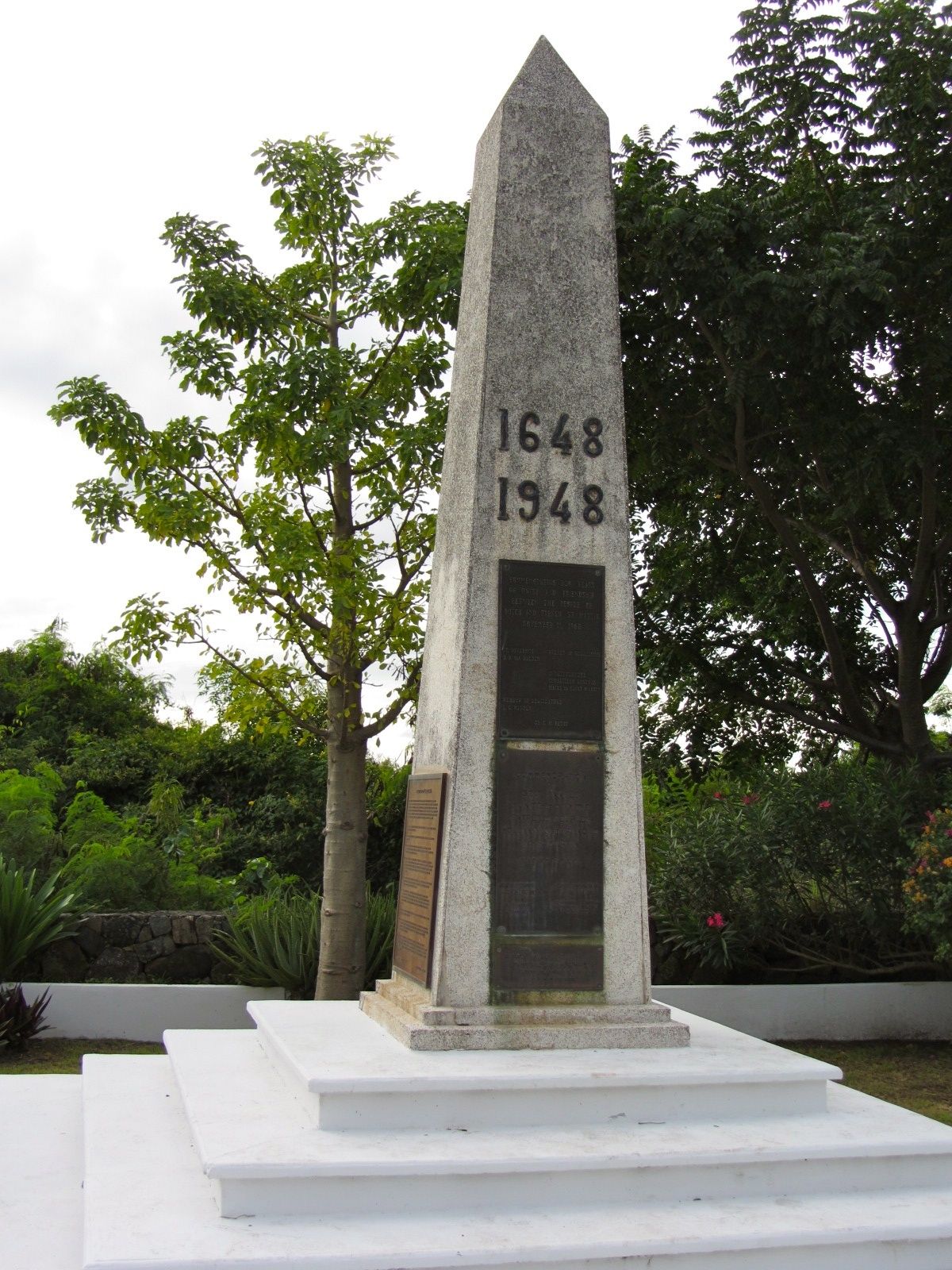
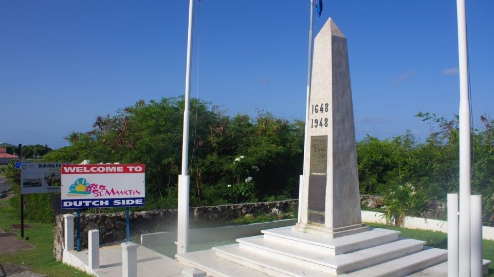
The border that runs through the middle of the island is open and has been since 1648, when the European powers signed the Treaty of Concordia, which split the island roughly in half (the French side is slightly larger). This monument marks where the autonomous Dutch side of the Caribbean island of St. Maarten / St. Martin stops and the French side (and European Union) commences—and vice versa.
In 1948, to celebrate 300 years of peaceful coexistence, a border monument was built on the main highway between the cities of Philipsburg (Sint Maarten) and Marigot (Saint-Martin). In 2008, a new border crossing monument was dedicated.
Next to the temples of Angkor Vath in Cambodia, the monument is the only building making it to a national flag (Dutch side Sint Maarten). It is also featured on the joint unity flag of the island.
Related Tags
Published
January 12, 2024