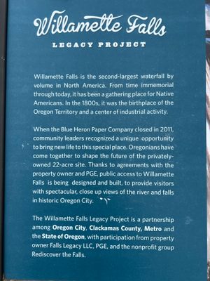
Trips Places Foods Stories Newsletters
Loading...
Loading...
Loading...
Loading...

No search results found for
“”

Make sure words are spelled correctly.

Try searching for a travel destination.

Places near me Random place

Popular Destinations

  • Paris
  • London
  • New York
  • Berlin
  • Rome
  • Los Angeles
Trips Places Foods Stories Newsletters
Sign In Join
Places near me Random place
All the United States Oregon Oregon City Willamette Falls

Willamette Falls

The second largest waterfall by volume in the U.S., Willamette Falls is outdone only by Niagara in the amount of water that is pushed northward.

Oregon City, Oregon

Added By
Brendan Keavney
Email
Been Here
Want to go
Added to list
CAPTION
Willamette Falls, second largest (by volume) in the US   Scott Griggs on Flickr
The Falls from the banks of the Willamette River   M.O. Stevens on WikiCommons
Industrial development along the Falls   Jeff Green on WikiCommons
The swollen falls after a December 2006 storm   Marku1988 on WikiCommons
Aerial view of the Falls, looking north downstream   US Army Corps of Engineers on WikiCommons
Salmon leaping at Willamette Falls   NOAA Photo Library on WikiCommons
A pile of sucking lampreys, harvested each year by local Native tribes   Geoff Parsons on Flickr
Lamprey harvesting at Willamette Falls   Meghan Kearney/US Fish and Wildlife Service on Flickr
This is downstream from the falls and what it powers.   heyyouoverthere / Atlas Obscura User
Willamette Falls from the McLoughlin Promenade in Oregon City, showing some of the old industrial area.   slgwv / Atlas Obscura User
  breaingram / Atlas Obscura User
Willamette Falls looking east from a viewpoint off Interstate-205.   slgwv / Atlas Obscura User
Once you park, this is the obligatory sign.   heyyouoverthere / Atlas Obscura User
Here it is!!! Yep, that is the entirety of it.  
Been Here
Want to go
Added to list

About

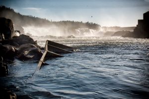
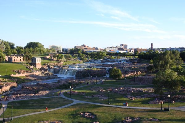
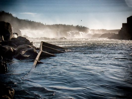
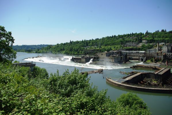
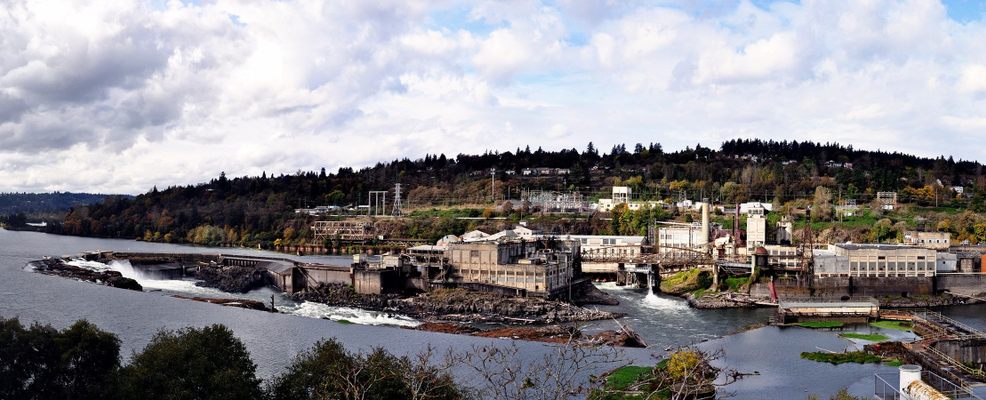
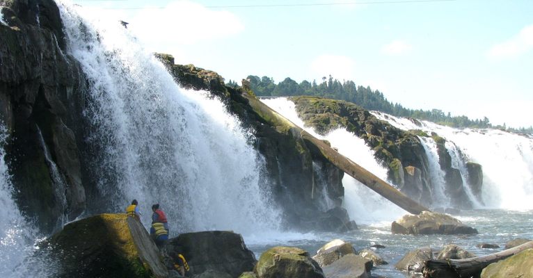
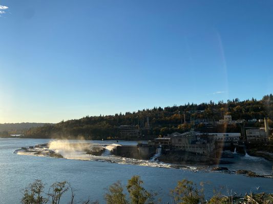
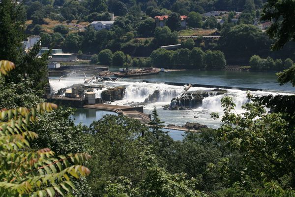
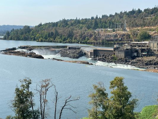
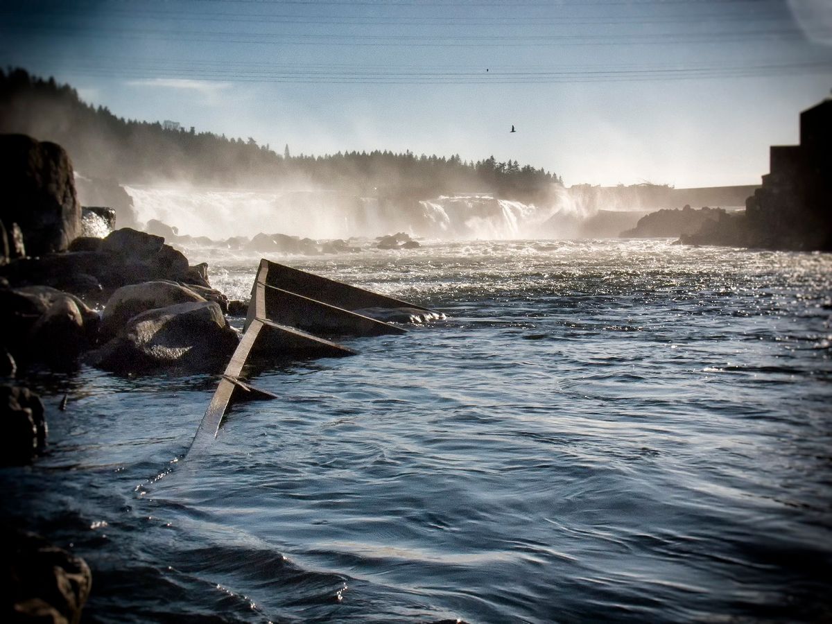
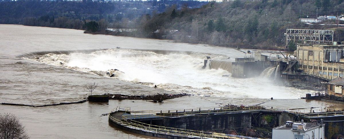
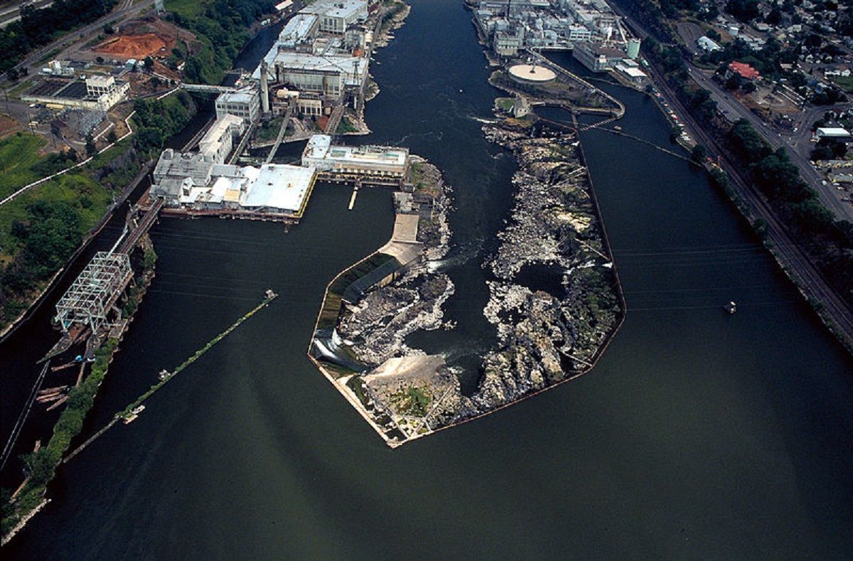
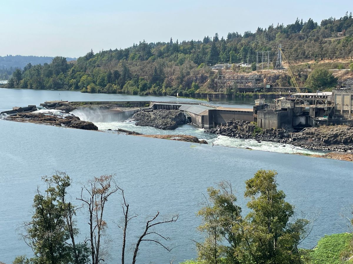
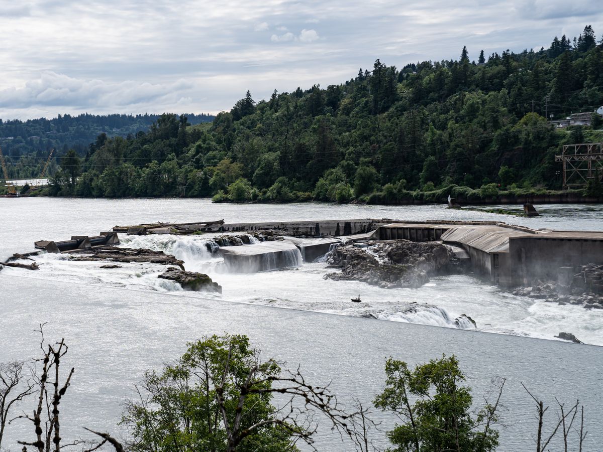
The Willamette River flows north through some of the most fertile and abundant land in the Pacific Northwest. So rich is the land around the Willamette that two-thirds of all Oregonians live within the confines of its valley. Rushing through the Oregon Coast range on one side and the Cascades on the other, the Willamette plummets abruptly straight down the height of a four-story building when it reaches Oregon City. Its average flow is nearly a quarter of a million gallons a second – for the U.S., that’s a volume of water second only to Niagara Falls.

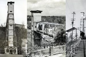
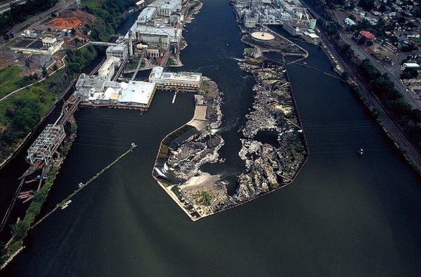
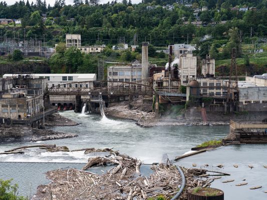
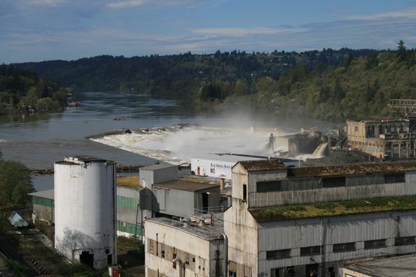
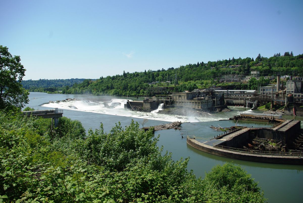
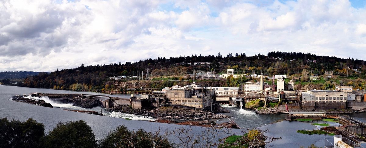
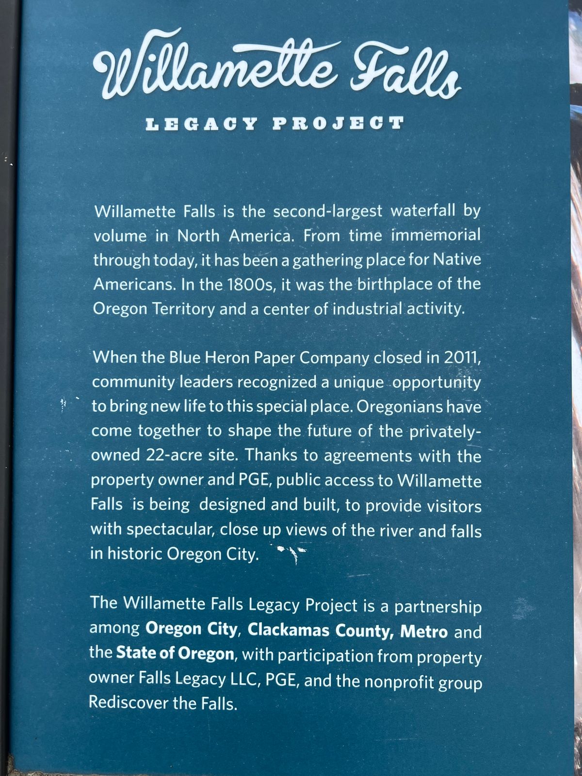
On the east and west sides of Willamette Falls, the livelihood of entire cities was long supported by two paper mills and one of the oldest water-powered plants in the country. Given the four-story drop of the Falls that spans over 1,500 feet, a system of locks and canals was needed to allow passage of logging and shipping vessels. But as local industry in both timber and paper waned by the end of the 20th century, the canal and locks system was first converted to accommodate pleasure and fishing boats. By 2011 it was no longer affordable to keep the system running at all, and it has since been shut down.

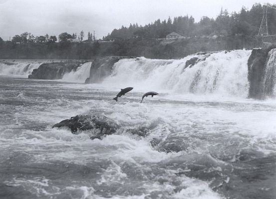
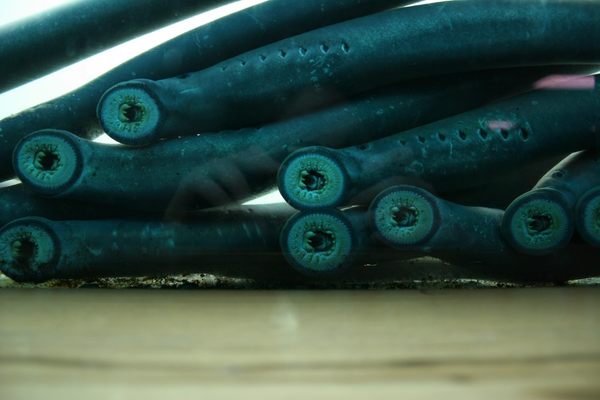
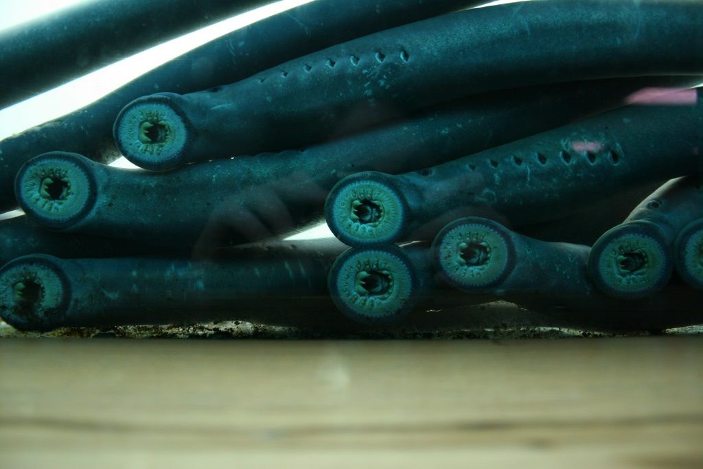
Willamette has powered not only heavy industry but also some of the most abundant fishing grounds in the western United States. As the last stop along the Oregon Trail, pioneers may have settled the area around the Falls starting in the mid-19th century – but before there were paper mills, canals or locks, long before the wagon trains arrived, Native Americans centered life around the Falls to harness the bounty of the churning waters. Dating back thousands of years, local Native tribes (the Warm Springs and the Yakama), have followed the natural migration of both chinook salmon and lamprey eels, fishing for salmon and harvesting the lamprey. And they have maintained treaty rights to the yearly lamprey harvest (crazy looking eel-like fish with rows and rows of sharp little teeth that make for some serious sucking ability). Salmon and lamprey stocks have declined dramatically over the past few decades, but maybe the loss of water-powered industry along Willamette Falls will be the chinook’s and lampreys’ gain.  

Related Tags

Waterfalls Industrial Rivers Water

Know Before You Go

The Falls are between Oregon City and West Linn, about 15 miles south of Portland

Community Contributors

Added By

omtinole

Edited By

Sun, breaingram, slgwv, causeiwander...

  • Sun
  • breaingram
  • slgwv
  • causeiwander
  • heyyouoverthere

Published

January 11, 2016

Edit this listing

Make an Edit
Add Photos
Sources
  • https://en.wikipedia.org/wiki/Willamette_Falls
  • http://www.willamettefalls.org/
  • http://www.dfw.state.or.us/fish/fish_counts/willamette%20falls.asp
Willamette Falls
McLoughlin Boulevard
(at about So. 2nd Street)
Oregon City, Oregon, 97045
United States
45.351557, -122.619041
Visit Website
Get Directions

Nearby Places

Oregon City Municipal Elevator

Oregon City, Oregon

miles away

Tree Climbing Planet

Oregon City, Oregon

miles away

Portland Puppet Museum

Portland, Oregon

miles away

Explore the Destination Guide

Photo of Oregon City

Oregon City

Oregon

Places 3

Nearby Places

Oregon City Municipal Elevator

Oregon City, Oregon

miles away

Tree Climbing Planet

Oregon City, Oregon

miles away

Portland Puppet Museum

Portland, Oregon

miles away

Explore the Destination Guide

Photo of Oregon City

Oregon City

Oregon

Places 3

Related Places

  • The region around Jajce is all about water, waterfalls, rivers, lakes… and watermills

    Jajce, Bosnia and Herzegovina

    Watermills of Jajce

    This cluster of little wooden huts once ground local farmers’ wheat into flour during the days of the Austro-Hungarian Empire.

  • Williamsport Falls

    Williamsport, Indiana

    Williamsport Falls

    A small rural town hides Indiana's tallest waterfall.

  • Lufubu Falls in 2018 from the “view point”

    Luwingu, Zambia

    Lufubu Falls

    A small but beautiful waterfall hidden away in the north of Zambia.

  • Sioux Falls Park

    Sioux Falls, South Dakota

    Falls Park

    More than 7,000 gallons of water pour over these cascading red quartzite waterfalls every second.

  • “Blue Pool” of Patillas

    Almirante Sur, Puerto Rico

    Charco Azul

    A natural swimming pool in the middle of the Carite Forest.

  • Waterfall 2

    San Antonio de Ureca, Equatorial Guinea

    Ureka

    This village surrounded by breathtaking waterfalls is one of the wettest places on earth.

  • Sahalie Falls

    McKenzie Bridge, Oregon

    Sahalie Falls

    Rushing water plunges over a 100-foot drop created by an ancient lava flow at this majestic waterfall.

  • Hogenakkal, India

    Hogenakkal Falls

    The Kaveri River cuts through the rocky terrain then drops off to form these misty falls.

Aerial image of Vietnam, displaying the picturesque rice terraces, characterized by their layered, verdant fields.
Atlas Obscura Membership

Become an Atlas Obscura Member


Join our community of curious explorers.

Become a Member

Get Our Email Newsletter

Follow Us

Facebook YouTube TikTok Instagram Pinterest RSS Feed

Get the app

Download the App
Download on the Apple App Store Get it on Google Play
  • All Places
  • Latest Places
  • Most Popular
  • Places to Eat
  • Random
  • Nearby
  • Add a Place
  • Stories
  • Food & Drink
  • Itineraries
  • Lists
  • Video
  • Podcast
  • Newsletters
  • All Trips
  • Family Trip
  • Food & Drink
  • History & Culture
  • Wildlife & Nature
  • FAQ
  • Membership
  • Feedback & Ideas
  • Community Guidelines
  • Product Blog
  • Unique Gifts
  • Work With Us
  • About
  • FAQ
  • Advertise With Us
  • Advertising Guidelines
  • Privacy Policy
  • Cookie Policy
  • Terms of Use
Atlas Obscura

© 2025 Atlas Obscura. All Rights Reserved.