Trips Places Foods Stories Newsletters
Loading...
Loading...
Loading...
Loading...

No search results found for
“”

Make sure words are spelled correctly.

Try searching for a travel destination.

Places near me Random place

Popular Destinations

  • Paris
  • London
  • New York
  • Berlin
  • Rome
  • Los Angeles
Trips Places Foods Stories Newsletters
Sign In Join
Places near me Random place
All Tunisia Ras Angela

Ras Angela

The northernmost point of continental Africa—or is it?

Ras Angela, Tunisia

Added By
Max Cortesi
Email
Been Here
Want to go
Added to list
CAPTION
Ras Angela   Max Cortesi / Atlas Obscura User
Rocky head with islet that are the true northernmost points of continental Africa   Max Cortesi / Atlas Obscura User
Ras Angela beach with the monument barely visible on the rocks   Max Cortesi / Atlas Obscura User
Approaching Ras Angela from inland   Max Cortesi / Atlas Obscura User
Ras Angela   Max Cortesi / Atlas Obscura User
Been Here
Want to go
Added to list

About

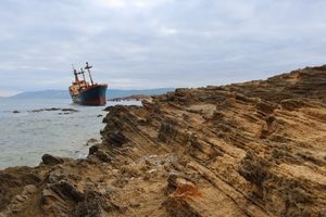
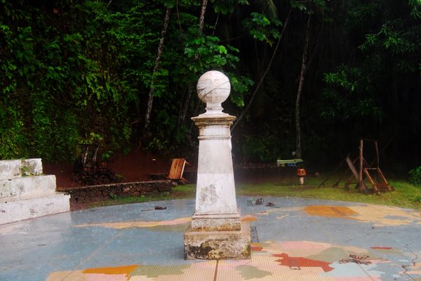
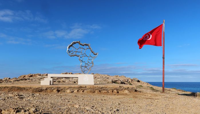
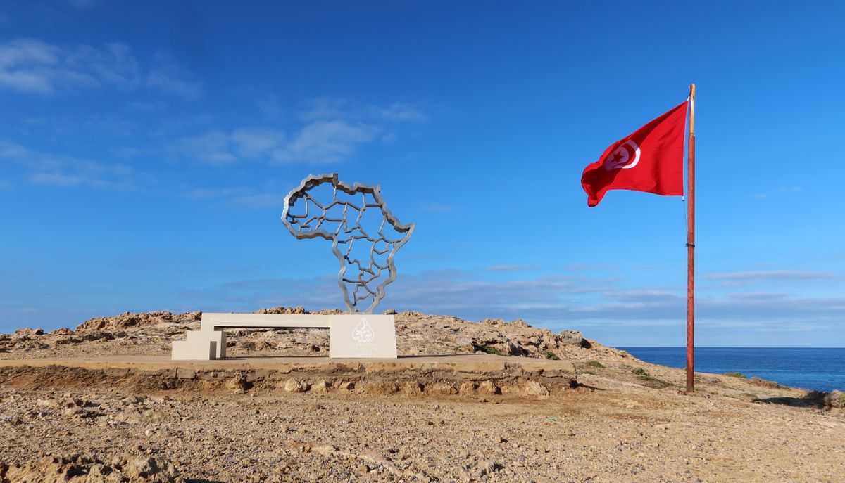
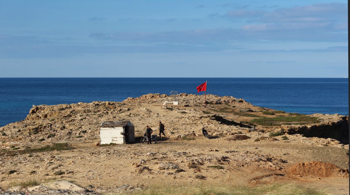
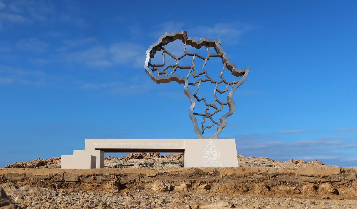
Ras Angela, or Cape Angela, is a rocky head that juts out into the Mediterranean Sea. A lovely picnic spot, it also just so happens to be the northernmost point of continental Africa—as noted by a monumental map just off the rocky coastline.

Until 2014, nearby Ras al-Abyad, or Cape Blanc, had been considered the northernmost point of continental Africa. Despite being merely eight kilometers (five miles) away, the mistake persisted until the Tunisian tourism ministry declared Ras Angela the northernmost location and invested in making it a small destination.

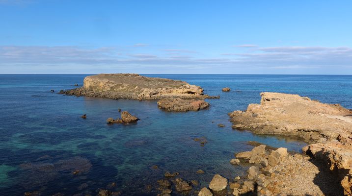
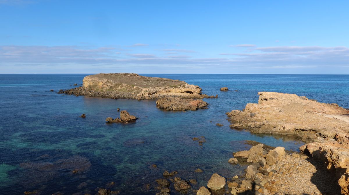
But the contest may not be resolved: a short walk east of the monument, there is another head that goes a few meters further north. Furthermore, at low tide, a corridor of land breaches the water to connect this head to an islet. If this were to be considered part of continental Africa, it would place the northernmost point even further north. 

All these locations are in Tunisia, and so is the northernmost point of (non-continental) Africa, which is the northernmost point of the northernmost island of the Galite Archipelago.

Related Tags

Monuments Maps Geographic Oddities Geographic Markers

Know Before You Go

You can take a taxi or louage (shared minibus) from the town of Bizerte to the scenic point, but you’ll need to walk the final sandy stretch to the coast. The point is also known as Ras ben Sakka.

Atlas Obscura Adventures

Tunisia: The Sahara, Mosaics & Star Wars Relics

A Sahara journey through ancient oases, diverse culture, & delicious cuisine.

Book Now

Community Contributors

Added By

Max Cortesi

Published

February 20, 2024

Edit this listing

Make an Edit
Add Photos
Ras Angela
Ras Angela
Tunisia
37.347329, 9.744923

Nearby Places

Rimel Beach

Menzel Jemil, Tunisia

miles away

Saint-Felix Church of Schuiggu

Chouigui, Tunisia

miles away

Villa Yvonne

Tunis, Tunisia

miles away

Explore the Destination Guide

Photo of Tunisia

Tunisia

Africa

Places 19
Stories 2

Nearby Places

Rimel Beach

Menzel Jemil, Tunisia

miles away

Saint-Felix Church of Schuiggu

Chouigui, Tunisia

miles away

Villa Yvonne

Tunis, Tunisia

miles away

Explore the Destination Guide

Photo of Tunisia

Tunisia

Africa

Places 19
Stories 2

Related Places

  • Tri-States Monument and Delaware River

    Port Jervis, New York

    Tri-States Monument

    A pair of 19th-century granite markers symbolically record where the state boundaries of New York, New Jersey, and Pennsylvania intersect.

  • Monument to the geographic center of Belgium

    Walhain, Belgium

    Geographic Center of Belgium

    This metal monument marking the middle of Belgium represents three regions coming together to form one country.

  • Markleysburg, Pennsylvania

    Old Tri-State Monument

    This original Mason-Dixon line cairn placed in the 1760s was put in the wrong location because of the gravitational pull of the Allegheny Mountains.

  • The Center of Google Earth mural in Chanute, Kansas.

    Chanute, Kansas

    Center of Google Earth Mural

    A Google software engineer's Easter egg led to what may be the world's most unusual saved screenshot.

  • Sign for L13

    Mannheim, Germany

    Mannheim Quadratestadt

    In this German city center, the streets have no names.

  • Marco do Equador on Ilhéu das Rolas

    Ilhéu das Rolas, São Tomé and Príncipe

    Marco do Equador

    The equator passes through this tiny island in the eastern Atlantic.

  • A PIRATA weather buoy, the only thing that is really at Null Island.

    Null Island

    A busy island at the center of the world that doesn’t actually exist.

  • Teec Nos Pos, Utah

    Four Corners Monument

    The marker offers a rare chance to be in four U.S. states at once, though there's some controversy over its geographic accuracy.

Aerial image of Vietnam, displaying the picturesque rice terraces, characterized by their layered, verdant fields.
Atlas Obscura Membership

Become an Atlas Obscura Member


Join our community of curious explorers.

Become a Member

Get Our Email Newsletter

Follow Us

Facebook YouTube TikTok Instagram Pinterest RSS Feed

Get the app

Download the App
Download on the Apple App Store Get it on Google Play
  • All Places
  • Latest Places
  • Most Popular
  • Places to Eat
  • Random
  • Nearby
  • Add a Place
  • Stories
  • Food & Drink
  • Itineraries
  • Lists
  • Video
  • Podcast
  • Newsletters
  • All Trips
  • Family Trip
  • Food & Drink
  • History & Culture
  • Wildlife & Nature
  • FAQ
  • Membership
  • Feedback & Ideas
  • Community Guidelines
  • Product Blog
  • Unique Gifts
  • Work With Us
  • About
  • FAQ
  • Advertise With Us
  • Advertising Guidelines
  • Privacy Policy
  • Cookie Policy
  • Terms of Use
Atlas Obscura

© 2025 Atlas Obscura. All Rights Reserved.