Trips Places Foods Stories Newsletters

Take your next trip with Atlas Obscura!

Our small-group adventures are inspired by our Atlas of the world's most fascinating places, the stories behind them, and the people who bring them to life.

Visit Adventures
Trips Highlight
A view of Brașov’s Old Town.
Romania • 12 days, 11 nights
Legends of Romania: Castles, Ruins & Culinary Delights
from
Balkans road trip
Bosnia and Herzegovina • 9 days, 8 nights
Balkans Road Trip: Serbia, Croatia & Bosnia and Herzegovina
from
View all trips
Top Destinations
Latest Places
Most Popular Places Random Place Lists Itineraries
Add a Place
Download the App
Top Destinations
View All Destinations »

Countries

  • Australia
  • Canada
  • China
  • France
  • Germany
  • India
  • Italy
  • Japan

Cities

  • Amsterdam
  • Barcelona
  • Beijing
  • Berlin
  • Boston
  • Budapest
  • Chicago
  • London
  • Los Angeles
  • Mexico City
  • Montreal
  • Moscow
  • New Orleans
  • New York City
  • Paris
  • Philadelphia
  • Rome
  • San Francisco
  • Seattle
  • Stockholm
  • Tokyo
  • Toronto
  • Vienna
  • Washington, D.C.
Latest Places
View All Places »
The ‘Old Secretariat’ government building in New Delhi.
The 'Old Secretariat'
This set is inspired by a Roman arena.
Bozdağ Film Platolari
The Sea Water Distilling Plant.
Sea Water Distilling Plant
Contemplative paths.
Ayo Rock Formations
Latest Places to Eat & Drink
View All Places to Eat »
The pavlova comes crowned with jewel-like fruit.
Central Park Boathouse
The Village Tavern of Long Grove - exterior.
The Village Tavern
Hunter House Hamburgers
L’Escamoteur
Names on the bartop.
The Dive
Recent Stories
All Stories Video Podcast
Most Recent Stories
View All Stories »
Wortley built the wooden backpack she used while retracing Alexandra David-Néel’s journey from a chair she found on the street in London.
How Elise Wortley Climbed Mont Blanc in 1830s Women’s Attire
29 days ago
Simplicity is key: Just a slice of bread with a sprinkling of salt and pepper is the perfect accompaniment.
The Sweet Second Life of Creole Cream Cheese
29 days ago
My rendition of frog legs, popping mushroom curry, pad prik khing with salted egg yolk, and sweet khanom thuai.
Recreating My Favorite Meal From Thailand
29 days ago
Inside London’s Gorgeously Curated ‘Art Restaurants’
29 days ago

No search results found for
“”

Make sure words are spelled correctly.

Try searching for a travel destination.

Places near me Random place

Popular Destinations

  • Paris
  • London
  • New York
  • Berlin
  • Rome
  • Los Angeles
Trips Places Foods Stories Newsletters
Sign In Join
Places near me Random place
All the United Kingdom Scotland Scottish Borders Great Polish Map of Scotland

Great Polish Map of Scotland

This huge concrete map of Scotland was built as a thank you gift from a Polish soldier.

Scottish Borders, Scotland

Added By
Stevie Douglas
Email
Been Here
Want to go
Added to list
Great Polish Map of Scotland   Kim Traynor on Wikipedia
Great Polish Map of Scotland next to Black Barony   John Riddell on Wikipedia
Great Polish Map of Scotland with people for scale   Kim Traynor on Wikipedia
Barony Hotel   SEANETTA / Atlas Obscura User
  SEANETTA / Atlas Obscura User
  SEANETTA / Atlas Obscura User
Firth of Forth/Edinburgh   SEANETTA / Atlas Obscura User
Viewing Platform   SEANETTA / Atlas Obscura User
“The Altar”   SEANETTA / Atlas Obscura User
Ravine   SEANETTA / Atlas Obscura User
  stevied / Atlas Obscura User
Ben Nevis   SEANETTA / Atlas Obscura User
  SEANETTA / Atlas Obscura User
Bridge walkway   SEANETTA / Atlas Obscura User
  SEANETTA / Atlas Obscura User
  SEANETTA / Atlas Obscura User
The great Polish map of Scotland   rojC / Atlas Obscura User
  rojC / Atlas Obscura User
  rojC / Atlas Obscura User
  rojC / Atlas Obscura User
  rojC / Atlas Obscura User
Drone shot, 80 meters above: July 2021   mascall / Atlas Obscura User
  SEANETTA / Atlas Obscura User
Birds-eye view from platform   SEANETTA / Atlas Obscura User
Been Here
Want to go
Added to list

About

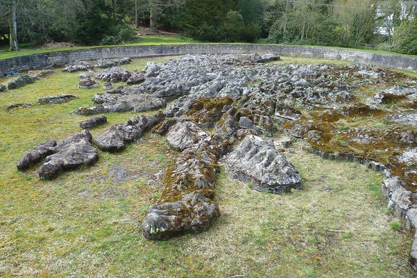
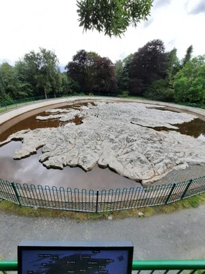
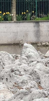
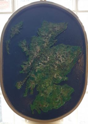
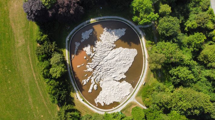
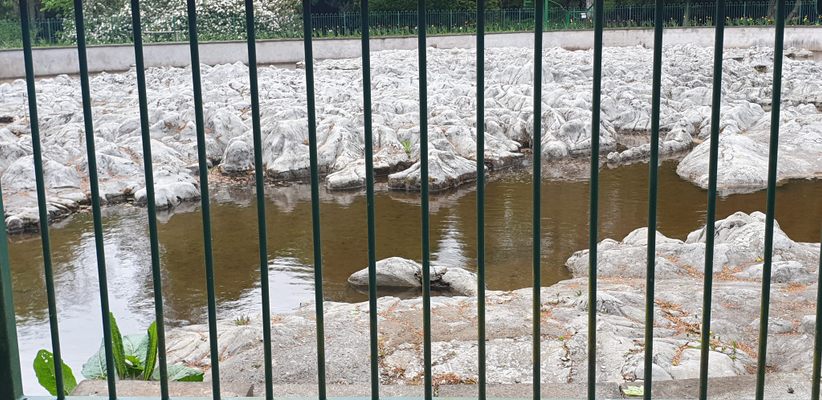
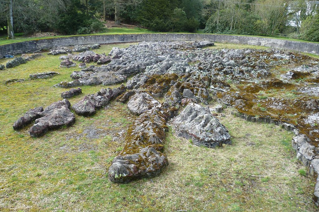
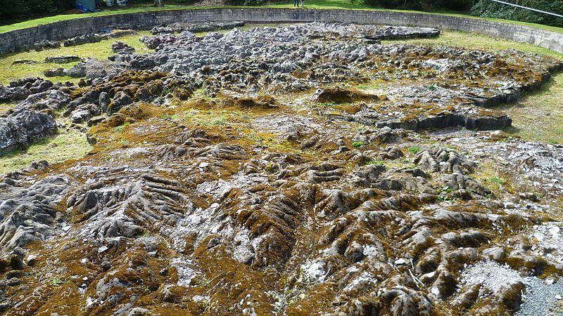
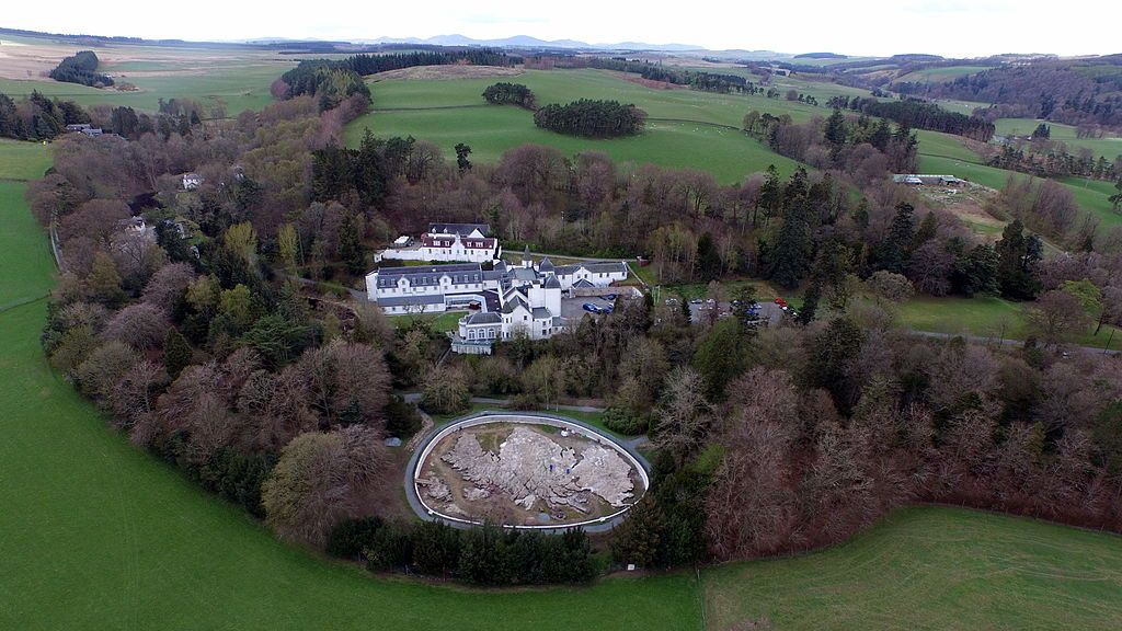
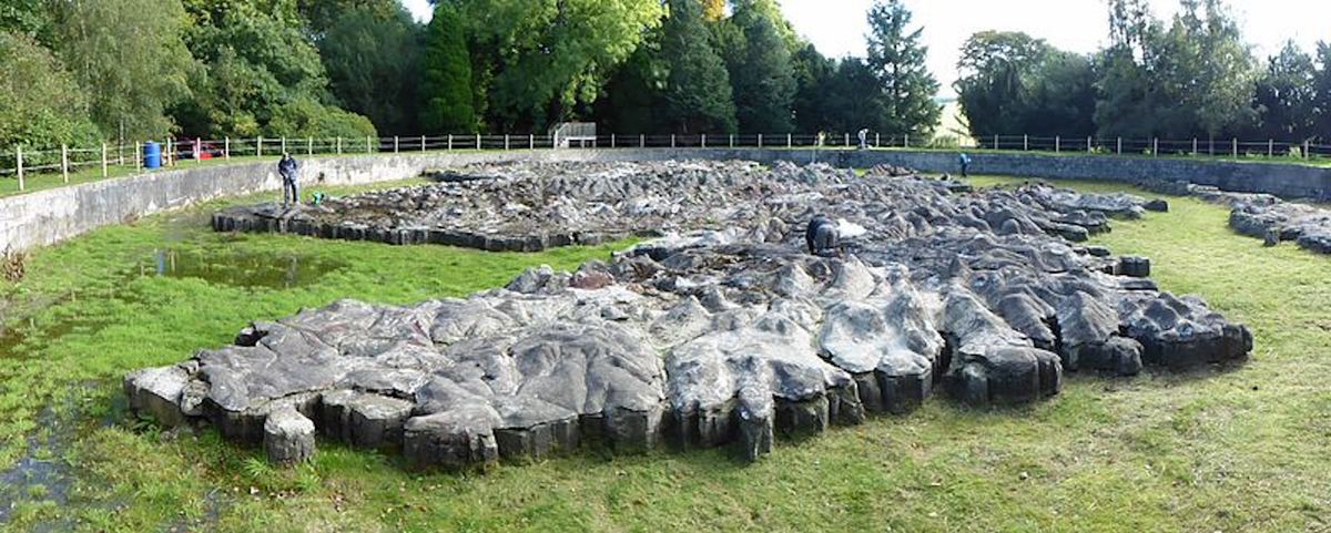
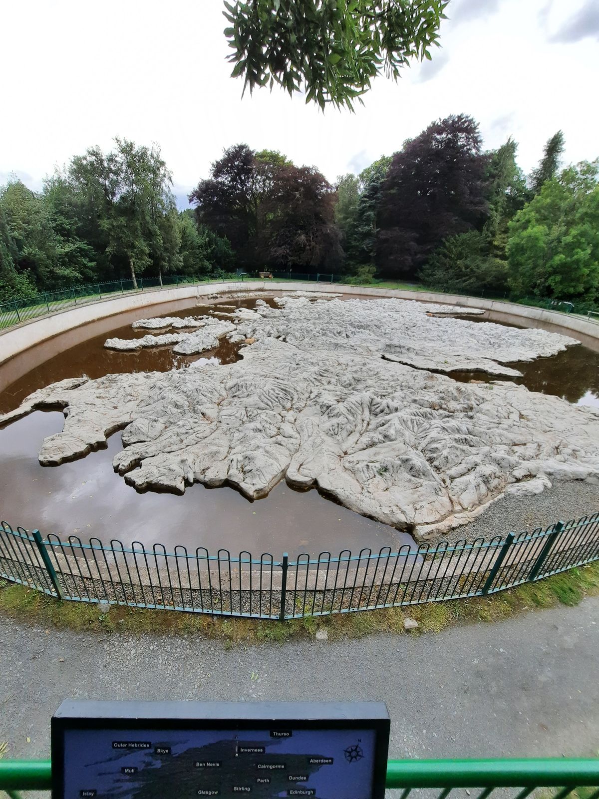
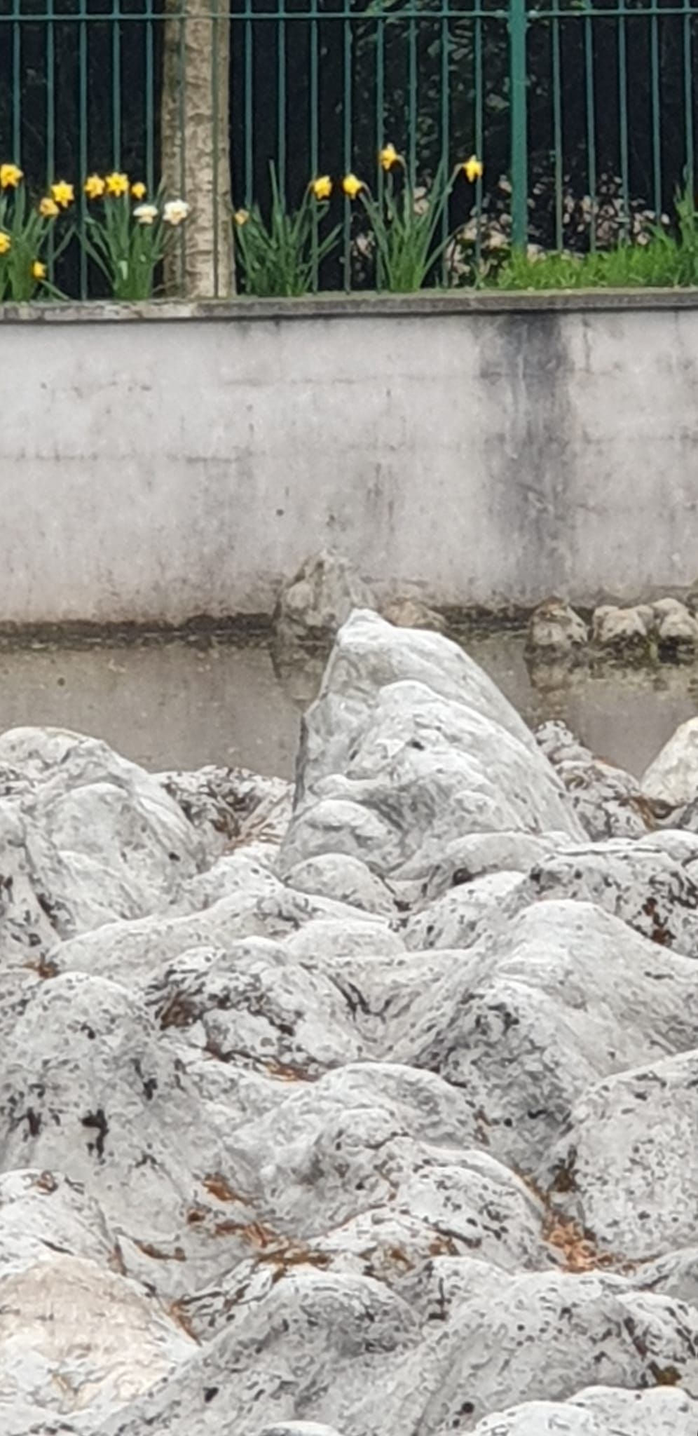
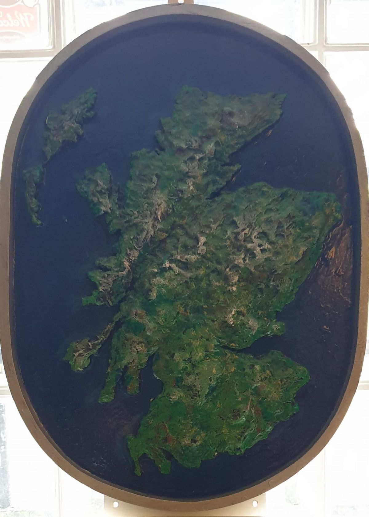
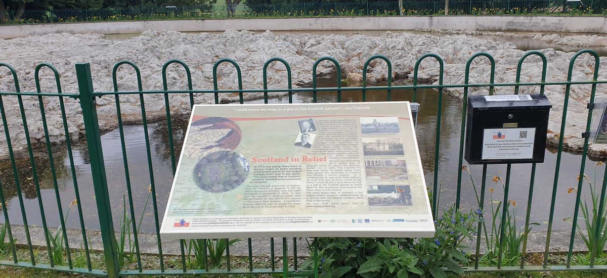
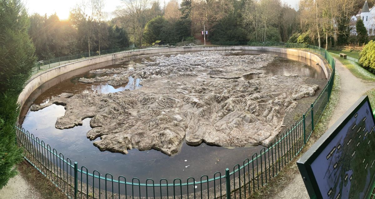
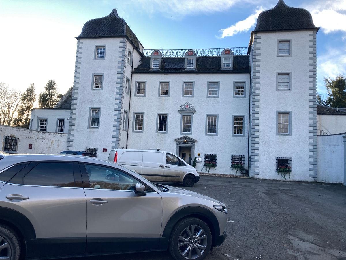
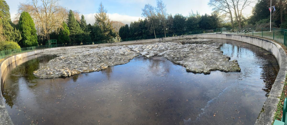
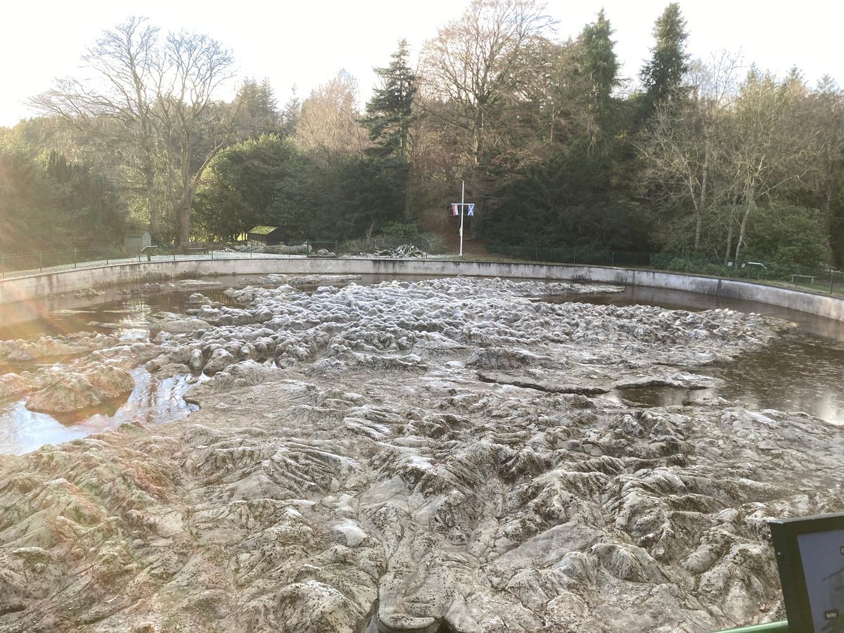
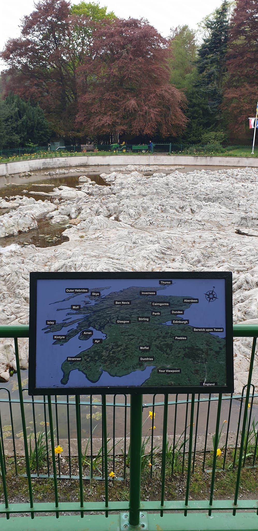
Sitting just off to the side of Scotland's Black Barony, a hotel that was formerly known as Barony Castle, is what appears at first glance to be a field of low-lying boulders covered in lichen and moss, but this is in fact a small model of Scotland. 

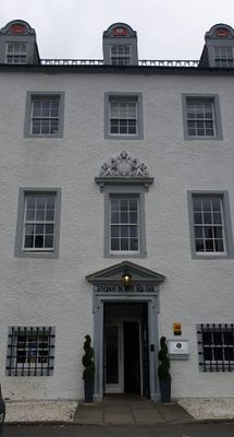
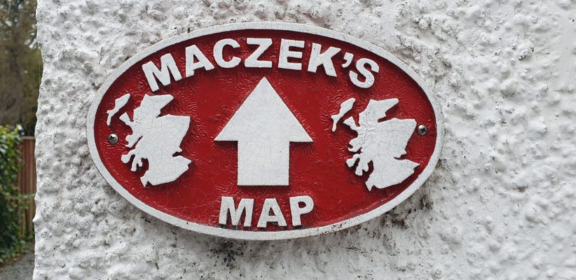
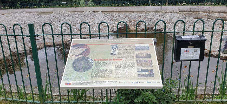
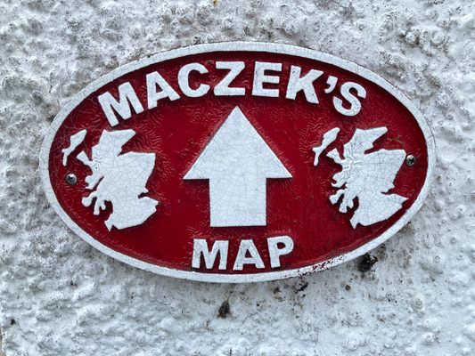
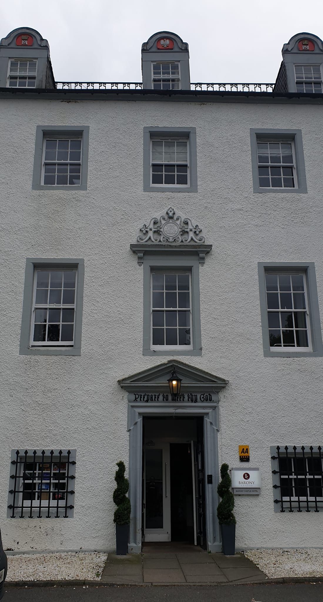
The Great Polish Map of Scotland, as it is known, may be the world's largest terrain relief map, but it all started as a gift from a grateful Polish soldier. Barony Castle, near the Scottish burgh of Eddleston, was requisitioned by the Polish army in World War II for training. Jan Tomasik, a Polish sergeant with the armored division, was stationed nearby helping to defend Scotland from the Germans. After WWII, Tomasik decided to remain in Scotland, reluctant to go home due to the new political regime in Poland. After the war, Barony Castle was turned into a hotel and in 1968, Tomasik actually purchased the castle and renovated it.

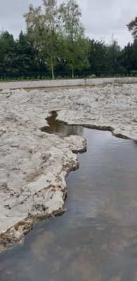
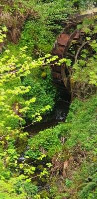
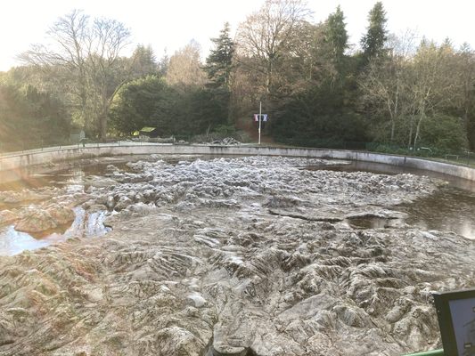
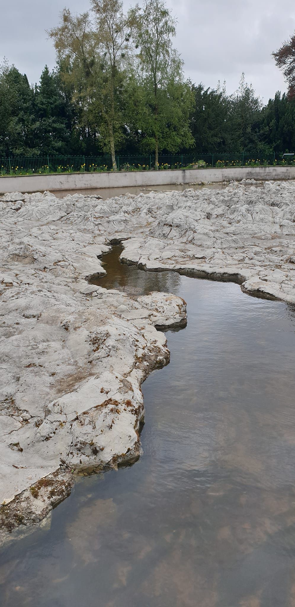
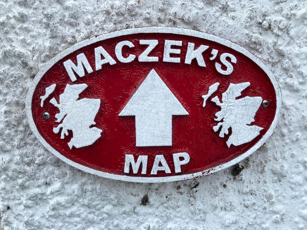
With a keen interest in topography, Tomasik wanted to build a scale map of Scotland on the grounds of the castle, as a thank you to the state that had become his new home. So he envisioned the Mapa Scotland, as The Great Polish Map of Scotland is also known. Construction began in 1974 and was completed in the summer of 1979. The map ended up being highly accurate despite its epic scale, measuring over 160 feet by over 130 feet, and ringed in by a squat wall. It also had running water in its rivers and lochs that was supplied by a system of pipes. 

Tomasik hoped the map would bring new visitors to the castle, including royalty. Sadly this was not the case and after Tomasiks death, the castle was again sold and the huge concrete map fell into obscurity and neglect. The water features dried up and the continents began to be lost beneath weeds and moss.

Finally, in 2010, a group was formed called "Mapa Scotland" to bring the colossal model back to life. They received a small  heritage grant and work began. Today, volunteers have gotten the map to a viewable state. While it no longer features the original painted colors or flowing rivers, the Great Polish Map of Scotland can still make visitors feel like a Celtic god.

Related Tags

Maps

Know Before You Go

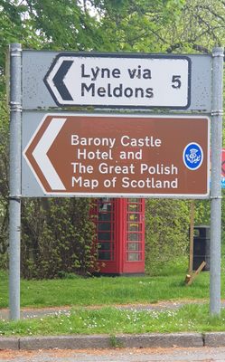
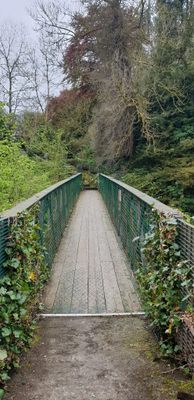
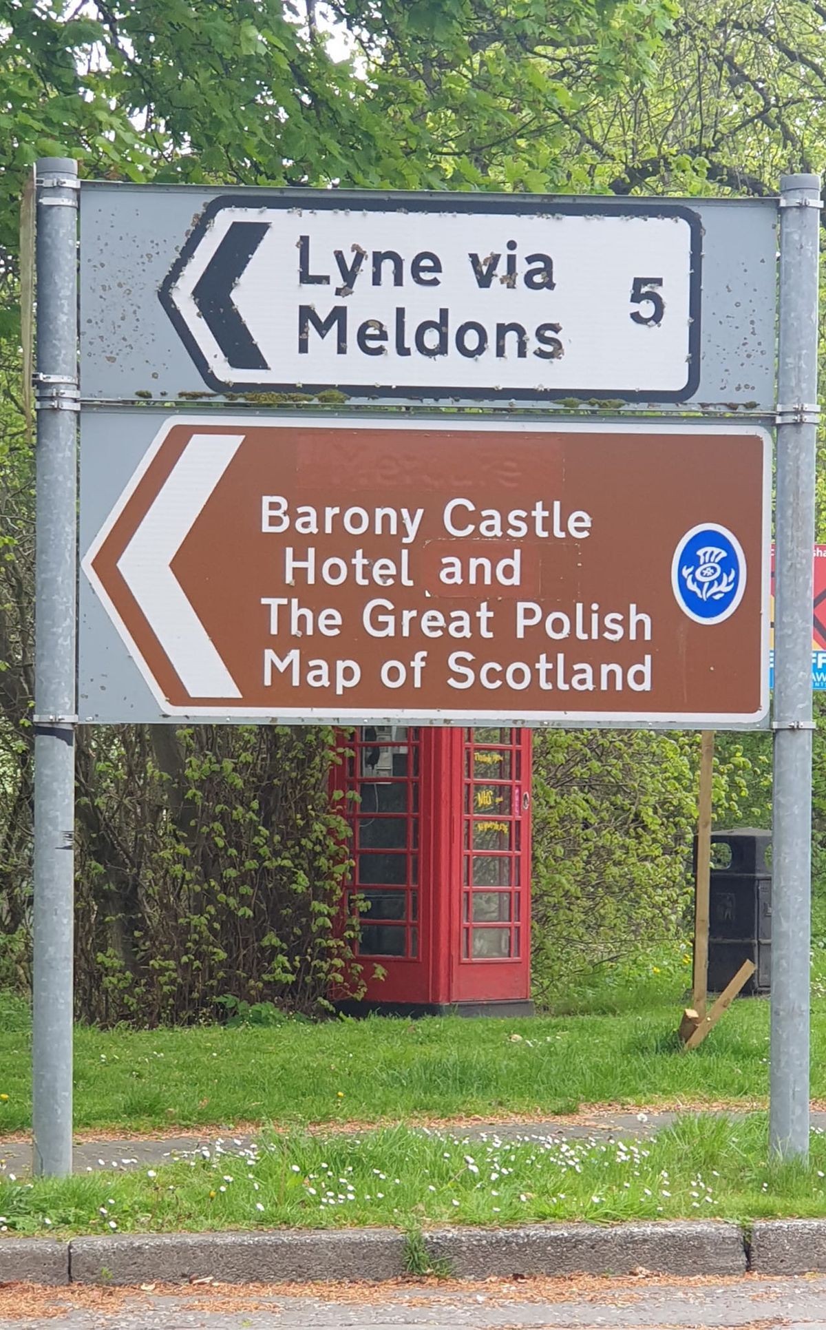
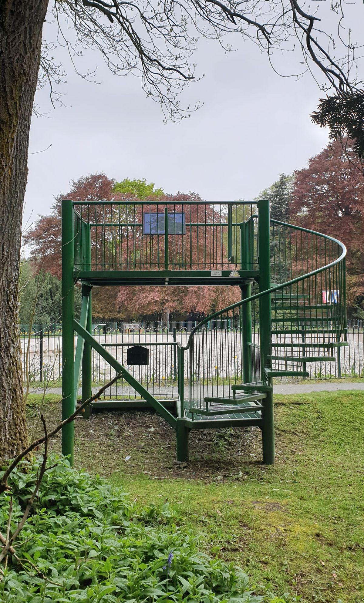
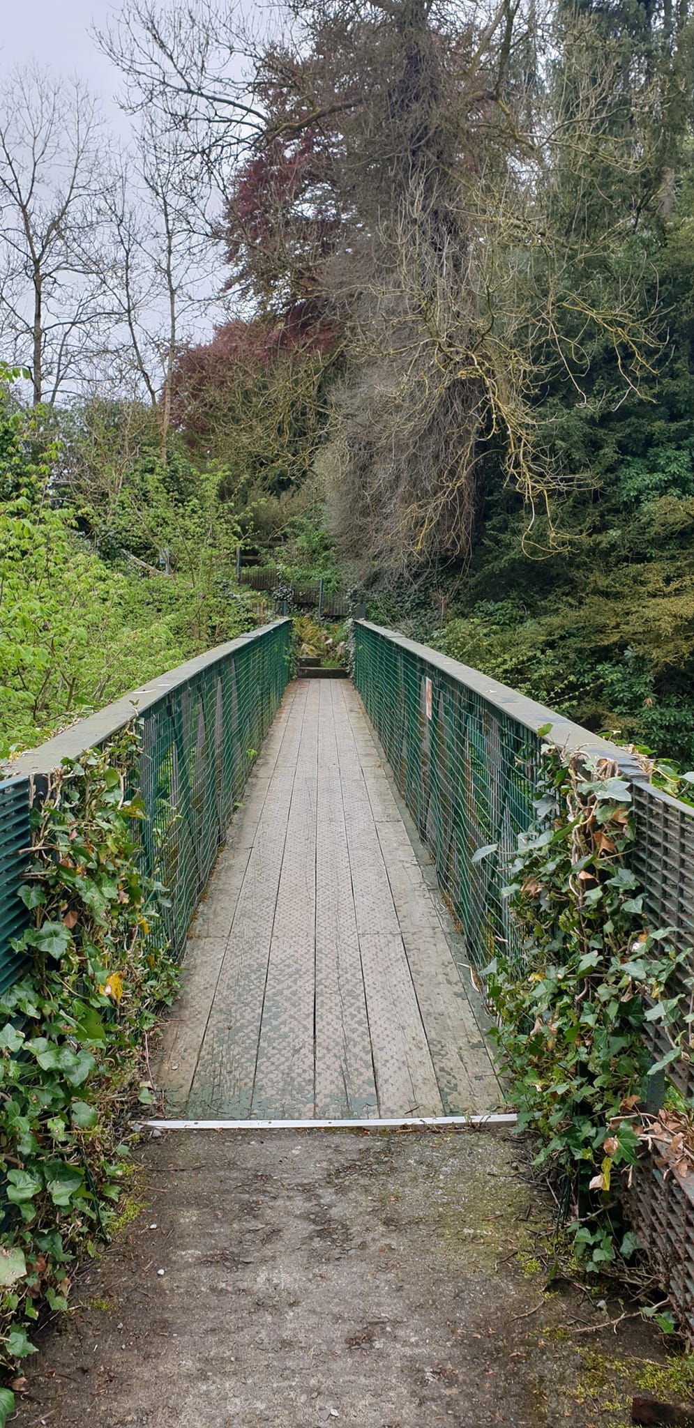
On the grounds of the Barony Castle Hotel. Due to a dangerously steep ravine that separates the map from the hotel, the pathway is not wheelchair accessible. Border Buses offers a limited service to Eddleston, the X62 to Galashiels. The bus leaves from several select stops every hour to a half-hour. The journey takes about 45 minutes. It is a 10-minute walk to the hotel from the Horseshoe Hotel.

Community Contributors

Added By

stevied

Edited By

SEANETTA, EricGrundhauser, mascall, rojC

  • SEANETTA
  • EricGrundhauser
  • mascall
  • rojC

Published

November 16, 2015

Edit this listing

Make an Edit
Add Photos
Sources
  • www.baronycastle.com
  • https://en.wikipedia.org/wiki/Great_Polish_Map_of_Scotland#External_link
Great Polish Map of Scotland
Black Barony
Scottish Borders, Scotland, EH45 8QW
United Kingdom
55.712823, -3.216916
Visit Website
Get Directions

Nearby Places

The John Buchan Story Museum

Peebles, Scotland

miles away

Peebles Mural Project

Peebles, Scotland

miles away

Neidpath Train Tunnel

Peebles, Scotland

miles away

Explore the Destination Guide

Photo of Scottish Borders

Scottish Borders

Scotland

Places 4

Nearby Places

The John Buchan Story Museum

Peebles, Scotland

miles away

Peebles Mural Project

Peebles, Scotland

miles away

Neidpath Train Tunnel

Peebles, Scotland

miles away

Explore the Destination Guide

Photo of Scottish Borders

Scottish Borders

Scotland

Places 4

Related Stories and Lists

13 Marvelous Maps That Go Way Beyond Paper

List

By Kavya Ram Mohan

Related Places

  • Saddles on display.

    Galveston, Texas

    Bryan Museum

    One of the largest historical collections on Texas and the American West.

  • Monument to the geographic center of Belgium

    Walhain, Belgium

    Geographic Center of Belgium

    This metal monument marking the middle of Belgium represents three regions coming together to form one country.

  • Ras Angela

    Ras Angela, Tunisia

    Ras Angela

    The northernmost point of continental Africa—or is it?

  • Suzhou, China

    Map of Pingjiang

    You can still find your way around Suzhou with this 800-year-old stone map.

  • Clocha na hÉireann  - the Stones of Ireland

    Glencolumbkille, Ireland

    Clocha na hÉireann (Stones of Ireland)

    A map made up of 32 different materials, representing Ireland's 32 counties.

  • Jana Seta Map Shop

    Riga, Latvia

    Jana Seta Map Shop

    A map store filled with original Cold War era Russian maps of the world.

  • The Center of Google Earth mural in Chanute, Kansas.

    Chanute, Kansas

    Center of Google Earth Mural

    A Google software engineer's Easter egg led to what may be the world's most unusual saved screenshot.

  • Sign for L13

    Mannheim, Germany

    Mannheim Quadratestadt

    In this German city center, the streets have no names.

Aerial image of Vietnam, displaying the picturesque rice terraces, characterized by their layered, verdant fields.
Atlas Obscura Membership

Become an Atlas Obscura Member


Join our community of curious explorers.

Become a Member

Get Our Email Newsletter

Follow Us

Facebook YouTube TikTok Instagram Pinterest RSS Feed

Get the app

Download the App
Download on the Apple App Store Get it on Google Play
  • All Places
  • Latest Places
  • Most Popular
  • Places to Eat
  • Random
  • Nearby
  • Add a Place
  • Stories
  • Food & Drink
  • Itineraries
  • Lists
  • Video
  • Podcast
  • Newsletters
  • All Trips
  • Family Trip
  • Food & Drink
  • History & Culture
  • Wildlife & Nature
  • FAQ
  • Membership
  • Feedback & Ideas
  • Community Guidelines
  • Product Blog
  • Unique Gifts
  • Work With Us
  • About
  • FAQ
  • Advertise With Us
  • Advertising Guidelines
  • Privacy Policy
  • Cookie Policy
  • Terms of Use
Atlas Obscura

© 2025 Atlas Obscura. All Rights Reserved.