Trips Places Foods Stories Newsletters

Take your next trip with Atlas Obscura!

Our small-group adventures are inspired by our Atlas of the world's most fascinating places, the stories behind them, and the people who bring them to life.

Visit Adventures
Trips Highlight
Puglia Italy - Matera
Italy • 8 days, 7 nights
Southern Italy: Castles, Caves & Coastal Treasures in Puglia
from
Turkmenistan Gates of Hell Darvaza crater
Turkmenistan • 10 days, 9 nights
Turkmenistan & the Gates of Hell
from
View all trips
Loading...
Loading...
Loading...

No search results found for
“”

Make sure words are spelled correctly.

Try searching for a travel destination.

Places near me Random place

Popular Destinations

  • Paris
  • London
  • New York
  • Berlin
  • Rome
  • Los Angeles
Trips Places Foods Stories Newsletters
Sign In Join
Places near me Random place
All the United States Texas El Paso Chamizal National Memorial
AO Edited

Chamizal National Memorial

This site honors the end of a 100-year boundary dispute between the United States and Mexico—all started by a river's shifting course.

El Paso, Texas

Added By
Brett Iredell
Email
Been Here
Want to go
Added to list
CAPTION
Marker at the Chamizal National Memorial   Carol M. Highsmith, Library of Congress
Chamizal National Memorial sign.   WhiskeyBristles / Atlas Obscura User
Mural at the Chamizal National Memorial   Carol M. Highsmith, Library of Congress
Statue of Mexican president Benito Juárez outside the museum.   WhiskeyBristles / Atlas Obscura User
  WhiskeyBristles / Atlas Obscura User
Map of the shifting Rio Grande over the decades.   WhiskeyBristles / Atlas Obscura User
  WhiskeyBristles / Atlas Obscura User
Been Here
Want to go
Added to list

About

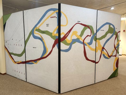
Rivers have frequently made convenient borders between neighboring groups. But what happens when years and years of erosion and shifting weather patterns cause a river to change its course? What happens when someone builds a dam or irrigation controls that alter the river's path? It had been a nearly universally-practiced convention that with the gradual and natural changes to a river over the course of many years, the boundary also gradually moves, but that sudden or man-made alterations would not change the location of a border. But what happens when both happen at the same time?

Along one section of the United States-Mexico border, between the cities of El Paso, Texas, and Ciudad Juárez, Chihuahua, both methods of altering the path of the river occurred simultaneously over many decades, eventually resulting in a confusing and diplomatic mess to determine where the border between the countries laid. 

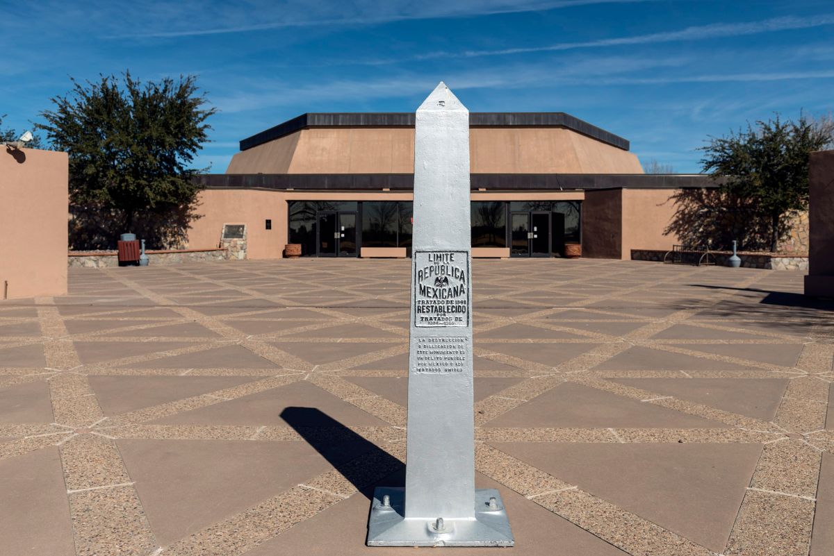
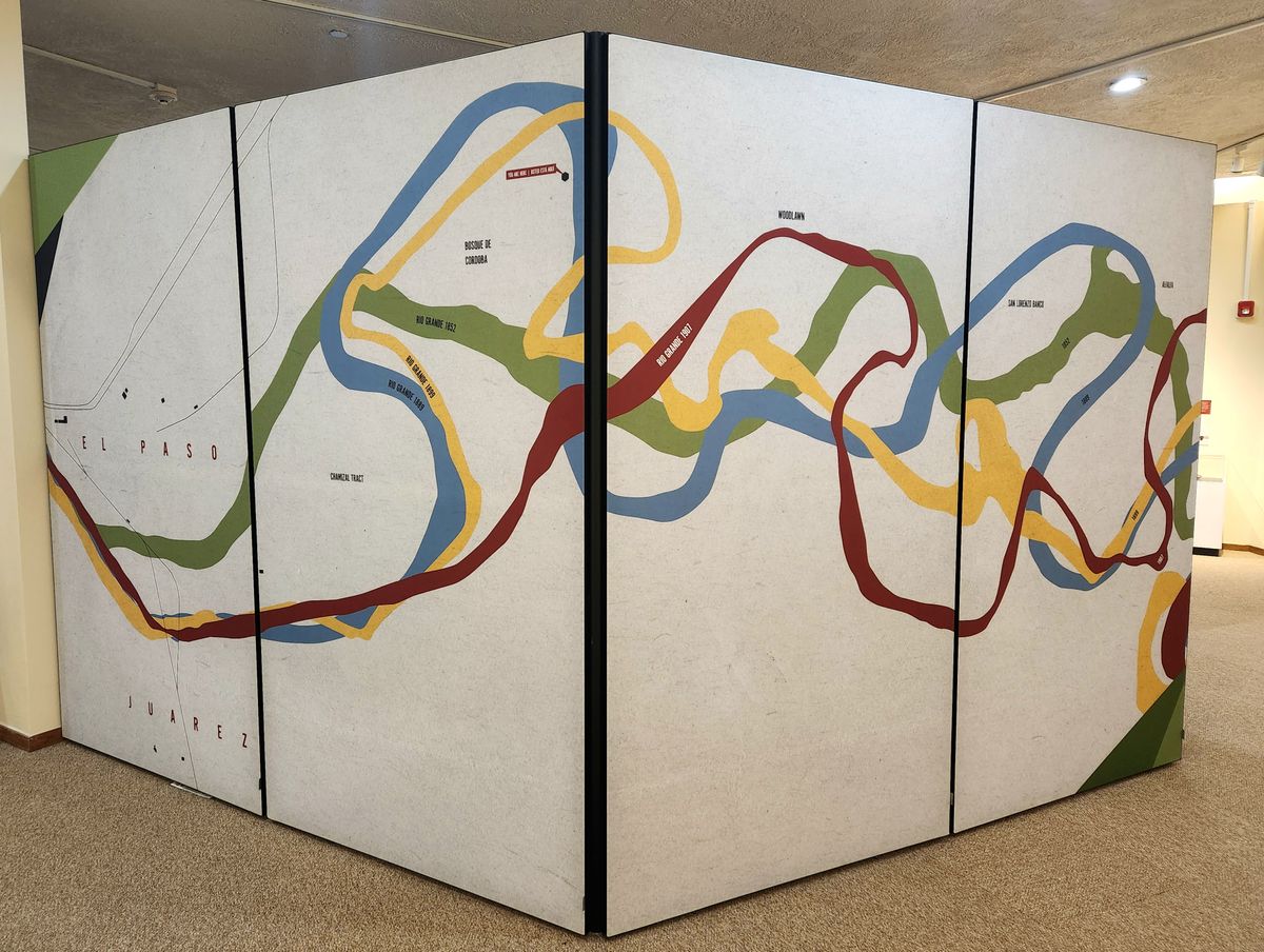
The Treaty of Guadalupe Hidalgo in 1848 that ended the Mexican-American War established much of the border between the countries at the deepest point along the Rio Grande. In the following decades, the river was surveyed as shifting south, mostly gradually but with one dramatic change after a flood in 1864. By 1873, the river had moved so far south that nearly 600 acres that had once been Mexico could arguably be inside the borders of the United States. Texans named this parcel of land "El Chamizal" and began settling there, although both countries claimed the land and lawsuits were filed in the courts of both countries. In 1899, both nations dug channels near the river's path in an effort at flood control. As this was an artificial change to the river's path, it was regarded as not moving the border, but did have the effect of placing an “island” of Mexican land inside the United States.

By the early 1900s, the murky border situation became enough of a diplomatic headache that the presidents of both nations agreed to meet and attempt to come to a settlement. In 1911, a commission recommended a new border be formally established after investigating where and how each section of the river had moved over the decades, but the United States rejected the commission's findings and the dispute continued for many more years, getting worse each year as the river continued to shift and more settlers from both nations moved into disputed territory. There were more proposals aimed at resolving the dispute, including the United States offering to assume Mexican debts or buy the disputed land outright, but none of these made it very far. The Chamizal issue became a stubborn point of pride for both nations. 

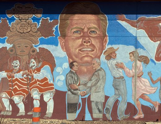
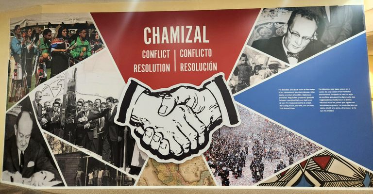
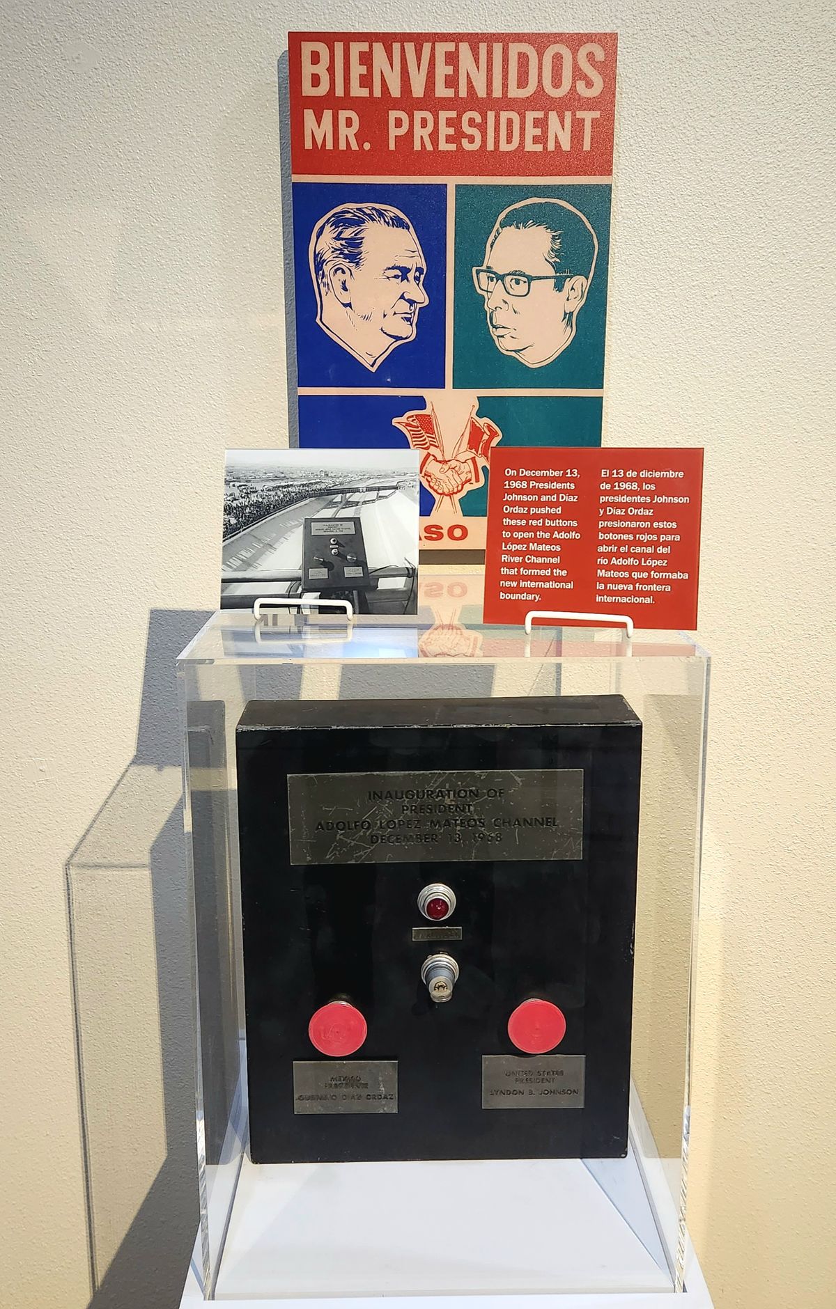
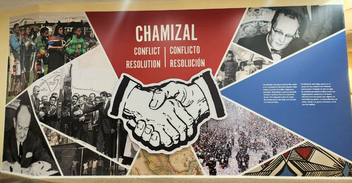
Finally, in 1963, President John F. Kennedy sent word to Mexico that the United States would be willing to accept the 1911 commission's findings. Unfortunately, he was assassinated before it could be formalized, but his successor, Lyndon B. Johnson, followed through on the commitment. Over 400 of the disputed acres were formally recognized to belong to Mexico and nearly 200 acres were recognized to belong to the United States. Both nations agreed to split the costs of creating a concrete channel for the river through the disputed area to prevent it from shifting any further. Nearly 5,600 Americans were required to move when the land they lived on was determined to be Mexican territory (they were compensated for their lost property).

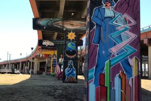
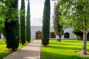
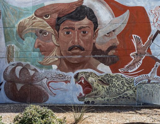
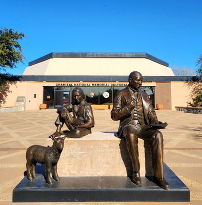
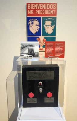
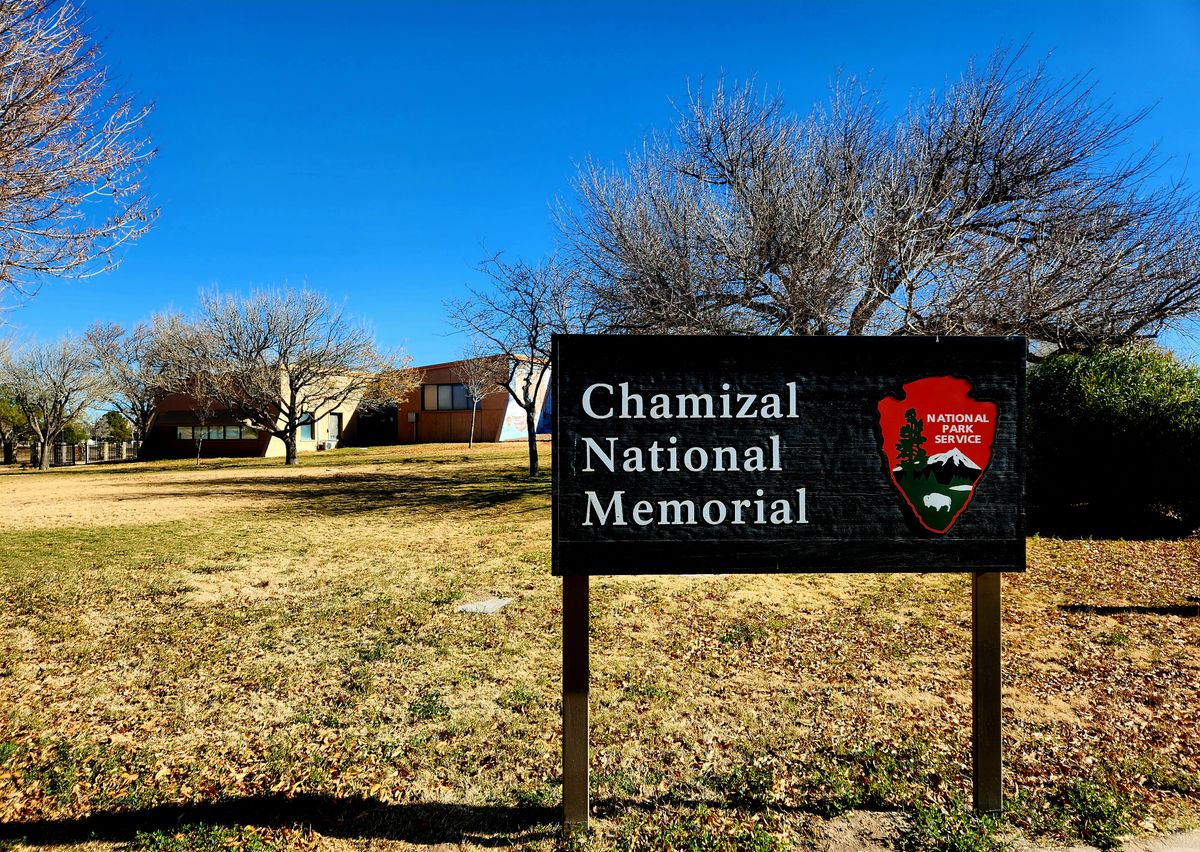
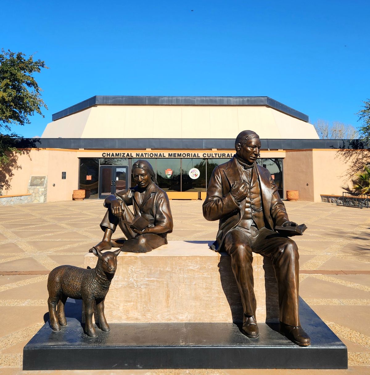
In 1967, the presidents of the U.S. and Mexico met at the disputed border and shook hands in a ceremony celebrating the diplomatic resolution to the dispute. In 1974 the United States established the Chamizal National Memorial on some of the formerly disputed land. A museum in the memorial celebrates the peaceful resolution of the Chamizal conflict and the shared cultural values between the United States and Mexico.

Related Tags

Geographic Oddities Borders National Monument Memorials

Know Before You Go

Chamizal National Memorial is free to visit and open daily, except for Thanksgiving, Christmas, and New Years Day. 

Community Contributors

Added By

WhiskeyBristles

Edited By

Michelle Cassidy

  • Michelle Cassidy

Published

January 19, 2023

Edit this listing

Make an Edit
Add Photos
Chamizal National Memorial
800 S San Marcial St
El Paso, Texas, 79905
United States
31.767241, -106.454337
Visit Website
Get Directions

Nearby Places

Lincoln Park aka Chicano Park

El Paso, Texas

miles away

John Wesley Hardin's Grave

El Paso, Texas

miles away

Magoffin Home

El Paso, Texas

miles away

Explore the Destination Guide

Photo of El Paso

El Paso

Texas

Places 9
Stories 1

Nearby Places

Lincoln Park aka Chicano Park

El Paso, Texas

miles away

John Wesley Hardin's Grave

El Paso, Texas

miles away

Magoffin Home

El Paso, Texas

miles away

Explore the Destination Guide

Photo of El Paso

El Paso

Texas

Places 9
Stories 1

Related Places

  • Wolford Chapel, with its Canadian flag outside.

    Devon, England

    Wolford Chapel

    Despite its location in the English countryside, this chapel is the property of Ontario, Canada.

  • Berlin, Germany

    Steinstücken Exclave

    A helicopter memorial commemorating what was once the only way to access this West Berlin exclave.

  • Tri-States Monument and Delaware River

    Port Jervis, New York

    Tri-States Monument

    A pair of 19th-century granite markers symbolically record where the state boundaries of New York, New Jersey, and Pennsylvania intersect.

  • Markleysburg, Pennsylvania

    Old Tri-State Monument

    This original Mason-Dixon line cairn placed in the 1760s was put in the wrong location because of the gravitational pull of the Allegheny Mountains.

  • Nahwa.

    Nahwa, United Arab Emirates

    Nahwa

    A small United Arab Emirates territory within an Omani enclave within the United Arab Emirates.

  • 1915 Michigan border post

    Erie, Michigan

    Michigan's Lost Peninsula

    This small piece of Michigan is entirely surrounded by Ohio.

  • Baarle-Hertog, Belgium

    The House with Two Numbers

    This residence straddles a border between Belgium and the Netherlands.

  • The border between Stewart, British Columbia and Hyder, as seen from the Canadian side.

    Hyder, Alaska

    Hyder

    The easternmost town in Alaska can only be accessed from Canada.

Aerial image of Vietnam, displaying the picturesque rice terraces, characterized by their layered, verdant fields.
Atlas Obscura Membership

Become an Atlas Obscura Member


Join our community of curious explorers.

Become a Member

Get Our Email Newsletter

Follow Us

Facebook YouTube TikTok Instagram Pinterest RSS Feed

Get the app

Download the App
Download on the Apple App Store Get it on Google Play
  • All Places
  • Latest Places
  • Most Popular
  • Places to Eat
  • Random
  • Nearby
  • Add a Place
  • Stories
  • Food & Drink
  • Itineraries
  • Lists
  • Video
  • Podcast
  • Newsletters
  • All Trips
  • Family Trip
  • Food & Drink
  • History & Culture
  • Wildlife & Nature
  • FAQ
  • Membership
  • Feedback & Ideas
  • Community Guidelines
  • Product Blog
  • Unique Gifts
  • Work With Us
  • About
  • FAQ
  • Advertise With Us
  • Advertising Guidelines
  • Privacy Policy
  • Cookie Policy
  • Terms of Use
Atlas Obscura

© 2025 Atlas Obscura. All Rights Reserved.