Nepal’s Mounting an Expedition to Discover if Everest Has Shrunk
The long history of measuring the world’s highest point.


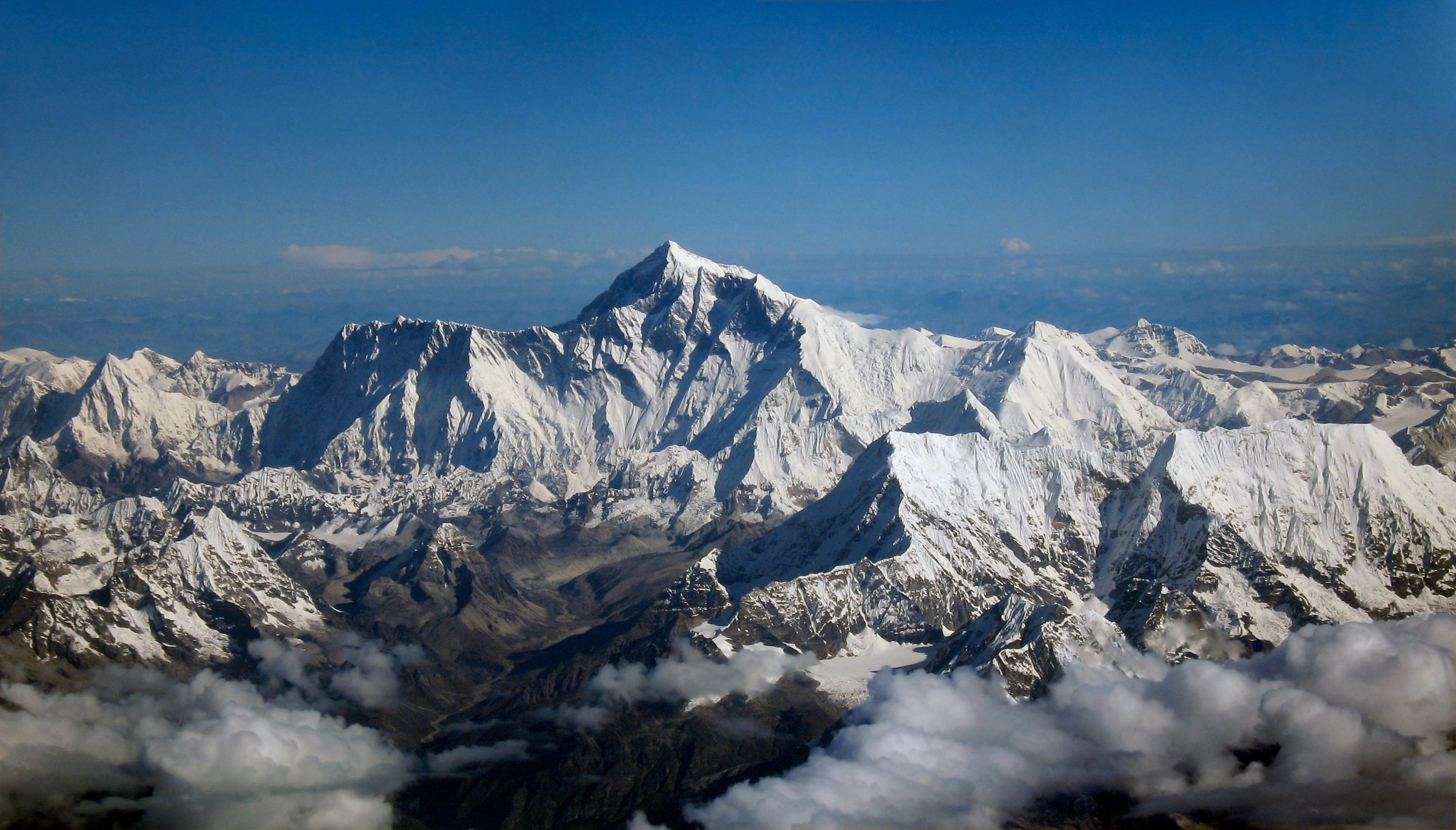
In April 2015, a 7.8-magnitude earthquake rocked Nepal. The quake destroyed buildings and claimed lives, but it also reshaped the region’s geology. It was large enough to cause many Himalayan peaks to drop slightly—including the world’s tallest mountain.
When satellites passed over Mount Everest, early readings suggested its peak appeared to have lost an inch. However, the initial measurements aren’t quite accurate enough to know what actually happened—an inch isn’t a lot on more than 29,000 feet of rock. Since the quake, the true height of Everest has been a topic of discussion in the scientific community. Now Nepal’s Survey Department is about to try to end those arguments by sending a specially trained team up to the summit to get a final, Nepal-approved height and quash rumors that the pride of the nation may have lost a little of its stature.
This effort began back in 2017, when the department commissioned a team of climbers to begin training and conducting fieldwork for the perilous technical journey. Now the team is ready. “Nepal has never measured Everest on its own although the world’s highest peak lies in its territory,” Ganesh Prasad Bhatta, head of the Survey Department, said to AFP in 2017. “So, we want to prove to our people that Nepal is capable of measuring Everest.”
It seems like the height of a mountain—even if it shifts or changes—shouldn’t be much cause for controversy, but measuring one with precision is easier said than done, and that can lead to disagreements. The first proper measurements of the mountain were taken during Britain’s Great Trigonometrical Survey of India, under the direction of Sir George Everest. It was announced in 1856 that the mountain’s highest point is 29,002 feet above sea level.
An Indian survey team measured the mountain at 29,029 feet in the 1950s, a number confirmed by Chinese surveyors—give or take a couple of inches—in the 1970s. An American team equipped with GPS came up with 29,035 in 1999, followed by another Chinese survey in 2005 that measured the bedrock without the ice and snow, and came up with 29,017. Over the years, different teams from different corners of the world have all come up with slightly different numbers.
China and Nepal have been at odds end over the height for a few years now. Specifically, some in Nepal believe that China’s 2005 height—slightly lower—diminished the mountain, and that China then started using the higher number again when they realized that Nepal was drawing more climbers than Tibet. It’s confusing, but at the very least, national pride is at stake.
According to the Nepal Survey Department, the team will employ precise leveling, trigonometric leveling, gravity surveys, and the Trimble R10, a new Global Navigation Satellite System gifted to them by New Zealand. Even then, no measurement will be final. The mountain will continue to lose height from earthquakes, gain it between them, and inch up as the Indian Plate presses northward.


Follow us on Twitter to get the latest on the world's hidden wonders.
Like us on Facebook to get the latest on the world's hidden wonders.
Follow us on Twitter Like us on Facebook