About
If ever there were a mountain range that gets no respect, it's the White Mountains of California. As they consist of a wide ridge some 60 miles long, much of it over 10,000 feet and including White Mountain Peak, California's third-highest at 14,252 feet (4,344 meters), this neglect might seem at first sight puzzling. The Whites' problem is that they lie in the shadow of the Sierra Nevada—both literally and figuratively.
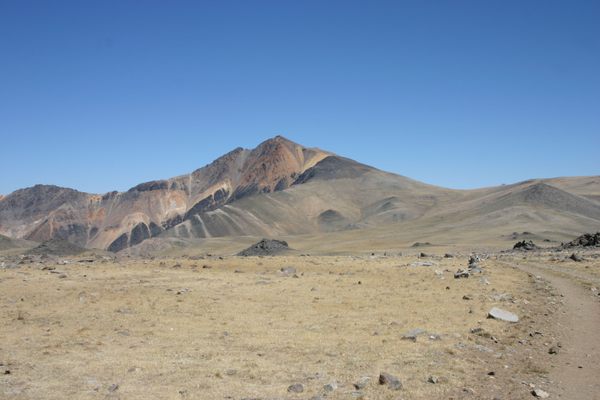
The abundant alpine lakes, streams, and meadows (not to mention the snowfields and glaciers) that are characteristic of the Sierra simply don't exist in the White Mountains. The dry climate of this range is much more like the ranges in the Great Basin to the east. And, although the White Mountains support one of the largest stands of bristlecone pines, famous for their great ages, forest cover overall is nonetheless minimal. To make up for the lack of greenery, the brilliantly colored rocks that make up much of the range do have a stark beauty of their own.
The White Mountains also contain several University of California high-altitude research stations, in particular the Barcroft Field Station at 12,470 feet (3,800 meters). It's on a dirt road that continues as a Jeep track all the way to the top of White Mountain Peak, where a summit hut is maintained as part of the research installation.
Normally the road to the Barcroft Station is gated about two miles before the station to prevent public vehicle access, although non-motorized travel all the way to the summit is permitted. Twice a year, however, the Barcroft Field Station holds an "open house" during which the public can drive all the way to the station, although motorized traffic on the Jeep road beyond is still not allowed. The UC personnel will have displays and give talks on their research.
You can also continue, on foot or mountain bike, to White Mountain Peak and so get a two-mile head start on the usual trail. In addition, medical technicians will be at the Summit Hut to check your blood oxygen, if you wish—though be warned, there tends to be a long wait! In any case, the sweeping views from the trail and summit are well worth the trip.
Related Tags
Know Before You Go
From Big Pine, California take State Route 168 12.8 miles east to the White Mountain Road (USFS 01) and turn left (north). It is now 25.5 miles to the gate to the Barcroft Station. The road is paved for the first 10 miles, to the Bristlecone Visitor Center, and graded thereafter. If it's Open House the gate will be open and you can proceed all the way to the Barcroft field station, another 2 miles. Although the road should be passable to passenger cars as far as the station, high clearance will be useful once there because parking is limited.
Covid precautions have currently (2021) postponed the open house. Check the website for updates and schedules.
Community Contributors
Added By
Published
February 3, 2022

