


About
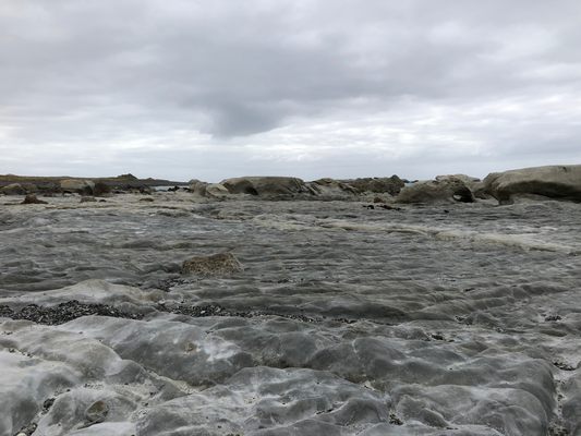
On November 4th, 2016, a 7.8 magnitude earthquake ripped across multiple fault lines on New Zealand’s South Island. This earthquake caused immense devastation and irreversibly changed the landscape in many areas.
One such area of dramatic landscape alteration was Ward Beach, about 83 miles (135 kilometers) northeast of the epicenter.
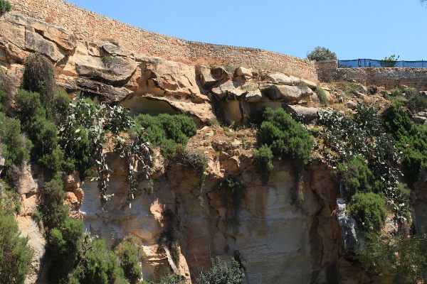
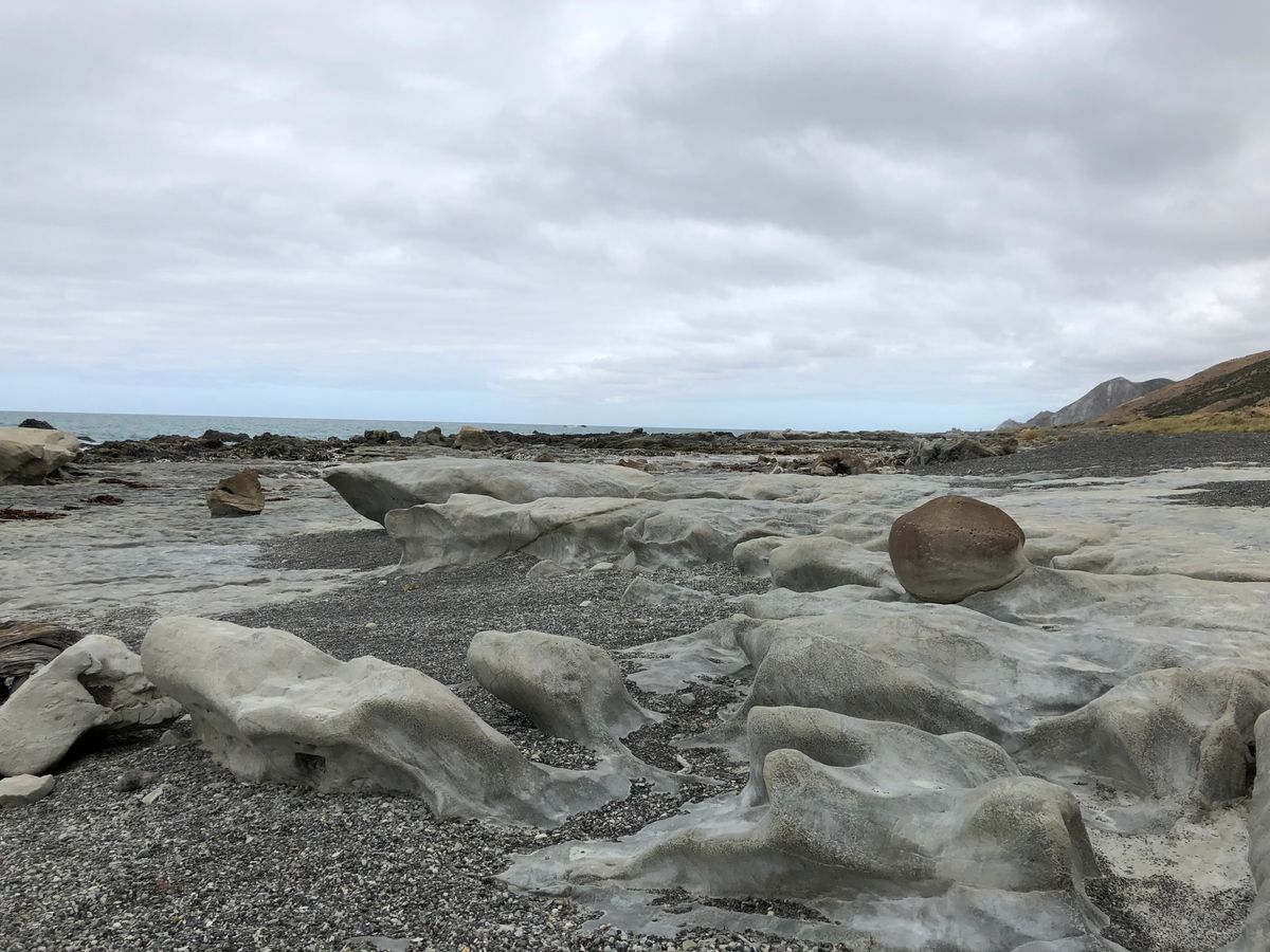
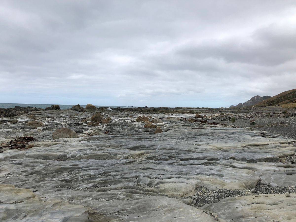
Here, the land rose by over six feet (two meters). This caused the seafloor to uplift, exposing an otherworldly landscape. The area that is now exposed includes the K-T Boundary or the Cretaceous-Palaeogene Boundary. The K-T Boundary represents the extinction event that ended the reign of dinosaurs. This boundary can be seen in the exposed rocks along the north end of the beach.
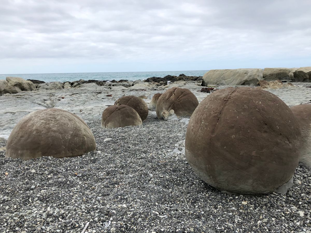
Concretions, large spherical rocks made of dolomite, can also be seen at Ward Beach. This landscape had been shaped by the action of the tides and waves for countless years, and now, exposed to the air, rain, and wind, begins another stage in its transformation.
Related Tags
Know Before You Go
Head to the end of Ward Beach Road (there is an unsealed/gravel section). There is plenty of parking for cars and camper vans once you reach the beach.
Head north from the parking area and you will come to the first area of uplift quite soon, but for more dramatic scenery and to see the K-T Boundary, keep walking for less than a mile and this will bring you to the Chancet’s Rock area.
The gravel on the beach can be deep and moving in places, so watch your step and steer clear of any seals that are there.
Wild New Zealand: Exploring the North & South Islands
Stunning landscapes, unique wildlife, and rich Māori culture.
Book NowCommunity Contributors
Added By
Published
July 9, 2021