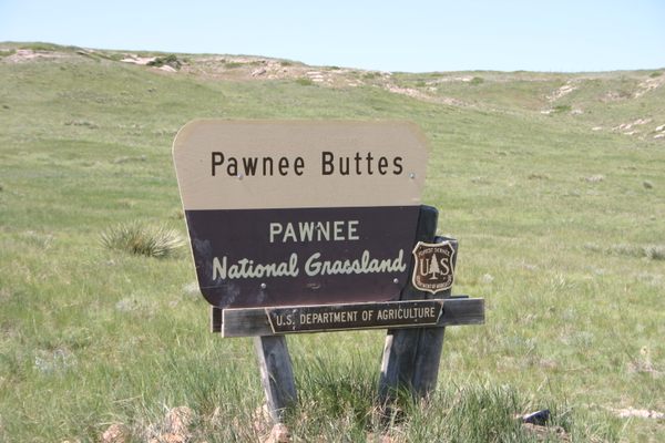
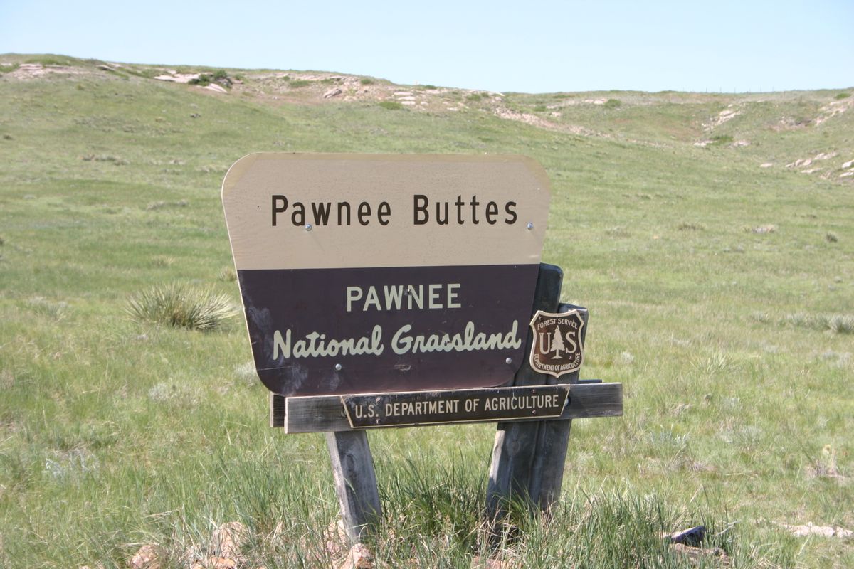
Trips Places Foods Stories Newsletters

Take your next trip with Atlas Obscura!

Our small-group adventures are inspired by our Atlas of the world's most fascinating places, the stories behind them, and the people who bring them to life.

Visit Adventures
Trips Highlight
Puglia Italy - Matera
Italy • 8 days, 7 nights
Southern Italy: Castles, Caves & Coastal Treasures in Puglia
from
Turkmenistan Gates of Hell Darvaza crater
Turkmenistan • 10 days, 9 nights
Turkmenistan & the Gates of Hell
from
View all trips
Top Destinations
Latest Places
Most Popular Places Random Place Lists Itineraries
Add a Place
Download the App
Top Destinations
View All Destinations »

Countries

  • Australia
  • Canada
  • China
  • France
  • Germany
  • India
  • Italy
  • Japan

Cities

  • Amsterdam
  • Barcelona
  • Beijing
  • Berlin
  • Boston
  • Budapest
  • Chicago
  • London
  • Los Angeles
  • Mexico City
  • Montreal
  • Moscow
  • New Orleans
  • New York City
  • Paris
  • Philadelphia
  • Rome
  • San Francisco
  • Seattle
  • Stockholm
  • Tokyo
  • Toronto
  • Vienna
  • Washington, D.C.
Latest Places
View All Places »
Pinal Airpark
Note the chrysanthemum crests.
Hachiman Bridge
Clarendon War Memorial.
Clarendon War Memorial
This fried chicken is one of Bangkok’s most famous.
Gai Tord Jae Kee
Latest Places to Eat & Drink
View All Places to Eat »
Order a flight of infused ya dong shots.
Tep Bar
Thai-Chinese makes up Bangkok’s largest diaspora.
Nai Ek Roll Noodle
This fried chicken is one of Bangkok’s most famous.
Gai Tord Jae Kee
Chefs Aruss Lerlerstkull and Atcharaporn Kiatthanawat lean into regional traditions.
Charmgang
The khao soi at Gedhawa comes with a rich, coconutty broth.
Gedhawa
Recent Stories
All Stories Video Podcast
Most Recent Stories
View All Stories »
Haleakalā National Park’s summit region, shrouded in the pre-dawn fog.
Beware the Legends Behind These National Park Souvenirs
6 days ago
For Aguilar-Carrasco, nature is a powerful reminder of the interconnectedness of all life.
How Can National Parks Be Made Accessible to All? AO Wants to Know.
7 days ago
Podcast: Finding ‘The Great Gatsby’ in Louisville
8 days ago
Here’s which treats you can safely lug home without risking a fine.
Dear Atlas: What International Food Can I Legally Bring Into the U.S.?
9 days ago

No search results found for
“”

Make sure words are spelled correctly.

Try searching for a travel destination.

Places near me Random place

Popular Destinations

  • Paris
  • London
  • New York
  • Berlin
  • Rome
  • Los Angeles
Trips Places Foods Stories Newsletters
Sign In Join
Places near me Random place
All the United States Colorado Grover Pawnee Buttes
AO Edited

Pawnee Buttes

On the edge of grassland in northeastern Colorado, these rock formations are some of the few remnants of a high plain that has eroded away over millions of years.

Grover, Colorado

Added By
slgwv
Email
Been Here
Want to go
Added to list
West Butte (left), with East Butte in the distance to the right.   slgwv / Atlas Obscura User
East Butte.   slgwv / Atlas Obscura User
Pawnee Buttes in the middle distance (West Butte to left, East Butte to right), with the Chalk Bluffs on the skyline. Note the wind turbines on the Chalk Bluffs.   slgwv / Atlas Obscura User
Official USFS sign.   slgwv / Atlas Obscura User
Trail to East Butte.   slgwv / Atlas Obscura User
East Butte seen from the north.   slgwv / Atlas Obscura User
Pawnee Buttes from the north. East Butte on the left.   slgwv / Atlas Obscura User
Pawnee Buttes with the Chalk Bluffs on the skyline; note the wind turbines. The East Butte is partly hidden behind the West Butte.   slgwv / Atlas Obscura User
West Butte and the trail.   slgwv / Atlas Obscura User
West Butte (left), with the East Butte beyond.   slgwv / Atlas Obscura User
Looking back west at West Butte.   slgwv / Atlas Obscura User
Pawnee Grasslands.   slgwv / Atlas Obscura User
Informational sign about Pawnee National Grasslands.   slgwv / Atlas Obscura User
Pawnee Buttes Trailhead   MZCHIF / Atlas Obscura User
Pawnee Buttes Dispersed Camping vista  
December 2024   shaseela / Atlas Obscura User
Been Here
Want to go
Added to list

About

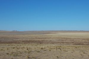
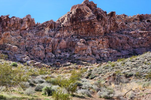
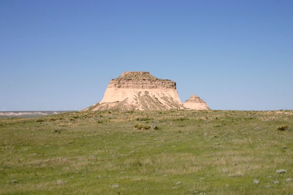
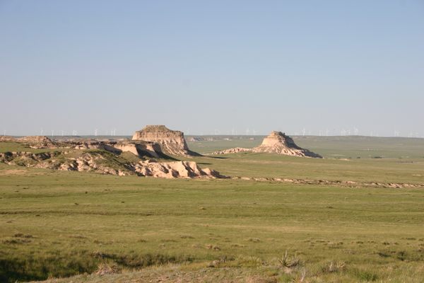
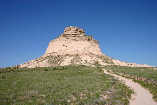
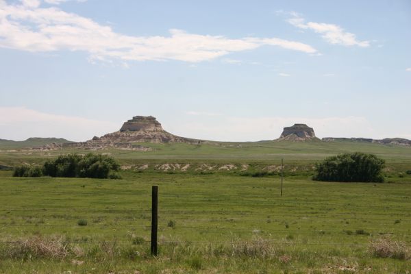
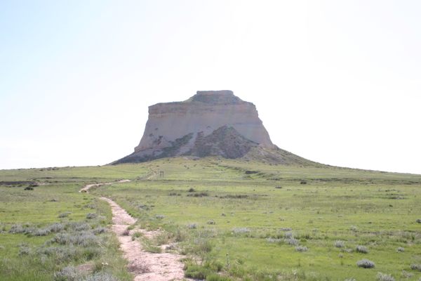
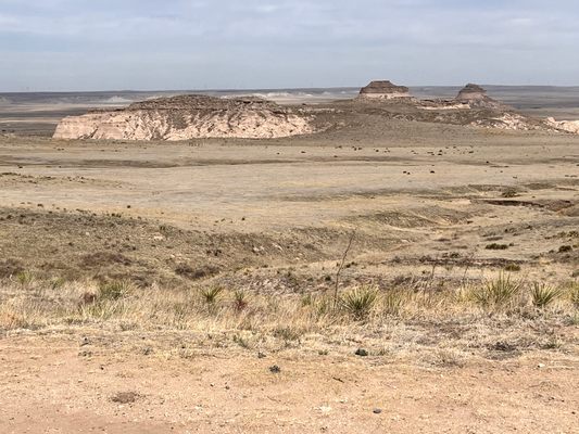
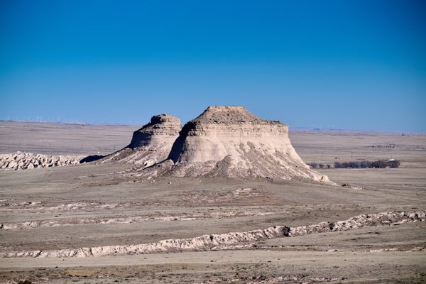
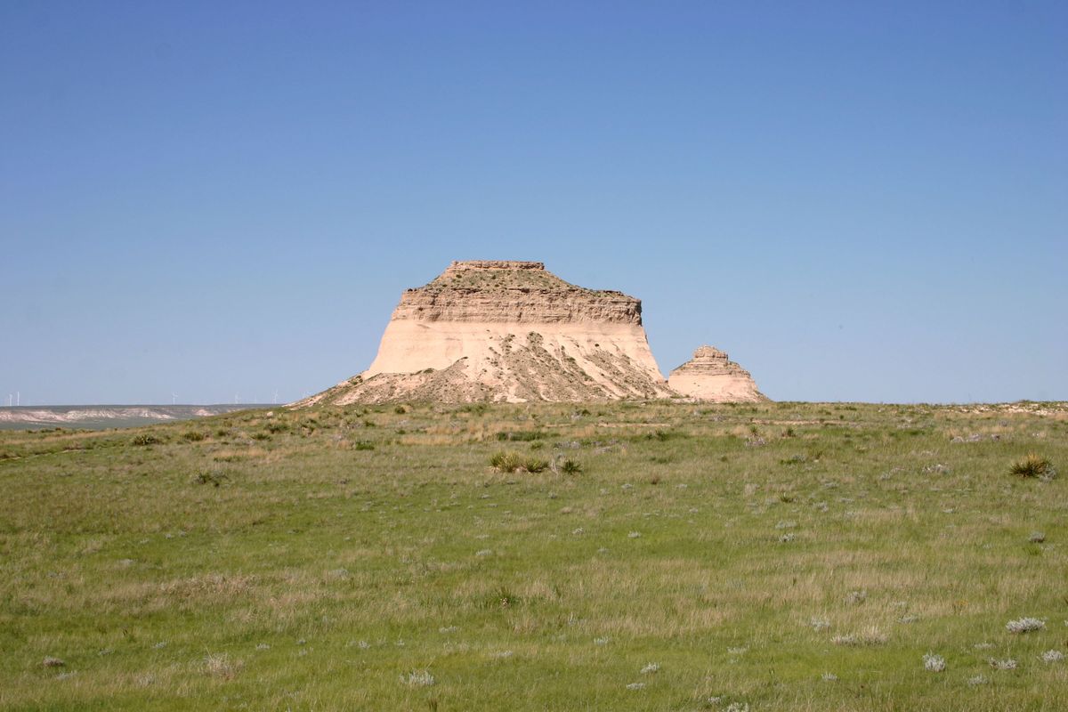
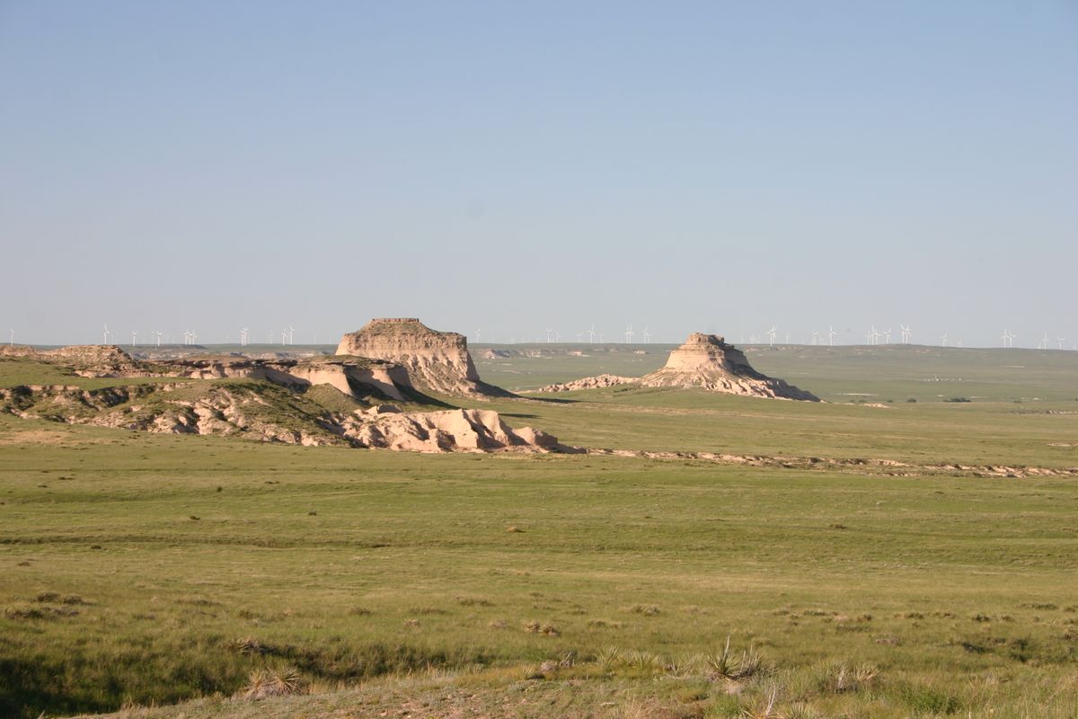
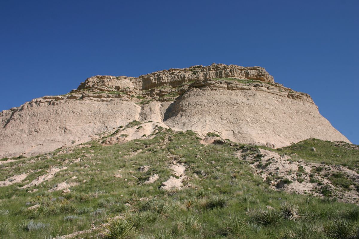
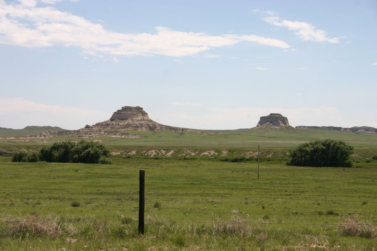
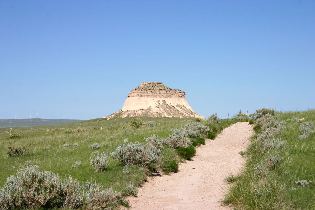
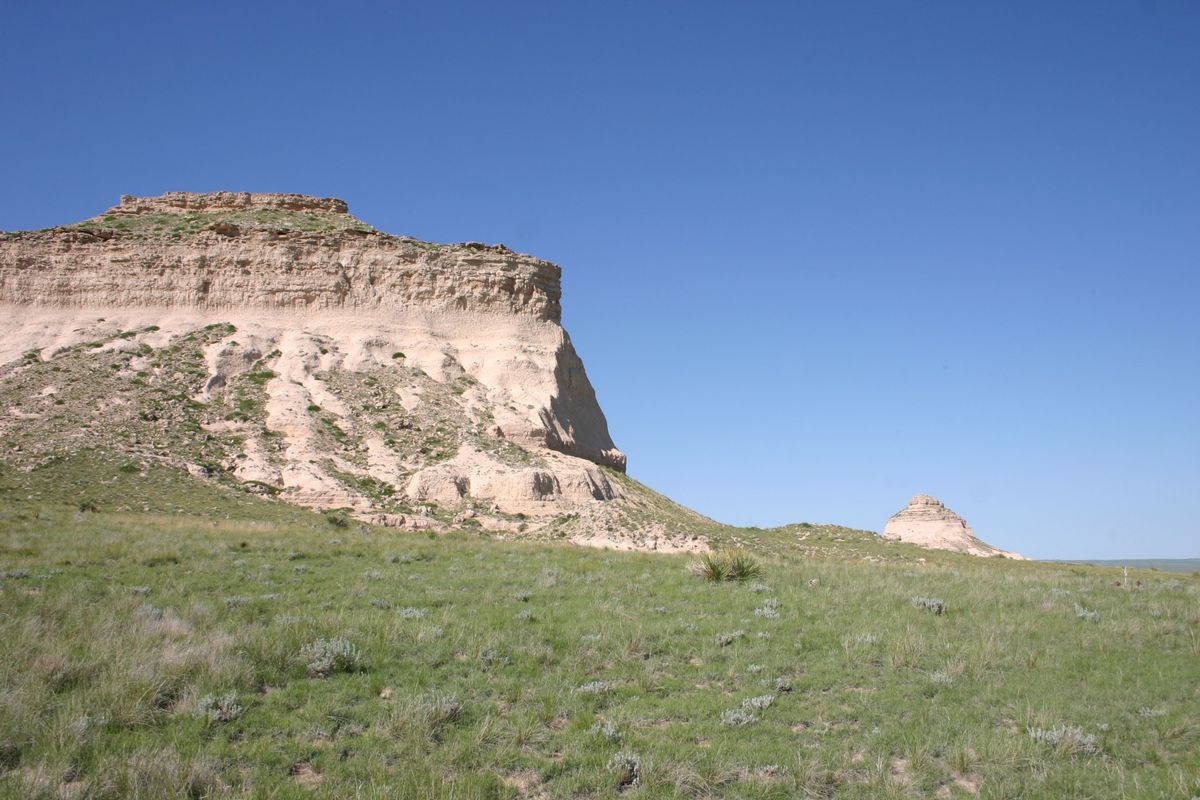
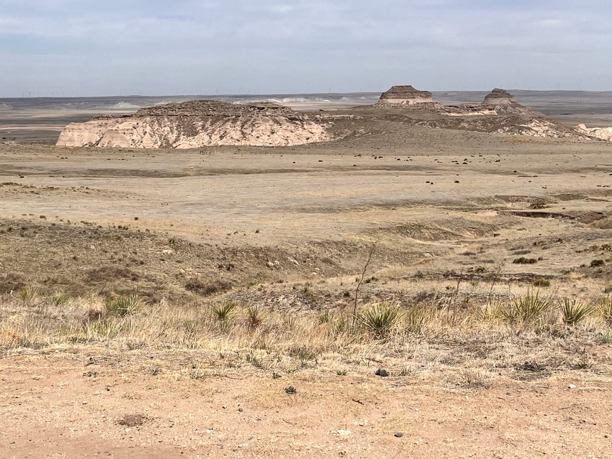
The Pawnee Buttes don't fit the usual Colorado stereotypes. You won't find towering mountains or deep canyons here, but a different landscape with its own charms and history. The buttes are the remnants of a higher plain that has mostly been eroded away here, but to the north is still a continuous plain known as the Chalk Bluffs.

The buttes rise some 300 feet (91 meters) above the surrounding plains, where large herds of bison once grazed and were hunted by Native Americans. Some trappers came through in the early 19th century, but the first major Euro-American influx was from the cattle drives out of Texas; at first from Texas into Colorado, but later along the Texas-Montana trail just to the east. Homesteaders arrived in the latter 19th century as barbed wire shut off the cattle drives, and they prospered for some decades. Falling prices and droughts, however, culminating in the infamous Dust Bowl, led to the abandonment of most agriculture aside from some ranching.

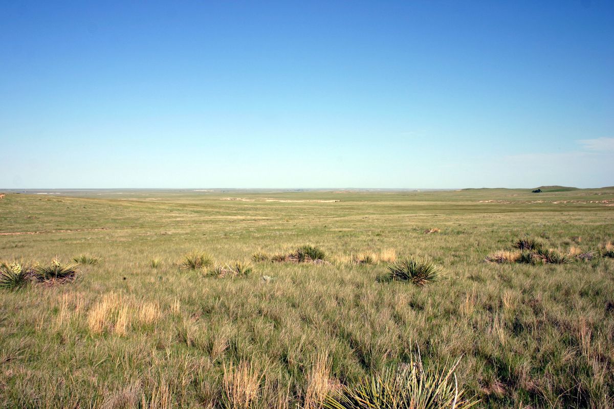
In the 1930s, the federal government took over most of the ruined farms, and today the area largely lies in the Pawnee National Grasslands. Native grasses have been replanted and the area is now an excellent example of a recovered shortgrass prairie.

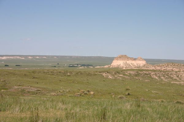
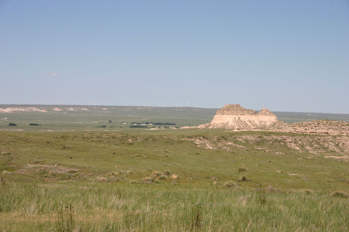
Energy is another traditional industry in the area. Some producing oil wells still exist, but more recently construction of wind farms has boomed. The Chalk Bluffs in particular are the site of a large turbine installation.

There is also an isolated remnant population of limber pines there left over from the last ice age. Limber pines are typically a higher altitude species found many miles away in the mountains.

Related Tags

Rocks Rock Formations Geology

Know Before You Go

The preferred route to Pawnee Buttes follows the first part of Pawnee Pioneer Trails, an official scenic byway. At the east end of Raymer on Colorado State Route 14 go north on County Road 129 to the intersection of Co. Rd. 110 and turn left. About 6.3 miles in Road 129 will dogleg to the left (west) and continue as County Road 127. A defunct Minuteman missile silo is situated along here, about 6.8 miles from Raymer.

Once on County Road 110 follow it 5.9 miles where it makes a right-angle bend north; the road then bends west again after half a mile. After another mile the main road bends south at a right angle, but another road comes in from the right. This is the road to the Pawnee Buttes trailhead. The trailhead is about 1.2 miles on the right, and is well-marked.  

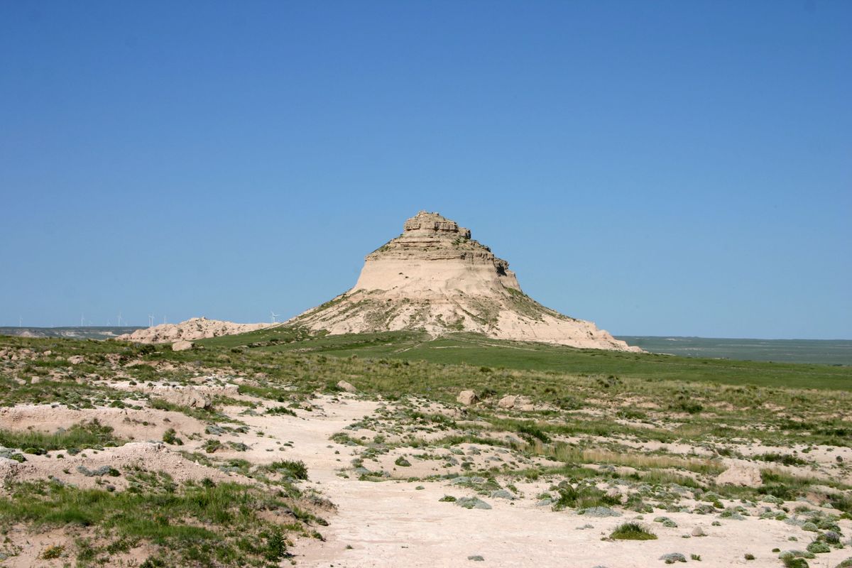
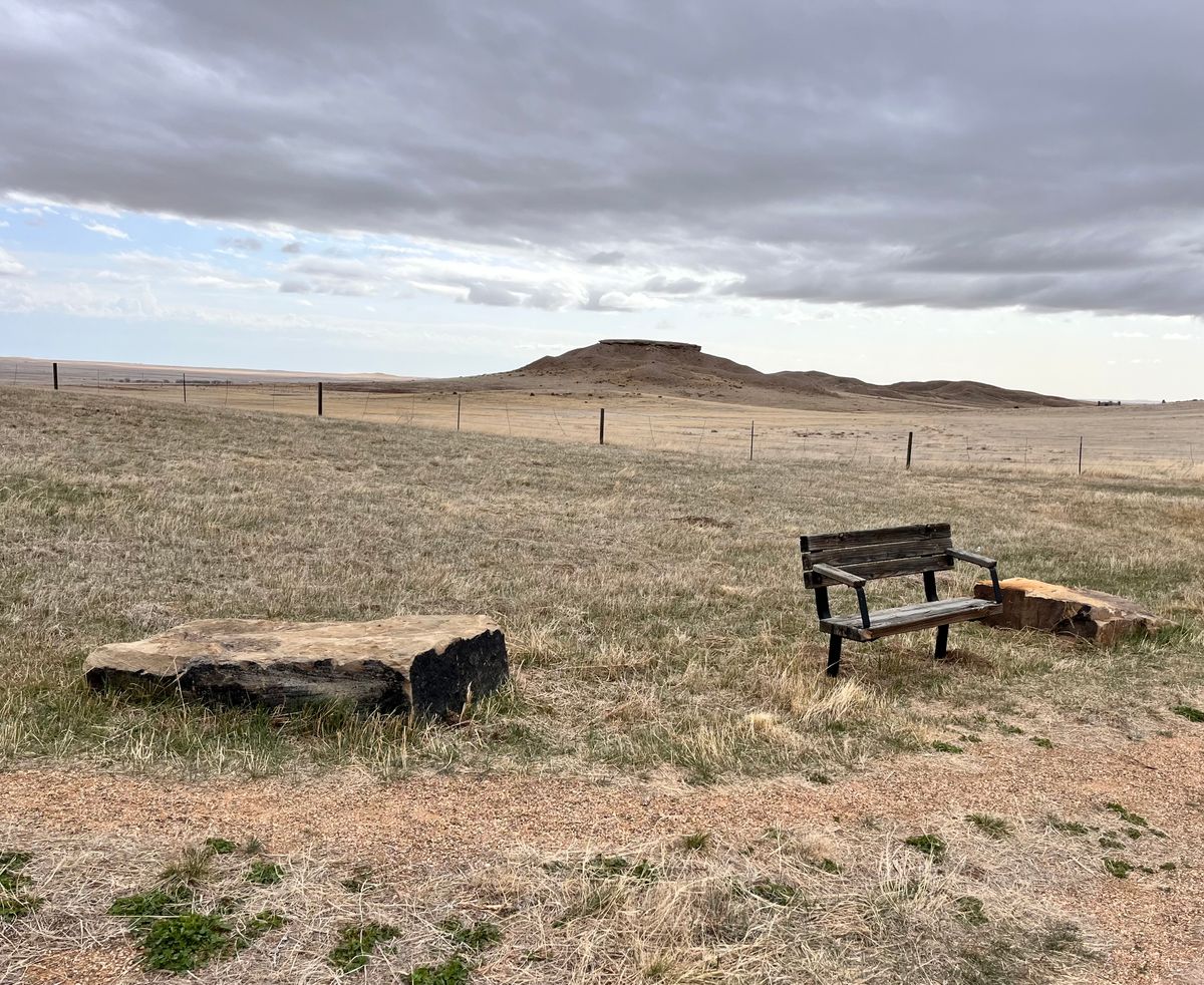
It is about 1.5 miles out to the West Butte, which is in the Pawnee National Grasslands. The trail continues another half mile or so to the East Butte, which mostly lies on private land. Please be respectful and leave any gates as you found them.

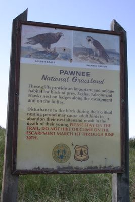
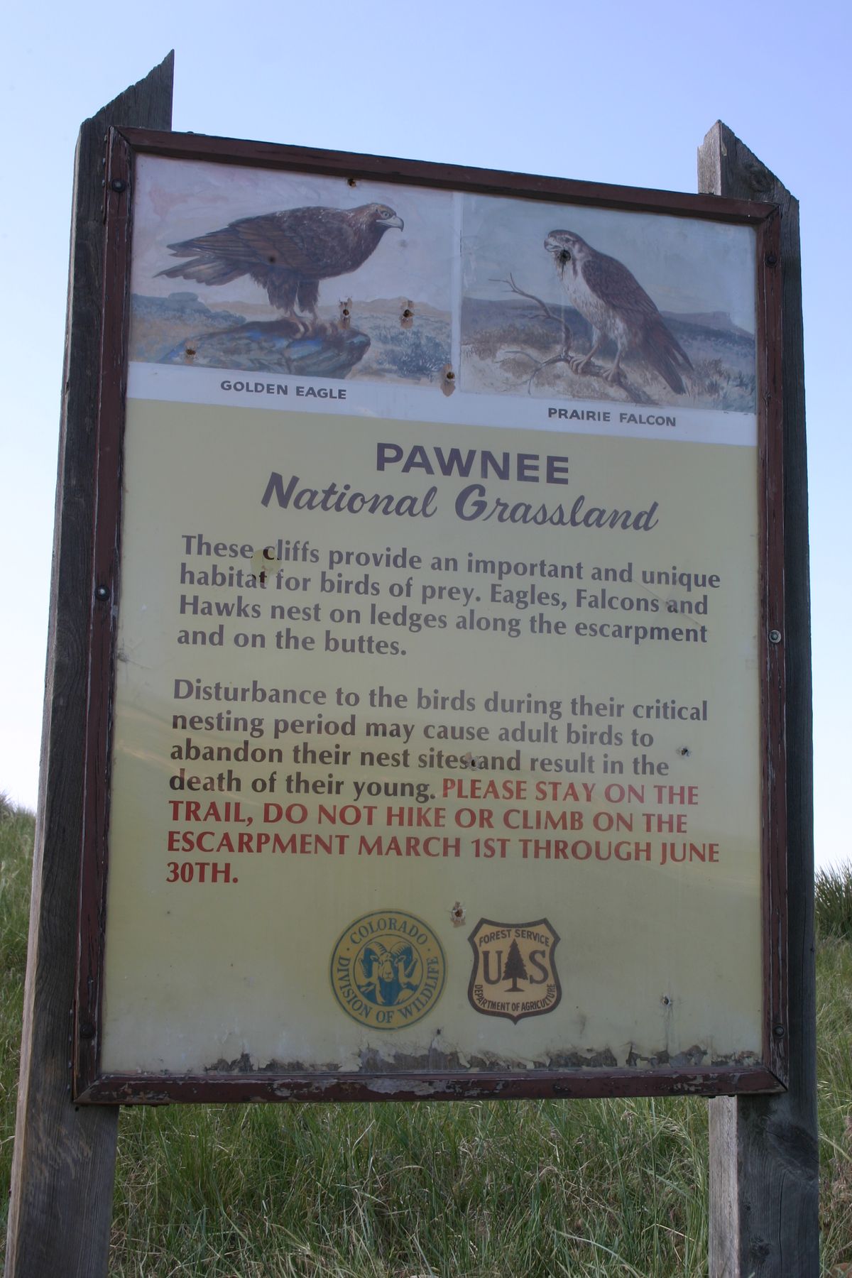
In particular, don't climb on the Buttes as that causes erosion damage. In addition, during the raptor nesting season (March 1 through June 30), the bluffs on either side of the trail near the beginning are closed.

Community Contributors

Added By

slgwv

Edited By

perreault611, MZCHIF, shaseela

  • perreault611
  • MZCHIF
  • shaseela

Published

May 13, 2022

Edit this listing

Make an Edit
Add Photos
Sources
  • https://www.thefencepost.com/news/a-brief-history-of-the-pawnee-buttes/
Pawnee Buttes
Grover, Colorado, 80729
United States
40.821604, -103.978515
Visit Website

Nearby Places

Colorado-Nebraska-Wyoming Tri-State Marker

Grover, Colorado

miles away

Panorama Point

miles away

Dearfield Ghost Town

Orchard, Colorado

miles away

Explore the Destination Guide

Photo of Grover

Grover

Colorado

Places 2

Nearby Places

Colorado-Nebraska-Wyoming Tri-State Marker

Grover, Colorado

miles away

Panorama Point

miles away

Dearfield Ghost Town

Orchard, Colorado

miles away

Explore the Destination Guide

Photo of Grover

Grover

Colorado

Places 2

Related Places

  • Window arch in the City of Rocks.

    Almo, Idaho

    City of Rocks

    This U.S. natural reserve is an ancient spiritual place and rock climber’s paradise.

  • Colorful sandstone cliff just west of the Colorock Quarry.

    Moapa Valley, Nevada

    Buffington Pockets

    The rocks exposed at Valley of Fire State Park also occur in a much less known but equally spectacular area a few miles to the southwest.

  • Grampian, Pennsylvania

    Bilger's Rocks

    Rocky outcrops containing overhangs, caves, fissures, clefts, and alcoves that invite exploration and scrambling.

  • Glen Rock

    Glen Rock, New Jersey

    Glen Rock

    The 570-ton boulder that gave a New Jersey town its name.

  • Mexican Hat

    Mexican Hat, Utah

    Mexican Hat

    This balancing rock is one of Utah's most unusual geological formations.

  • Mortana, Australia

    Murphy’s Haystacks

    These oddly shaped pink granite formations got their name after being mistaken for massive piles of hay.

  • Prominent “fang.”

    Nye County, Nevada

    Fang Ridge

    Red rock "fangs" jut out of the desert near the Extraterrestrial Highway.

  • Edmaier’s Secret

    Big Water, Utah

    Edmaier's Secret

    This hidden gem in Arizona is truly worth the rugged journey.

Aerial image of Vietnam, displaying the picturesque rice terraces, characterized by their layered, verdant fields.
Atlas Obscura Membership

Become an Atlas Obscura Member


Join our community of curious explorers.

Become a Member

Get Our Email Newsletter

Follow Us

Facebook YouTube TikTok Instagram Pinterest RSS Feed

Get the app

Download the App
Download on the Apple App Store Get it on Google Play
  • All Places
  • Latest Places
  • Most Popular
  • Places to Eat
  • Random
  • Nearby
  • Add a Place
  • Stories
  • Food & Drink
  • Itineraries
  • Lists
  • Video
  • Podcast
  • Newsletters
  • All Trips
  • Family Trip
  • Food & Drink
  • History & Culture
  • Wildlife & Nature
  • FAQ
  • Membership
  • Feedback & Ideas
  • Community Guidelines
  • Product Blog
  • Unique Gifts
  • Work With Us
  • About
  • FAQ
  • Advertise With Us
  • Advertising Guidelines
  • Privacy Policy
  • Cookie Policy
  • Terms of Use
Atlas Obscura

© 2025 Atlas Obscura. All Rights Reserved.