Trips Places Foods Stories Newsletters
Loading...
Loading...
Loading...
Loading...

No search results found for
“”

Make sure words are spelled correctly.

Try searching for a travel destination.

Places near me Random place

Popular Destinations

  • Paris
  • London
  • New York
  • Berlin
  • Rome
  • Los Angeles
Trips Places Foods Stories Newsletters
Sign In Join
Places near me Random place
All the United States Pennsylvania Bilger's Rocks
AO Edited

Bilger's Rocks

Rocky outcrops containing overhangs, caves, fissures, clefts, and alcoves that invite exploration and scrambling.

Grampian, Pennsylvania

Added By
slgwv
Email
Been Here
Want to go
Added to list
CAPTION
  slgwv / Atlas Obscura User
  slgwv / Atlas Obscura User
Top of the rocks.   slgwv / Atlas Obscura User
  slgwv / Atlas Obscura User
  slgwv / Atlas Obscura User
  slgwv / Atlas Obscura User
  slgwv / Atlas Obscura User
  slgwv / Atlas Obscura User
  slgwv / Atlas Obscura User
  slgwv / Atlas Obscura User
Looking from the top of the rocks.   slgwv / Atlas Obscura User
Map of Bilger’s Rocks.   slgwv / Atlas Obscura User
About Bilger’s Rocks.   slgwv / Atlas Obscura User
Start of the hiking trail below the rocks.   slgwv / Atlas Obscura User
Top of the rocks.   slgwv / Atlas Obscura User
Been Here
Want to go
Added to list

About

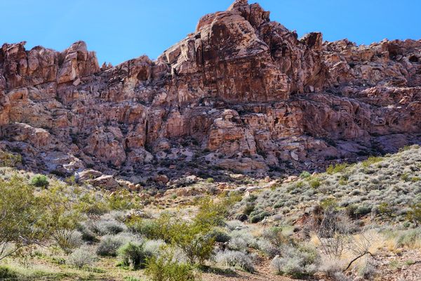
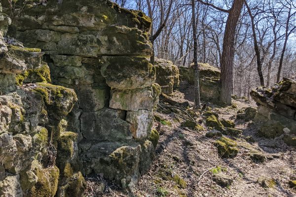
A "rock city" consisting of large blocks weathering out of an outcrop is common in arid environments, and not only can be an aesthetically attractive feature but a recreational resource. Such features are not common in a humid environment like the Appalachians, however, where weathering is more extreme and heavy vegetation tends to smother bedrock outcrops.

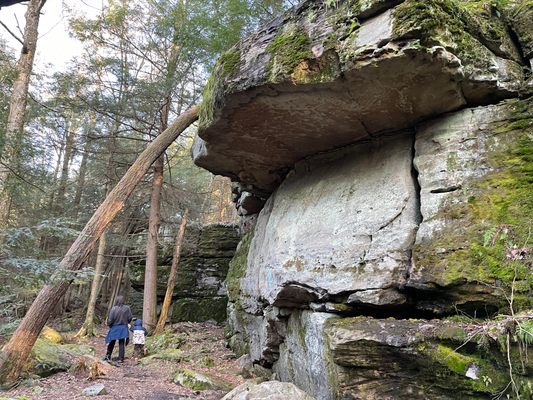
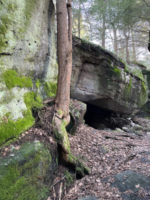
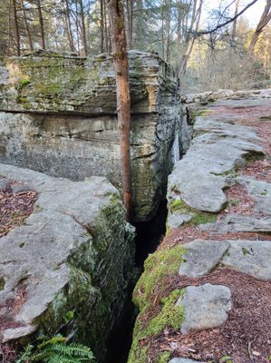
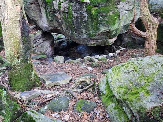
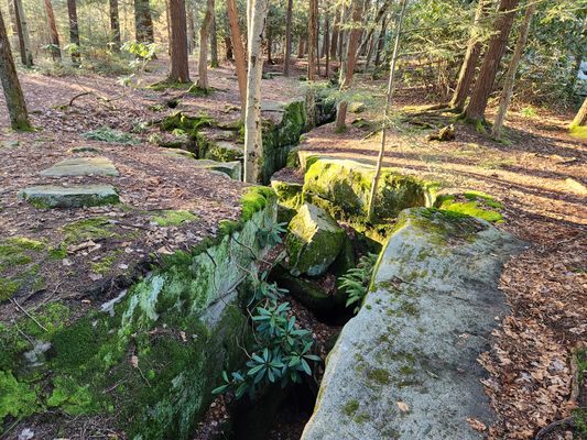
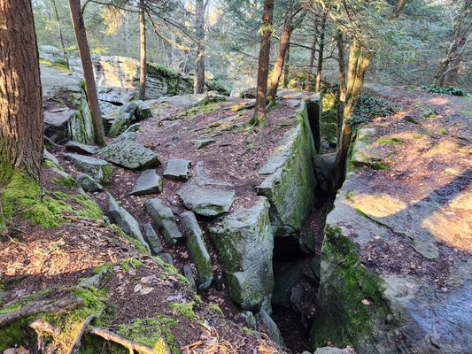
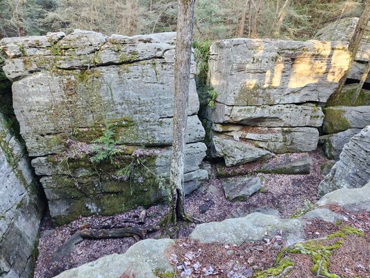
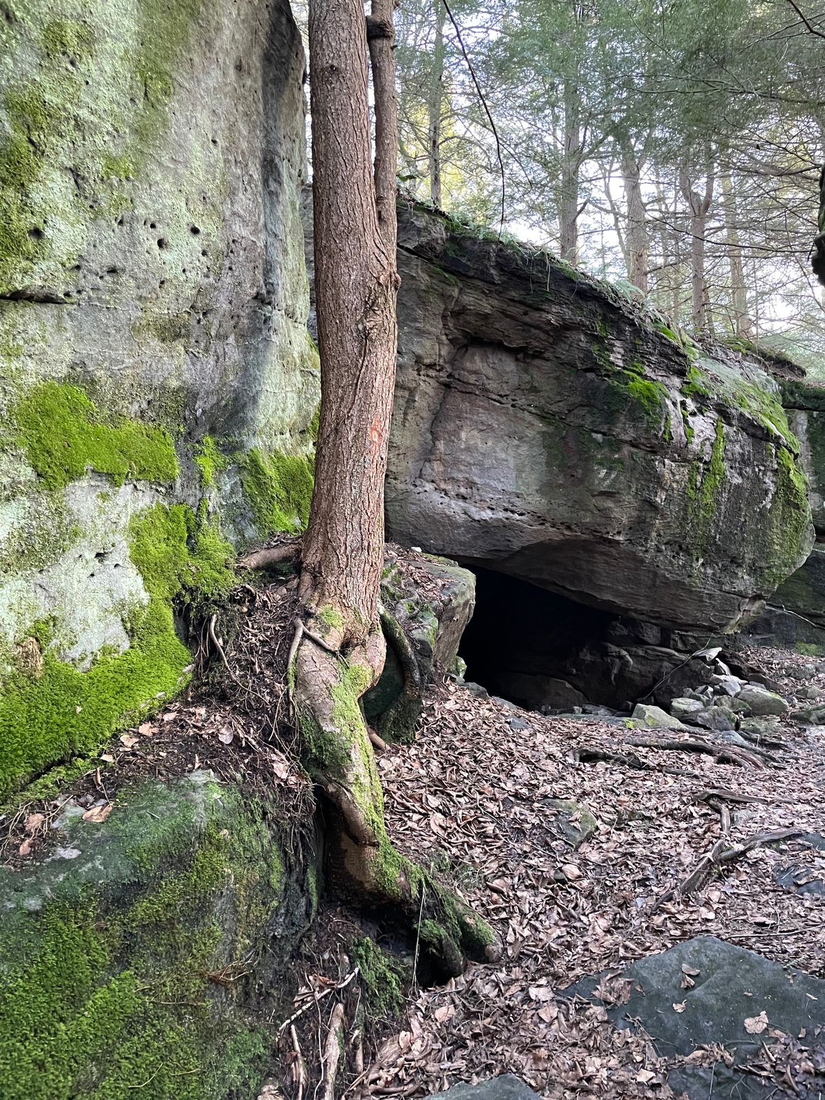
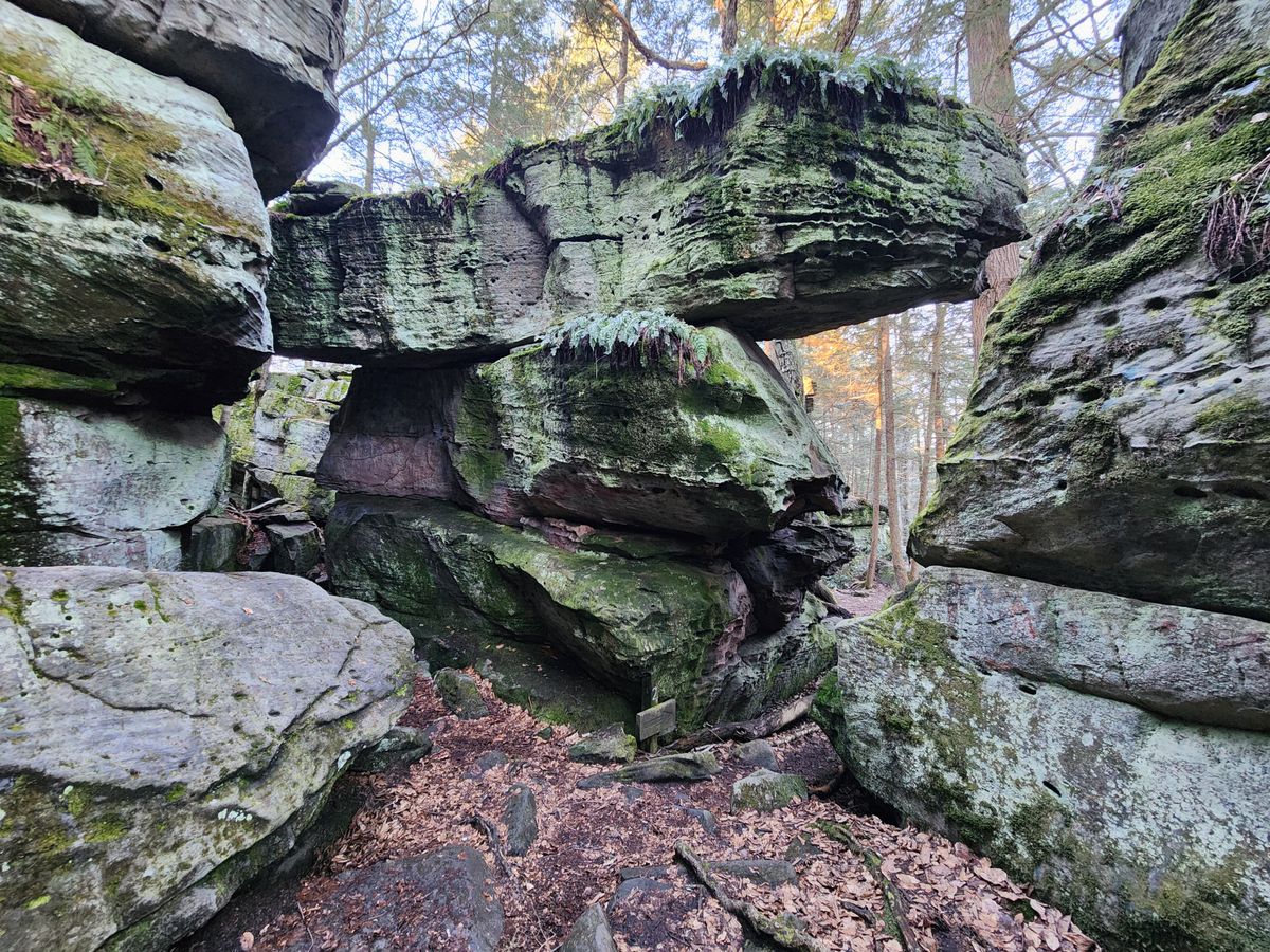
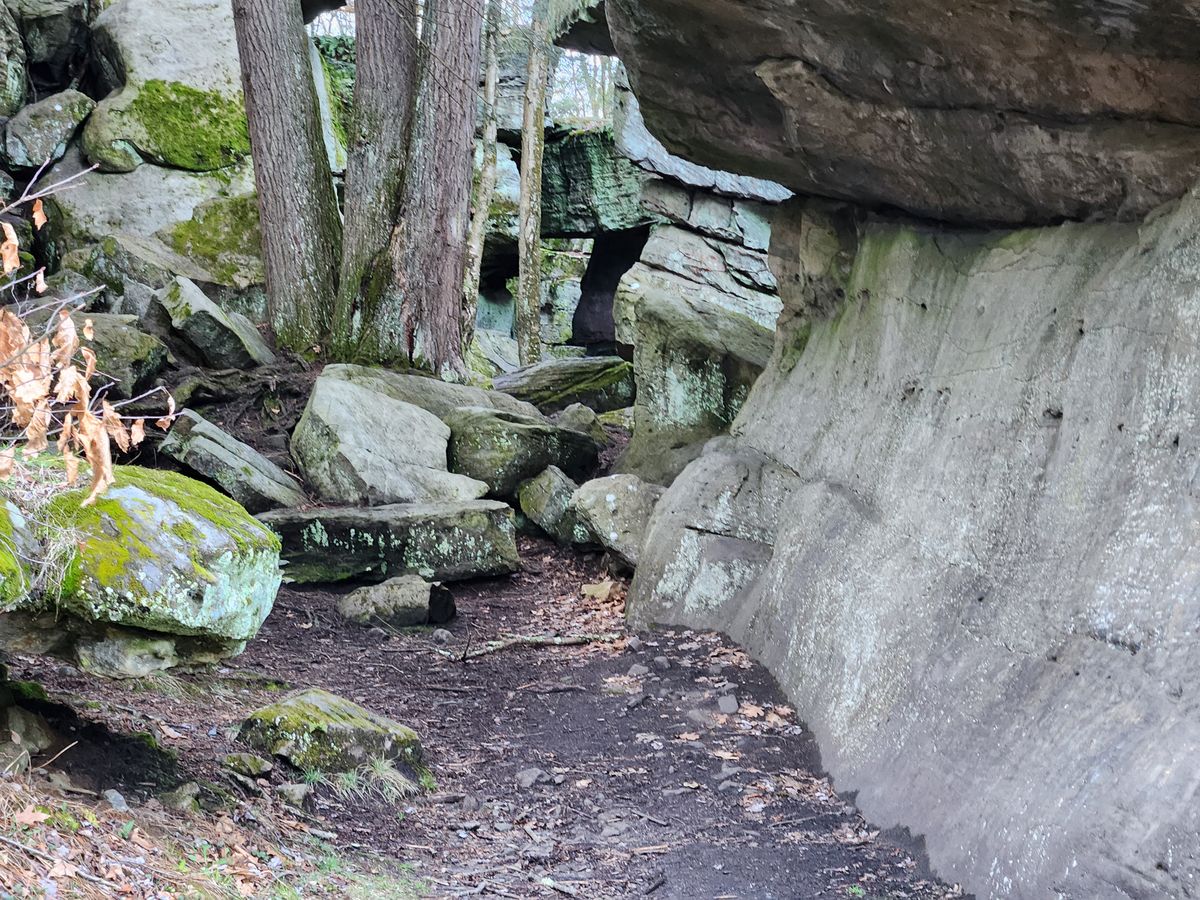
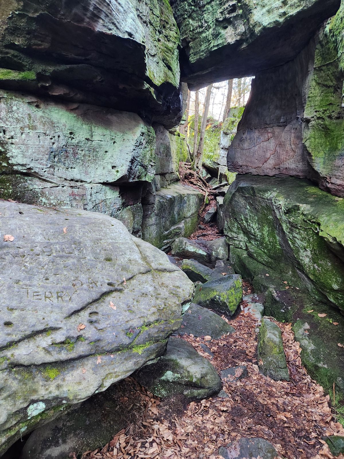
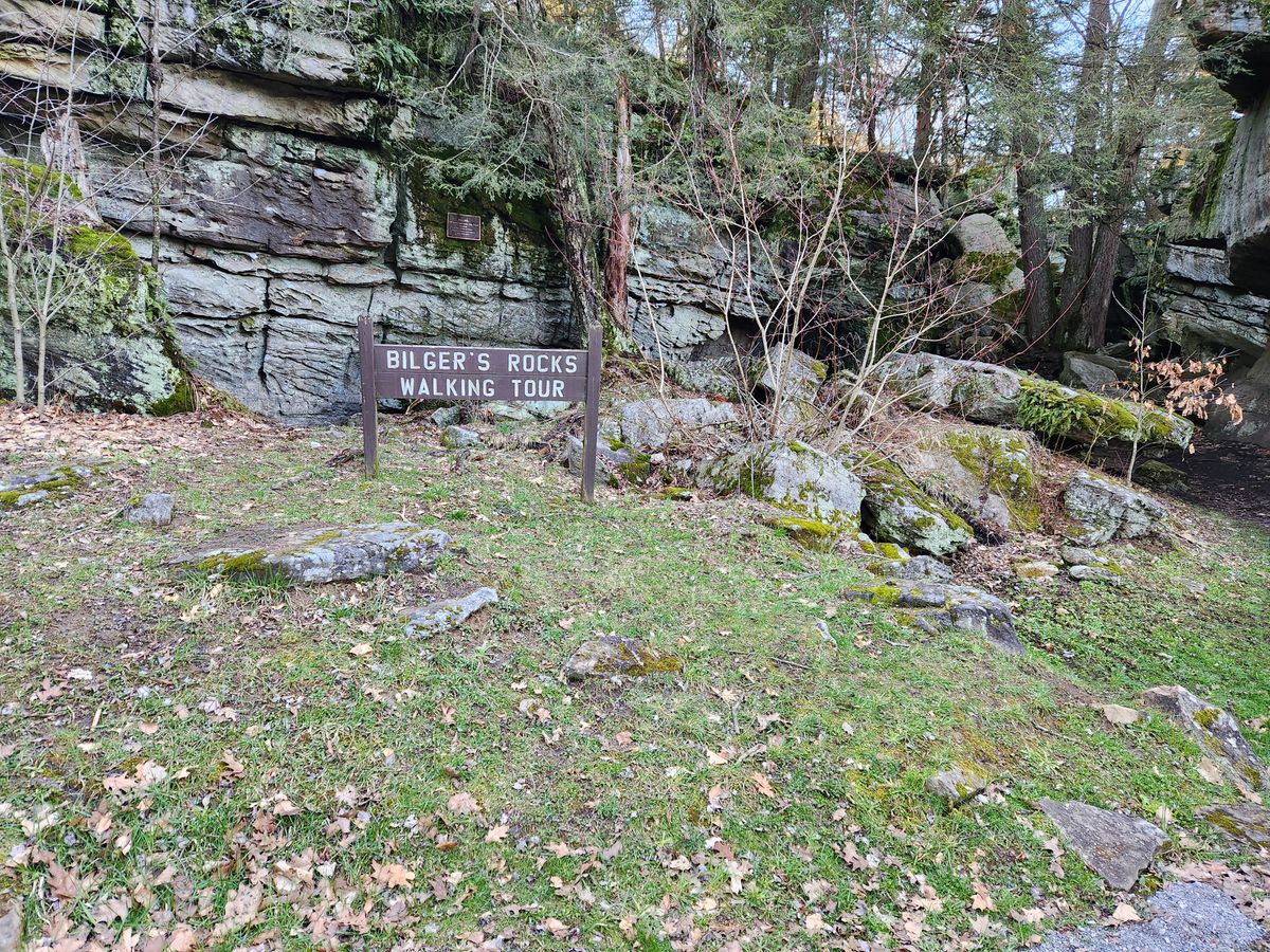
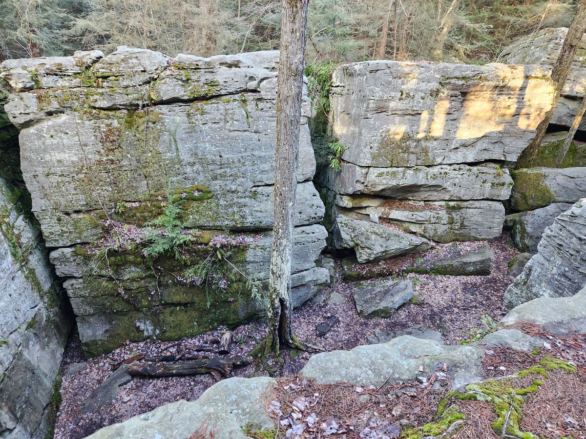
A few such places do exist, however, and Bilger's Rocks is one of the most spectacular. In fact, it's been called the best example in Pennsylvania. Here blocks of crossbedded Homewood Sandstone of the Pottsville Formation, typically 20-25 feet thick, have broken out of the continuous strata in the bedrock.

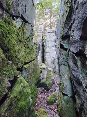
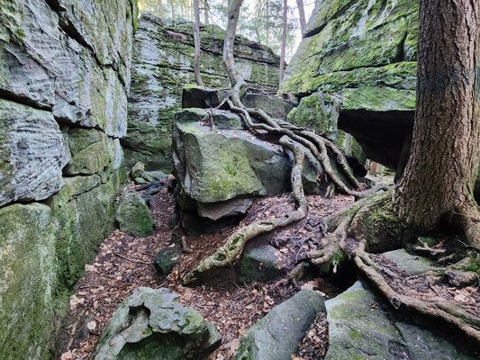
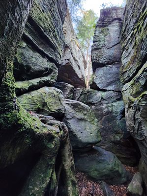
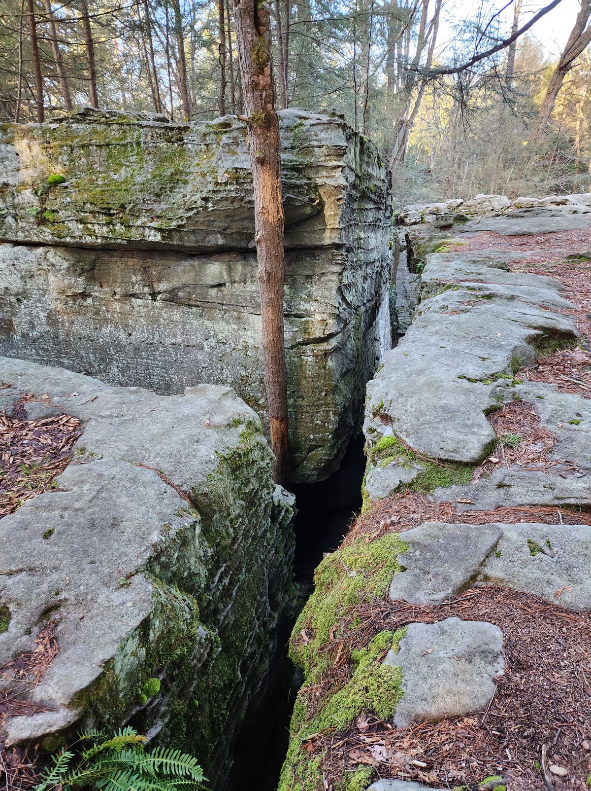
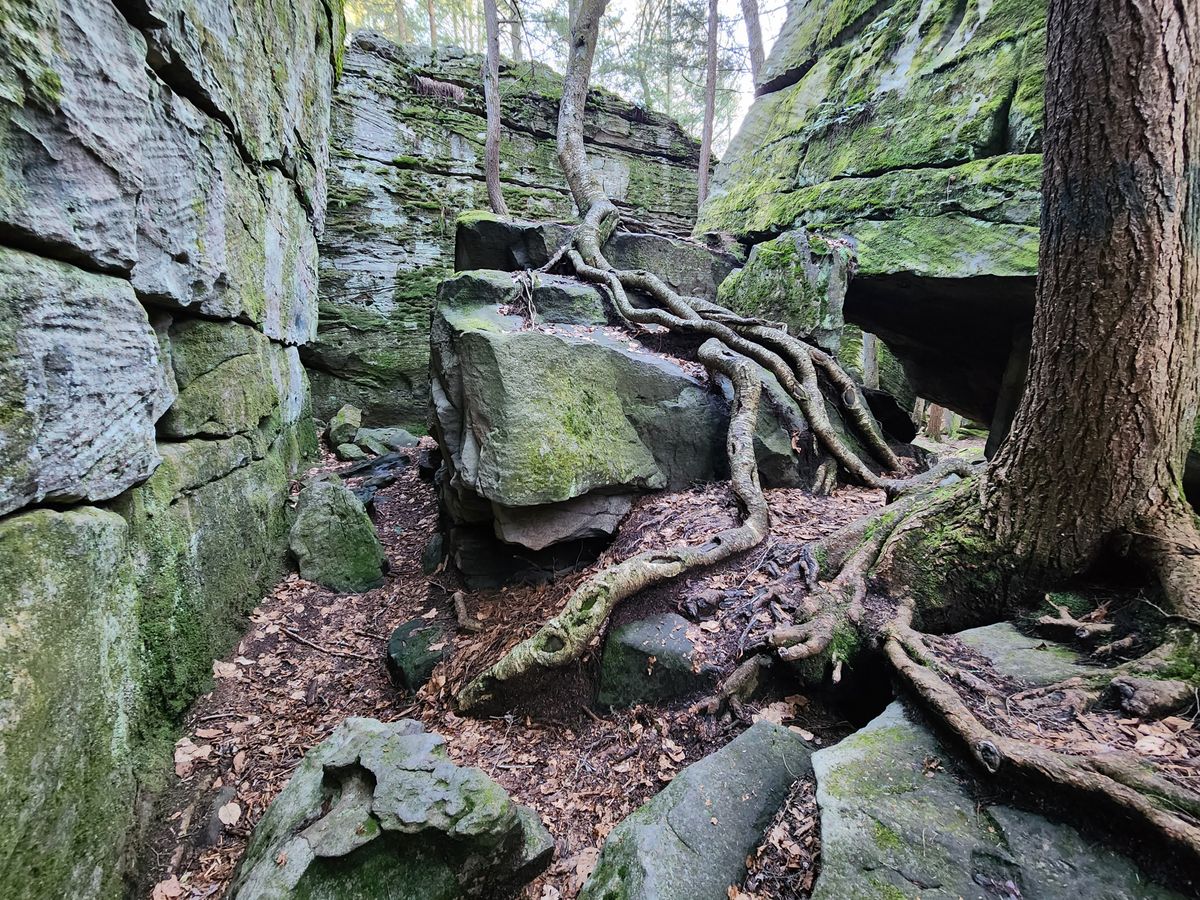
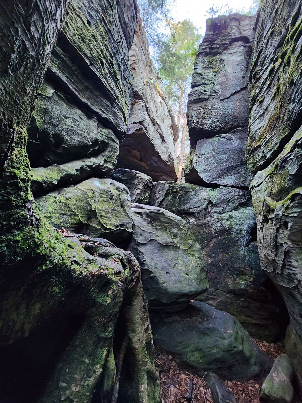
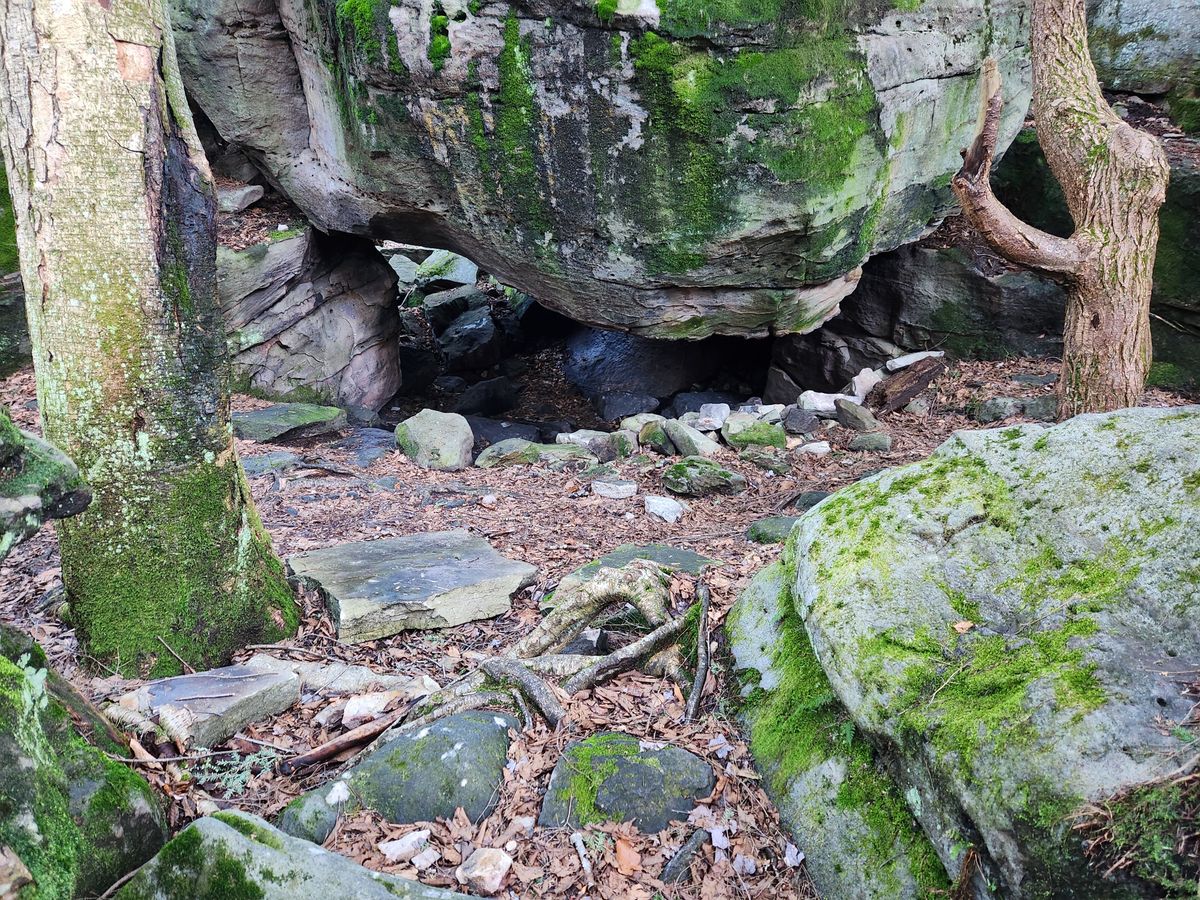
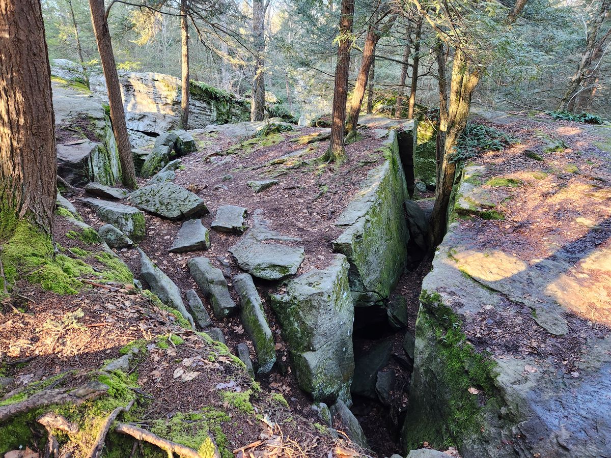
Glacial freeze-thaw cycles let blocks settle into the soft substrate and slide apart at jointing (straight cracks), leading to gaps between the blocks ranging from inches to feet. Frost wedging (splitting by ice forming in cracks) no doubt also contributed to the erosion. Vegetation, tree roots in particular, has added to the wedging action and also the aesthetic appeal.

The appearance of large roots growing over the blocks has been likened to ruins in a lost city in the jungle. The larger cracks, wide enough to be passable to a person, also form hidden pathways that invite exploration.

Related Tags

Rock Formations Geological Oddities Geology Rocks

Know Before You Go

One straightforward way is to take State Route 879 off Interstate 80 through Clearfield for 10.4 miles and turn right on the Greenville Pike. Then follow the Greenville Pike 2.3 miles to Bilger's Rocks Road and turn left. Follow this road 0.7 mile; Bilger's Rocks will be on the right.

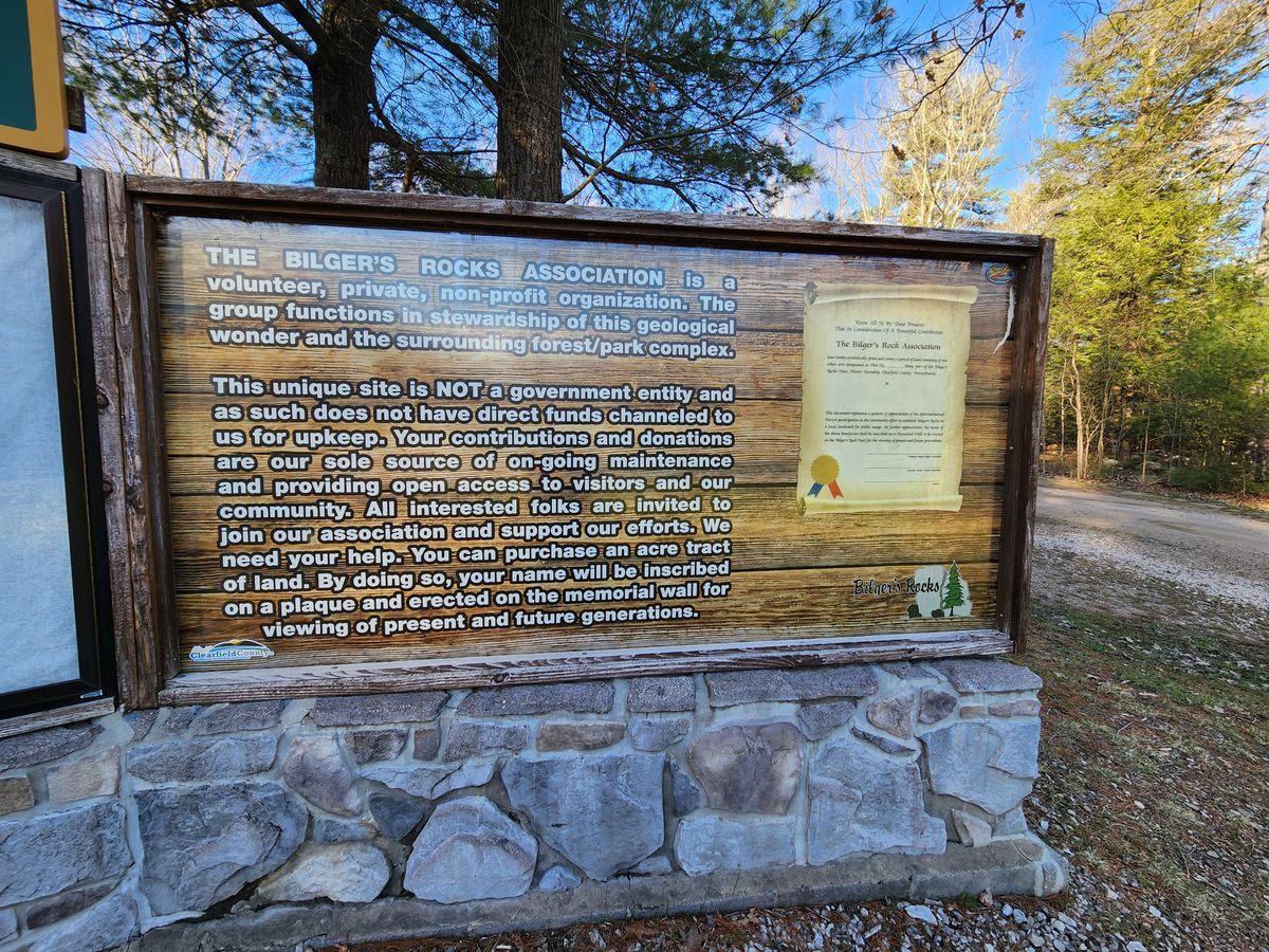
Bilger's Rocks is owned by a private non-profit corporation. There is no admission fee, but donations are requested.

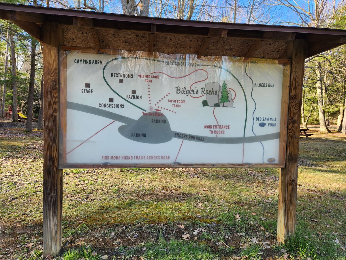
On top, above the "rock city," is the main parking area, as well as a playground and picnic area. However, the best access to the rock city is from below, where a trailhead is marked. To get there backtrack downhill along the road in, keeping on the left (facing downhill). Be careful of oncoming traffic.

Obviously, also be very careful with children and pets. Many of the cracks are wide enough, and deep enough, to cause serious injury, or even to be fatal in the event of a fall. The same also goes for the bluffs at the edge of the blocks.

Community Contributors

Added By

slgwv

Published

July 19, 2024

Edit this listing

Make an Edit
Add Photos
Sources
  • Reese, Stuart O., Bilgers Rocks, Clearfield County, Trail of Geology 16-032.0, 2016. (Outstanding Geologic Feature of Pennsylvania series)
Bilger's Rocks
1921 Bilgers Rocks Rd
Grampian, Pennsylvania, 16838
United States
40.993316, -78.593085
Visit Website
Get Directions

Nearby Places

Gobbler's Knob

Punxsutawney, Pennsylvania

miles away

Scripture Rocks Heritage Park

Brookville, Pennsylvania

miles away

Decker's Chapel

St Marys, Pennsylvania

miles away

Explore the Destination Guide

Photo of Pennsylvania

Pennsylvania

United States

Places 417
Stories 28

Nearby Places

Gobbler's Knob

Punxsutawney, Pennsylvania

miles away

Scripture Rocks Heritage Park

Brookville, Pennsylvania

miles away

Decker's Chapel

St Marys, Pennsylvania

miles away

Explore the Destination Guide

Photo of Pennsylvania

Pennsylvania

United States

Places 417
Stories 28

Related Places

  • Colorful sandstone cliff just west of the Colorock Quarry.

    Moapa Valley, Nevada

    Buffington Pockets

    The rocks exposed at Valley of Fire State Park also occur in a much less known but equally spectacular area a few miles to the southwest.

  • Mexican Hat

    Mexican Hat, Utah

    Mexican Hat

    This balancing rock is one of Utah's most unusual geological formations.

  • Mortana, Australia

    Murphy’s Haystacks

    These oddly shaped pink granite formations got their name after being mistaken for massive piles of hay.

  • Edmaier’s Secret

    Big Water, Utah

    Edmaier's Secret

    This hidden gem in Arizona is truly worth the rugged journey.

  • Mina de Mármol

    Cuatrociénegas, Mexico

    Mina de Mármol

    A former travertine mine traces the geological history of this unique desert filled with crystalline blue pools.

  • Brady’s Rocks are the southernmost surface exposure of the massive Niagara Escarpment.

    Eagle, Wisconsin

    Brady's Rocks

    These modest Midwestern formations are kin to Niagara Falls' impressive cliffs, more than 600 miles away.

  • Lake Powell, Utah

    Cathedral in the Desert

    The damming of the Colorado River buried an iconic geologic formation before record-breaking drought brought it back.

  • Indian Head

    Lincoln, New Hampshire

    Indian Head

    The Old Man of the Mountain’s less-famous, but still beloved little brother is said to resemble a leader of the Abenaki tribe.

Aerial image of Vietnam, displaying the picturesque rice terraces, characterized by their layered, verdant fields.
Atlas Obscura Membership

Become an Atlas Obscura Member


Join our community of curious explorers.

Become a Member

Get Our Email Newsletter

Follow Us

Facebook YouTube TikTok Instagram Pinterest RSS Feed

Get the app

Download the App
Download on the Apple App Store Get it on Google Play
  • All Places
  • Latest Places
  • Most Popular
  • Places to Eat
  • Random
  • Nearby
  • Add a Place
  • Stories
  • Food & Drink
  • Itineraries
  • Lists
  • Video
  • Podcast
  • Newsletters
  • All Trips
  • Family Trip
  • Food & Drink
  • History & Culture
  • Wildlife & Nature
  • FAQ
  • Membership
  • Feedback & Ideas
  • Community Guidelines
  • Product Blog
  • Unique Gifts
  • Work With Us
  • About
  • FAQ
  • Advertise With Us
  • Advertising Guidelines
  • Privacy Policy
  • Cookie Policy
  • Terms of Use
Atlas Obscura

© 2025 Atlas Obscura. All Rights Reserved.