


About
Traditional smelting of metal ores requires carbon and high temperature to carry out so-called carbothermal reduction, to produce molten metal. In modern times this is accomplished by the combustion of coke, a nearly pure carbon made from coal. Traditional smelting used charcoal, a carbon product from much more widely available wood. In the early days of the mining rush in the American West, charcoal was used widely for smelting because transportation was rudimentary while scrub vegetation and forests were abundant.
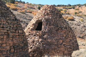
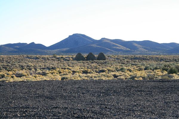
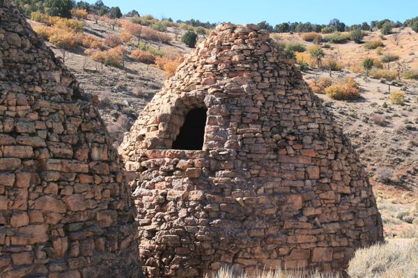
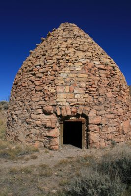
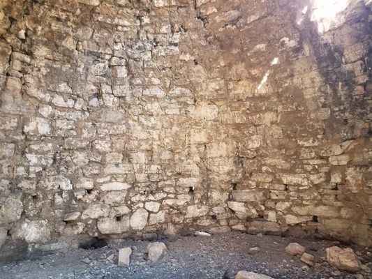
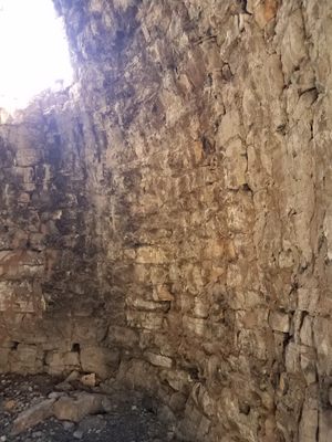
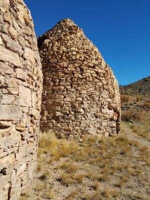
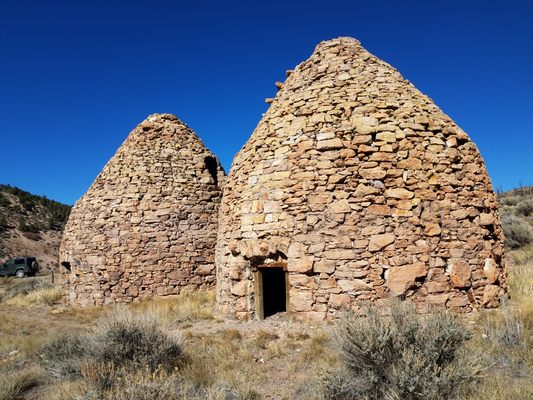
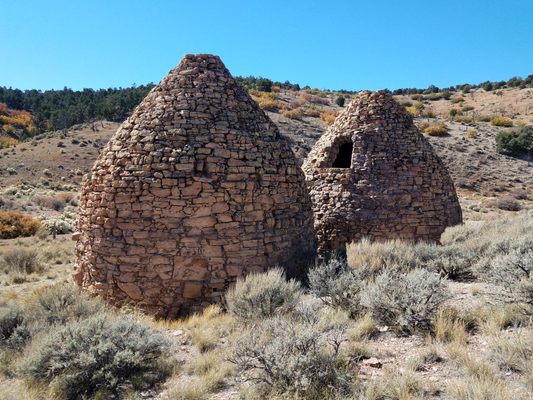
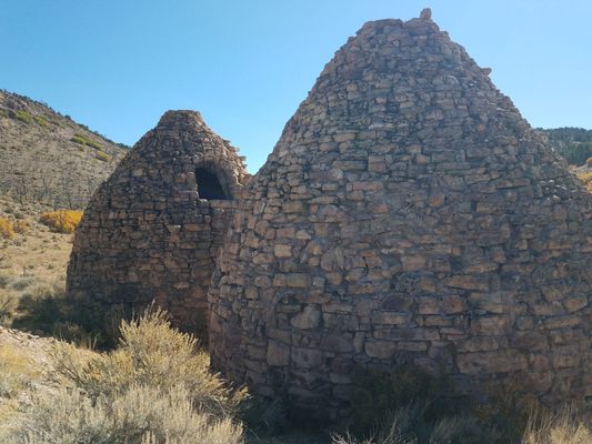
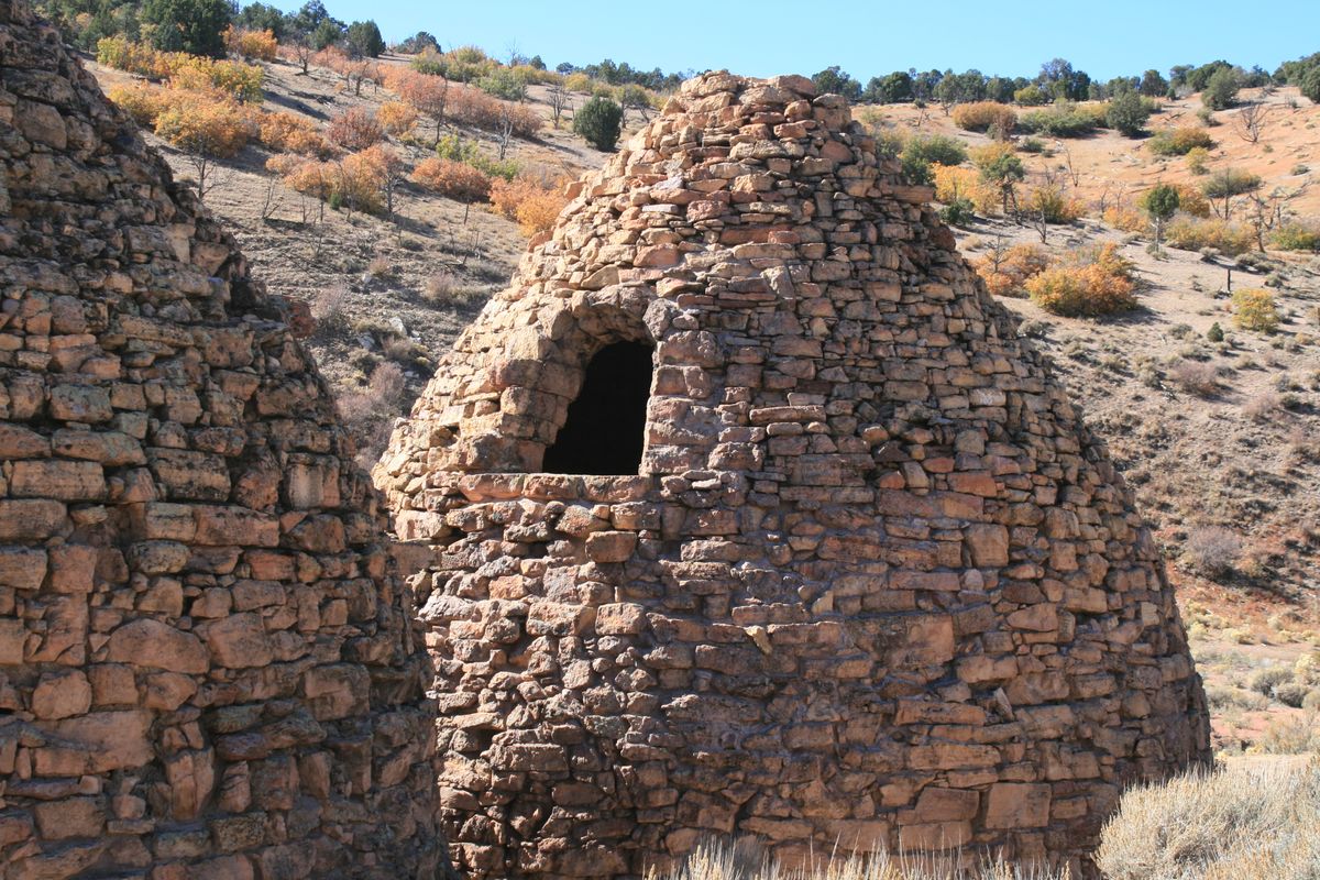
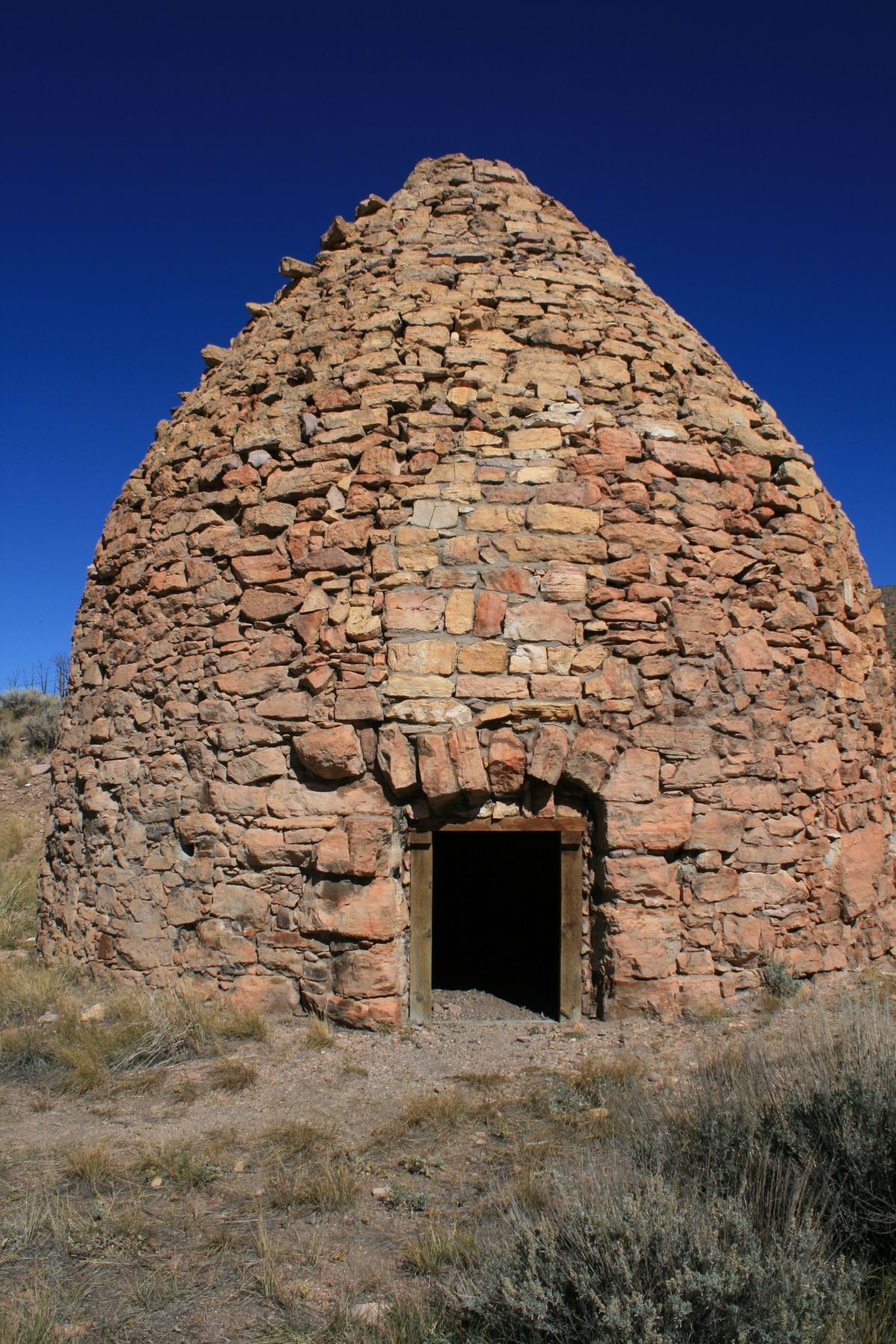
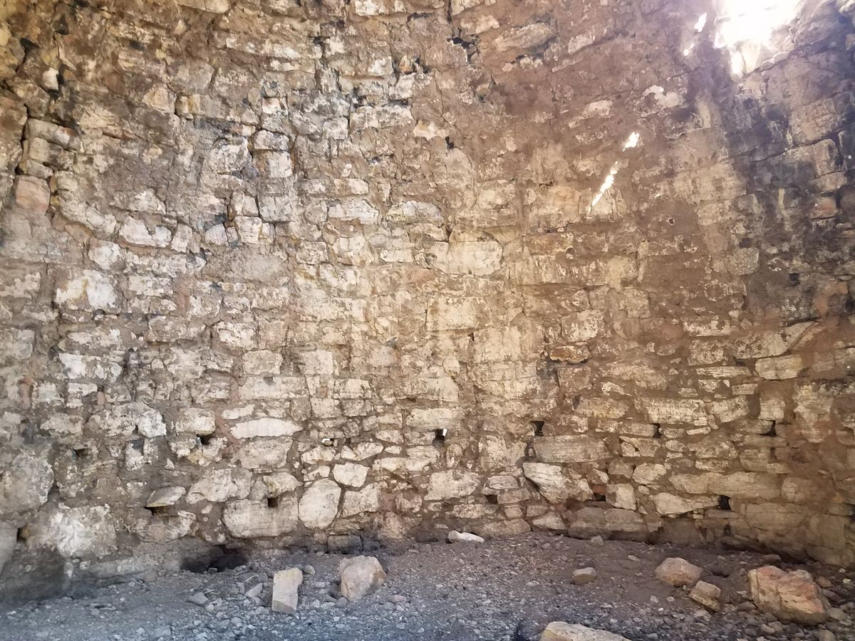
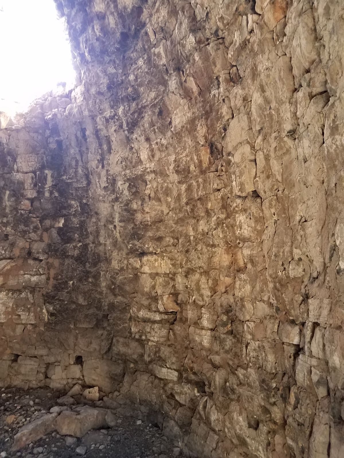
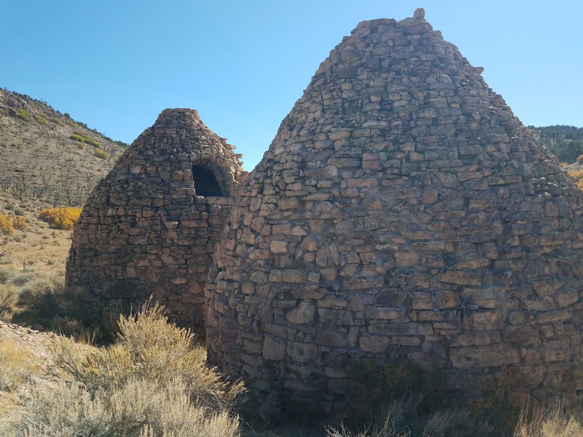
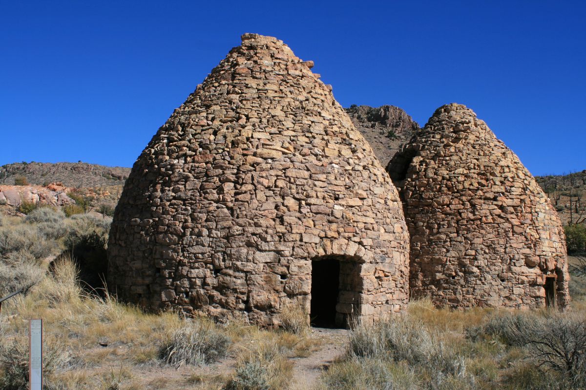
Hence, charcoal manufacture became a widespread activity. Typically, beehive-shaped kilns made of local stone were used. The kilns were charged with raw wood, which could include scrub and slash that otherwise were useless. Once the kiln was full, the charge was kindled and the openings were sealed. The charge was left to smolder for about a month, at which point the kiln was allowed to cool and then carefully opened. The finished charcoal could then be loaded. The kilns were located near the wood source; it was much cheaper to ship the finished charcoal than the raw wood, particularly in an era of primitive freight transportation.
These remote kilns are among the best-preserved representatives of their kind. The workmanship is extraordinary; the arch over the lower portal on the best-preserved kiln (the one nearest the parking area) is just in stone. It's not reinforced with a metal beam, as is common elsewhere. These artisans were professional stonemasons.
The market for the charcoal was the smelters in Pioche and Bullionville, about 20 miles west. When the smelters in Bullionville finally closed in the 1890s, the kilns shut down too.
Related Tags
Know Before You Go
The kilns are a bit tricky to find. The most straightforward route is off the paved highway between Panaca, Nevada, and Modena, Utah (SR-319 in Nevada, becoming SR-56 in Utah).
Turn north onto the Panaca Kilns Road 7.1 miles west of the Utah-Nevada state line. Although the road is named on Google Maps, the intersection is unmarked; it's about 37.752055 N, 114.173402 W. If, while going west, you reach Panaca Summit on NV SR-319 you've gone about 1.3 miles too far.
The Panaca Kilns Road first doglegs back east for 0.4 miles and then goes north along a drainage that will eventually cross a low summit. The kilns are about 4.4 miles from the turn into the drainage. This road is nominally graded but commonly washed out, so high clearance will probably be necessary.
Community Contributors
Added By
Published
May 1, 2023