Trips Places Foods Stories Newsletters

Take your next trip with Atlas Obscura!

Our small-group adventures are inspired by our Atlas of the world's most fascinating places, the stories behind them, and the people who bring them to life.

Visit Adventures
Trips Highlight
Central Asia yurt night stars
Uzbekistan • 15 days, 14 nights
Central Asia Road Trip: Backroads & Bazaars
from
A view of Brașov’s Old Town.
Romania • 12 days, 11 nights
Legends of Romania: Castles, Ruins & Culinary Delights
from
View all trips
Top Destinations
Latest Places
Most Popular Places Random Place Lists Itineraries
Add a Place
Download the App
Top Destinations
View All Destinations »

Countries

  • Australia
  • Canada
  • China
  • France
  • Germany
  • India
  • Italy
  • Japan

Cities

  • Amsterdam
  • Barcelona
  • Beijing
  • Berlin
  • Boston
  • Budapest
  • Chicago
  • London
  • Los Angeles
  • Mexico City
  • Montreal
  • Moscow
  • New Orleans
  • New York City
  • Paris
  • Philadelphia
  • Rome
  • San Francisco
  • Seattle
  • Stockholm
  • Tokyo
  • Toronto
  • Vienna
  • Washington, D.C.
Latest Places
View All Places »
Ñaño house with mausoleum skull in foreground.
Ñaño Casa Museo
Honningsvåg Bamse Statue
The salt cairn.
The Lewis and Clark Salt Works
South entrance.
Reigate Tunnel
Latest Places to Eat & Drink
View All Places to Eat »
Names on the bartop.
The Dive
Cacio e pepe lasagna combines two classics.
C'è Pasta... E Pasta!
Spaghetto taratatà is named for the sound of rattling sabers.
Giano Restaurant
The gnocchi here get blanketed in a sugo with braised oxtail.
Cesare al Pellegrino
Romans insist you should feel the cracked peppercorns and cheese grains on your tongue.
Flavio al Velavevodetto
Recent Stories
All Stories Video Podcast
Most Recent Stories
View All Stories »
The 2,653-mile-long Pacific Crest Trail spans the entire West Coast from Canada to Mexico.
Meet the Volunteers Who Keep Thru-Hikers Moving
10 days ago
The Haskell Free Library and Opera House building on the U.S.-Canadian border.
Could New Border Restrictions Literally Tear the Haskell Free Library Apart?
10 days ago
A woman peering into the cave of Sarah Bishop c. 1900.
The Curious History of New England’s Hermit Tourism
10 days ago
The Big Well
This Kansas Town Advertised the World’s Largest Well. It Wasn’t.
11 days ago

No search results found for
“”

Make sure words are spelled correctly.

Try searching for a travel destination.

Places near me Random place

Popular Destinations

  • Paris
  • London
  • New York
  • Berlin
  • Rome
  • Los Angeles
Trips Places Foods Stories Newsletters
Sign In Join
Places near me Random place
All the United States Nevada Meadow Valley Wash
AO Edited

Meadow Valley Wash

Much of the spectacular canyon followed over a century ago by the Los Angeles & Salt Lake railroad is now accessible to cars.

Etna, Nevada

Added By
slgwv
Email
Been Here
Want to go
Added to list
Looking south not far from Caliente. The paved path to the right of the highway connects Caliente with Kershaw-Ryan State Park and is open to non-motorized traffic.   slgwv / Atlas Obscura User
  slgwv / Atlas Obscura User
  slgwv / Atlas Obscura User
  slgwv / Atlas Obscura User
East side of the Wash; railroad tracks in the foreground.   slgwv / Atlas Obscura User
  slgwv / Atlas Obscura User
  slgwv / Atlas Obscura User
Looking back north near the intersection of Rainbow Pass Road.   slgwv / Atlas Obscura User
Looking south; Mormon Mountains in the distance.   slgwv / Atlas Obscura User
Looking back north near the intersection of Rainbow Pass Road.   slgwv / Atlas Obscura User
  slgwv / Atlas Obscura User
  slgwv / Atlas Obscura User
One of many railroad tunnels in the canyon.   slgwv / Atlas Obscura User
  slgwv / Atlas Obscura User
  slgwv / Atlas Obscura User
  slgwv / Atlas Obscura User
  slgwv / Atlas Obscura User
Low bridge!   slgwv / Atlas Obscura User
  slgwv / Atlas Obscura User
  slgwv / Atlas Obscura User
East side of the Wash.   slgwv / Atlas Obscura User
  slgwv / Atlas Obscura User
  slgwv / Atlas Obscura User
Been Here
Want to go
Added to list

About

As early as the 1880s, not long after the completion of the Transcontinental Railroad at Promontory Point, there was serious discussion about a railroad connecting Salt Lake City with Los Angeles. Both cities had boomed in the late 19th century, and connecting them seemed good for business.

By the turn of the new century, two rival groups were building competing railroads, in the grand tradition of 19th-century railroad entrepreneurs: William A. Clark, the "Copper King," and Edward Henry Harriman of the Union Pacific. From 1900-02 the "Clark-Harriman" war ensued, carried out mostly in the courts but with a smattering of violence. Eventually, a joint-ownership compromise was reached, with the Union Pacific holding half-interest in Clark's San Pedro, Los Angeles, and Salt Lake railroad. (In 1916 it just became the Los Angeles and Salt Lake.)

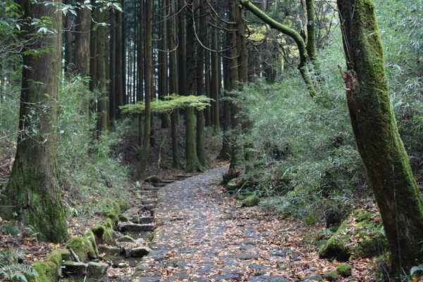
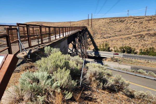
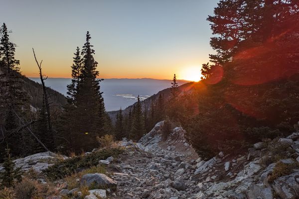
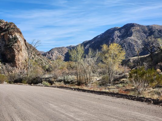
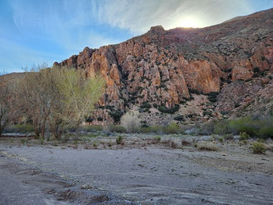
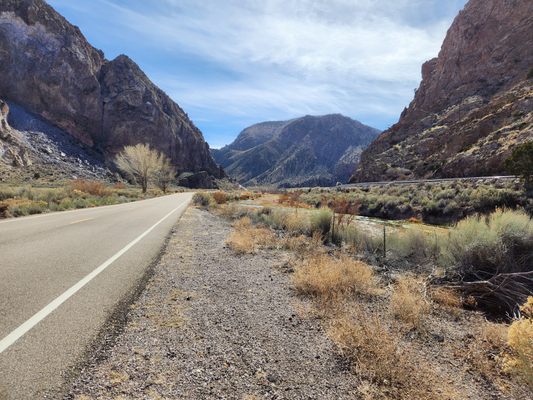
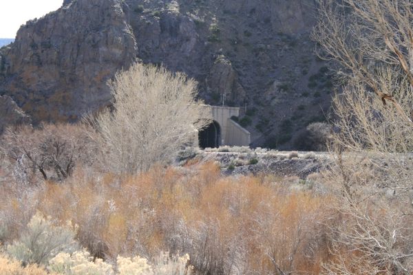
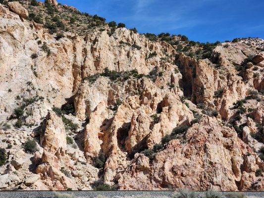
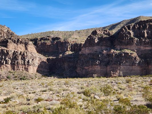
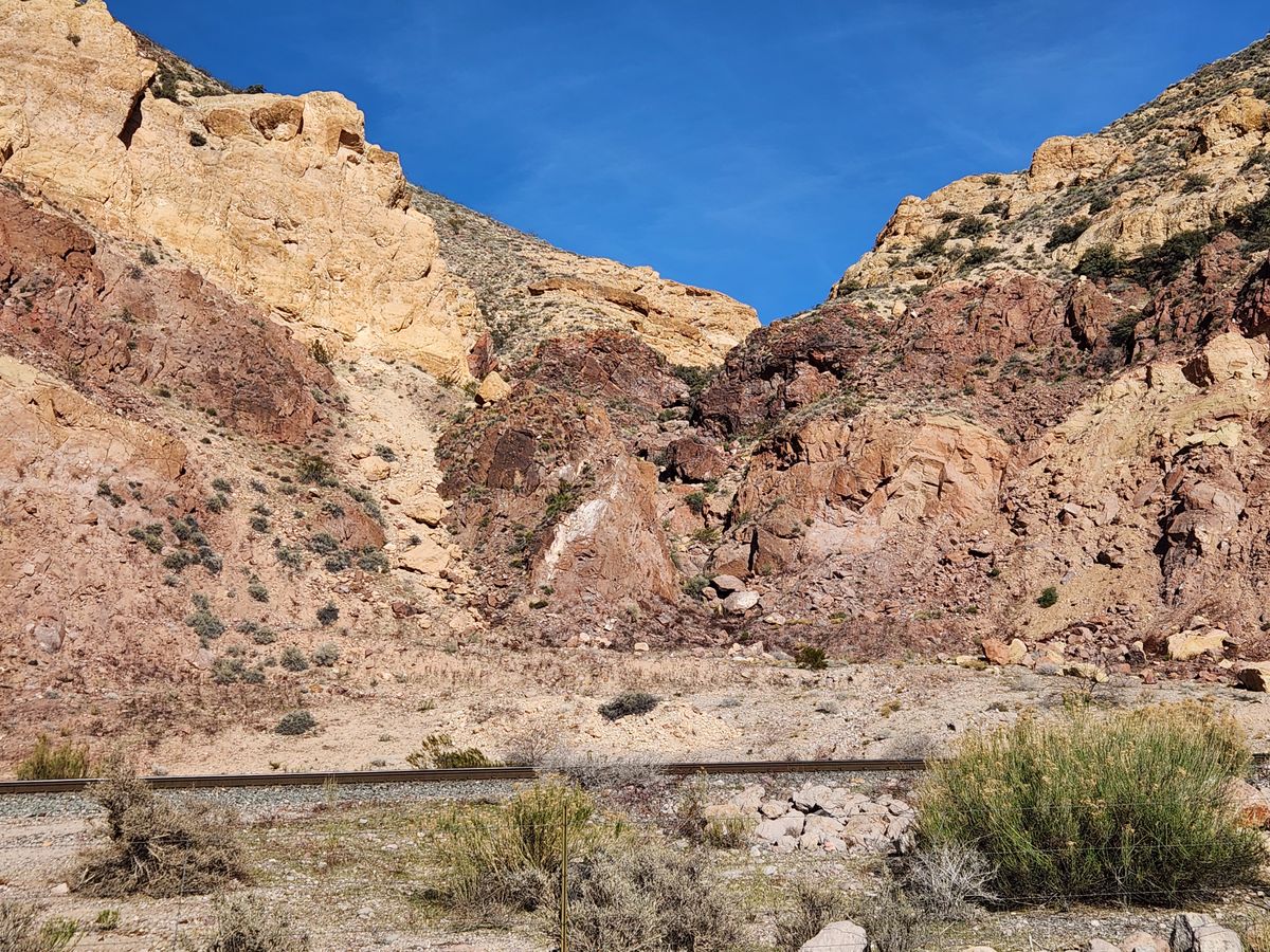
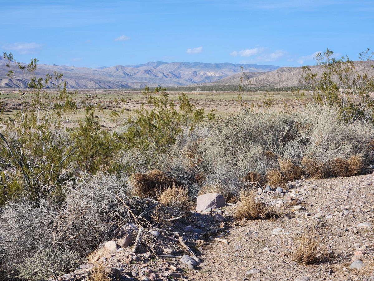
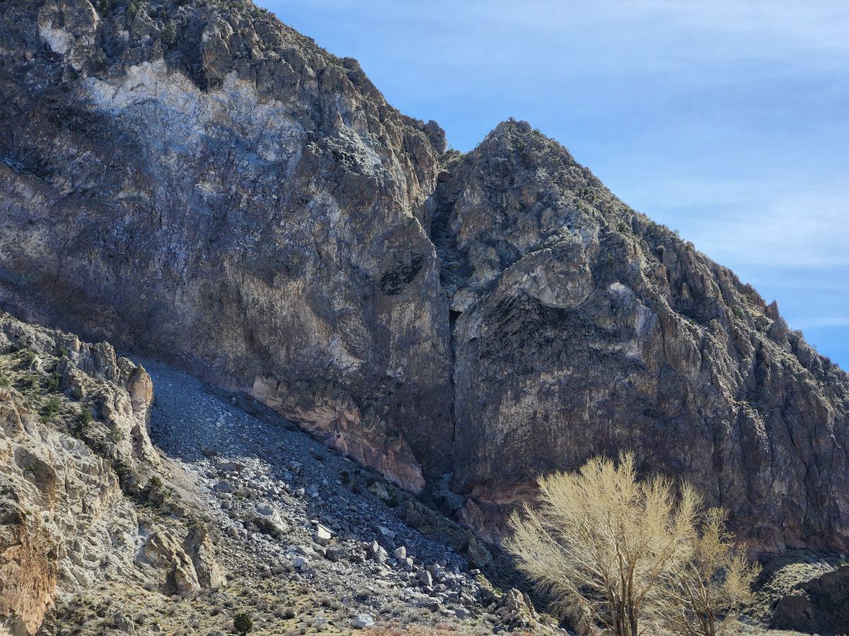
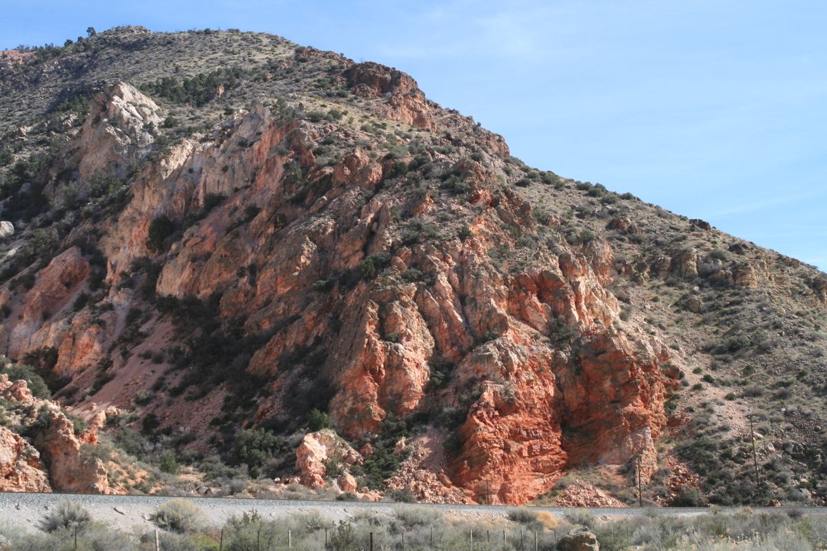
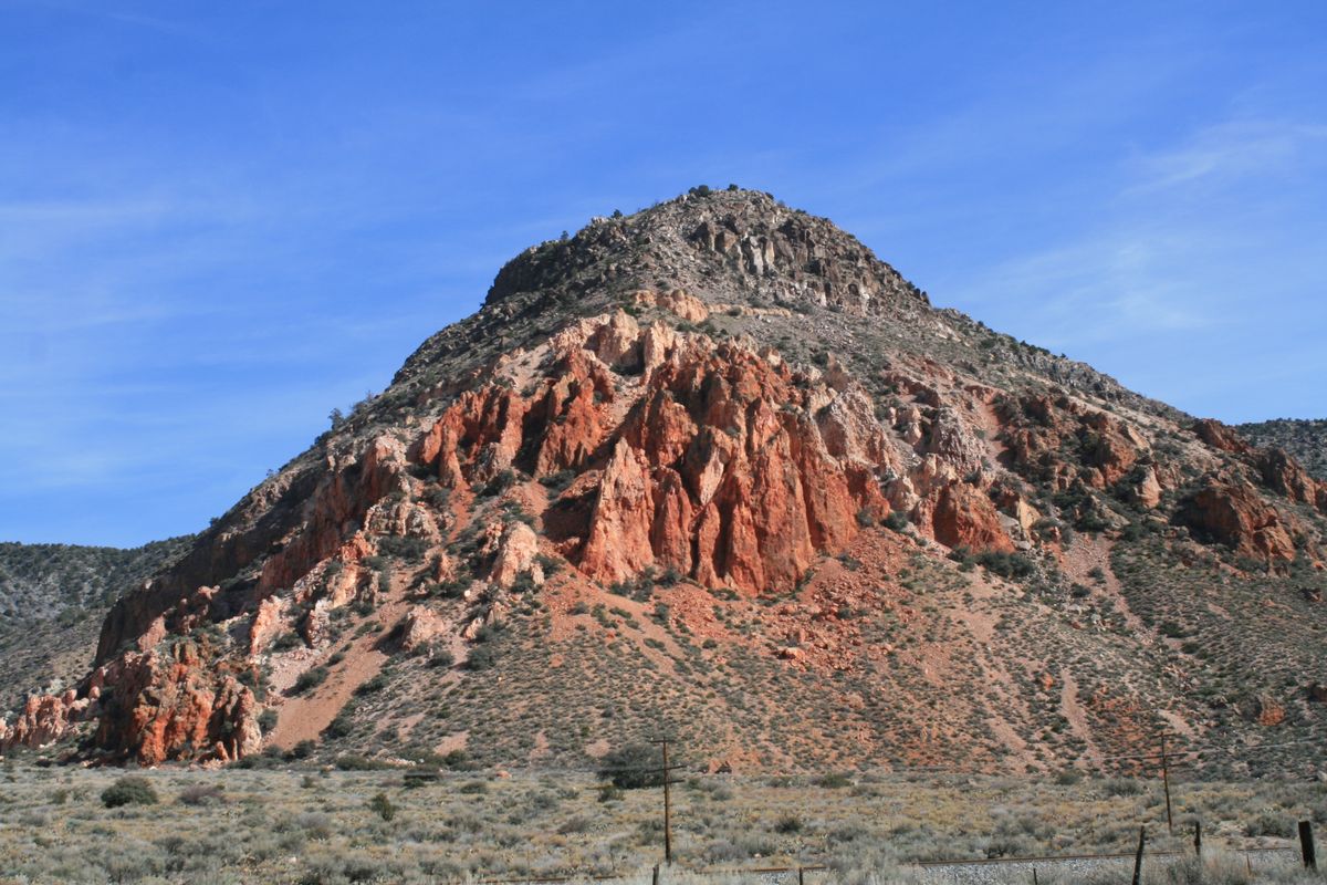
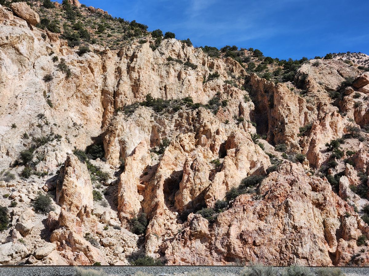
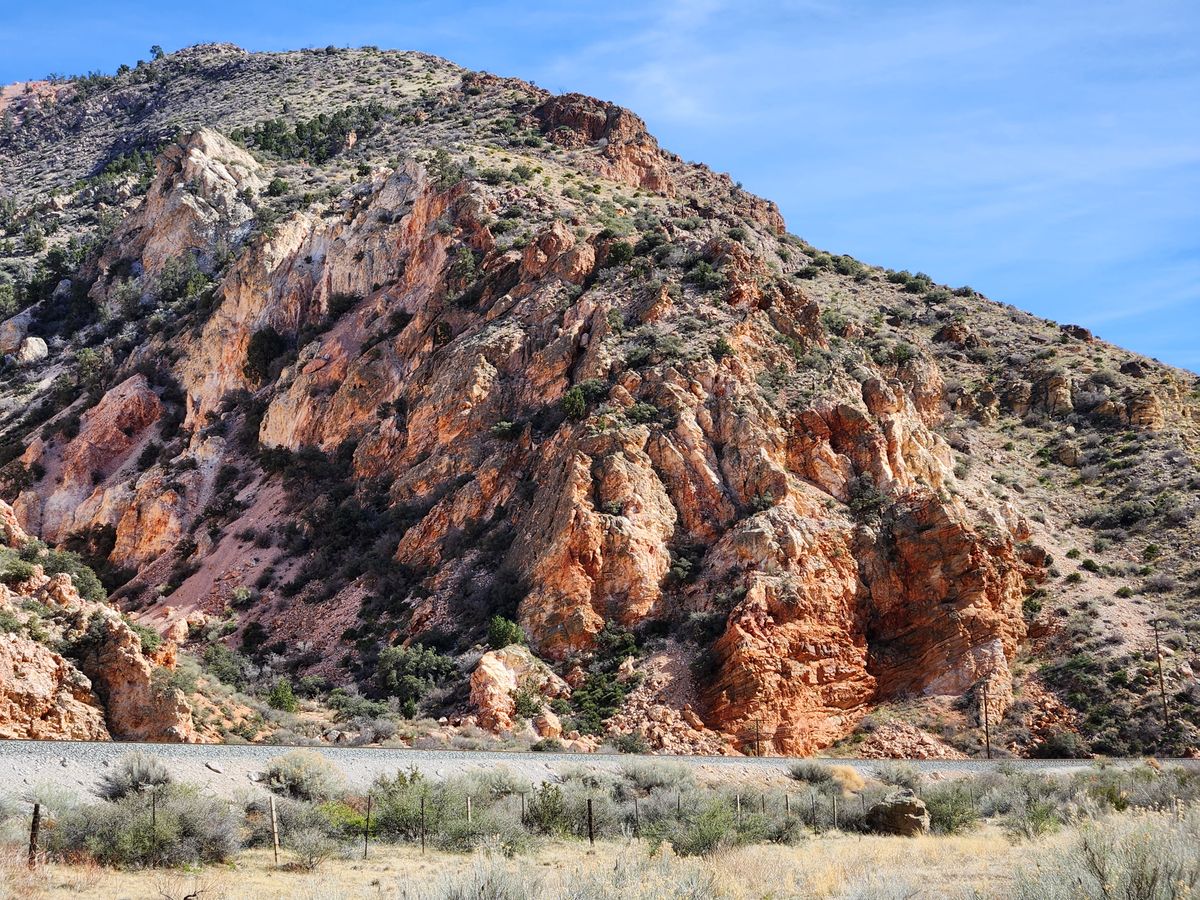
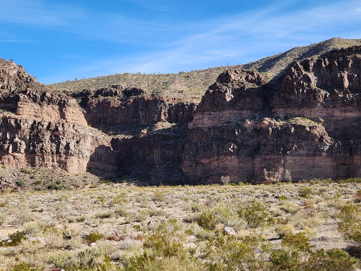
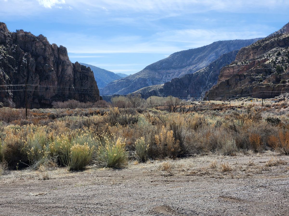
With the ownership settled, the next question was the route south into Nevada. Meadow Valley Wash rises in the mountains of extreme eastern Nevada, not far from the Utah line. Just south of Caliente, it runs through scenic Rainbow Canyon, and ultimately, some 80 miles south, it joins the Muddy River near the village of Glendale, on what's now Interstate 15.

Because of its southerly trend, it seemed an obvious route for a railroad, but it is subject to extreme flooding. It was nonetheless chosen, with misgivings, because the alternatives would involve crossing mountain passes and thus involve large altitude changes.

The misgivings would be proven justified. Just after the route was completed in 1905, a flood took out much of the newly constructed right-of-way. More floods followed in 1906, 1907, and the biggest in 1910. As recently as 2005, the right-of-way in Meadow Valley Wash was shut down because of major flooding.

Nonetheless, the route is still in use. It is all part of the Union Pacific now, and it continues south through Las Vegas, where it played a major role in the creation of the modern city. It also remains a major rail link into Southern California, and includes both the old Kelso Depot and Afton Canyon in the Mojave Desert.

Related Tags

Roads Floods Transportation Canyons Railroads

Know Before You Go

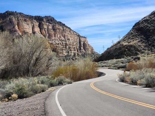
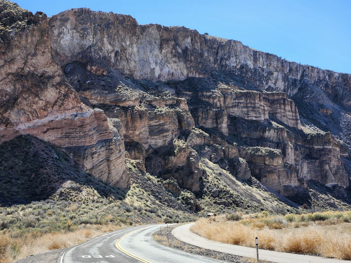
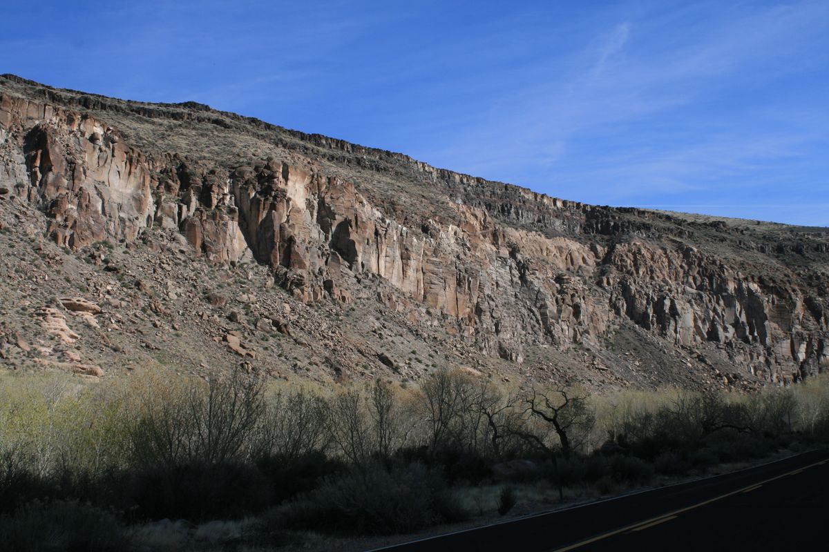
The north end of the Wash, just south of Caliente through Rainbow Canyon, is the most spectacular, and in any event the Union Pacific no longer permits public travel along Meadow Valley Wash between the old railroad stops of Carp and Rox, due to extensive flood damage in 2005.

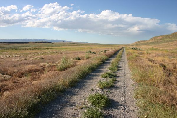
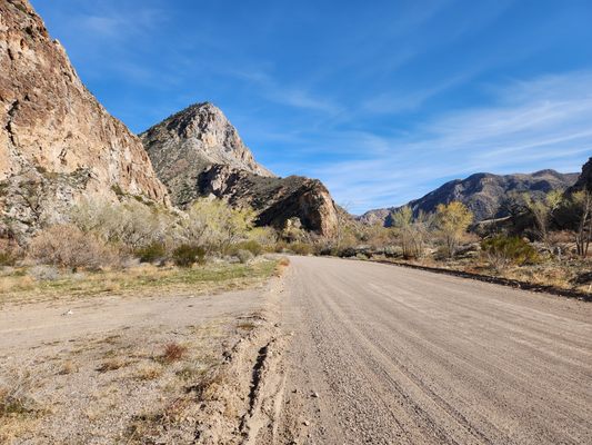
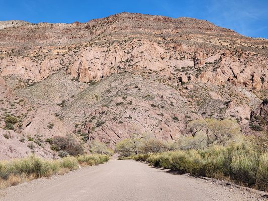
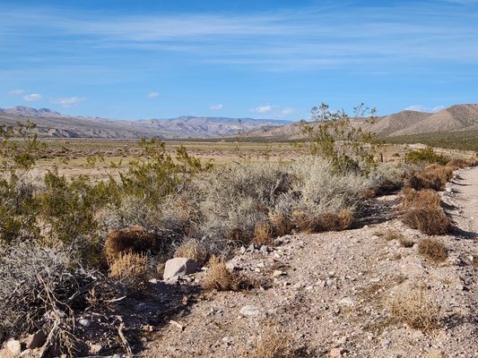
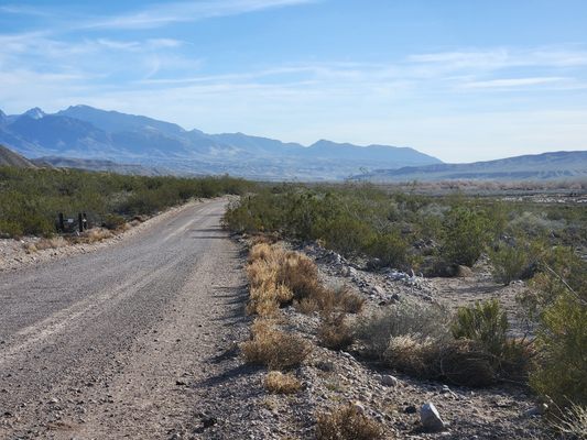
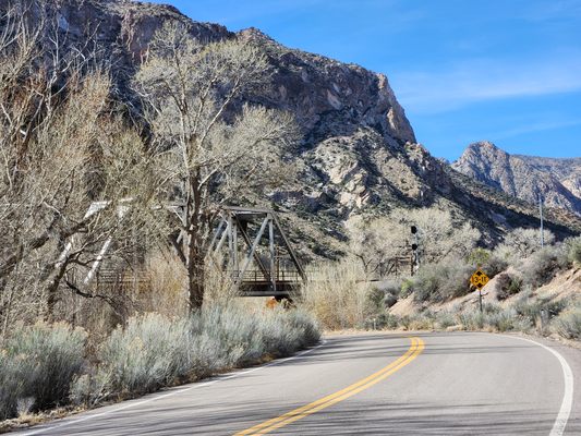
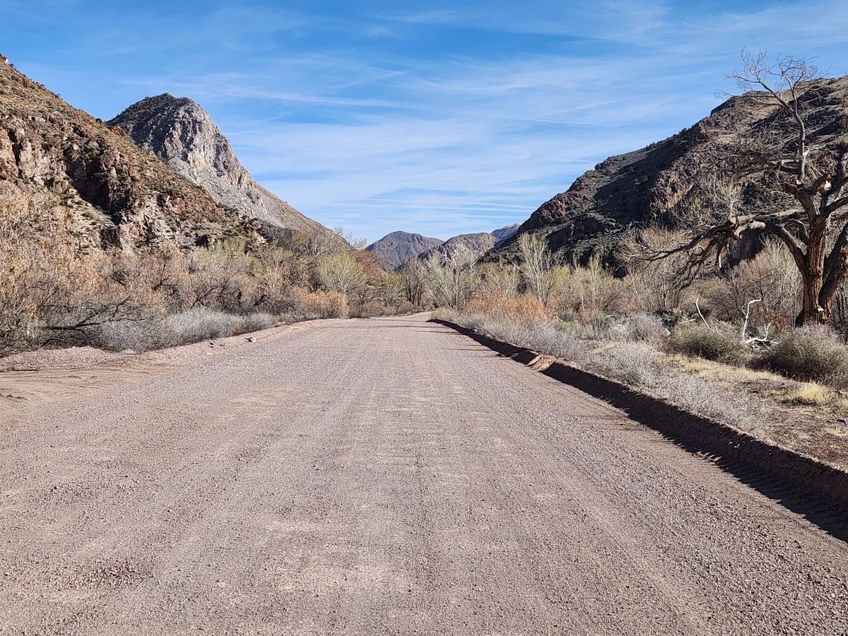
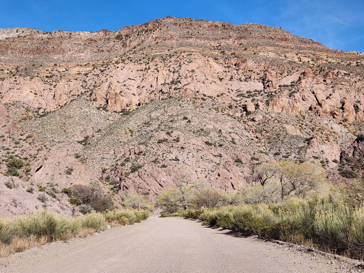
Nevada State Route 317 accesses the north end of the Wash, and it is reached on a junction just south of Caliente. It is paved and passable to passenger cars, but not to high motorhomes or large trailers, because of a low clearance underpass under the railroad. At about 21.5 miles south of the turnoff, State Route 317 loses its pavement when it climbs out of the wash to the southwest, becoming Kane Springs Wash road. This graded road should be easily passable to passenger cars and joins US-93 in about 37 miles.

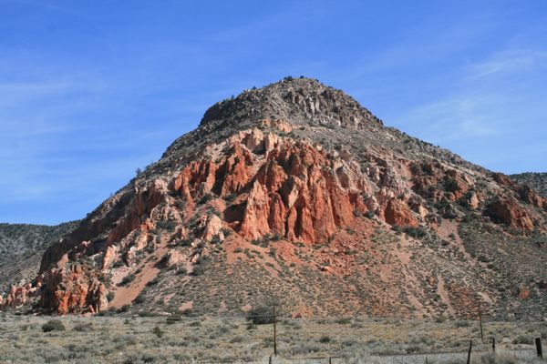
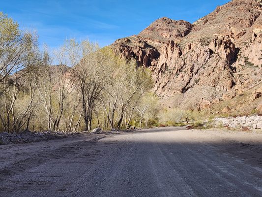
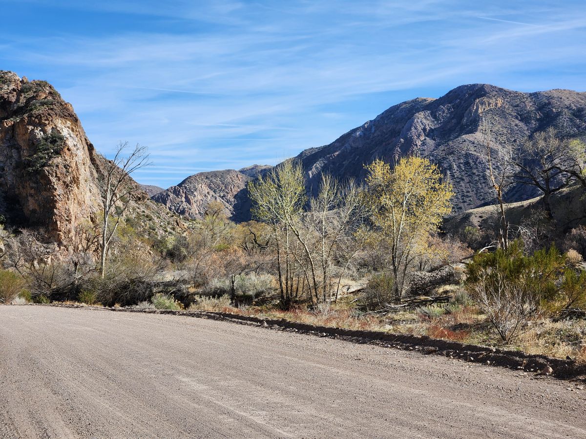
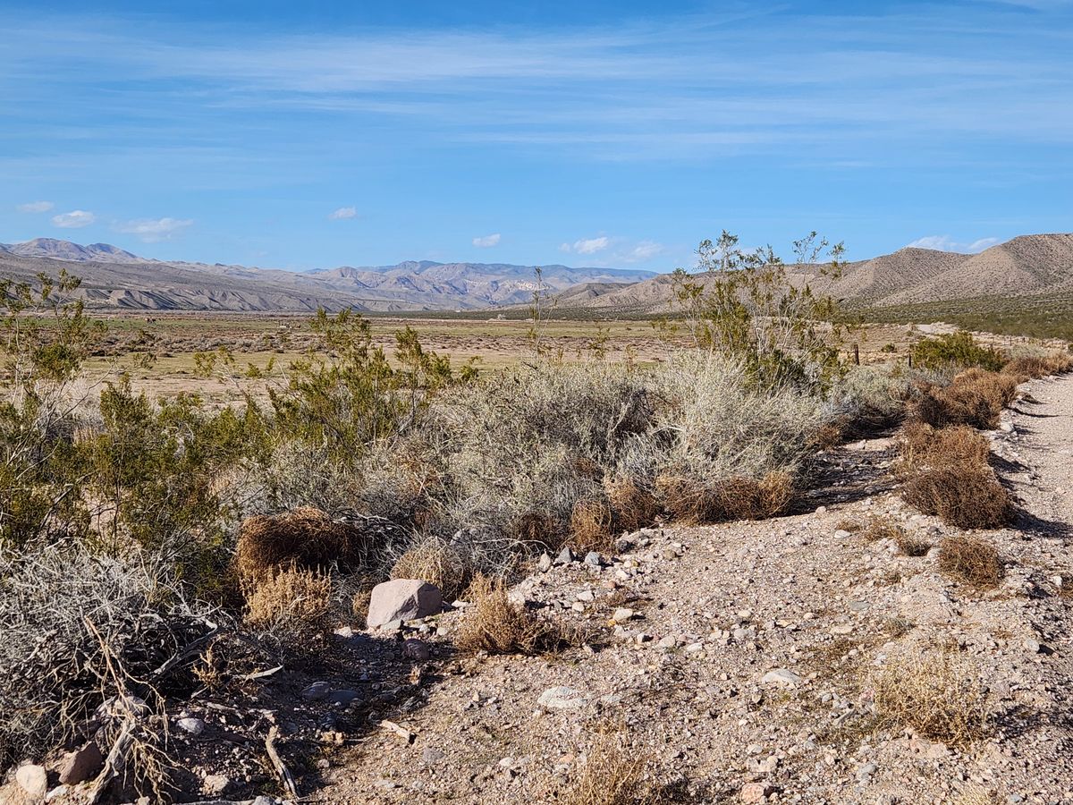
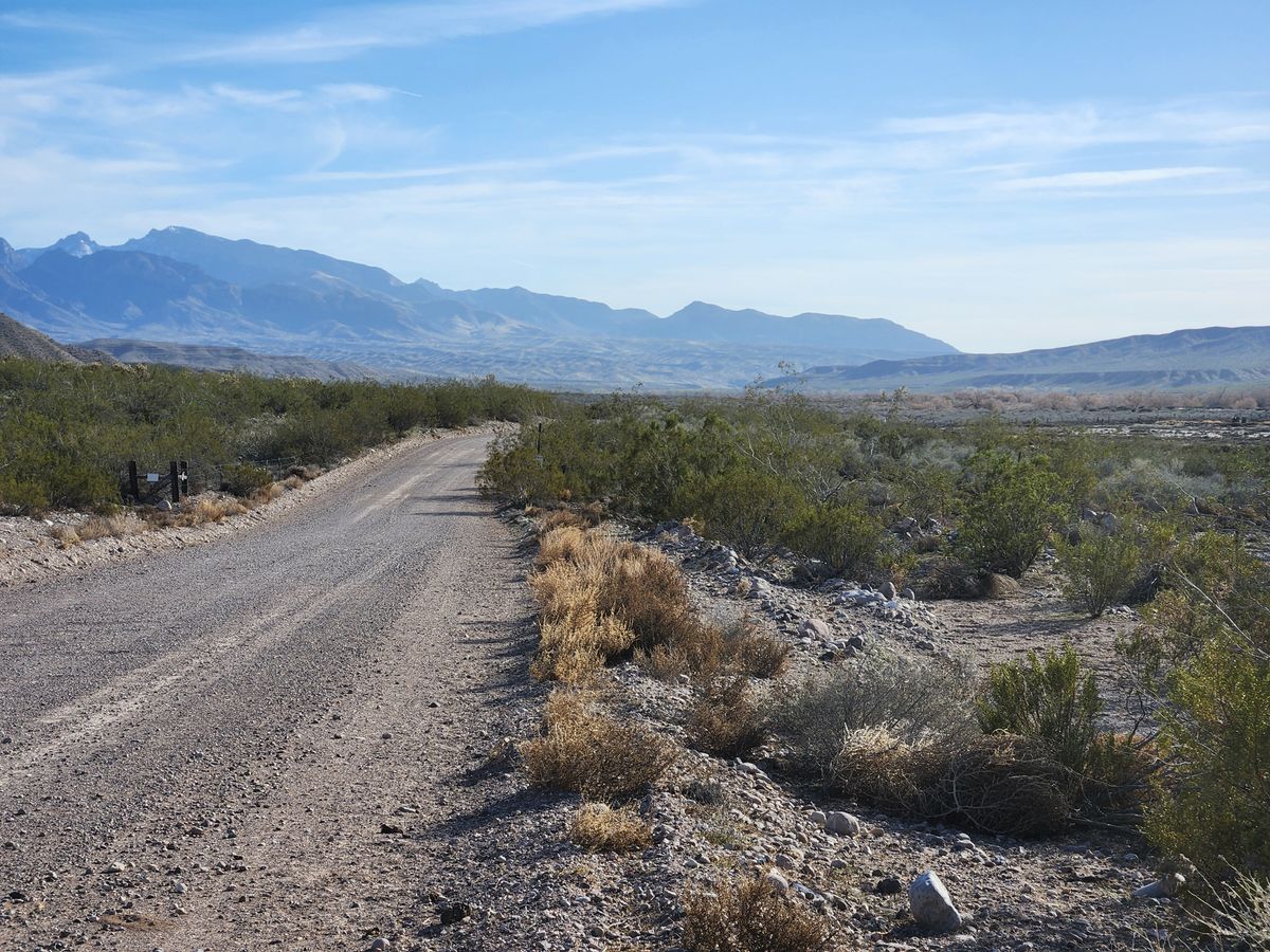
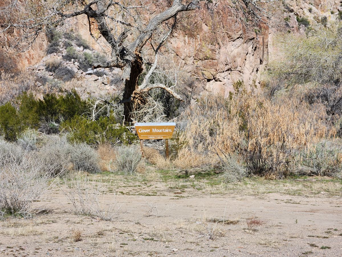
Alternatively, you can turn off the pavement onto a graded road to the site of Elgin, about 0.6 miles before the pavement ends. This graded road then continues down the wash. It still should be passable to passenger cars. It is also scenic, passing the western edge of the Clover Mountains Wilderness a few miles farther on. The wash then opens out after about 7 miles. From the turnoff to Elgin, it is 16.4 miles to Lyman Crossing, where there is a turnoff to the east, and 19.7 miles to the railroad crossing at Carp. There is a locked gate south of Carp, but from Lyman Crossing you can take the Carp-Elgin Road/Rainbow Pass Road down over Rainbow Pass to Interstate-15, about 34.0 miles. This road is graded but rough; passenger cars may be able to do it but it will be slow. 

Community Contributors

Added By

slgwv

Published

September 5, 2024

Edit this listing

Make an Edit
Add Photos
Sources
  • Myrick, David F. Railroads of Nevada and Eastern California, Volume II: The Southern Roads, University of Nevada Press, 1992, pp. 622-683.
Meadow Valley Wash
Etna, Nevada, 89008
United States
37.452512, -114.572296

Nearby Places

Delamar Ghost Town

Caliente, Nevada

miles away

Delamar Dry Lake

Nevada

miles away

Cathedral Gorge

Panaca, Nevada

miles away

Explore the Destination Guide

Photo of Nevada

Nevada

United States

Places 265
Stories 24

Nearby Places

Delamar Ghost Town

Caliente, Nevada

miles away

Delamar Dry Lake

Nevada

miles away

Cathedral Gorge

Panaca, Nevada

miles away

Explore the Destination Guide

Photo of Nevada

Nevada

United States

Places 265
Stories 24

Related Places

  • Right of way looking northerly.

    Corinne, Utah

    Transcontinental Railroad Back Country Byway

    This now-abandoned part of the original transcontinental railroad route provides a surreal driving and historical experience.

  • Come journey into the feudal past.

    Hakone, Japan

    Old Tokaido Way

    The centuries-old cobblestones of a feudal highway remain in the woods of Hakone.

  • Looking up at the Highball Signal.

    Delmar, Delaware

    Highball Signal

    This relic is one of the last survivors of the earliest eras of the American railroad.

  • The trestle from off the southeast abutment.

    Renslow, Washington

    Renslow Trestle

    A former railroad trestle over Interstate 90 has been refurbished for non-motorized traffic on the Palouse to Cascades trail.

  • Riga, Latvia

    Latvian Railway History Museum

    A collection of historical engines and rolling stock from throughout Riga's rich railway history.

  • Looking down Lake Como road at sunset

    Blanca, Colorado

    Lake Como Road

    The worst road in Colorado is the main gateway to some of its highest peaks.

  • TY 51 locomotive.

    Krakow, Poland

    Kraków-Płaszów Train Graveyard

    This cemetery of rusting Soviet-era steam locomotives and train cars offers an apocalyptic glimpse into a bygone era.

  • Swales (wagon ruts) at Lobanillo Swales

    Bronson, Texas

    Lobanillo Swales

    The preserved wheel ruts of El Camino Real de los Tejas, an 18th-century Spanish colonial road across America's Southwest.

Aerial image of Vietnam, displaying the picturesque rice terraces, characterized by their layered, verdant fields.
Atlas Obscura Membership

Become an Atlas Obscura Member


Join our community of curious explorers.

Become a Member

Get Our Email Newsletter

Follow Us

Facebook YouTube TikTok Instagram Pinterest RSS Feed

Get the app

Download the App
Download on the Apple App Store Get it on Google Play
  • All Places
  • Latest Places
  • Most Popular
  • Places to Eat
  • Random
  • Nearby
  • Add a Place
  • Stories
  • Food & Drink
  • Itineraries
  • Lists
  • Video
  • Podcast
  • Newsletters
  • All Trips
  • Family Trip
  • Food & Drink
  • History & Culture
  • Wildlife & Nature
  • FAQ
  • Membership
  • Feedback & Ideas
  • Community Guidelines
  • Product Blog
  • Unique Gifts
  • Work With Us
  • About
  • FAQ
  • Advertise With Us
  • Advertising Guidelines
  • Privacy Policy
  • Cookie Policy
  • Terms of Use
Atlas Obscura

© 2025 Atlas Obscura. All Rights Reserved.