Trips Places Foods Stories Newsletters
Loading...
Loading...
Loading...
Loading...

No search results found for
“”

Make sure words are spelled correctly.

Try searching for a travel destination.

Places near me Random place

Popular Destinations

  • Paris
  • London
  • New York
  • Berlin
  • Rome
  • Los Angeles
Trips Places Foods Stories Newsletters
Sign In Join
Places near me Random place
All the United States Michigan Skanee Mount Arvon

Mount Arvon

The honor of highest point in Michigan was almost given to the wrong peak before this mountain won out by 11 inches.

Skanee, Michigan

Added By
Thomas Harper
Email
Been Here
Want to go
Added to list
CAPTION
View to Lake Superior   Thomas Harper
Mount Arvon   michigan.org
  cmaxson / Atlas Obscura User
  cmaxson / Atlas Obscura User
Mount Arvon in 2016   Thomas Harper
Been Here
Want to go
Added to list

About

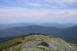
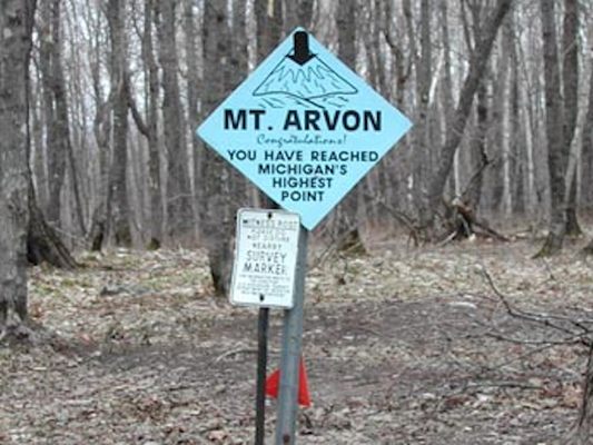
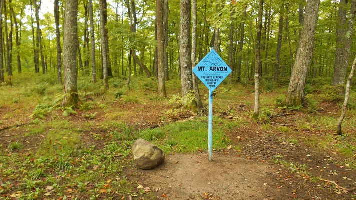
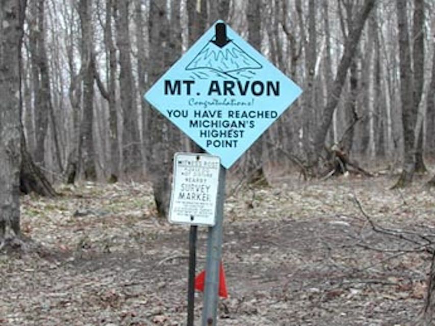
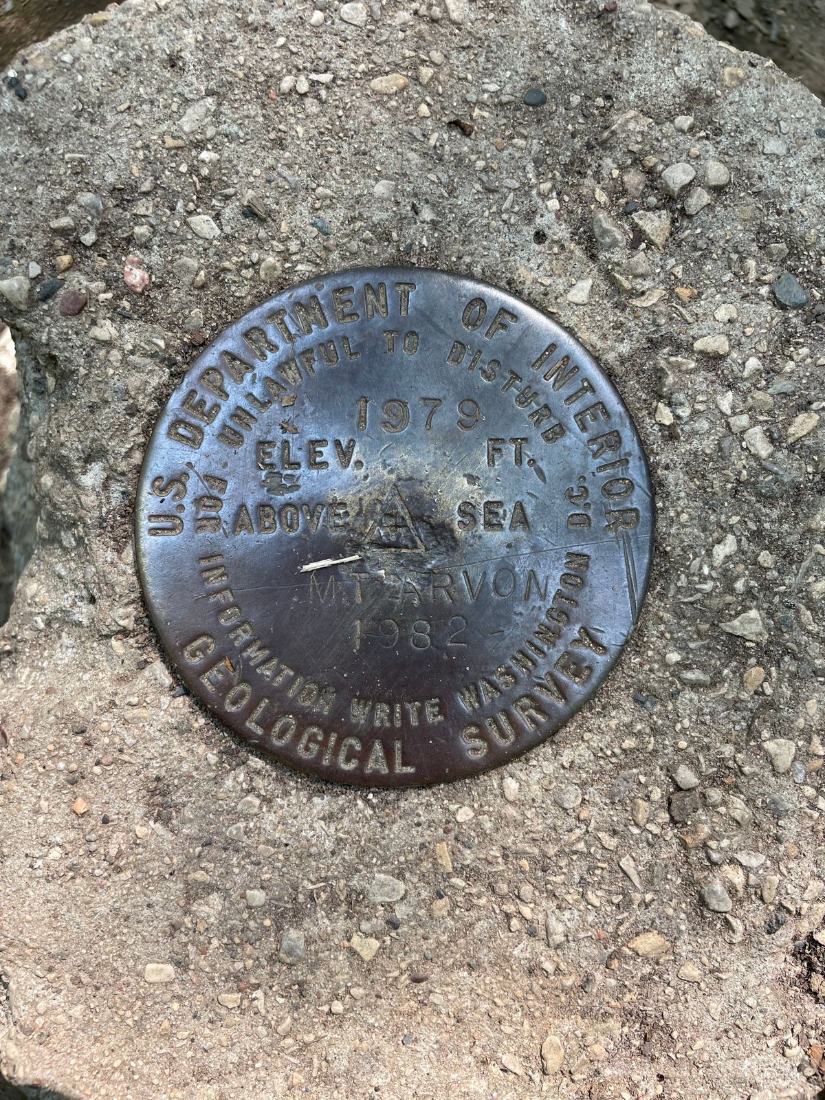
In a maze of logging roads in the Upper Peninsula of Michigan stands Mount Arvon, the state's highest point at 1,979 feet above sea level. However, until recently, another peak nearby was thought to have that title.

The Huron Mountains are well-eroded peaks from the Precambrian period, and their tops have been worn smooth. A neighboring peak of Mount Arvon, Mount Curwood was listed as the highest point in the state until a 1982 survey found that Arvon was a mere 11 inches higher. Some maps to this day may list Curwood as the state's pinnacle.

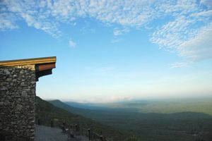
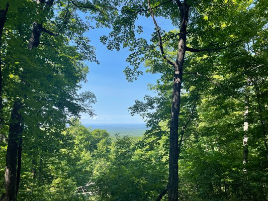
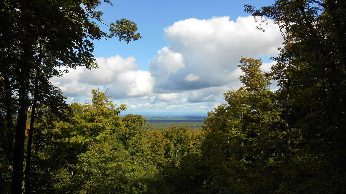
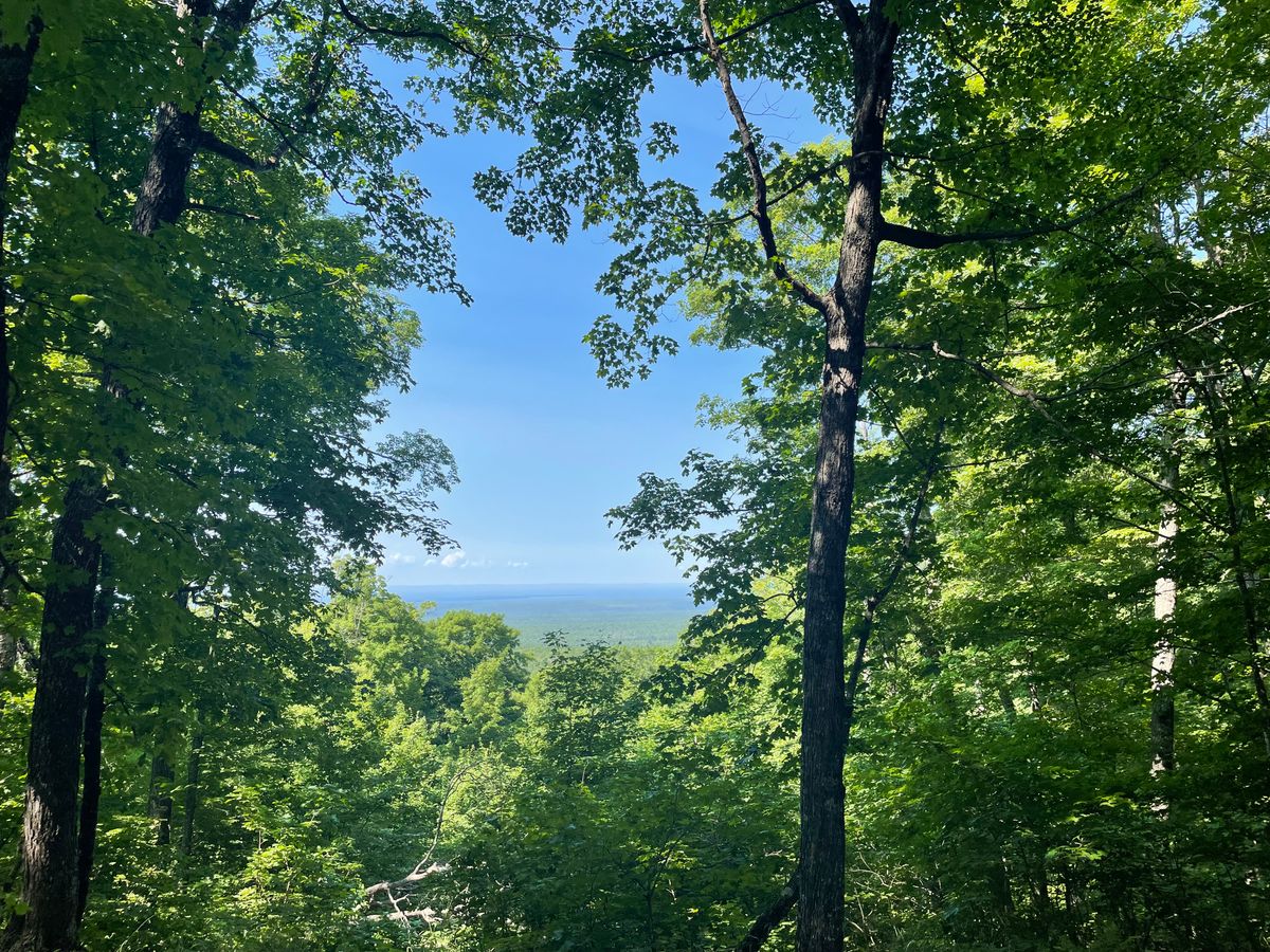
Reaching the scenic peak is thankfully not too challenging. Due to logging activity, the roads may change on the approach, but signs have been posted along the route from Ravine River Road onward. If some upstanding member of the community has taken them down, a copy of the latest directions can be received from the Baraga County Tourism office in L'Anse. The roads are only suitable for a two-wheel-drive passenger car if the roads are dry. Otherwise, a four-wheel-drive vehicle will be necessary. From the parking lot, it's a short hike to the summit glade, where some trees have been cut to allow a view of Lake Superior.

Related Tags

State High Points Mountains Geographic Markers

Know Before You Go

From Main Street in L'Anse, MI, turn on to Skanee Road and go 16.1 miles to Roland Lake Road. Turn south and go 3 miles to Ravine River Road, then follow the blue signs to the parking lot, and hike a half mile to the summit. These roads are dirt and used by heavy logging trucks. A passenger car will likely not make it if the roads are wet.If coming from the south (Marquette) you will also be traveling on dirt roads, with no gas stations for over an hour any direction.

Community Contributors

Added By

thomasharper

Edited By

AttnFiend, EricGrundhauser, cmaxson

  • AttnFiend
  • EricGrundhauser
  • cmaxson

Published

June 18, 2014

Edit this listing

Make an Edit
Add Photos
Sources
  • http://www.summitpost.org/mount-arvon/151786
  • http://en.wikipedia.org/wiki/Huron_Mountains
  • http://en.wikipedia.org/wiki/Mount_Arvon
  • http://exploringthenorth.com/baraga/attractions.html
Mount Arvon
Mount Arvon
Skanee, Michigan, 49962
United States
46.755485, -88.155963
Get Directions

Nearby Places

Bishop Baraga Shrine

L'Anse, Michigan

miles away

Da Yoopers Tourist Trap

Ishpeming, Michigan

miles away

Cliffs Shaft Mine Museum

Ishpeming, Michigan

miles away

Explore the Destination Guide

Photo of Michigan

Michigan

United States

Places 271
Stories 29

Nearby Places

Bishop Baraga Shrine

L'Anse, Michigan

miles away

Da Yoopers Tourist Trap

Ishpeming, Michigan

miles away

Cliffs Shaft Mine Museum

Ishpeming, Michigan

miles away

Explore the Destination Guide

Photo of Michigan

Michigan

United States

Places 271
Stories 29

Related Stories and Lists

The Highest Places in America

List

By Meg Neal

The Summit Scaling Subculture of Highpointing

geographic markers

By Thomas Harper

Related Places

  • Mount Denali

    Denali National Park and Preserve, Alaska

    Denali

    The king of U.S. high points towers over every other peak on the continent.

  • Mount Rainier

    Ashford, Washington

    Mount Rainier

    The highest point in Washington state is a volcano covered in glaciers.

  • Mount Hood

    Government Camp, Oregon

    Mount Hood

    Despite a legend that says this highest peak in Oregon was climbed in high heels, scores of people have died on its slopes.

  • Gannett Peak

    Cora, Wyoming

    Gannett Peak

    The easiest way to the highest point in Wyoming is only accessible via one hefty fee.

  • Granite Peak

    Granite Peak

    The highest point in Montana is as rugged and singular as the state itself.

  • Borah Peak

    Mackay, Idaho

    Borah Peak

    This highest peak in Idaho can only be reached by traversing a formation known as "Chicken-Out Ridge."

  • Kings Peak

    Duchesne County, Utah

    Kings Peak

    The highest peak in Utah is the hardest to reach, but only if explorers choose the hard way.

  • Wheeler Peak

    Taos Ski Valley, New Mexico

    Wheeler Peak

    This highest peak in New Mexico is named after an explorer who had a habit of lending his moniker to peaks.

Aerial image of Vietnam, displaying the picturesque rice terraces, characterized by their layered, verdant fields.
Atlas Obscura Membership

Become an Atlas Obscura Member


Join our community of curious explorers.

Become a Member

Get Our Email Newsletter

Follow Us

Facebook YouTube TikTok Instagram Pinterest RSS Feed

Get the app

Download the App
Download on the Apple App Store Get it on Google Play
  • All Places
  • Latest Places
  • Most Popular
  • Places to Eat
  • Random
  • Nearby
  • Add a Place
  • Stories
  • Food & Drink
  • Itineraries
  • Lists
  • Video
  • Podcast
  • Newsletters
  • All Trips
  • Family Trip
  • Food & Drink
  • History & Culture
  • Wildlife & Nature
  • FAQ
  • Membership
  • Feedback & Ideas
  • Community Guidelines
  • Product Blog
  • Unique Gifts
  • Work With Us
  • About
  • FAQ
  • Advertise With Us
  • Advertising Guidelines
  • Privacy Policy
  • Cookie Policy
  • Terms of Use
Atlas Obscura

© 2025 Atlas Obscura. All Rights Reserved.