Trips Places Foods Stories Newsletters
Loading...
Loading...
Loading...
Loading...

No search results found for
“”

Make sure words are spelled correctly.

Try searching for a travel destination.

Places near me Random place

Popular Destinations

  • Paris
  • London
  • New York
  • Berlin
  • Rome
  • Los Angeles
Trips Places Foods Stories Newsletters
Sign In Join
Places near me Random place
All the United States Nevada Moapa Airmail Arrow

Moapa Airmail Arrow

A well-preserved example from a 1920s network of airmail navigation arrows sits near Interstate 15 in southern Nevada.

Moapa Valley, Nevada

Added By
slgwv
Email
Been Here
Want to go
Added to list
CAPTION
Looking back at the contemporary installations.   slgwv / Atlas Obscura User
Looking north. Mormon Mountains on the skyline to extreme left.   slgwv / Atlas Obscura User
Looking north. Mormon Mountains on the skyline to left.   slgwv / Atlas Obscura User
Looking southerly, toward the modern installations.   slgwv / Atlas Obscura User
Looking north.   slgwv / Atlas Obscura User
Looking across Mormon Mesa, where Interstate 15 is visible. Virgin Mountains on the skyline to the right.   slgwv / Atlas Obscura User
Looking northeast across Mormon Mesa. Interstate 15 is visible crossing the mesa.   slgwv / Atlas Obscura User
Dribbles of recent pink paint   Avoiding Regret
Closed gate at the turnoff   Avoiding Regret
Traces of old yellow paint   Avoiding Regret
Been Here
Want to go
Added to list

About

In the early days of flight, pilots had to follow landmarks on the ground, as radio was primitive and radar non-existent. And flying at night, as might be expected, was extremely hazardous and avoided if at all possible.

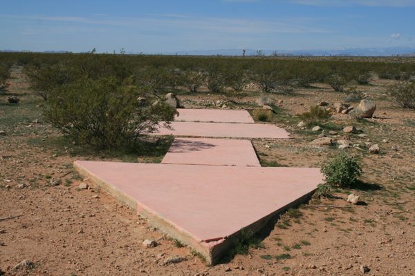
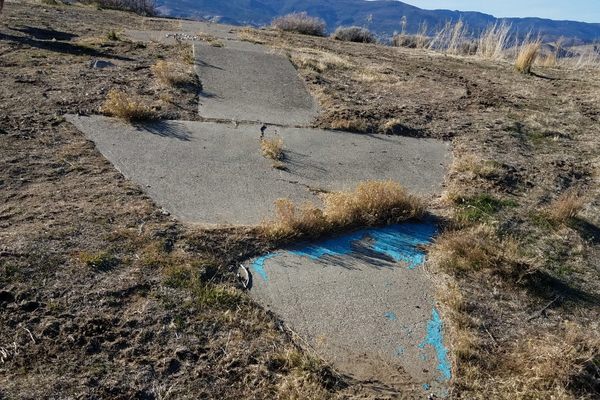
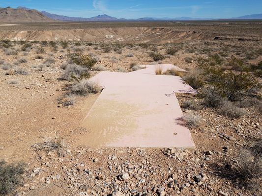
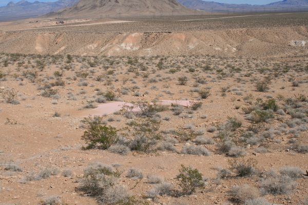
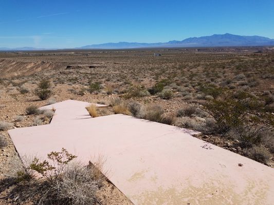
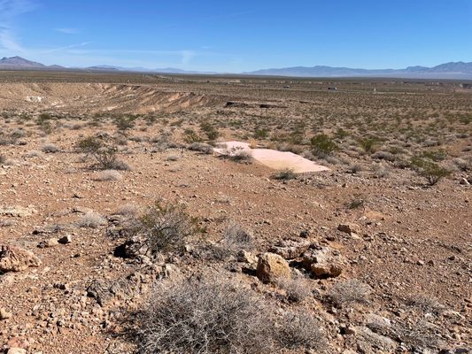
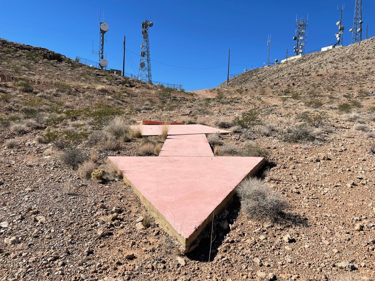
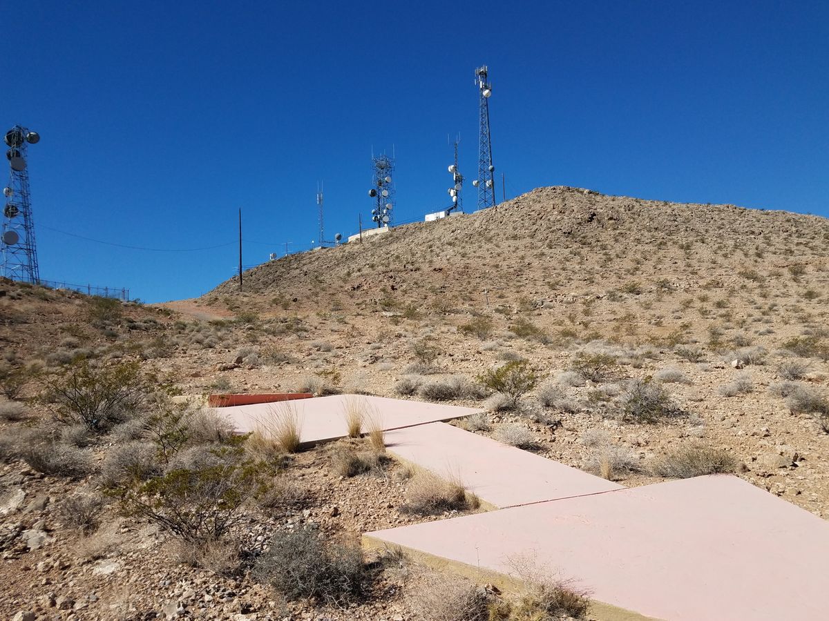
The rise of airmail service in the 1920s motivated improvements in the official airmail routes by building easy-to-recognize landmarks that would also allow night flying. Officially named Beacon Stations, these were large concrete arrows, originally painted yellow, that always pointed easterly on east-west routes and northerly on north-south routes. The arrows were also accompanied by a tower with a bright light so pilots could follow a course from light to light after dark.

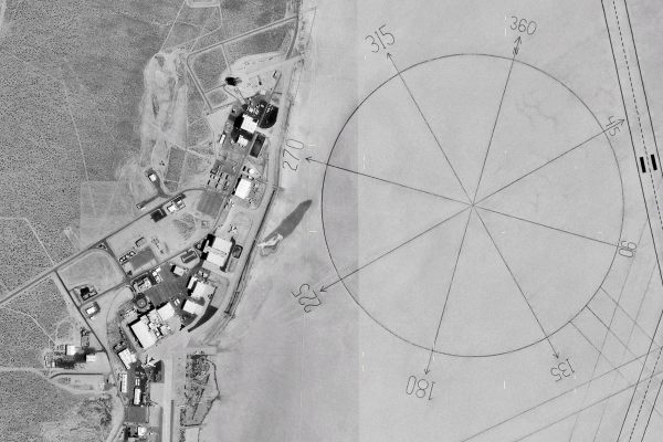
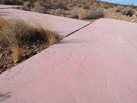
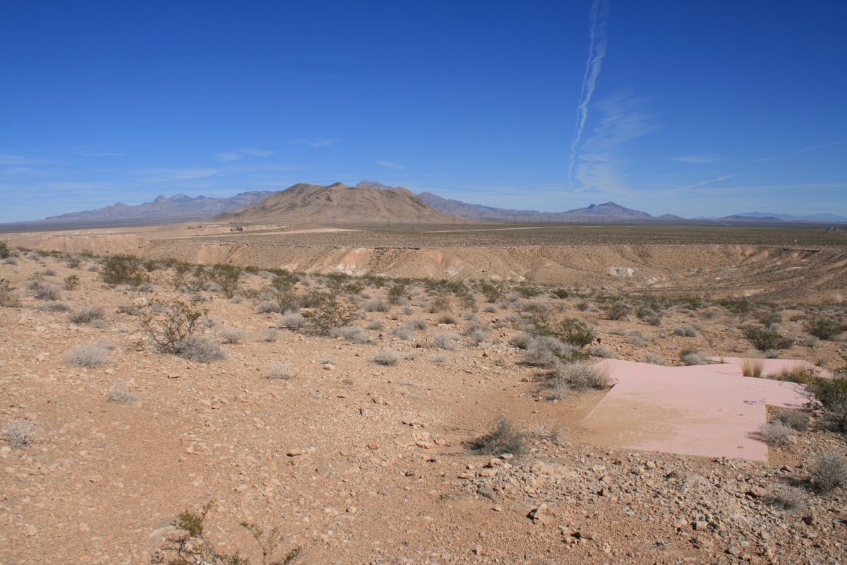
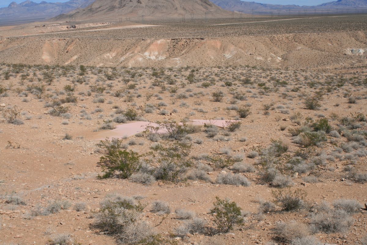
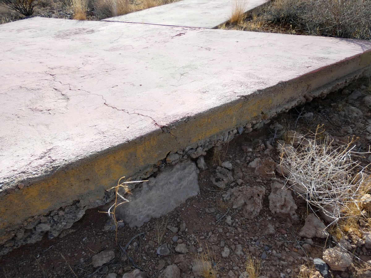
This arrow is beacon station 31 LA-SL (Los Angeles to Salt Lake City) on CAM (Contract Air Mail) route 04. (It's also called Mormon Mesa #31.) The tower was salvaged for scrap decades ago, as were those at most of the beacon stations, but the arrow remains in remarkably good shape.

Related Tags

Geographic Markers Mail Navigation Aircraft

Know Before You Go

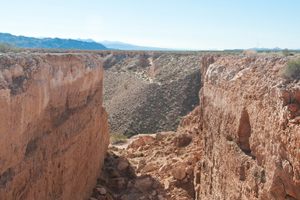
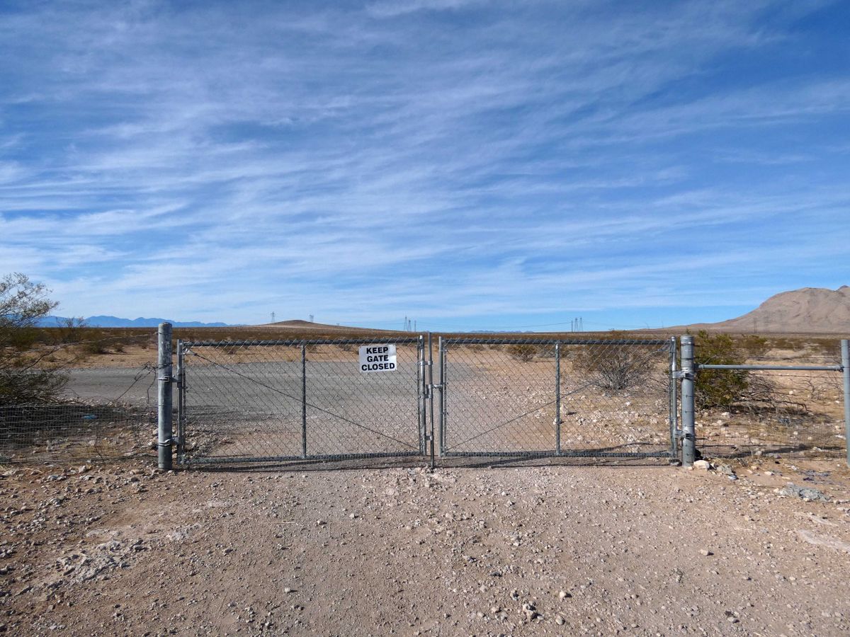
If available, the easiest way to the arrow is from a truck parking area on southbound Interstate 15 at about mile 95.5. Here there is a gate through the access fence, which is typically unlocked and not marked as "no trespassing." Cross through this gate onto the obvious dirt road beyond, being sure to close the gate behind you. Now drive up the road toward the prominent installations on the knolls ahead. The arrow will become visible below, on the right, before the road turns south to go to the installations.

If the gate is locked or otherwise unavailable, you can exit at the Carp Exit (#100). Go north about 0.9 miles, then turn left and follow the powerline road 4.9 miles; then turn left back toward the freeway and go 0.8 miles to pick up the road above. These roads are extremely rough and will require high clearance at a minimum.

The arrow itself is at about 36.685337 N, 114.517625 W and shows up plainly in Google satellite view.

Community Contributors

Added By

slgwv

Edited By

Avoiding Regret

  • Avoiding Regret

Published

December 25, 2023

Edit this listing

Make an Edit
Add Photos
Sources
  • https://www.dreamsmithphotos.com/arrow/
Moapa Airmail Arrow
Moapa Valley, Nevada, 89021
United States
36.685146, -114.517793
Visit Website

Nearby Places

Double Negative

Clark County, Nevada

miles away

Lost City Museum

Overton, Nevada

miles away

Arrow Canyon

Moapa, Nevada

miles away

Explore the Destination Guide

Photo of Nevada

Nevada

United States

Places 265
Stories 24

Nearby Places

Double Negative

Clark County, Nevada

miles away

Lost City Museum

Overton, Nevada

miles away

Arrow Canyon

Moapa, Nevada

miles away

Explore the Destination Guide

Photo of Nevada

Nevada

United States

Places 265
Stories 24

Related Places

  • The arrow, looking back toward arrow #31 by Moapa.

    Mesquite, Nevada

    Airmail Arrow #32 LA-SL

    A concrete arrow from a 1920s airmail navigation network.

  • Tip of the arrow, looking back west.  The skylined mountains are Boca Ridge in California.  The blue paint is _not_ original.

    Reno, Nevada

    Airmail Arrow

    A concrete arrow from a 1920s network of airmail beacons is still preserved at the western edge of suburban Reno.

  • Repère Pierre du Niton

    Geneva, Switzerland

    Repère Pierre du Niton

    This stone in Lake Geneva was once the reference point used to determine altitude in Switzerland.

  • El Hierro, Spain

    Monumento Meridiano Cero (Zero Meridian Monument)

    What many consider the original prime meridian and westernmost point of the old world.

  • Center of Edinburgh.

    Edinburgh, Scotland

    'Center of Edinburgh' Bollard

    This mundane post marks the old location of the city's main postal hub.

  • A sign marking the Tropic of Capricorn.

    Namibia

    Tropic of Capricorn Crossing

    Road signs in Namibia mark the location of one of the five major circles of latitude.

  • Green Belt sign in Emsworth.

    Pittsburgh, Pennsylvania

    Allegheny County Belt System

    Color-coded signs direct drivers on a network of routes designed to avoid Pittsburgh traffic.

  • World’s Largest Compass Rose

    Edwards Air Force Base, California

    World's Largest Compass Rose

    Etched into a dry lake bed, this massive directional indicator is accurate without magnets.

Aerial image of Vietnam, displaying the picturesque rice terraces, characterized by their layered, verdant fields.
Atlas Obscura Membership

Become an Atlas Obscura Member


Join our community of curious explorers.

Become a Member

Get Our Email Newsletter

Follow Us

Facebook YouTube TikTok Instagram Pinterest RSS Feed

Get the app

Download the App
Download on the Apple App Store Get it on Google Play
  • All Places
  • Latest Places
  • Most Popular
  • Places to Eat
  • Random
  • Nearby
  • Add a Place
  • Stories
  • Food & Drink
  • Itineraries
  • Lists
  • Video
  • Podcast
  • Newsletters
  • All Trips
  • Family Trip
  • Food & Drink
  • History & Culture
  • Wildlife & Nature
  • FAQ
  • Membership
  • Feedback & Ideas
  • Community Guidelines
  • Product Blog
  • Unique Gifts
  • Work With Us
  • About
  • FAQ
  • Advertise With Us
  • Advertising Guidelines
  • Privacy Policy
  • Cookie Policy
  • Terms of Use
Atlas Obscura

© 2025 Atlas Obscura. All Rights Reserved.