


About
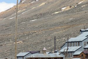
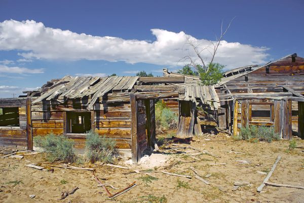
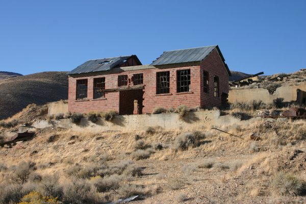
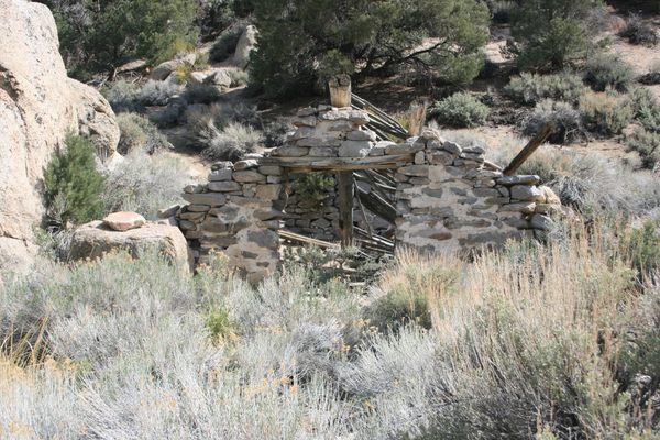
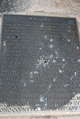
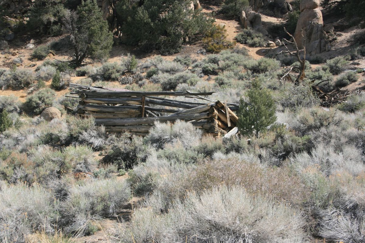
Gold was struck in this area around 1860, but little activity occurred then because nearby Aurora overshadowed the location. Most of the early prospectors were Freemasons, however, and they did leave their names on the district.
Masonic didn't boom until the early 20th century. A 16-year-old, Joe Green, found gold at what would become the Jump-Up-Joe in 1900 and sold his claim for a small sum, (The sale wouldn't become contested until the Jump-Up-Joe became a major producer.) Green's find did, however, trigger new interest in the district.
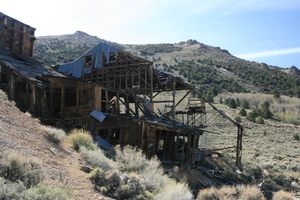
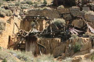
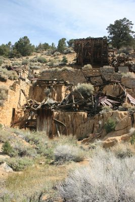
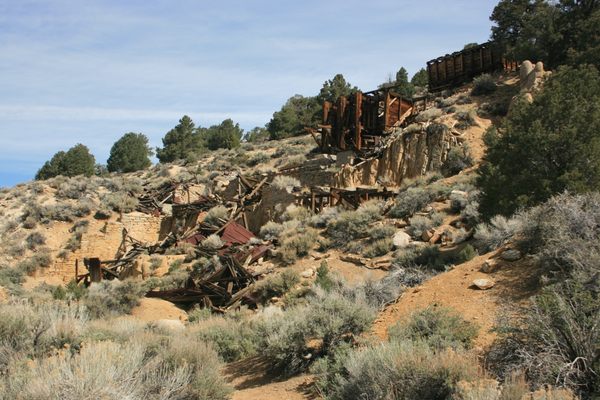
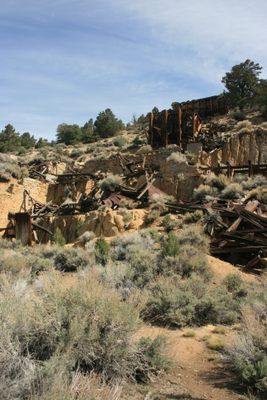
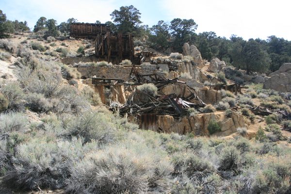
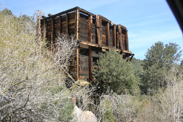
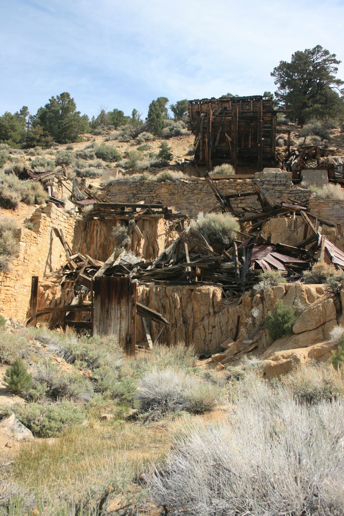
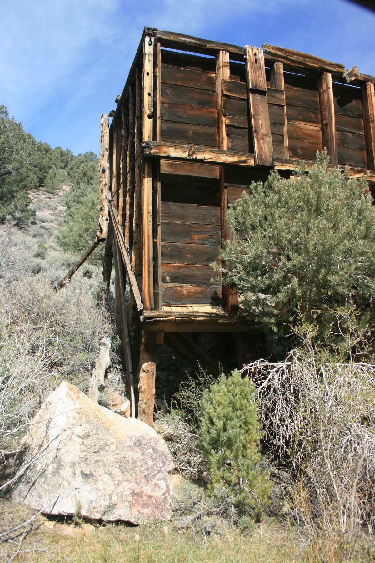
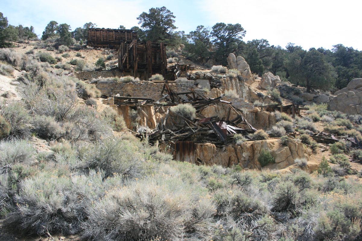
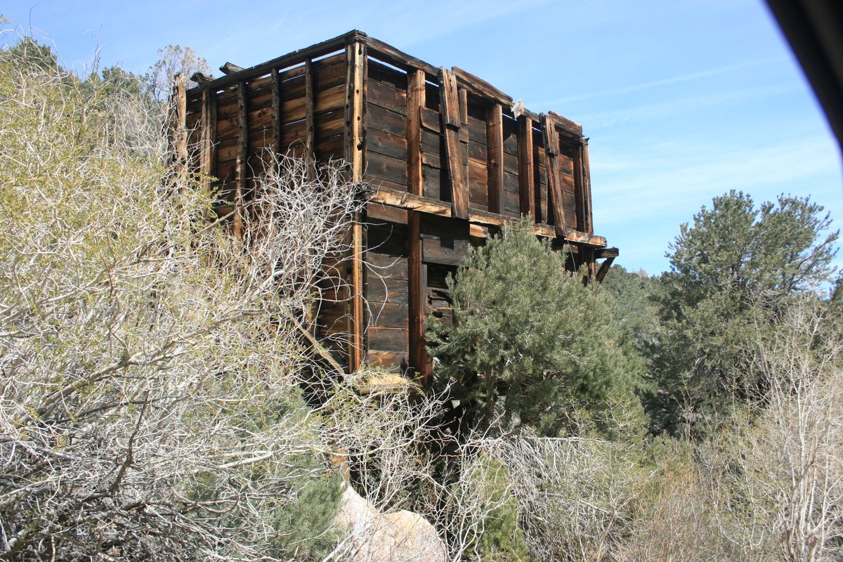
What would become the second major producer in the district, the Pittsburg-Liberty Mine, was discovered on July 4, 1902, though it didn't begin production until 1904. Other claims were staked in the 1900s, although none would become large producers. Still, roads were built from Bridgeport and Bodie, and some stage lines were established. In September of 1907, the Pittsburg-Liberty opened a 10-stamp mill, meaning that ore no longer needed to be shipped out for processing.
However, by 1911, production declined, and even the construction of a tramway in 1913 to the mill provided only a temporary respite. A lawsuit in 1911 between Pittsburg-Liberty and its general manager didn't help, and by 1924, only 24 registered voters lived in Masonic.
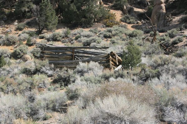
Through all this, the camp acquired a nearly unprecedented reputation for peacefulness. The violence and shootouts so notorious in Bodie simply didn't occur. Unfortunately, the camp's work ethic didn't stave off the exhaustion of the mines.
Related Tags
Know Before You Go
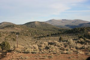
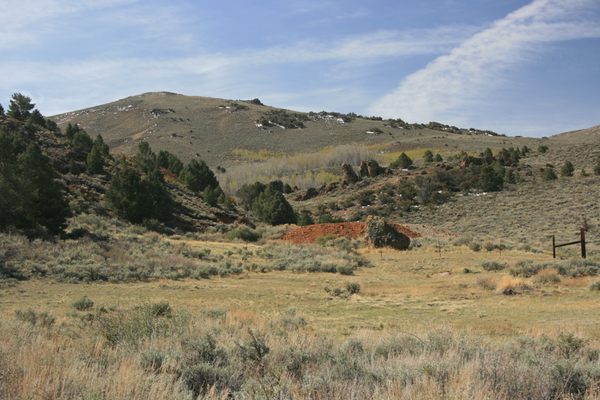
There are several ways to get to Masonic, all involving more-or-less extended stretches on rough-graded dirt roads on which high clearance at a minimum will be required and 4WD appreciated.
You can come directly from Bodie on the Bodie Masonic road. You will have to pay the entry fee at Bodie. The Bodie Masonic Road has a junction on the west side of Bodie at about 38.21373 N, 119.01555 W.
Go northwest on this road. At about 5.9 miles there will be a junction (38.25663 N, 119.17586 W) with a road coming in from the west. Continue straight here. In another 2.8 miles, there will be an intersection with Aurora Canyon Road (on the left) and Cow Camp Road (on the right), at 38.27976 N, 119.09878 W.
Again, continue straight across. Go 6.7 miles to the intersection with Masonic Road/US Forest Service 046 (from the left, at 35.35459 N, 119.11801 W). Turn right here and proceed 1.1 miles to the site of Masonic
Alternatively, you can follow Masonic Road past the Chemung Mine. Continue 2.8 miles past the Chemung Mine turnoff to the intersection above.
Or you can come in from Nevada. Start east off Nevada SR-338 at the junction (at 38.4428 N, 119.13162 W) with National Forest Road 028, as though going to The Elbow unit of Walker River State Recreation Area or Aurora.
Follow USFS-028 1.9 miles to a junction on the south (which should be signed for Masonic) with USFS 046. Turn south (right) here; drive 6.7 miles to Masonic.
Community Contributors
Added By
Published
May 10, 2024