


About
The majestic Haleakalā, meaning "House of the Sun" in Hawaiian, dominates the eastern side of the island of Maui. Though partially dormant today, Haleakalā was until recently (geologically speaking at least), a highly active volcano. Its massive outpourings of lava is responsible for creating the land of eastern Maui.
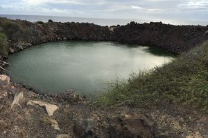
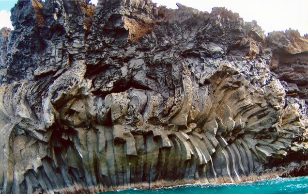
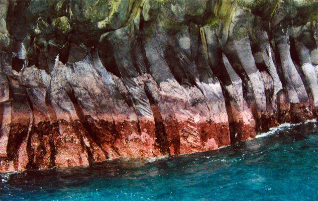
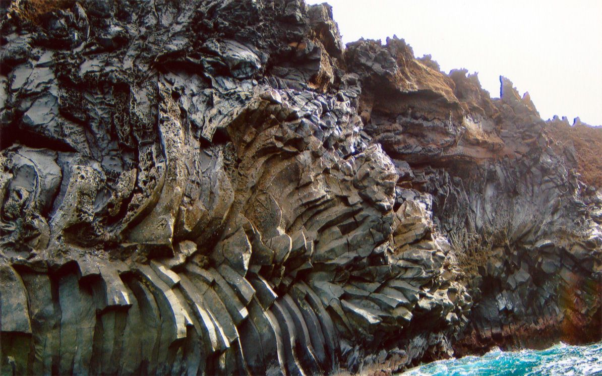
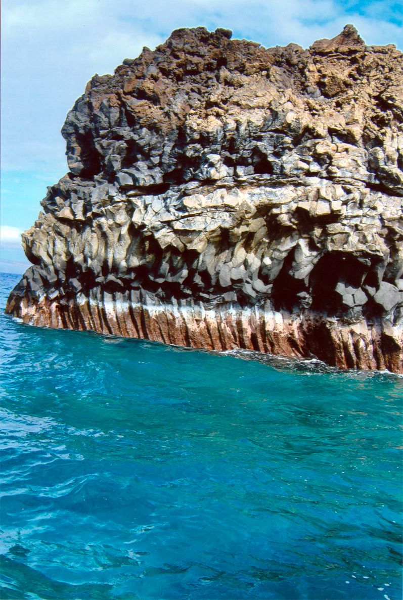
The last lava flow from Haleakalā occurred in the 18th-century and poured down its southern flank all the way to the ocean. Where molten rock touched water, it cooled slowly enough for its constituent minerals to crystallize into a surreal, almost artificial-looking landscape of gigantic hexagonal pillars known as columnar basalt.
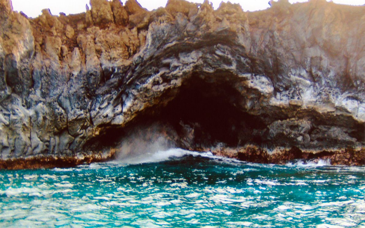
Numerous bays and sea caves cut into this rugged coast, providing habitats for an abundance of marine life including schools of fish, sea turtles, sharks and spinner dolphins.
At least a third of the landward side of the Kanaio Coast is in the protected Ahihi-Kinau Natural Area Reserve. Being so young, the lava field has not yet acquired a layer of soil and plants and remains an open, moon-like plain of sharp, black stone.
Related Tags
Know Before You Go
The waves near the columnar basalt formations can be treacherous. To see them safely it's best to charter a boating trip or kayak tour in one of the nearby towns such as Kihei.
Published
August 30, 2019