About
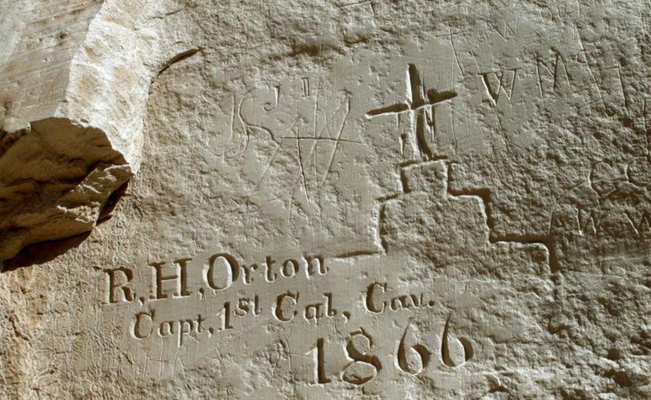
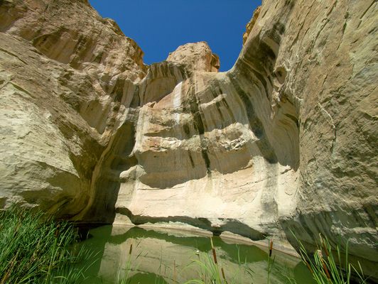
In the high desert water is difficult to find, and a permanent spring that forms a pool is very rare indeed. The spring at the El Morro bluff, hidden at the base of a cliff, has flowed for a thousand years or more. The pool has served as an oasis for groups including Native Americans, Spanish conquistadores, and 19th-century emigrants, and they have all left their mark.
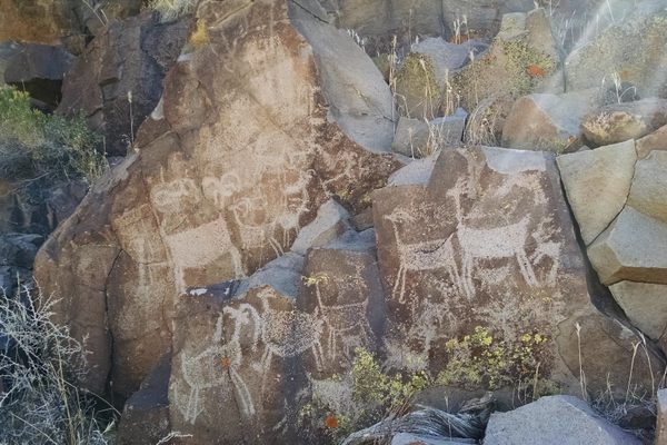
Hundreds of years ago, local Ancestral Puebloan people built dwellings on top of the mesa and farmed the surrounding land. Although they carved inscriptions and petroglyphs in the rock wall by the spring, their story has been mostly lost to time. The ancient Zuni Indians developed pueblos near water sources and large sandstone structures on which they carved the petroglyphs that still remain today.
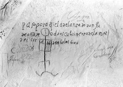
Then in the late 1500s, men in steel suits with steel swords and lead shot came to conquer the land and the peoples that still lived there. One of the conquistadores, Juan de Oñate, was “given” the land to settle, which he did with a vengeance. After massacring and enslaving the people of the Acoma Pueblo, he left his mark on the wall of El Morro in 1605. It is one of the earliest markings by European colonists in America, 15 years before the Pilgrims landed at Plymouth Rock.
Oñate was followed by others. One soldier couldn’t resist adding to his commander’s inscription, “The 14th day of July 1736 passed by here the General Juan Paez Hurtado, Inspector,” with the addendum, “And in his company, the Corporal Joseph Trujillo!” Another name is that of P. Gilmer Breckinridge, a wrangler for the U.S. Camel Corps under Lt. Edward Beale.
In the years that followed, countless more soldiers and American settlers, both well known and lost to history, came through the desert and left their mark at this watering hole. There are now around 2,000 signatures at the base of the cliff, and the El Morro National Monument was established to protect this unique historical record.
In June 2015, Cultural Heritage Imaging, the National Park Service, and the University of Colorado Denver began working together on a project that would capture important inscriptions and petroglyphs at El Morro. They used photogrammetry to capture large-scale sections of the rock, creating a record of the inscriptions that can be used to monitor changes to the site over time. The historical record is critical because of the fragility of the petroglyphs and inscriptions at the site.
Related Tags
Know Before You Go
Take Exit 81 on I-40 for Grants, New Mexico. Take Highway 53 south toward El Malpais visitor center for 43 miles. Admission and camping are free. The park is dog friendly, as long as they are leashed. There are ruins on the top of the mesa and the views from the top are spectacular. The hike to the top of the mesa is not difficult, but be prepared with water, sunscreen, and appropriate shoes. The upper loop is about 4 miles total. A climb to the top of the mesa is not required, however. The inscriptions are on the north and east end of the bluffs at ground level on an easy walking path.
Community Contributors
Added By
Edited By
Published
November 28, 2018

