Trips Places Foods Stories Newsletters
Loading...
Loading...
Loading...
Loading...

No search results found for
“”

Make sure words are spelled correctly.

Try searching for a travel destination.

Places near me Random place

Popular Destinations

  • Paris
  • London
  • New York
  • Berlin
  • Rome
  • Los Angeles
Trips Places Foods Stories Newsletters
Sign In Join
Places near me Random place
All the United States Utah Escalante Hell's Backbone Scenic Road

Hell's Backbone Scenic Road

Despite its name, this route in southern Utah offers a heavenly day trip.

Escalante, Utah

Added By
lastpearl
Email
Been Here
Want to go
Added to list
CAPTION
View from Hell’s Backbone Bridge overlooking Box-Death Hollow Wilderness Area   Caddymob
Looking up at Hell’s Backbone Bridge   Caddymob
View from Hell’s Backbone ridge   National Forest Service
Looking at Hell’s Backbone from below   National Forest Service
It’s a sheer drop from parts of the road   lastpearl (Atlas Obscura User)
The guardrail along the bridge is old, low and made out of wood   lastpearl / Atlas Obscura User
Fall colors along the way   Caddymob
A little history of Hell’s Backbone Road   Caddymob
road sign at the start   lastpearl / Atlas Obscura User
Been Here
Want to go
Added to list

About

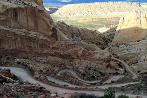
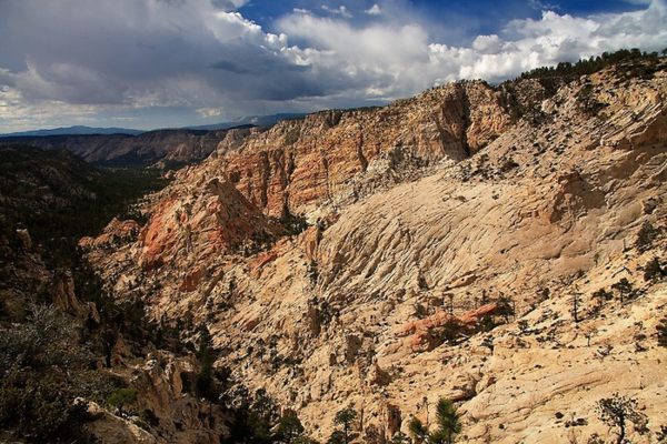
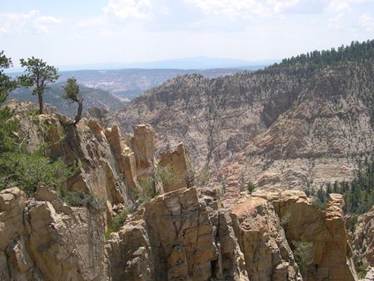
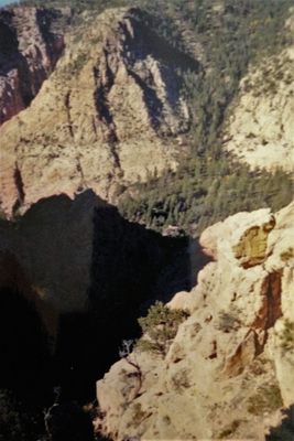
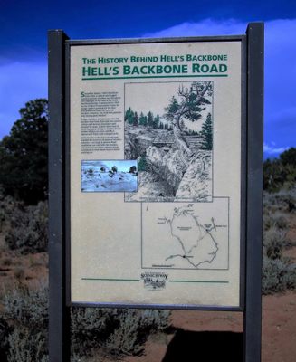
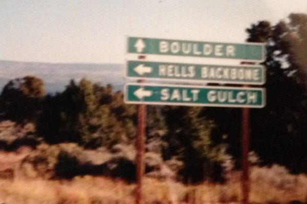
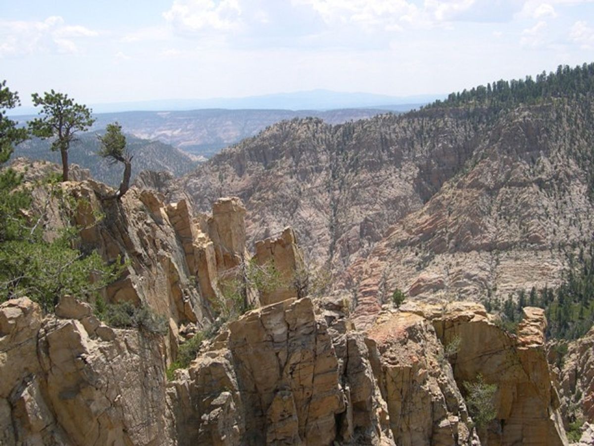
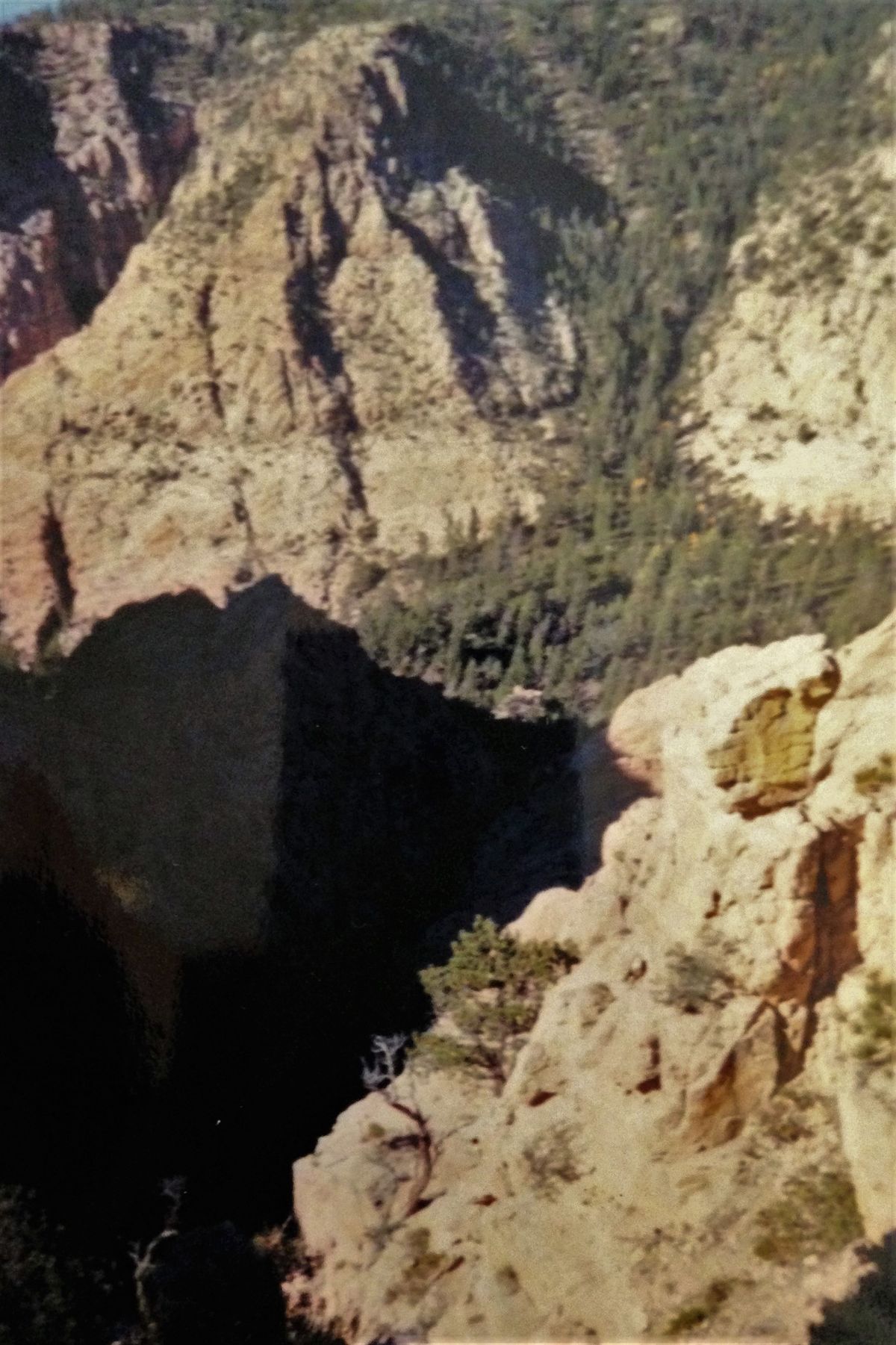
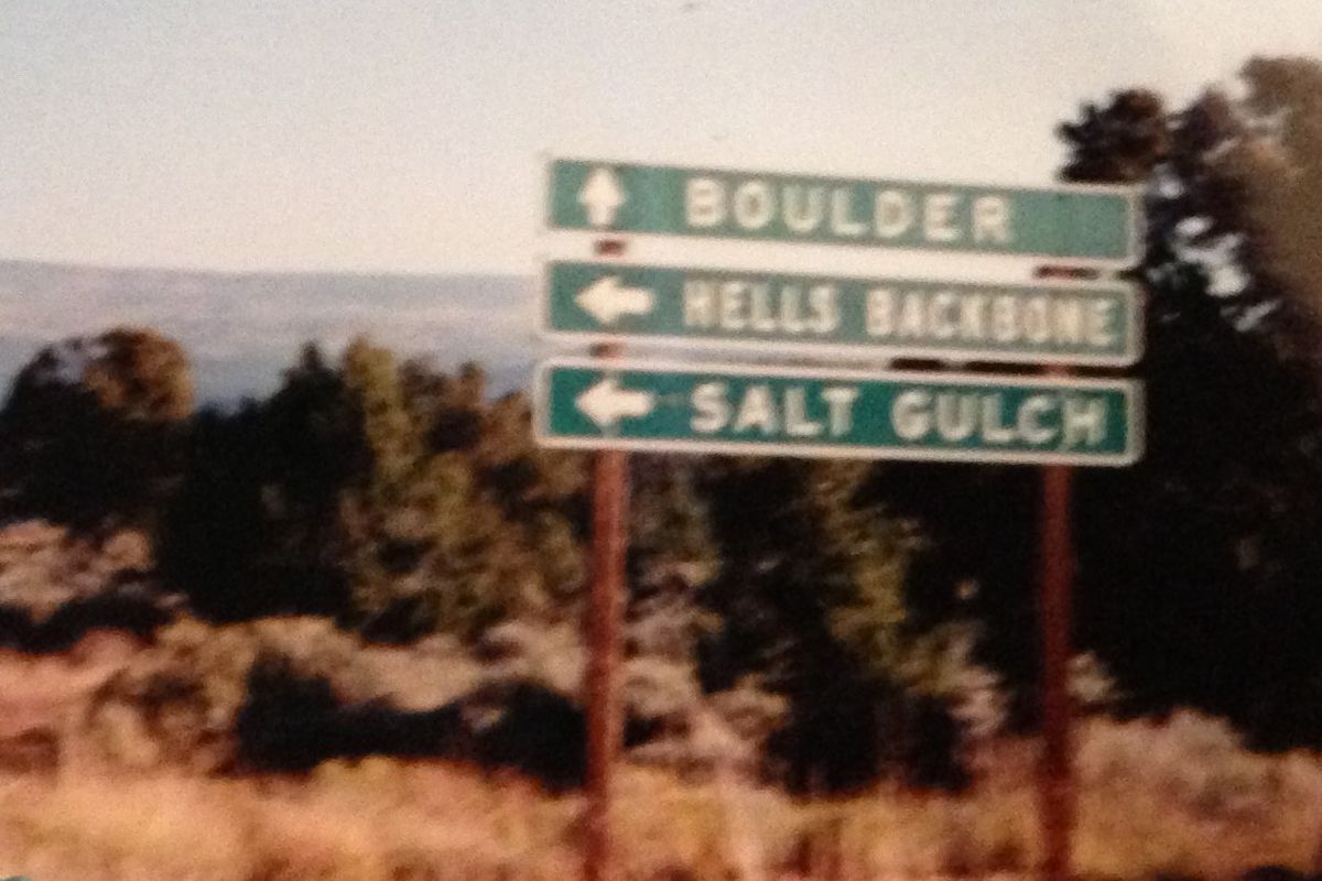
Some evocative names swirl around a scenic road in southern Utah. The men who built it called it The Poison Road; its craggy terrain is known as desert slickrock; it is surrounded by the Box-Death Hollow wilderness area; and it winds around a town called Salt Gulch. The road's name is most evocative of all: Hell’s Backbone.

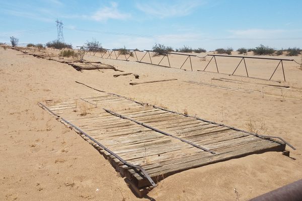
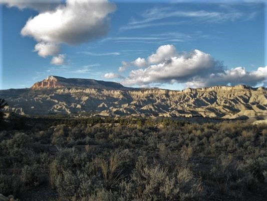
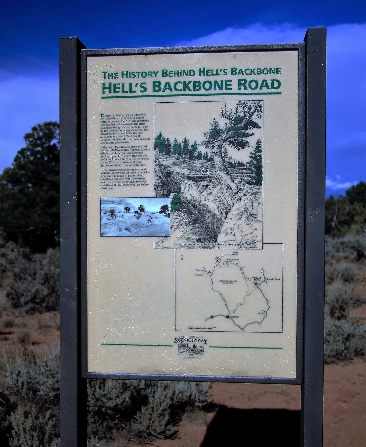
There are two roads between the towns of Boulder and Escalante, Utah. One, a lovely route over Scenic Byway 12, is paved. The other, Hell’s Backbone, is most certainly not. Both roads were built in the early 1930s by the Civilian Conservation Corps (the CCC), the construction and public works arm of the Works Projects Administration (the WPA). Before 1933 there were no automobile routes to Boulder or between the two towns, there were only wagon routes and mule trails. When the CCC was formed under the WPA, the two towns asked for funding to bring them into the 20th century. They got it, starting with a gravel road along the ridge called Hells’ Backbone. Given the sheer drop along some stretches, it was the CCC crews who dubbed it the Poison Road – one false step, and down you go.

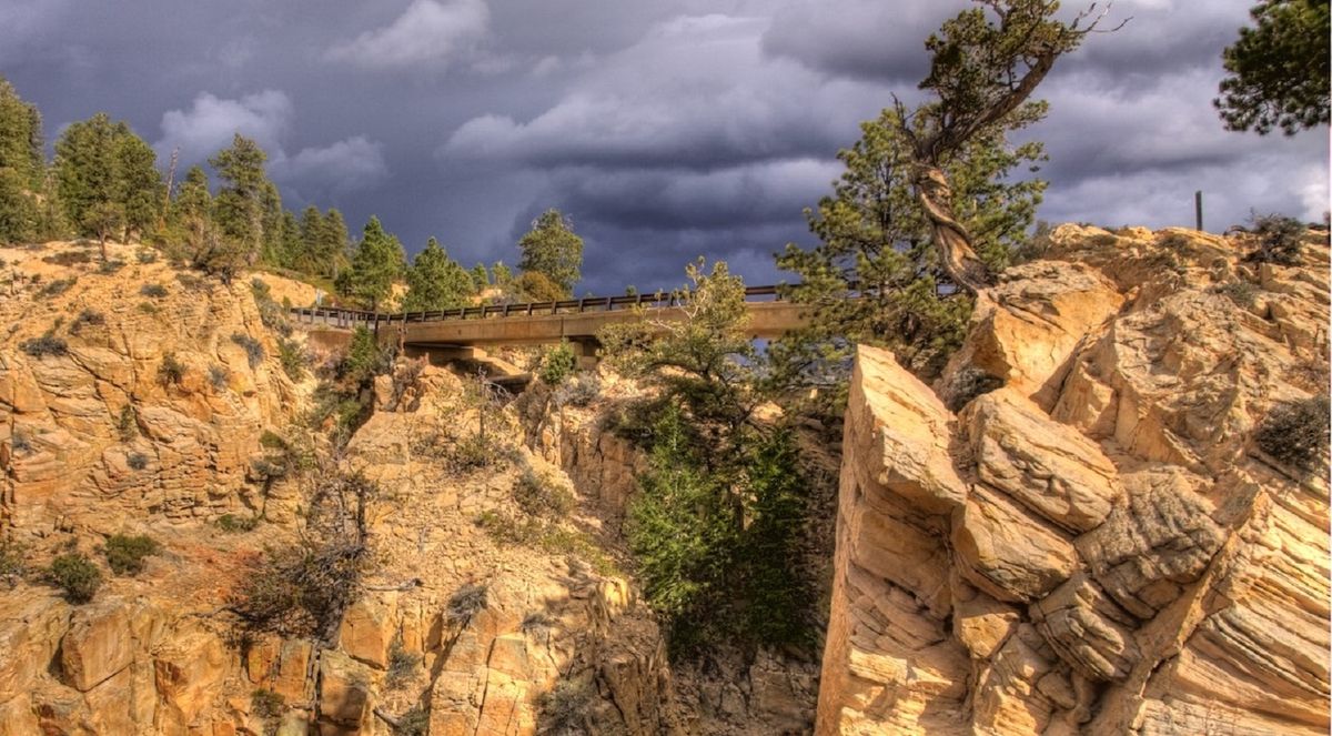
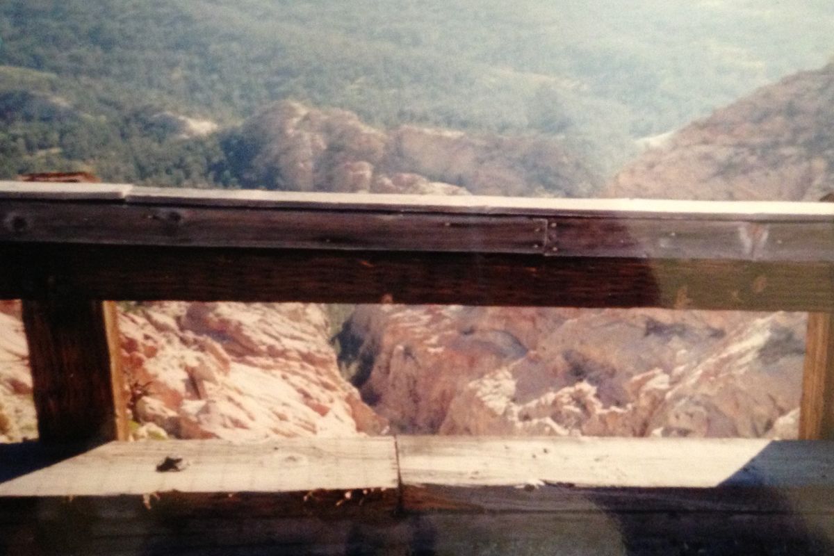
It only took the CCC a couple of years to complete Hell’s Backbone Road, which is still gravel today. It took a few more years to complete the paved road, which was finished by 1940. It is still the smooth, all-weather route between Boulder and Escalante. Both roads boast ridiculously beautiful western scenery, but only one has a bridge that can make an acrophobic’s heart skip a beat.

Related Tags

Roads Wild West Automotive History

Know Before You Go

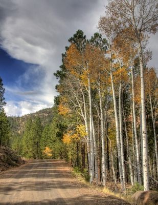
Hell's Backbone Road is about a 35 mile drive between Boulder and Escalante, Utah. It can be treacherous travel in the wrong weather or under the wrong road conditions, so check before making the trip and plan for about a 2-hour drive between the two towns. The road is closed in the winter, so if traveling between Boulder and Escalante in the snowy months, Scenic Byway Rt. 12 is the route. To get to the road from Boulder, Utah, follow Rt. 12 south for about 5 miles and Hell's Backbone Road (a/k/a FR-153) will be a right turn. And if heights aren't your thing, there's always the Hell's Backbone Grill in downtown Boulder.

Community Contributors

Added By

lastpearl

Edited By

nezztribe

  • nezztribe

Published

May 20, 2016

Edit this listing

Make an Edit
Add Photos
Sources
  • https://www.nps.gov/parkhistory/online_books/ccc/ccc/chap6.htm
  • https://en.wikipedia.org/wiki/Hell%27s_Backbone_Road
  • https://bridgehunter.com/ut/garfield/hells-backbone/
Hell's Backbone Scenic Road
Hell's Backbone Road
Escalante, Utah, 84726
United States
37.970024, -111.598866
Visit Website
Get Directions

Nearby Places

Burr Trail Switchbacks

Garfield County, Utah

miles away

Factory Butte

Torrey, Utah

miles away

Tropic Ditch

Tropic, Utah

miles away

Explore the Destination Guide

Photo of Utah

Utah

United States

Places 155
Stories 29

Nearby Places

Burr Trail Switchbacks

Garfield County, Utah

miles away

Factory Butte

Torrey, Utah

miles away

Tropic Ditch

Tropic, Utah

miles away

Explore the Destination Guide

Photo of Utah

Utah

United States

Places 155
Stories 29

Related Stories and Lists

From Desert Waterfalls to Wind-Carved Hoodoos: Dive Into Utah’s Wild Dreamscapes

List

Sponsored by Visit Utah

Related Places

  • National Route 66 Museum

    Elk City, Oklahoma

    National Route 66 Museum

    An Oklahoma museum that celebrates the history of the "Mother Road."

  • Singapore Grand Prix at Old Upper Thomson Road - Racing in progress on the track

    Singapore

    Devil's Bend (Old Upper Thomson Road)

    This sharp turn was once the most dangerous part of the Singapore Grand Prix circuit.

  • Alaska Highway Mile 0 sign

    Dawson Creek, British Columbia

    Alaska-Canada Highway Mile 0

    The arch marks the beginning of the road for northbound travelers.

  • The final marker

    San Francisco, California

    Western Terminus of the Lincoln Highway

    The United States' first transcontinental automobile road came to its end at this spot in San Francisco's Lincoln Park.

  • Official start to the Dalton Highway

    Fairbanks, Alaska

    Haul Road (Dalton Highway)

    This gravelly, dangerous highway is the only road in the United States that leads to the Arctic Ocean.

  • The Old Plank Road.

    Winterhaven, California

    Old Plank Road

    The remnants of an early automobile route across shifting sand dunes can still be found in the deserts of Southern California.

  • Bell at Mission Santa Inez

    San Luis Obispo, California

    The Bells of El Camino Real

    A chain of bells connect the California Missions and honor the legend of the "King’s Highway."

  • Island Lamp at night, intersection of Madison Road and Edwards Road

    Cincinnati, Ohio

    Cincinnati Yellow Lamps

    An obsolete, vanishing traffic device warns Cincinnati drivers away from middle-of-the-road obstructions.

Aerial image of Vietnam, displaying the picturesque rice terraces, characterized by their layered, verdant fields.
Atlas Obscura Membership

Become an Atlas Obscura Member


Join our community of curious explorers.

Become a Member

Get Our Email Newsletter

Follow Us

Facebook YouTube TikTok Instagram Pinterest RSS Feed

Get the app

Download the App
Download on the Apple App Store Get it on Google Play
  • All Places
  • Latest Places
  • Most Popular
  • Places to Eat
  • Random
  • Nearby
  • Add a Place
  • Stories
  • Food & Drink
  • Itineraries
  • Lists
  • Video
  • Podcast
  • Newsletters
  • All Trips
  • Family Trip
  • Food & Drink
  • History & Culture
  • Wildlife & Nature
  • FAQ
  • Membership
  • Feedback & Ideas
  • Community Guidelines
  • Product Blog
  • Unique Gifts
  • Work With Us
  • About
  • FAQ
  • Advertise With Us
  • Advertising Guidelines
  • Privacy Policy
  • Cookie Policy
  • Terms of Use
Atlas Obscura

© 2025 Atlas Obscura. All Rights Reserved.