


About
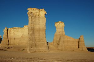
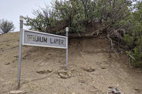
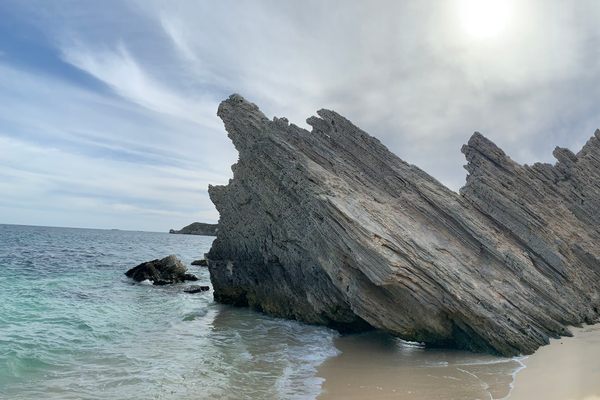
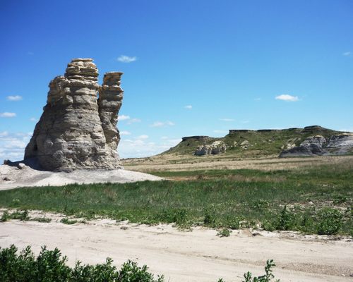
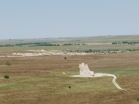
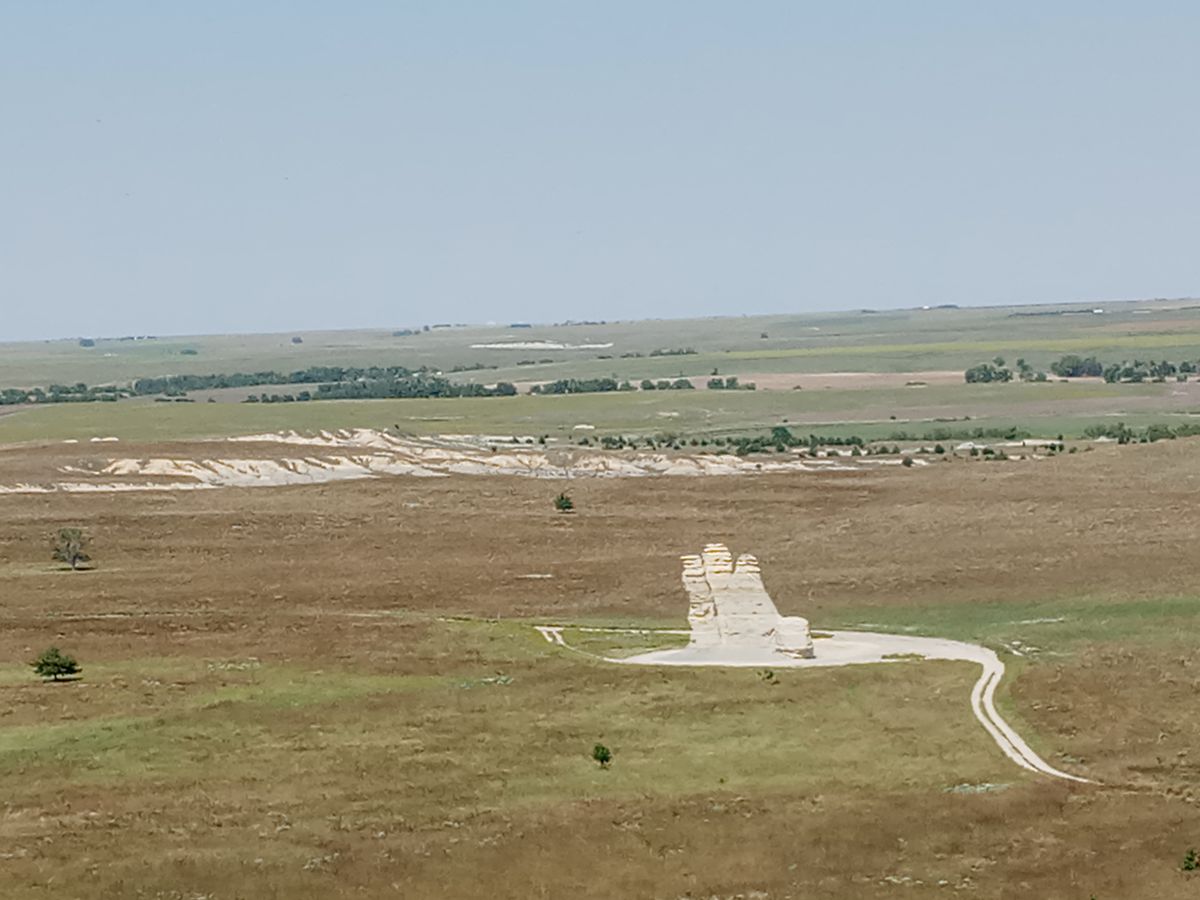
Utilized as a landmark for Native Americans and European settlers for centuries, Castle Rock itself stands 70-feet high on the otherwise gently rolling western Kansas prairie. It's all that remains after the erosion of what was once the floor of the Western Interior Seaway from the Cretaceous Period.
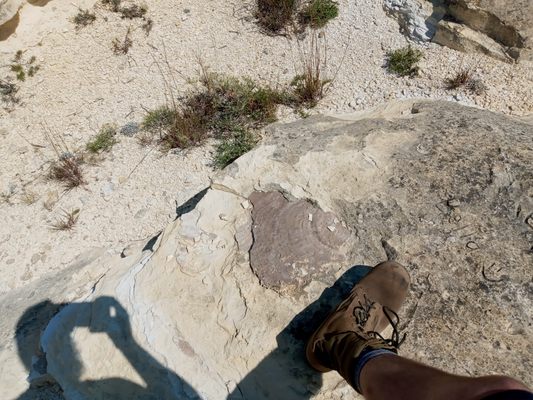
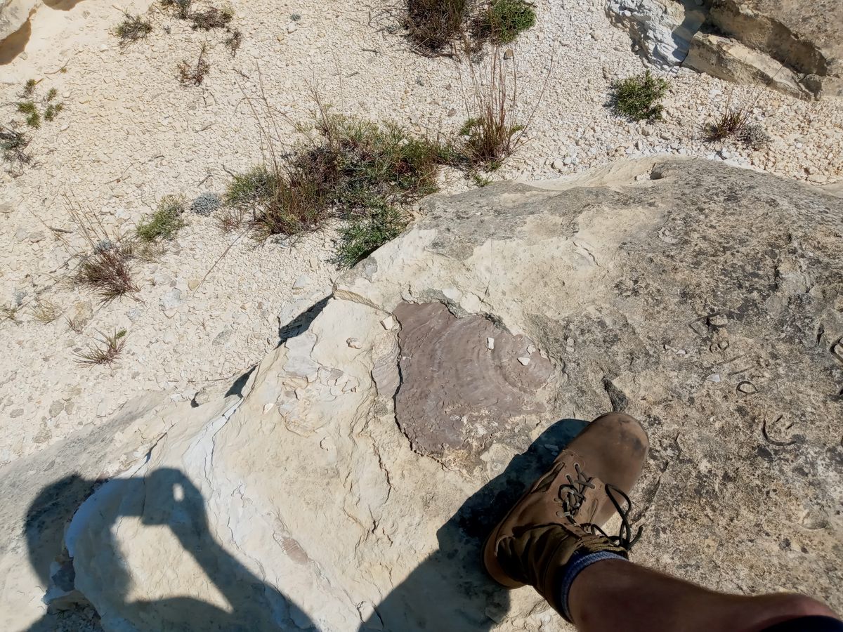
This particular layer of rock is known as the Niobrara Chalk: lending its name to the University of Kansas' Rock Chalk chant. The chalk is full of fossils from the sea such as giant clams, flying reptiles, and mosasaurs.
Castle rock is very fragile and will not last forever. In 2001, a large portion of the tallest spire fell after a thunderstorm, lopping ten feet off the overall height. All that remains of the fourth spire is a stub on the west end. The wind and rain that formed this geological wonder are still eroding it today. Human interaction has accelerated the process as well.
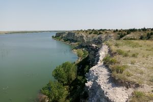
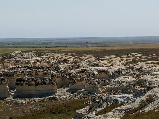
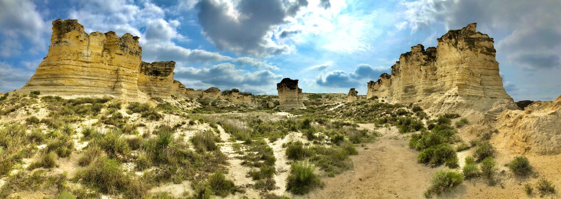
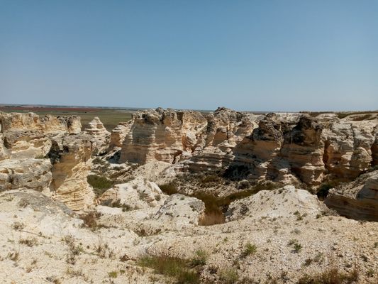
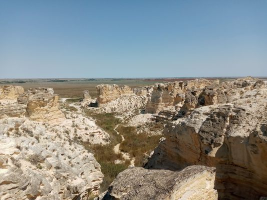
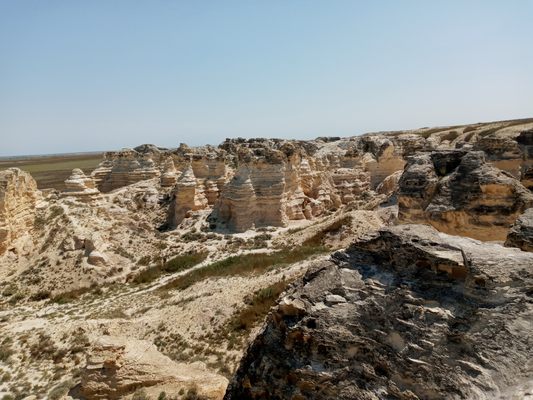
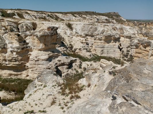
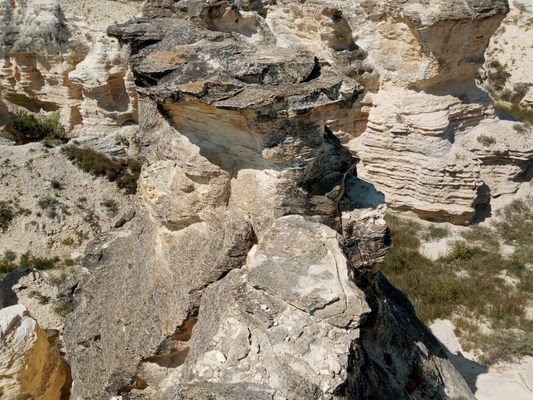
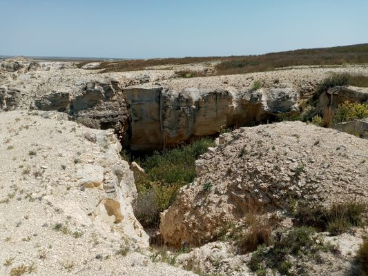
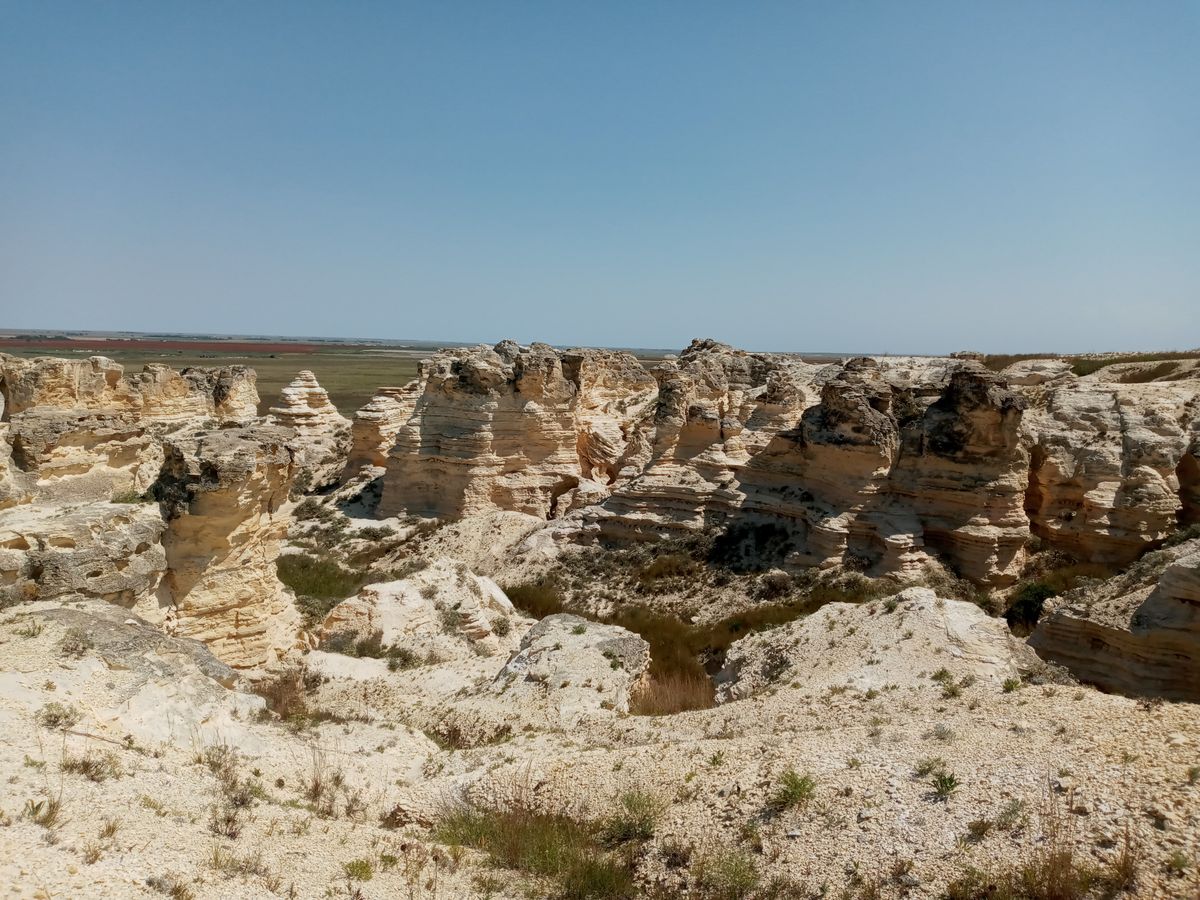
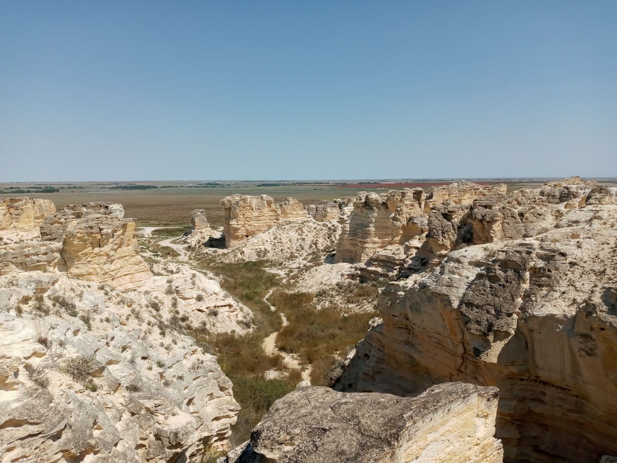
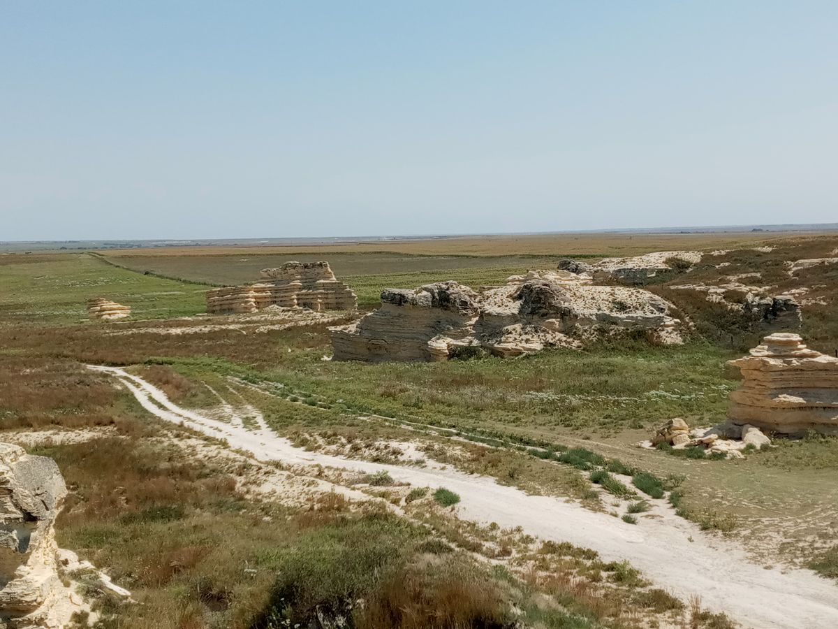
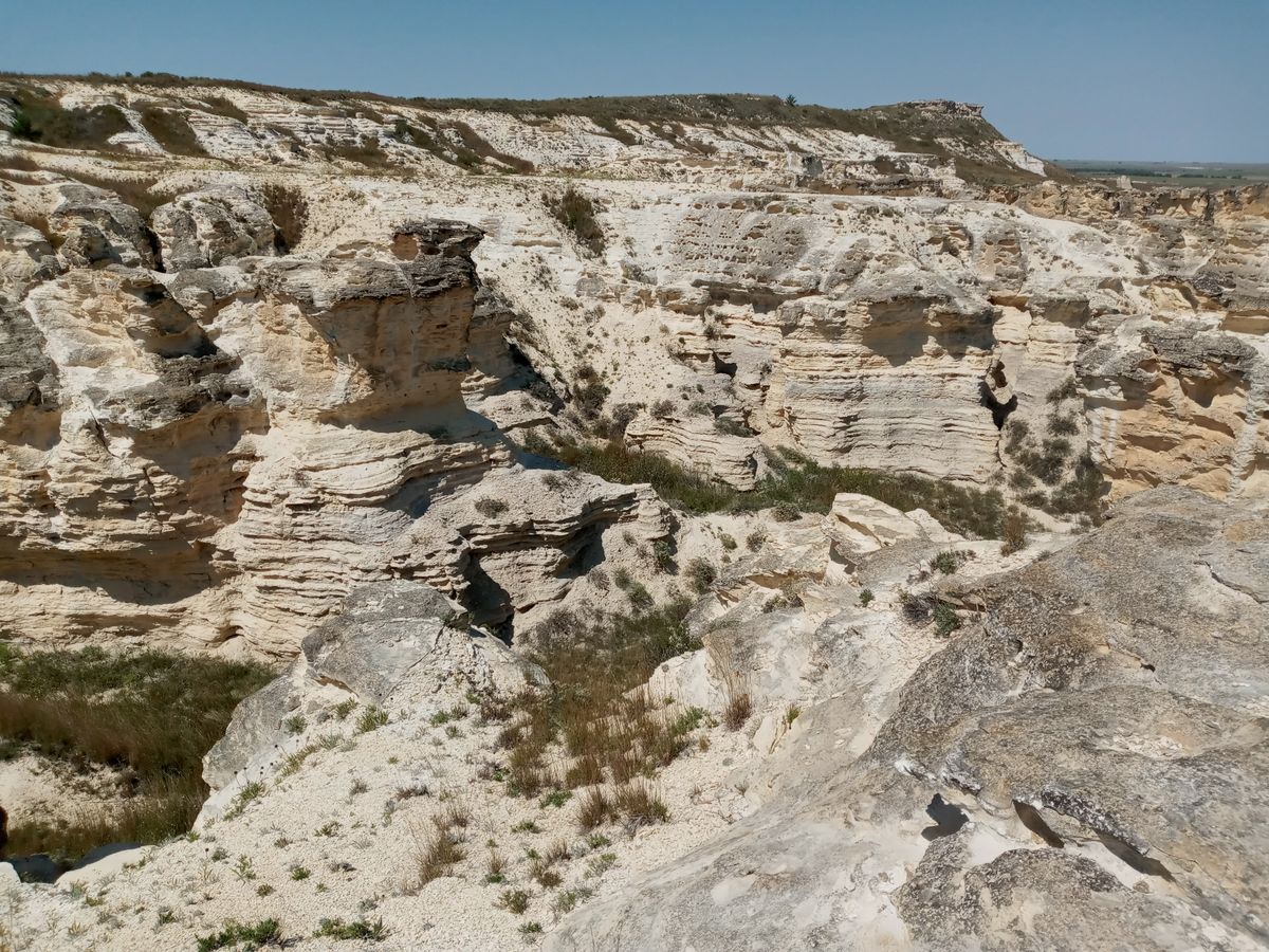
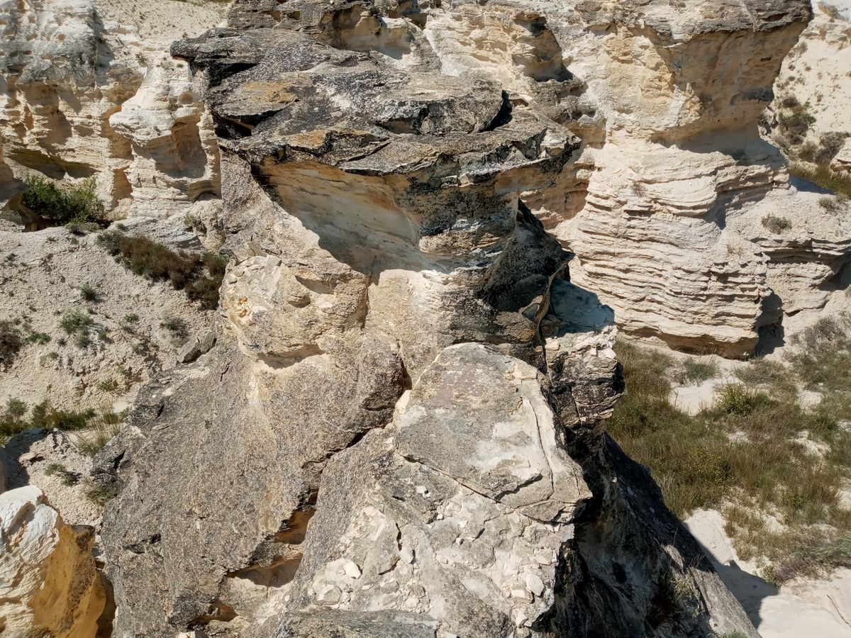
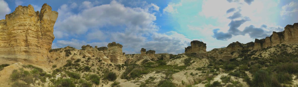
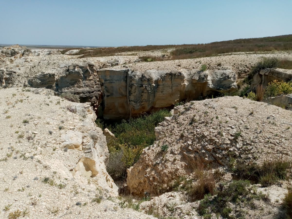
Just south of Castle Rock are the Castle Rock Badlands. The badlands consist of steep crevices and hoodoos leading off a large ridge. They are fragile as well, with one of the hoodoos known as Cobra Rock collapsing in 1998. Like Castle Rock and nearby Monument Rocks, the Badlands are comprised of Niobrara Chalk and shale.
The crevices provide shelter for several small plant and animal species. The hoodoos also provide perches and nesting areas for local birds such as Great horned owls, hawks, and kestrels. Visitors can also see lizards darting from hole to hole in the summer, Mule deer, antelopes, coyotes, kangaroo rats, jackrabbits, and prairie dogs.
The remoteness of the badlands allows visitors to feel as if they were the first to discover the region. The only hint of civilization are the nearby oil tanks and pumps scattered across western Kansas.
Related Tags
Know Before You Go
Access from I-70 at Quinter (exit 107) and take Castle Rock Road south for about 14 miles. Turn left on Gove K Road and head east for just over four miles to Gove 80 road. Turn left and head north through the entrance.
When entering, follow the road staying left, past some oil tanks and pumps, and around the ridge. This will take you to the base of Castle Rock. Continue south to get a view of the badlands from below. Backtrack to the first right that you passed upon entering and go east (now left) to see the badlands from the top.
Stay left on this path, as one right route goes down through a gulch and requires a 4x4 vehicle. This upper route eventually gets a bit rough and requires a high clearance vehicle or a normal 4x4 truck. This rough path continues up the ridge and winds back to the oil tanks. Try to stay on the paths.
Castle Rock is on private land and access is a privilege, not a right. Hike only on established paths. There may be cattle present so drive slow. Roads are dirt and will be muddy after rain.
Community Contributors
Added By
Published
October 28, 2020