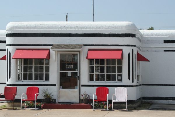
Trips Places Foods Stories Newsletters
Loading...
Loading...
Loading...
Loading...

No search results found for
“”

Make sure words are spelled correctly.

Try searching for a travel destination.

Places near me Random place

Popular Destinations

  • Paris
  • London
  • New York
  • Berlin
  • Rome
  • Los Angeles
Trips Places Foods Stories Newsletters
Sign In Join
Places near me Random place
All the United States California Needles Carty's Camp

Carty's Camp

An abandoned 1920s-era stretch of cabins now overshadowed by the 66 Motel.

Needles, California

Added By
Lew Blank
Email
Been Here
Want to go
Added to list
CAPTION
Abandoned cabins and gas station of Carty’s Camp   Map Data © 2016 Google
66 Motel sign along the original Route 66   Doug Wertman / CC BY 2.0
66 Motel sign, ruins of Carty’s Camp behind it   el-toro / CC BY 2.0
Classic 66 Motel sign   Own work
Original 66 Motel   Own work
  01hair / Atlas Obscura User
  01hair / Atlas Obscura User
  01hair / Atlas Obscura User
  01hair / Atlas Obscura User
  01hair / Atlas Obscura User
  01hair / Atlas Obscura User
  01hair / Atlas Obscura User
  01hair / Atlas Obscura User
  breaingram / Atlas Obscura User
  01hair / Atlas Obscura User
  01hair / Atlas Obscura User
  01hair / Atlas Obscura User
  01hair / Atlas Obscura User
  01hair / Atlas Obscura User
Been Here
Want to go
Added to list

About

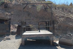
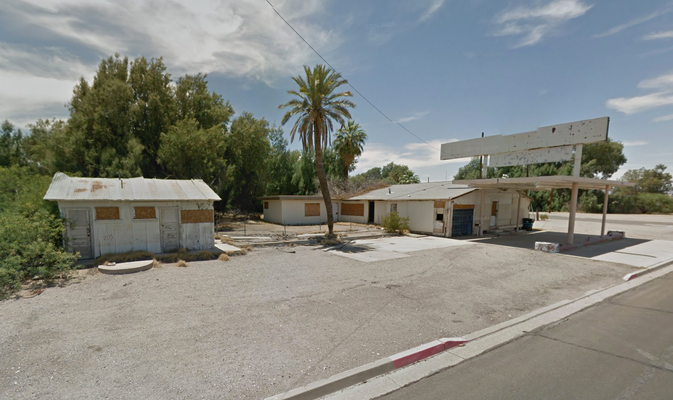
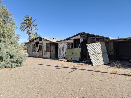
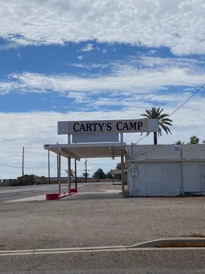
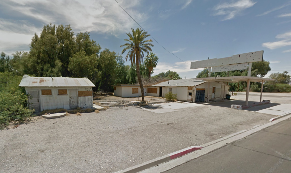
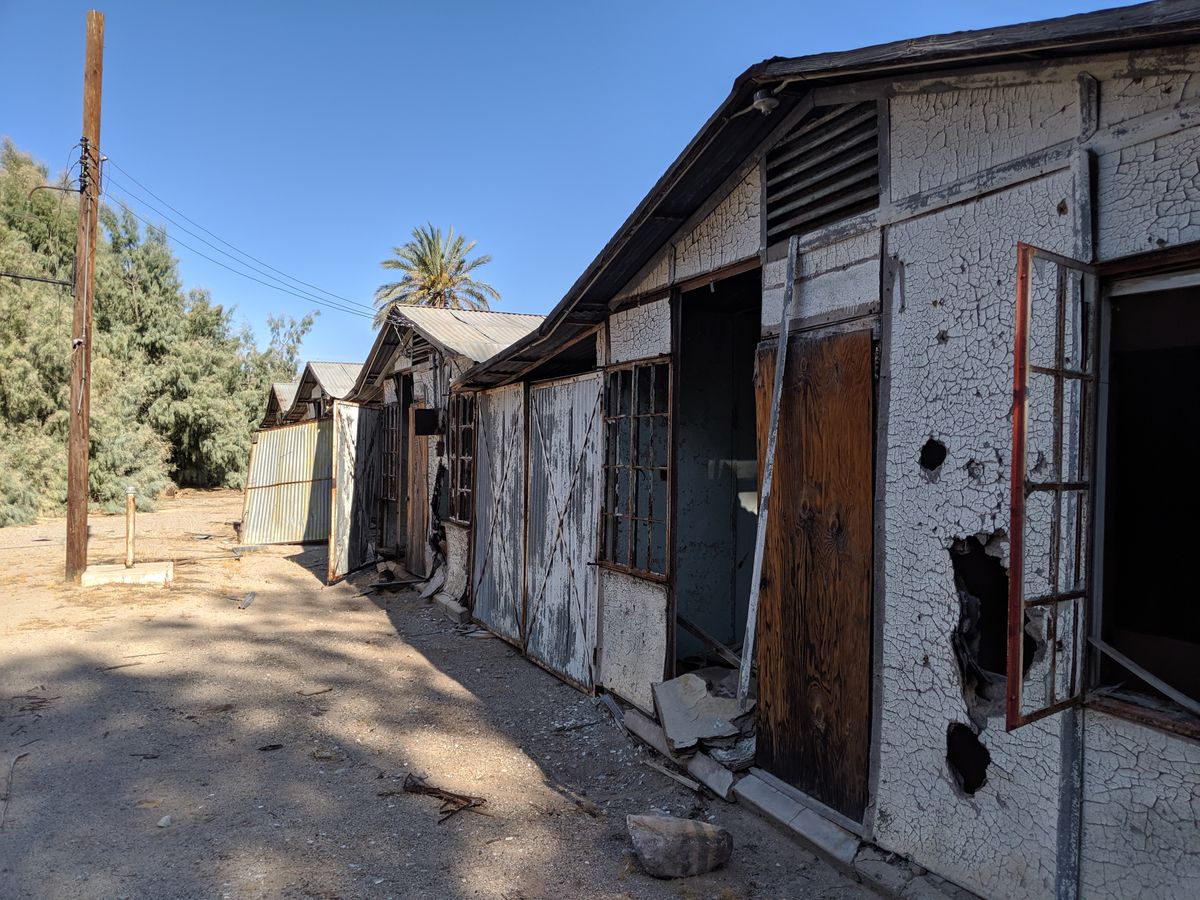
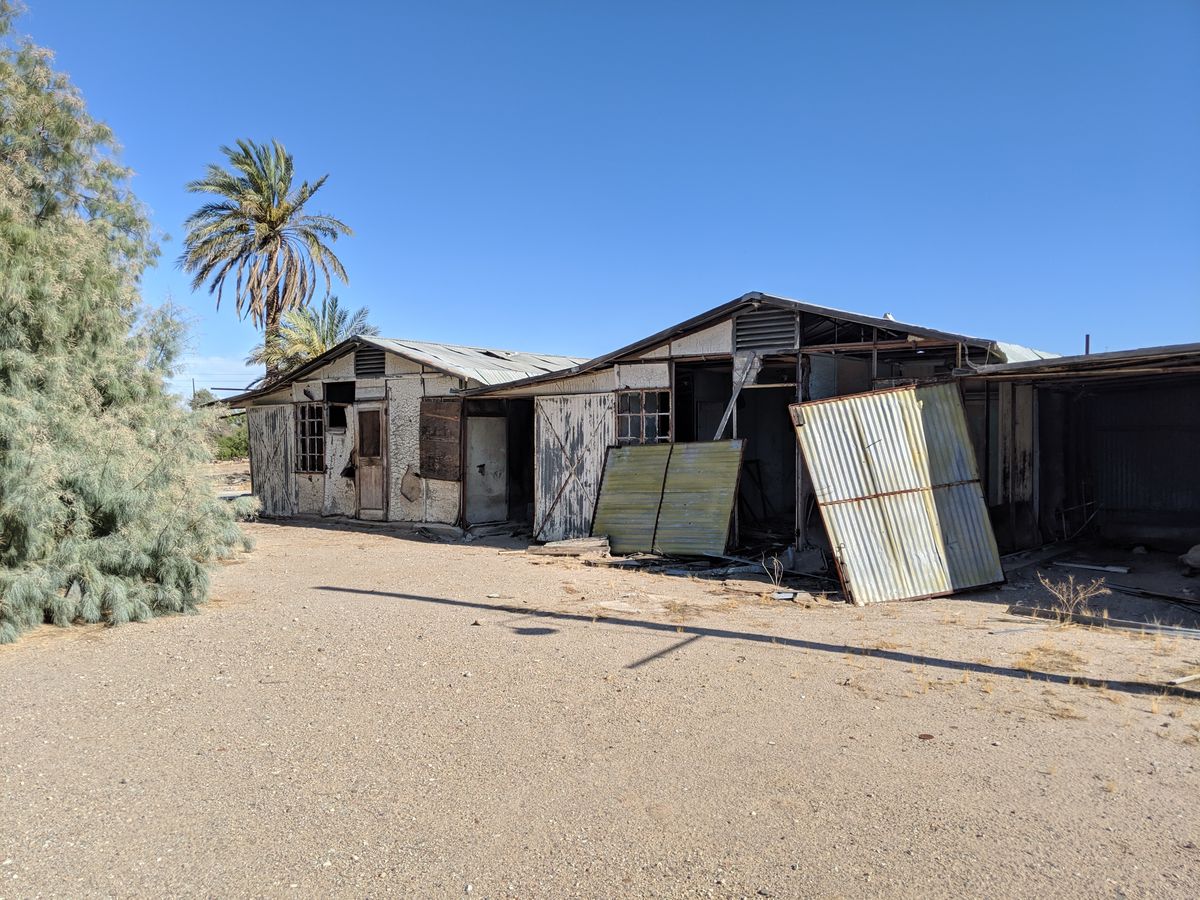
Before it became Route 66, the National Trails Highway brought many travelers through Needles, California on the road out west. To provide accommodation for these new passersby, locals William Carty and Dick Mansker built “Carty’s Camp”, a 28-cabin tourist town, in March of 1923.

According to the local newspaper, the “Needles Nugget”, Carty's Camp featured “cabins, shade, a store well stocked with groceries and other goods, an oil station, auto accessories, and an up-to-date lunchroom with five ton ice storage.” Carty’s Camp even makes an appearance in the classic film, The Grapes of Wrath, when the Joads pass it by on the Nevada-California border (as can be seen here).

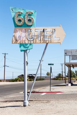
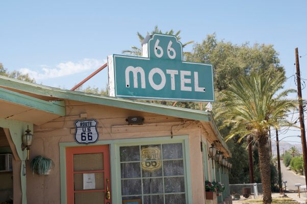
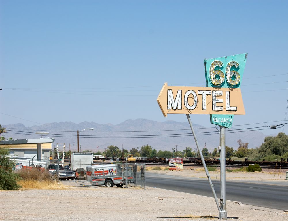
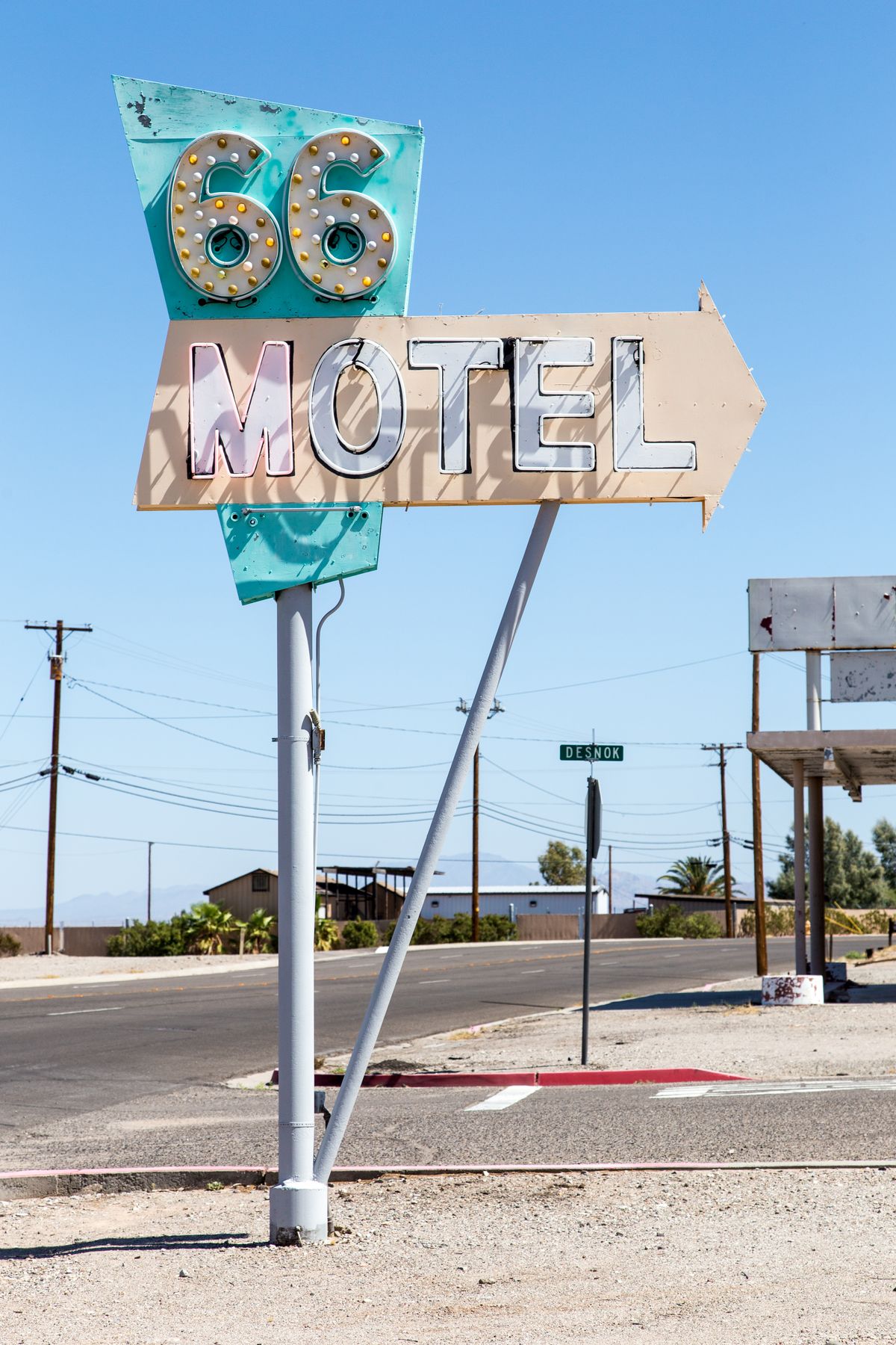
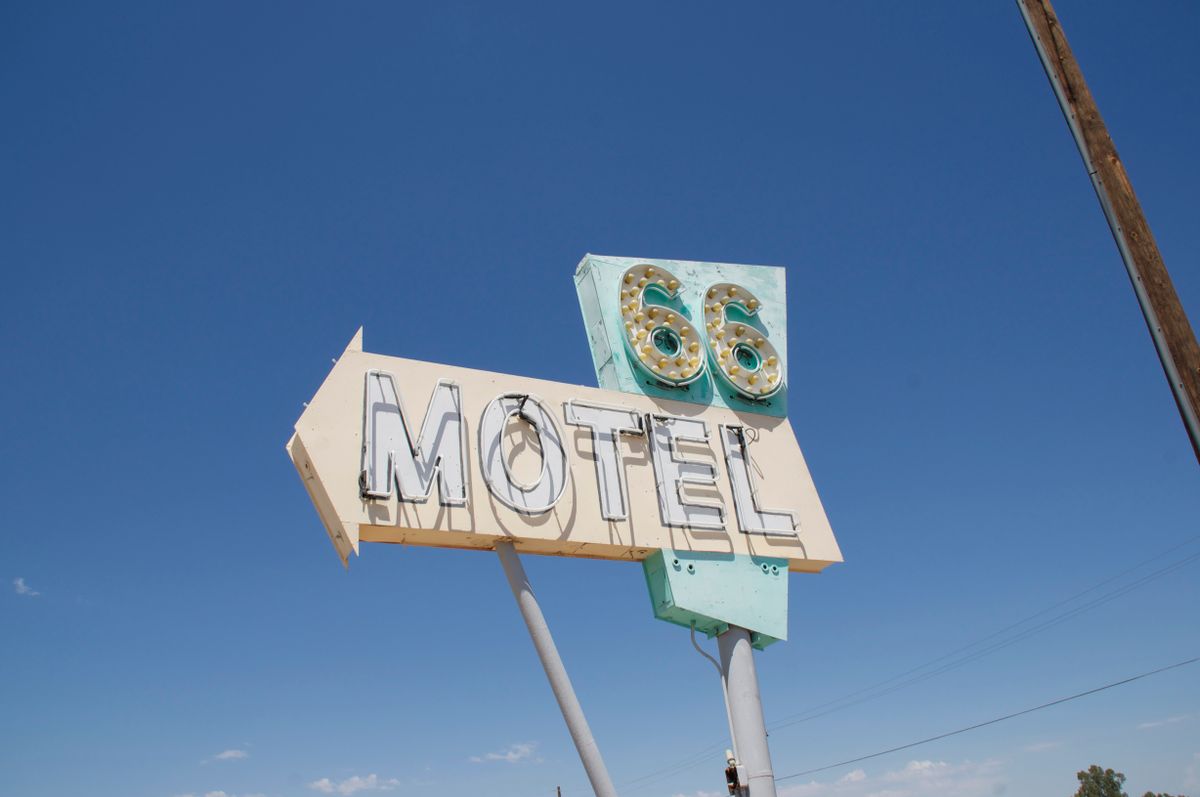
As the 1940s came around, Route 66 was used more and more. Many well-off motorists decided to stay in roadside motels as opposed to cabins built for so-called “tin-can tourists.” In 1947, the 66 Motel, complete with kitchenettes, air conditioning, and a classic neon sign was built just yards away from Carty’s Camp. As the motel’s popularity grew, that of Carty’s Camp shrunk.

From its opening in 1947, the 66 Motel’s vintage neon sign drew in a steady supply of customers—that is, until 1970, when Interstate 40 bypassed the Old Route 66 in Needles. In the words of the owner, “this motel has a lot of potential, but what it boiled down to is that Mama-and-Papa businesses in this country are dead, dead, dead.”

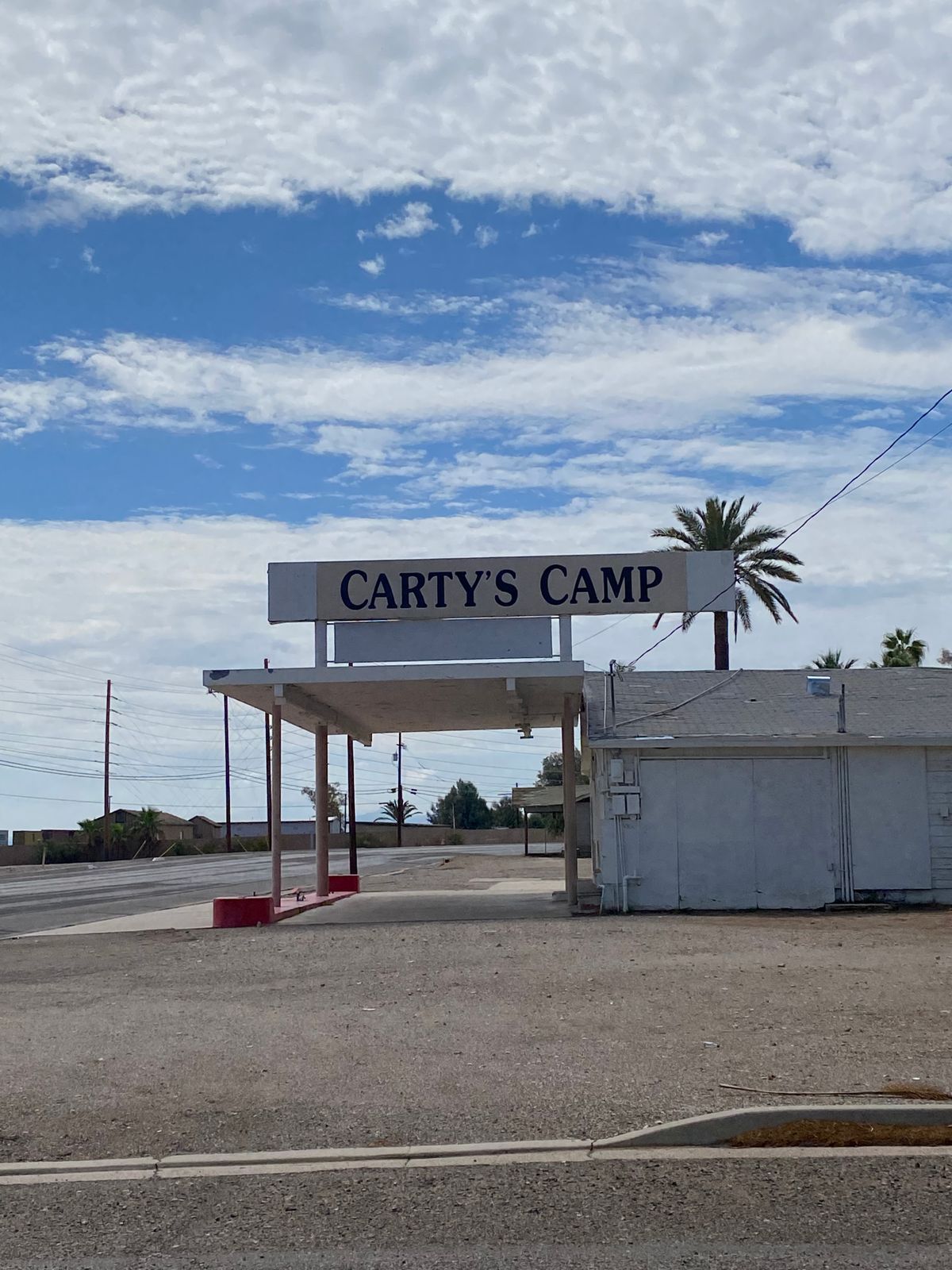
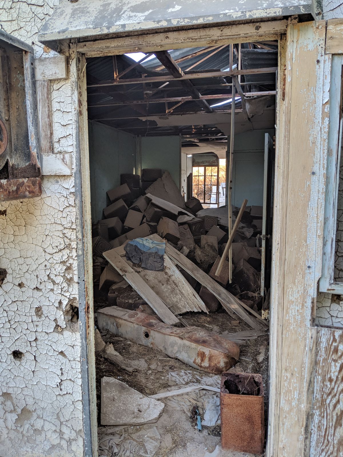
Nowadays, neither the 66 Motel nor Carty’s Camp house tourists for the night. The original six rooms inside the 66 Motel are now used for monthly rentals, and while the classic sign has been given a $2,000 repair, the original cabins and gas station of Carty’s Camp have been left to decay and rust. As drivers pass the derelict Carty’s Camp and the adjacent 66 Motel on the Old Route 66, they are reminded of the damage done by replacing the old Mother Road with a three-lane highway.

Related Tags

Hotels Route 66 Cabins Abandoned Signs Neon

Community Contributors

Added By

lewblank

Edited By

01hair, breaingram

  • 01hair
  • breaingram

Published

September 2, 2016

Edit this listing

Make an Edit
Add Photos
Sources
  • https://en.wikipedia.org/wiki/66_Motel_(Needles)
  • http://www.desertexplorers.org/2015-trips/item/349-2015-trip-report-carty-s-camp-de-visit
Carty's Camp
Desnok and East Broadway St.
Needles, California
United States
34.833197, -114.595882
Get Directions

Nearby Places

Fort Mojave Twins

Fort Mohave, Arizona

miles away

Oatman

Oatman, Arizona

miles away

Fish Bowl Spring

Golden Valley, Arizona

miles away

Explore the Destination Guide

Photo of California

California

United States

Places 1,494
Stories 135

Nearby Places

Fort Mojave Twins

Fort Mohave, Arizona

miles away

Oatman

Oatman, Arizona

miles away

Fish Bowl Spring

Golden Valley, Arizona

miles away

Explore the Destination Guide

Photo of California

California

United States

Places 1,494
Stories 135

Related Places

  • Horse Shoe Motel sign, 1953, with replica Paul the Waver.

    Casa Grande, Arizona

    Casa Grande Neon Sign Park

    This collection of vintage signs reflects the long and colorful history of this Arizona town.

  • The restored motel reopened for business in 2012.

    Carthage, Missouri

    Boots Court Motel

    This historic motel standing at the "crossroads of America" offers a radio in every room and was saved by local protesters.

  • Touch nothing at this fragile archeological site.

    Hayfield, California

    Carey's Castle

    Hidden deep in the Joshua Tree Wilderness, this 1940s miner's cabin built into a gap between two mega-sized boulders.

  • Wu Chi Kai is estimated to be one of only seven masters left in the territory still handcrafting neon signs.

    Hong Kong

    Wu Chi Kai’s Neon Light Workshop

    Only seven masters are keeping the tradition of Hong Kong's vanishing neon signs alive.

  • The Ulysses Lodge overlooks Ramla Bay in the background.

    Xagħra, Malta

    Ulysses Lodge

    Hike up to this abandoned hotel for one of the best panoramic views of the island of Gozo.

  • The Maribel Caves Hotel is located next to a park that shares its name.

    Maribel, Wisconsin

    Maribel Caves Hotel

    These rural ruins are of a Midwestern hotel that was once an elegant spa for the wealthy, then a gangster’s hideaway, and finally a haunted retreat.

  • Marsaskala, Malta

    Jerma Palace Hotel

    So opulent and massive it was once dubbed a palace, this hotel's doors closed temporarily in 2007 and failed to reopen.

  • Circus Liquor sign

    Los Angeles, California

    Circus Liquor Clown

    This iconic neon jester is a local landmark that you might recognize from his cameos in film and television.

Aerial image of Vietnam, displaying the picturesque rice terraces, characterized by their layered, verdant fields.
Atlas Obscura Membership

Become an Atlas Obscura Member


Join our community of curious explorers.

Become a Member

Get Our Email Newsletter

Follow Us

Facebook YouTube TikTok Instagram Pinterest RSS Feed

Get the app

Download the App
Download on the Apple App Store Get it on Google Play
  • All Places
  • Latest Places
  • Most Popular
  • Places to Eat
  • Random
  • Nearby
  • Add a Place
  • Stories
  • Food & Drink
  • Itineraries
  • Lists
  • Video
  • Podcast
  • Newsletters
  • All Trips
  • Family Trip
  • Food & Drink
  • History & Culture
  • Wildlife & Nature
  • FAQ
  • Membership
  • Feedback & Ideas
  • Community Guidelines
  • Product Blog
  • Unique Gifts
  • Work With Us
  • About
  • FAQ
  • Advertise With Us
  • Advertising Guidelines
  • Privacy Policy
  • Cookie Policy
  • Terms of Use
Atlas Obscura

© 2025 Atlas Obscura. All Rights Reserved.