


About
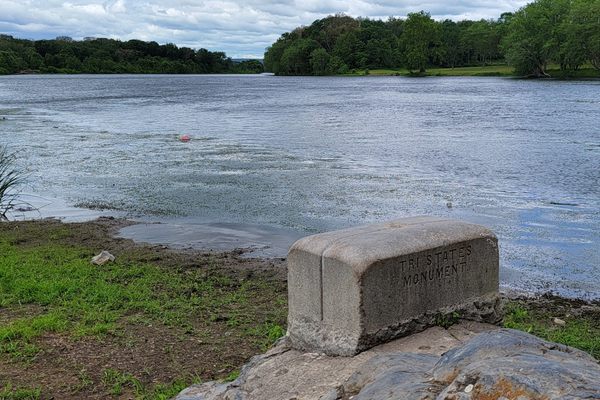
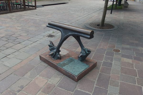
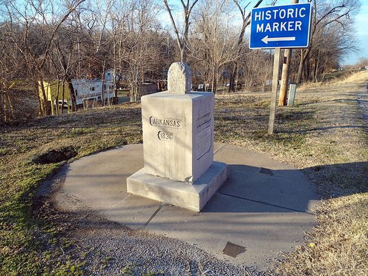
There are more than 60 places in the United States where the borderlines of three states converge. The one on Missouri Route 43, where Arkansas and Missouri meet Oklahoma, is marked with three stone monuments stacked on top of each other.
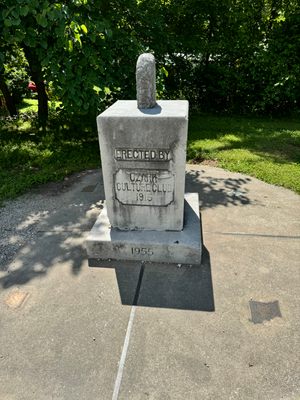
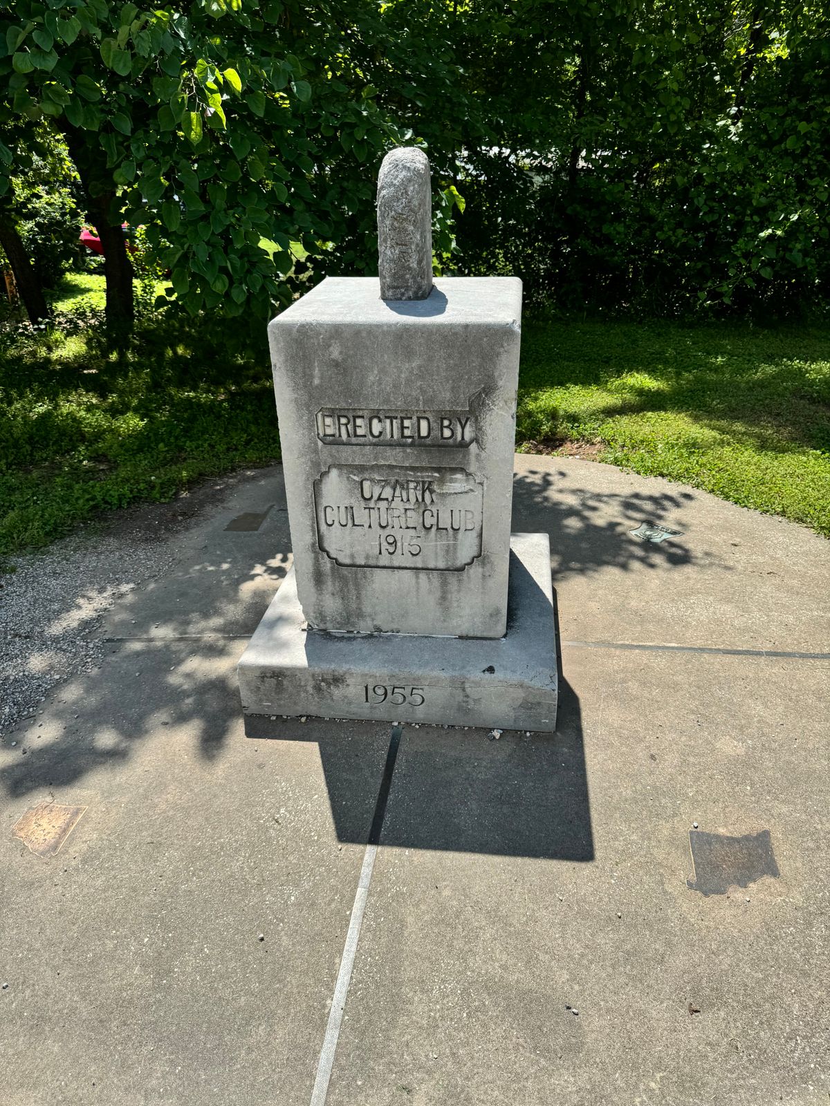
The first marker is the 10-foot cement circle on the bottom, which has bronze lines indicating where the state boundaries are. It was put there in the 1960s by the Lions Club. The other two are stacked right at the point where the lines cross.
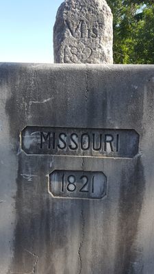
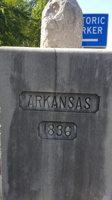
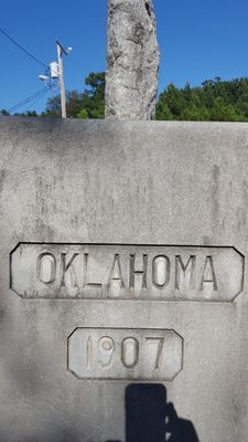
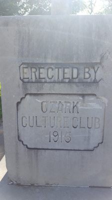
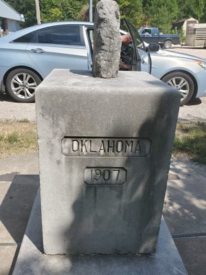
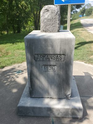
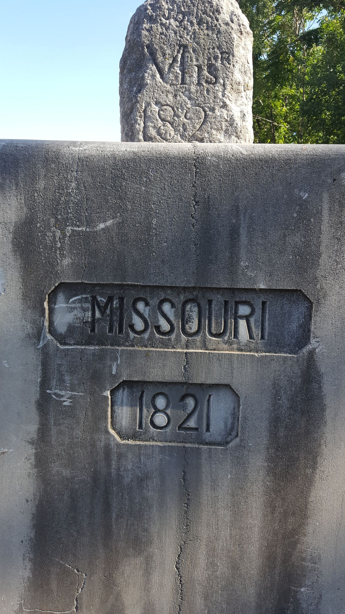
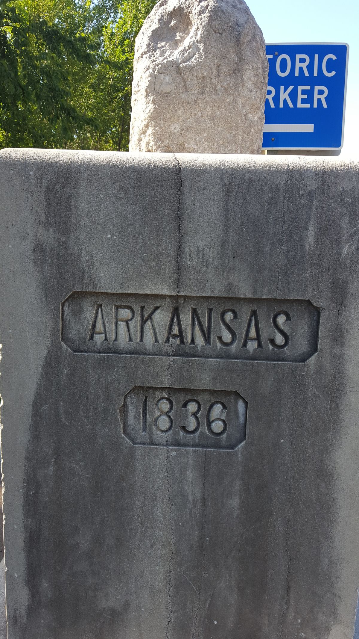
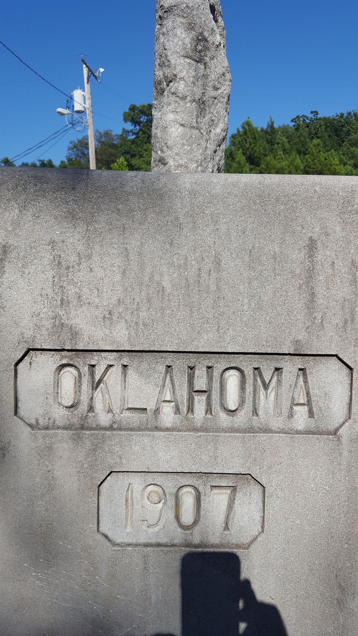
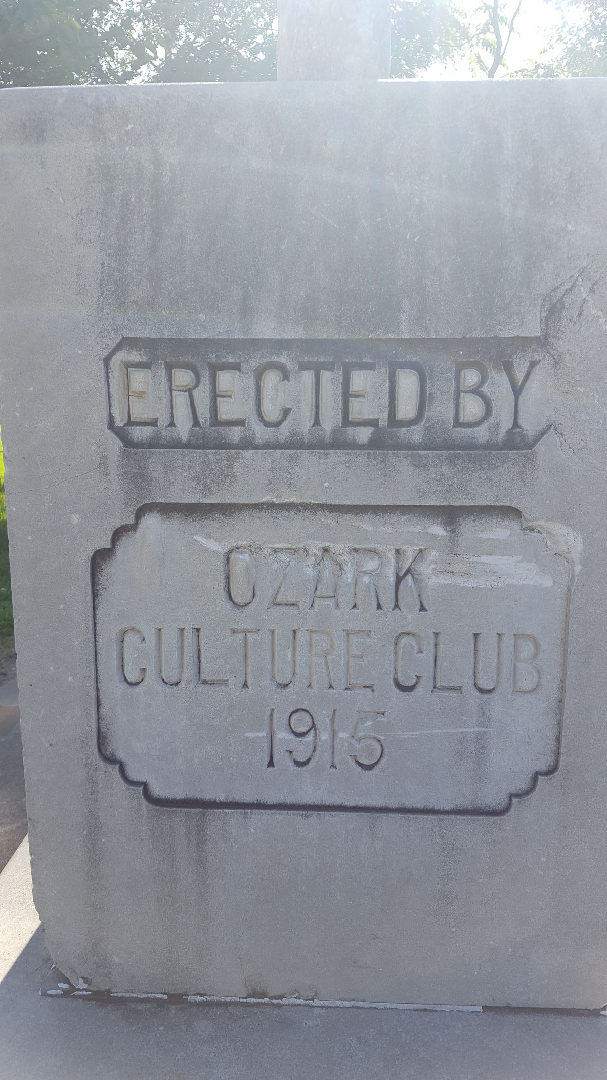
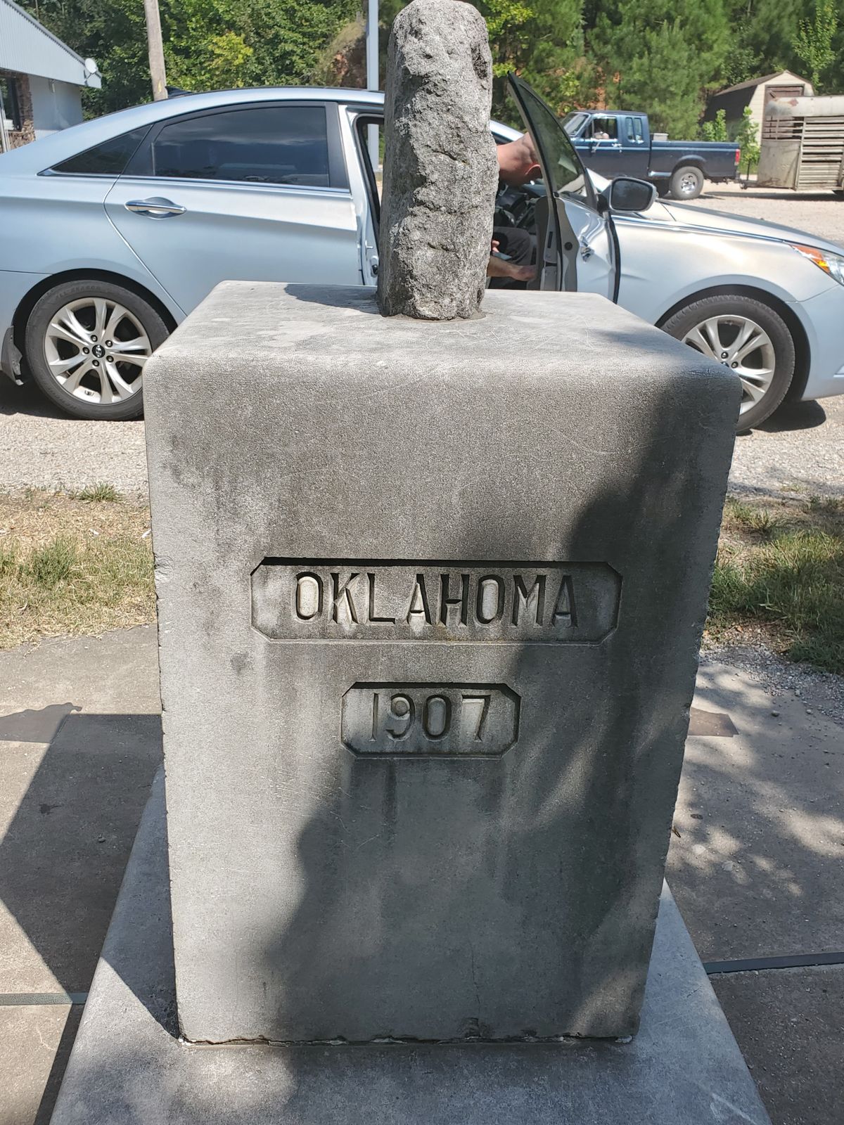
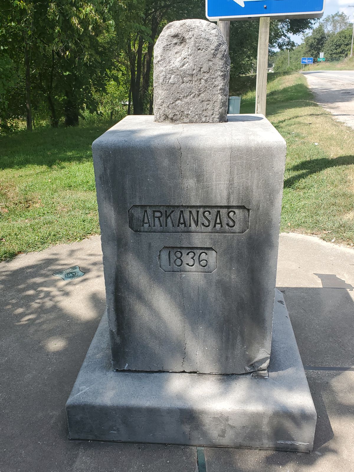
In 1915, the Ozark Culture Club installed the marble pedestal, the middle marker, with the name of each state and its date of admittance to the United States inscribed on the appropriate side. The fourth side, straddling Arkansas and Missouri, has the club’s name.
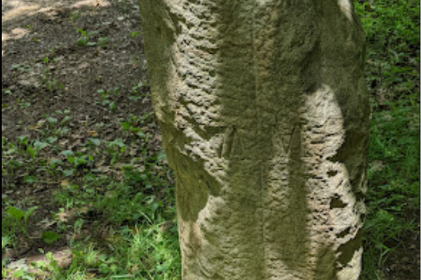
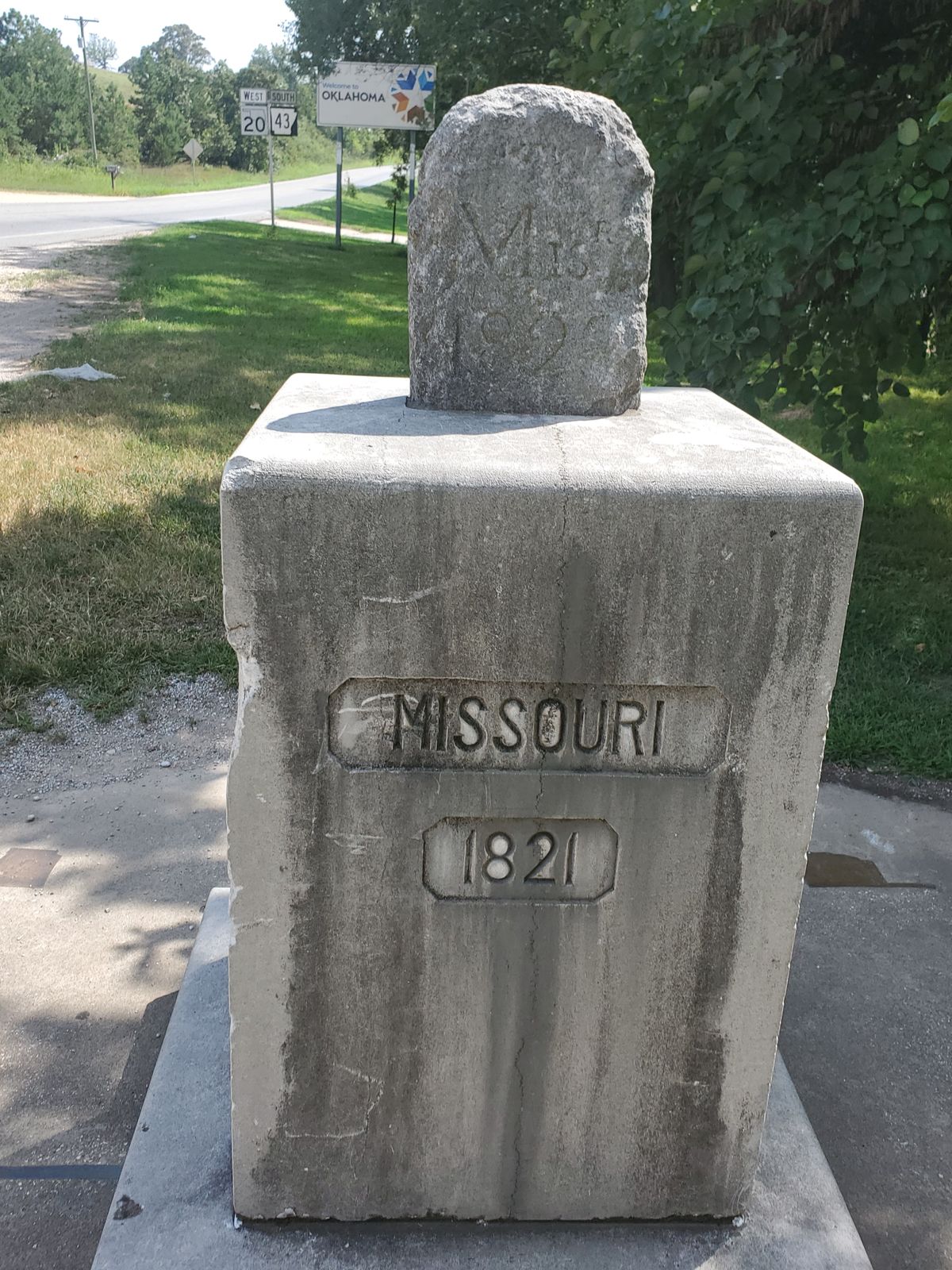
The headstone-like marker on the top is from 1821, the year Missouri became a state. Arkansas was still a U.S. territory, and Oklahoma was still Native American territory. It is marked “Mis. 1821” and “Ark.” on the north and south sides, respectively.
The top stone is supposedly related to the 1820 Missouri Compromise, which allowed Missouri to enter the Union as a slave state, under the stipulation that no state north of the boundary of Missouri’s southern border extended west, where the stone was placed, would be allowed to own slaves.
Related Tags
Community Contributors
Added By
Edited By
Published
September 5, 2017
Sources
- https://www.washingtonpost.com/graphics/lifestyle/trifinia/
- http://www.waymarking.com/waymarks/WMGXQP_Oklahoma_Missouri_Arkansas_Tripoint
- https://books.google.com/books?id=xcxWsmxRzVEC&pg=PA194&lpg=PA194&dq=ozark+culture+club&source=bl&ots=BbmuDEjZlx&sig=SJXSVyg48Nt1F213-O3D6xkmACI&hl=en&sa=X&ei=MWh0UYyzGYLm2QWYxoHIDw&ved=0CEEQ6AEwAg#v=onepage&q=ozark%20culture%20club&f=false
- http://clui.org/ludb/site/ar-mo-ok-tripoint
- https://en.wikipedia.org/wiki/OKARMO_Corner
- http://www.history.com/topics/missouri-compromise