Scientists Tracked Truly Enormous Tuna From Way Up in the Air
Drones helped researchers keep up with fish that are longer than a person and as fast as a car.
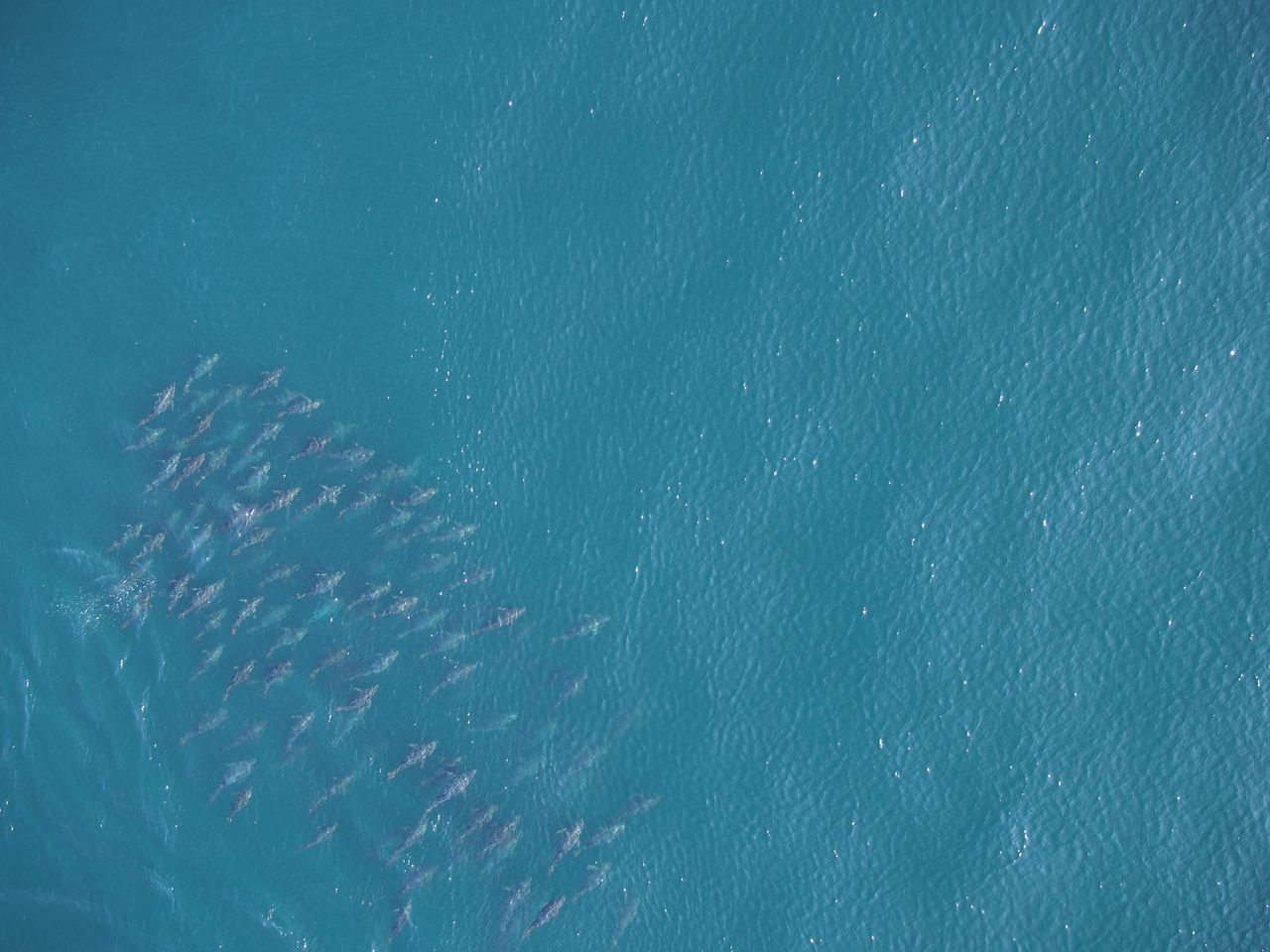

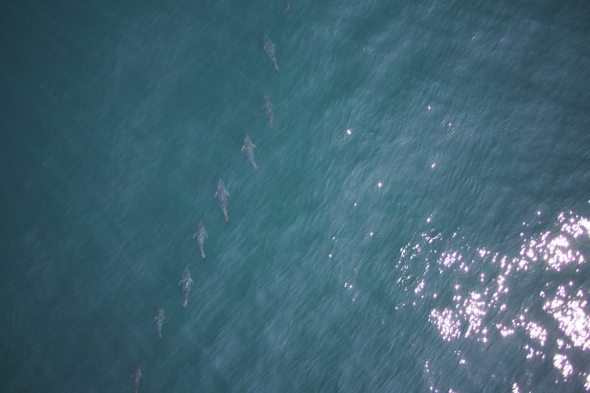
The Atlantic bluefin tuna hunts like a wolf and is built like a barrel. “They’re power-packed animals,” says Mike Jech, a fishery biologist with the National Oceanic and Atmospheric Administration’s Northeast Fisheries Science Center in Woods Hole, Massachusetts. Often stretching more than six feet long and topping 500 pounds, hefty Thunnus thynnus travel in packs, zooming in and out of various types of formations, from long lines to dense clusters. Typically, the titanic tuna swim at the pace of a moderate walk, around three miles an hour, but when they need to really book it, they can swim 30 miles an hour or more—as fast as a car. Torpedo-shaped, with big fins, the fish are essentially all muscle, and their speed and brawn make them hard to capture and survey with nets. Even if you could keep up with them, “you can’t put your arms around them,” Jech says. So, instead, he and five collaborators tried a different approach: tracking tuna from the sky, with the help of a drone.
Scientists have several reasons to be curious about what the tuna are up to. From a population management perspective, they want to get a better handle on the number in the wild, particularly since the stocks dwindled from historic overfishing. By looking at the shapes and sizes of different fish in the population and estimating their mass, researchers can gauge population health. Surveying different formations can also yield fresh insight into tuna behavior, Jech says: For example, some researchers speculative that the fish stretch out into a straight line while hunting, to maximize the distance they cover, and then slide into other formations when they’re cruising.
Jech and his collaborators flew an APH-22 drone above schools of juvenile tuna in the Gulf of Maine, northeast of Cape Cod. They launched the drone from a small boat and guided it with input from a “spotter pilot,” who was in an airplane above, looking out for schools of tuna and weighing in on where to send the machine. Over the course of eight flights spanning two days in 2015, they collected nearly 1,100 images of Atlantic bluefin tuna. The researchers have just published their findings in the Journal of Unmanned Vehicle Systems.
Before setting their sights on the fish, the team calibrated the drone’s measuring tools by flying them over objects of known sizes, such as a “resolution chart” that looks a bit like a geometric poster you’d see during an eye exam. Because the scientists knew the exact altitude of the drone and the angle of the camera on board (and it stayed steady, unlike one held by even the most careful of humans), they were able to remotely measure the length and width of the fish, as well as how closely they huddled together.
Scientists are increasingly relying on drones for aerial surveys, and they can be mightily helpful. Jarrod Hodgson, an ecologist at the University of Adelaide who has used drones for population surveys, has remarked that drones allow researchers to keep an eye on animals that would otherwise be hard to access, or that might be negatively impacted by scientists getting too close. But as Jech and his coauthors describe in their new paper, the drone technology has its limitations. For one thing, the drones only had about 15 minutes of battery life. “Those 15 minutes go by really, really fast when you’re getting over these fast-moving animals,” Jech says.
What’s more, the strategy only works when the fish and the weather happen to cooperate. The images are best when the fish are fairly close to the surface (researchers haven’t yet pinned down exactly how deep the fish could go while still being measurable). And the surveys are most effective on calm days, with fairly placid water rather than whitecaps, Jech says. “Imagine taking black tape and blotting out the tail or nose or head,” he says. That’s essentially what happened when the waves were choppy. Even when conditions were just so, it proved hard to fit an entire school in a single image. A wide-angle lens would have distorted the edges and monkeyed with the measurements.
While drones won’t fully displace surveys from boats or planes, Jech’s team found that they’re another useful tool in the seafaring toolbox. When it comes to tagging along with Atlantic bluefin tuna, drones can help us keep up.


Follow us on Twitter to get the latest on the world's hidden wonders.
Like us on Facebook to get the latest on the world's hidden wonders.
Follow us on Twitter Like us on Facebook