Trips Places Foods Stories Newsletters
Loading...
Loading...
Loading...
Loading...

No search results found for
“”

Make sure words are spelled correctly.

Try searching for a travel destination.

Places near me Random place

Popular Destinations

  • Paris
  • London
  • New York
  • Berlin
  • Rome
  • Los Angeles
Trips Places Foods Stories Newsletters
Sign In Join
Places near me Random place
All the United Kingdom England Ripponden Windy Hill
AO Edited

Windy Hill

The longest cutting on the M62 contains some surprises—though it's best to leave the motorway to appreciate them.

Ripponden, England

Added By
Jooniur Erik
Email
Been Here
Want to go
Added to list
CAPTION
Windy Hill transmitter   jooniur / Atlas Obscura User
Windy Hill border signs   David Dixon/CC BY-SA 2.0
Pennine Way footbridge   Jooniur/CC BY-SA 4.0
Red rose marker on M62   Jooniur/CC BY-SA 4.0
Been Here
Want to go
Added to list

About

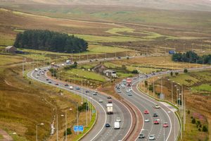
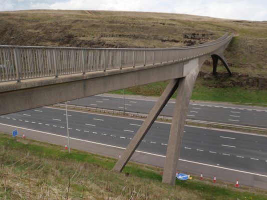
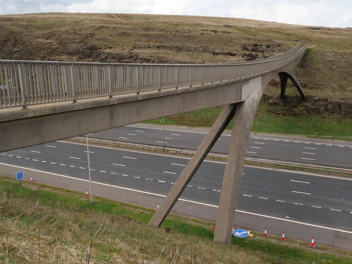
The most obvious of the features of the long Windy Hill cutting on the M62 is the elegant and narrow parabolic arched bridge that sweeps overhead. In a display of pedestrian power, it's there to carry the remote and rugged Pennine Way across the motorway.

The bridge itself is designed to cope with wind speeds up to 120 mph (it's called Windy Hill for a reason), although you'd hope that the hikers had retired to the pub long before it got to that point.

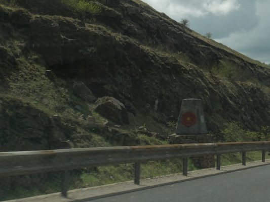
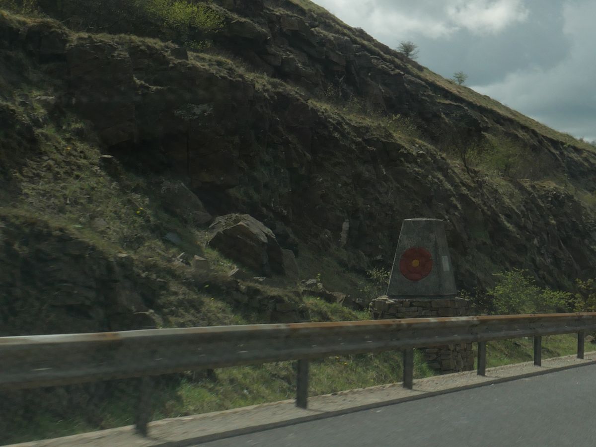
Between the 300 and 200 yard markers for J22 eastbound, there's an unusual cairn on the other side of the barrier, marked with a white rose and a plaque. A matching one on the opposite carriageway has a red rose. These stones mark the boundary between Greater Manchester and West Yorkshire. They date from the Queen's visit in 1971 to cut a ribbon to officially open the Pennine stretch of the motorway. The text reads: "This plaque marks the boundary between the counties of Lancaster and York and was unveiled by THE QUEEN on the occasion of Her Majesty's visit to the Lancashire Yorkshire motorway M62 on the 14th October 1971."

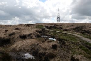
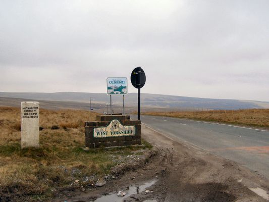
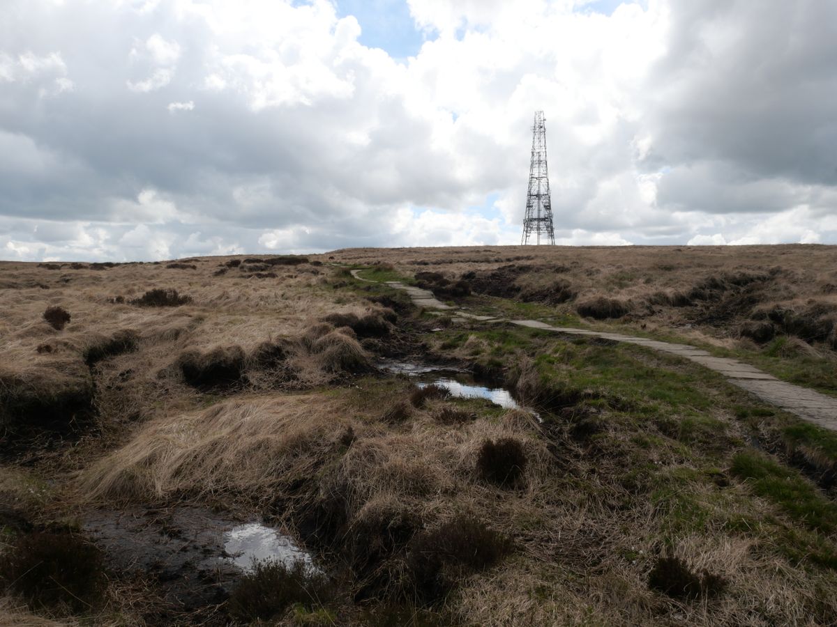
At the lay-by on the A672 next to the Windy Hill transmitter, there's a random assortment of municipal boundary signs from different eras. From there you can walk along a section of the Pennine Way and cross the footbridge, where the marker stones are visible in the distance.

Further east on the M62 is Stott Hall Farm, the famous house in the middle of the motorway.

Related Tags

Highways Hiking Roads Roadside Attractions

Know Before You Go

Stopping to look at the cairns would be illegal and dangerous. The best way of inspecting them is via Google Street View.

To get to the footbridge, take the A672 towards Oldham. The lay-by is just past the transmitter. Pick up the Pennine Way on the same side of the road and follow it to the footbridge. The red marker stone is visible in the distance on the lefthand side

Community Contributors

Added By

jooniur

Published

June 29, 2021

Edit this listing

Make an Edit
Add Photos
Windy Hill
Pennine Way
Ripponden, England, OL3 5UN
United Kingdom
53.629376, -2.026433
Get Directions

Nearby Places

Stott Hall Farm

Ripponden, England

miles away

Rochdale Pioneers Museum

Rochdale, England

miles away

Stoodley Pike Monument

Todmorden, England

miles away

Explore the Destination Guide

Photo of Ripponden

Ripponden

England

Places 2

Nearby Places

Stott Hall Farm

Ripponden, England

miles away

Rochdale Pioneers Museum

Rochdale, England

miles away

Stoodley Pike Monument

Todmorden, England

miles away

Explore the Destination Guide

Photo of Ripponden

Ripponden

England

Places 2

Related Places

  • Musical Road Ahead

    Palmdale, California

    R. Lee Ermey Musical Road

    The road plays 30 seconds of the Marine’s Hymn when driving over the grooved pavement.

  • National Route 66 Museum

    Elk City, Oklahoma

    National Route 66 Museum

    An Oklahoma museum that celebrates the history of the "Mother Road."

  • Milepost 1523 is near the Cushman Street Bridge.

    Fairbanks, Alaska

    Alaska Highway's Milepost 1523

    This mile marker stands at the unofficial end of a highway built to defend the United States from a Japanese invasion during World War II.

  • Indianapolis, Indiana

    The Idle

    A park where you can watch the highway zoom past.

  • Highway 412

    Guymon, Oklahoma

    U.S. Route 412

    Is this 47.7-mile stretch of highway the longest straight road in the United States?

  • Purano Jhangajholi, Nepal

    Mulkot Mirror Wall

    This twisty section of highway in the Himalayan foothills is lined with thousands of small mirrors.

  • Avenue of the Giants

    Humboldt County, California

    Avenue of the Giants

    One of the most scenic stretches of road in America winds between some of the country's oldest trees.

  • Petrópolis, Brazil

    Belvedere do Grinfo

    This spaceship-like structure was once a popular roadside restaurant.

Aerial image of Vietnam, displaying the picturesque rice terraces, characterized by their layered, verdant fields.
Atlas Obscura Membership

Become an Atlas Obscura Member


Join our community of curious explorers.

Become a Member

Get Our Email Newsletter

Follow Us

Facebook YouTube TikTok Instagram Pinterest RSS Feed

Get the app

Download the App
Download on the Apple App Store Get it on Google Play
  • All Places
  • Latest Places
  • Most Popular
  • Places to Eat
  • Random
  • Nearby
  • Add a Place
  • Stories
  • Food & Drink
  • Itineraries
  • Lists
  • Video
  • Podcast
  • Newsletters
  • All Trips
  • Family Trip
  • Food & Drink
  • History & Culture
  • Wildlife & Nature
  • FAQ
  • Membership
  • Feedback & Ideas
  • Community Guidelines
  • Product Blog
  • Unique Gifts
  • Work With Us
  • About
  • FAQ
  • Advertise With Us
  • Advertising Guidelines
  • Privacy Policy
  • Cookie Policy
  • Terms of Use
Atlas Obscura

© 2025 Atlas Obscura. All Rights Reserved.