


About
Tucked into the pastoral fields of Rosemount, Minnesota there is a sprawling network of abandoned World War II-era structures. Known as UMore Park, this former munitions plant sits eerily empty and seemingly forgotten.
In 1943 the US government took control over 12,000 acres of farmland, about twenty miles south of Minneapolis, to build a munitions plant to produce smokeless gun powder and other artillery by-products. The plant was given the folksy, paradoxical name of Gopher Ordnance Works, but by the time it was up and running in January of 1945, the end of the War was only seven months away. That quickly curtailed the need for large quantities of gunpowder, and the plant soon sat idle. Two years later the land was deeded to the University of Minnesota, and since then it has been used mostly for academic research and agricultural projects (the acronym UMore stands for University of Minnesota Outreach, Research, and Education).
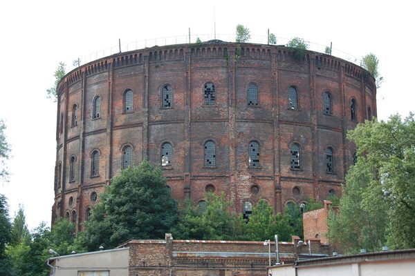
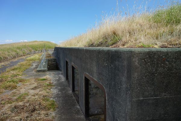
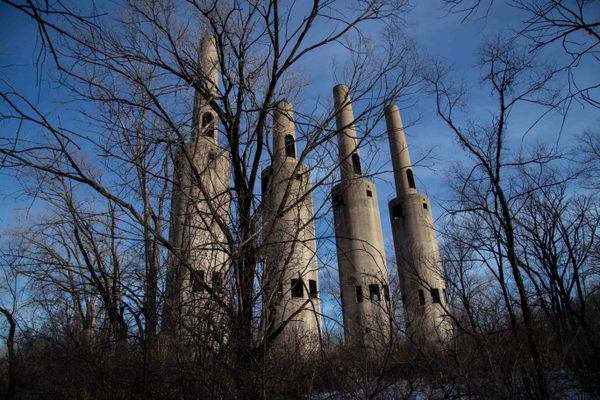
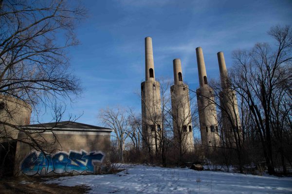
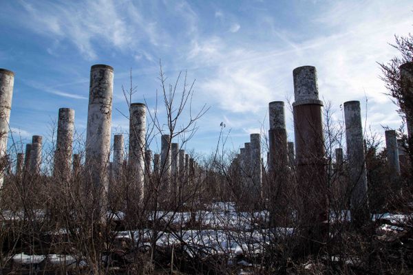
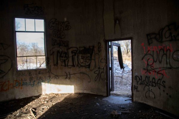
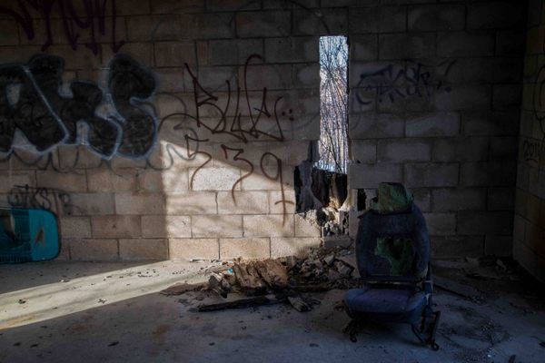
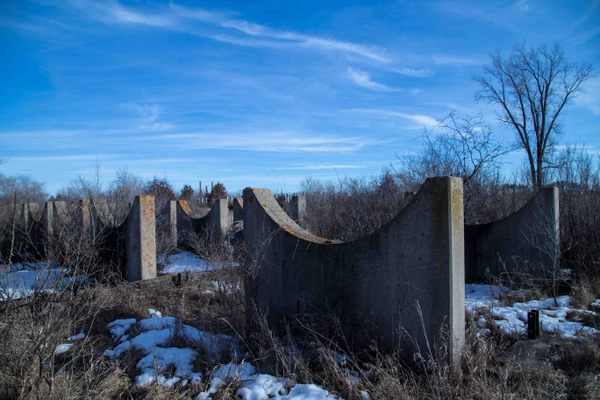
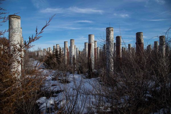
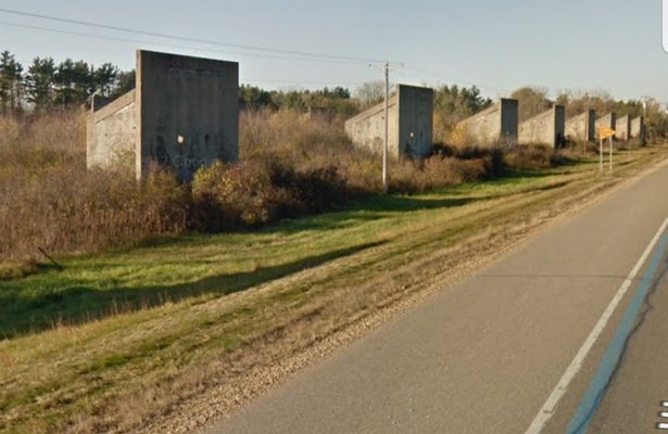
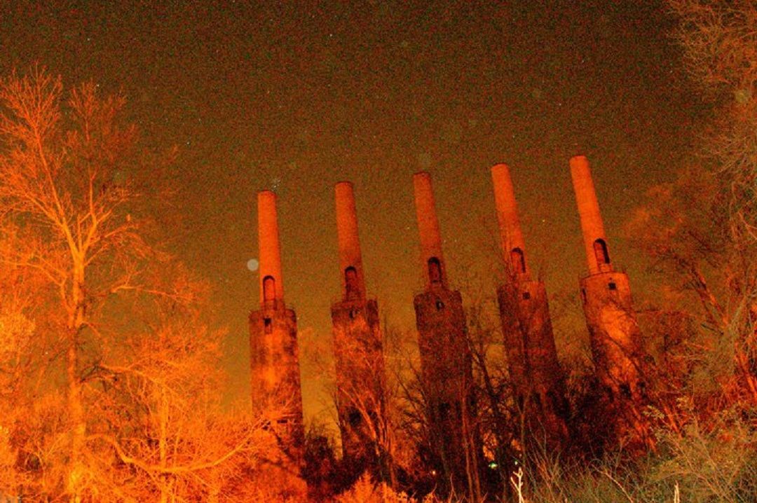
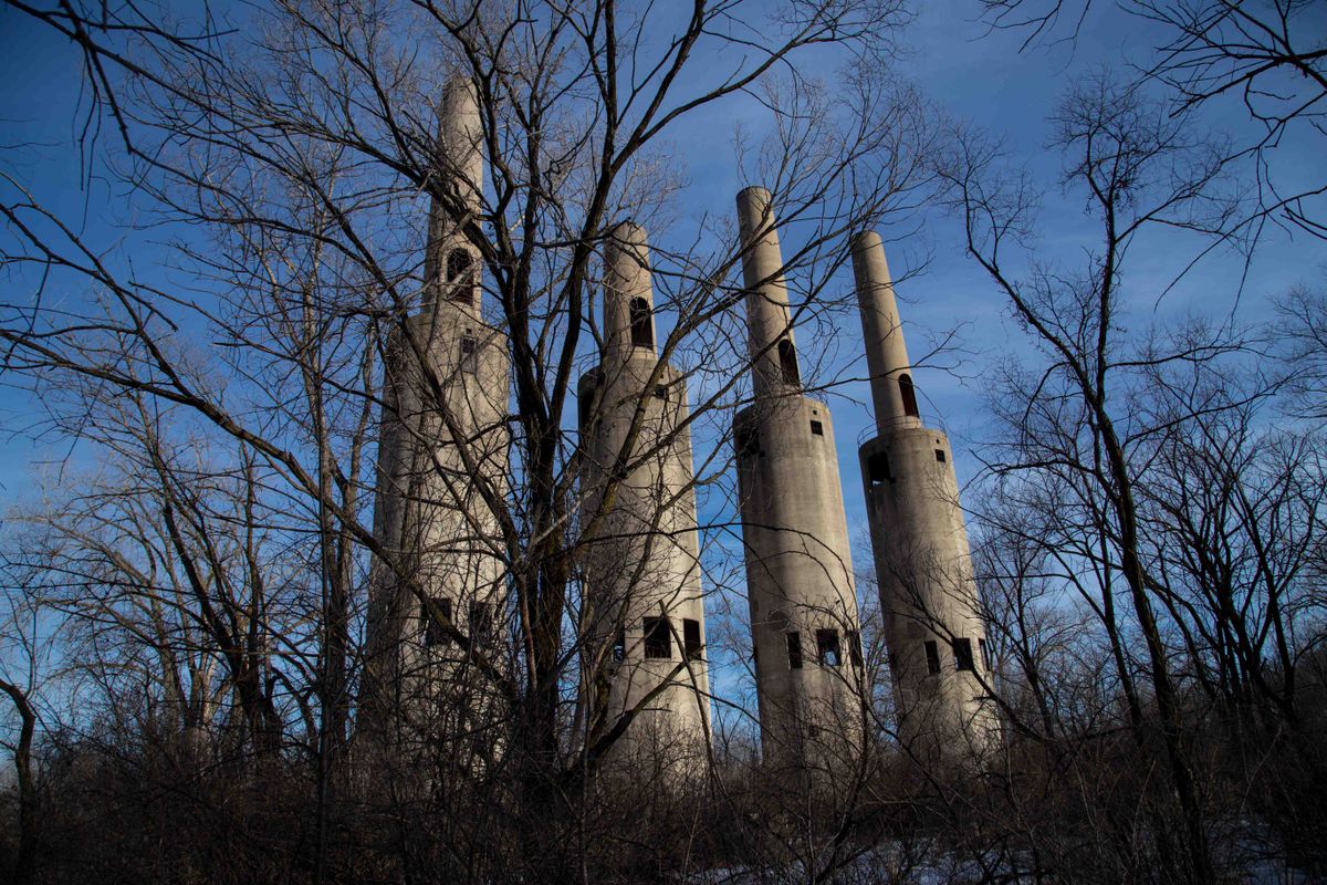
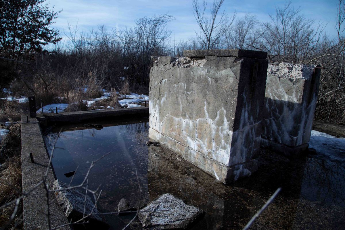
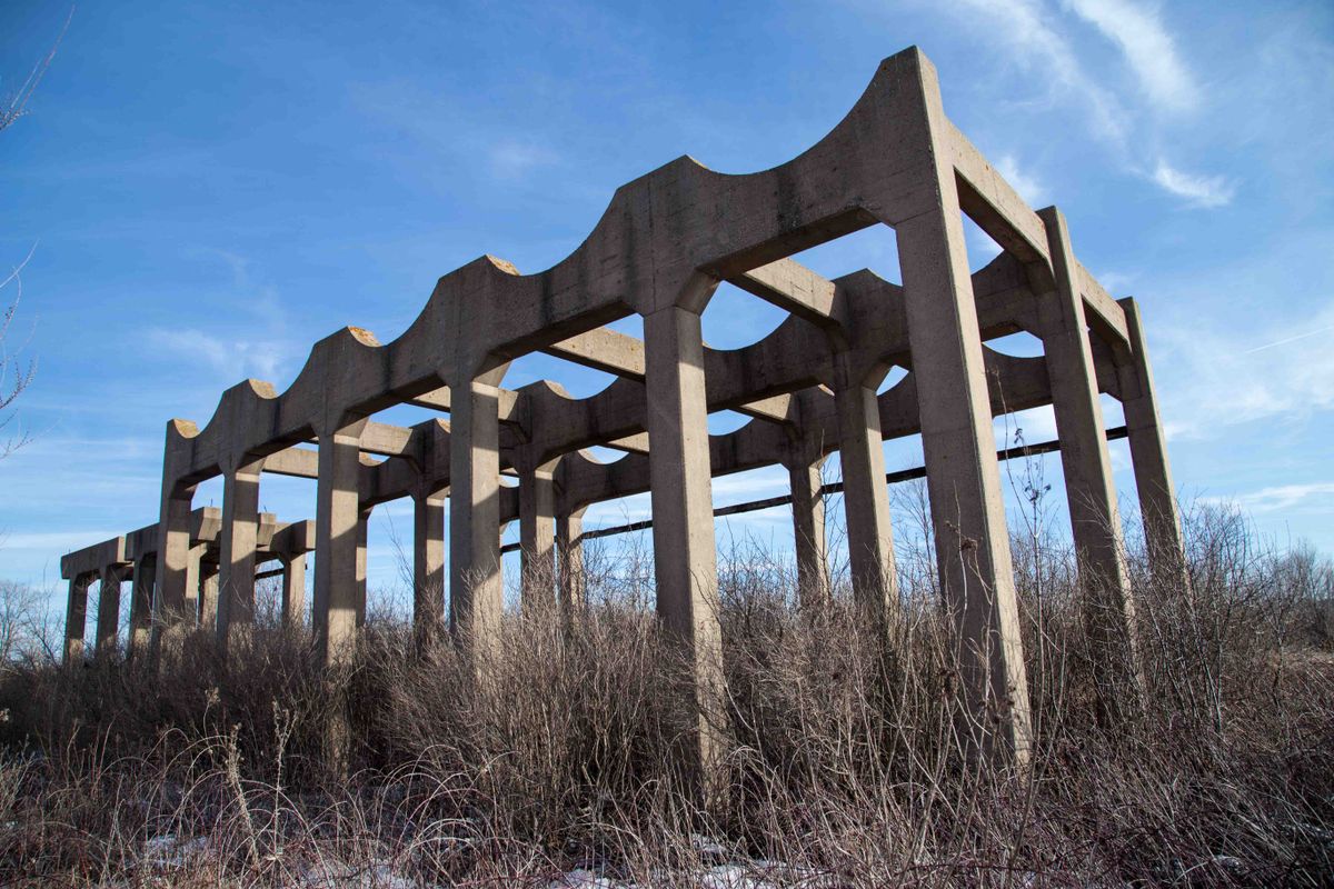
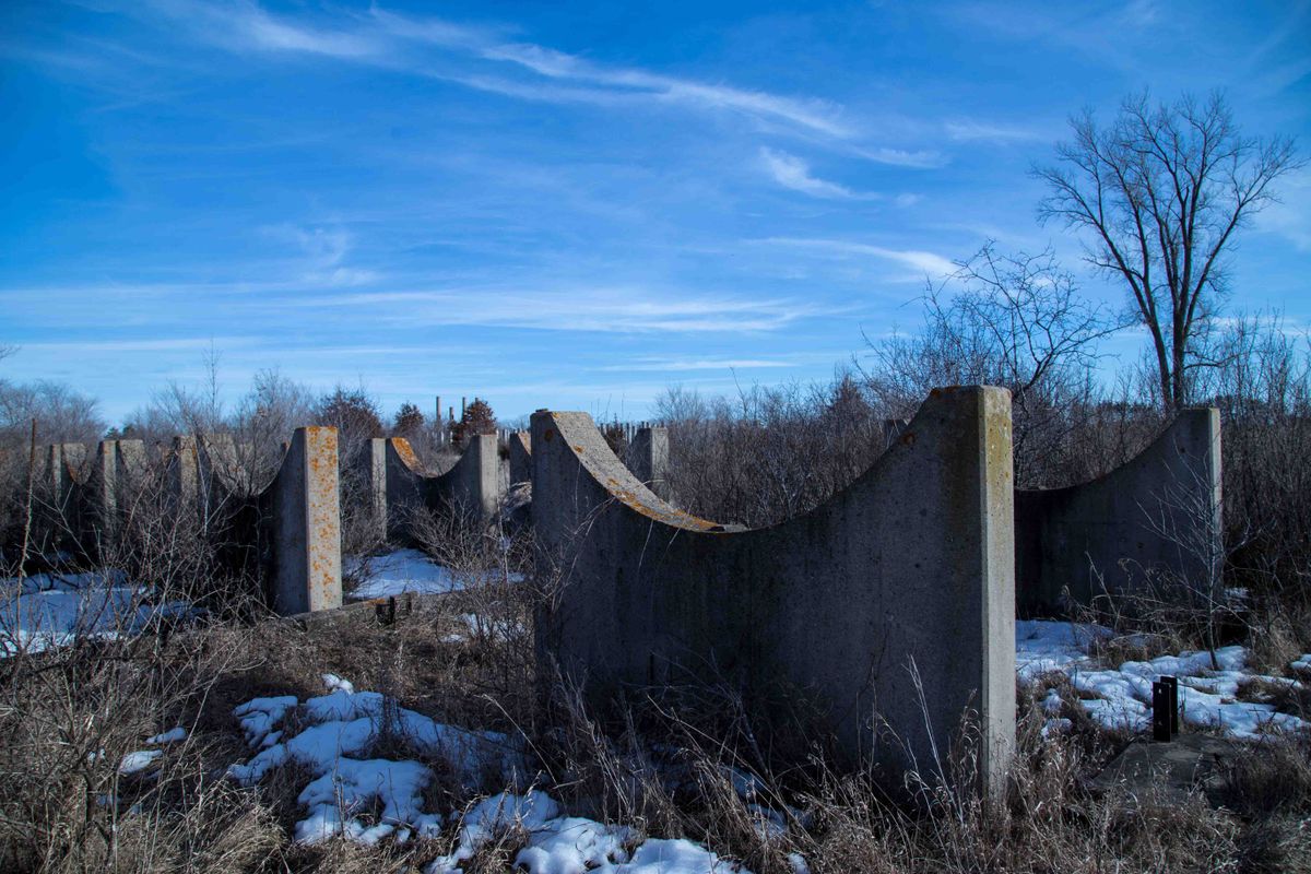
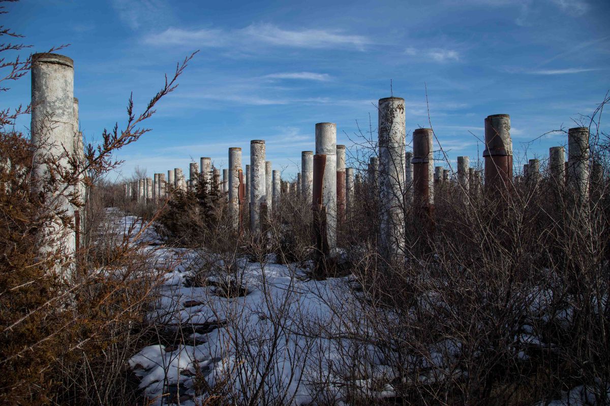
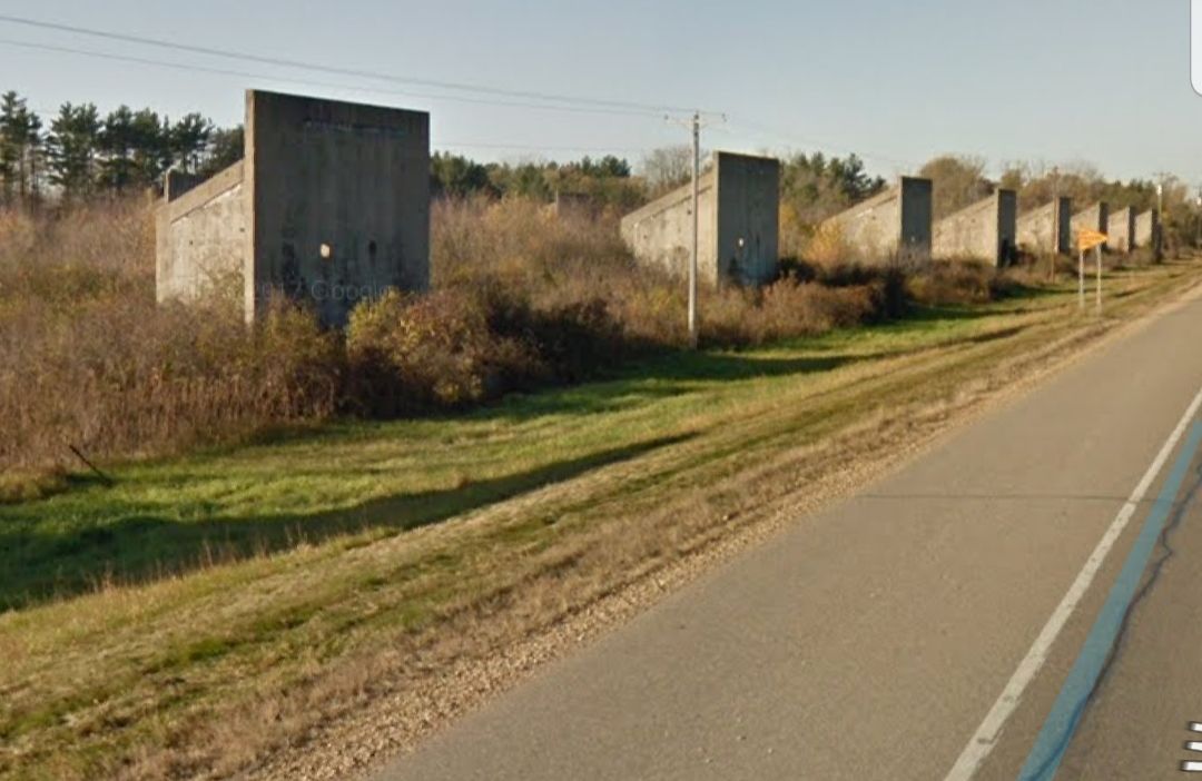
Portions have been opened to the public as parkland and trails, but the buildings and support structures of the old Gopher Ordnance Works, officially off-limits to the public, have been left alone and empty. You can still see the rows and rows of cement columns wrapped in ceramic, large concave supports, dismantled storage tanks, and in the distance, four ominous venting towers shaped like gun barrels, dominating the view. T-wall structures, or blast walls, were the support structures in the buildings for solvent recovery, part of the gunpowder-making process.
It’s a tough site to figure out what to do with. Both the University and the Army Corps of Engineers have done development and environmental assessments, but the results have been mixed. Some of the land has been given the go-ahead for development, some not. Either way, nothing much has happened, and the war factory still casts its long shadow.
Update 2016: The smokestacks and many of the buildings have been torn down, however the "T-walls" along Highway 46 remain.
Related Tags
Know Before You Go
From I-494 take exit for US-52 South towards Rosemount and exit west on County Rd 42. Head south on Akron Ave just past Dakota County Technical College. The remaining structures are best seen from Angus Ave and US Route 52 (160 St. E). Be forewarned there is a no trespassing sign on the trail leading to the structures, and citations are issued to those who ignore the sign.
Published
April 27, 2016