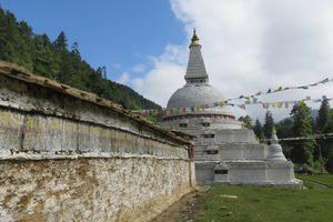
Trips Places Foods Stories Newsletters
Loading...
Loading...
Loading...
Loading...

No search results found for
“”

Make sure words are spelled correctly.

Try searching for a travel destination.

Places near me Random place

Popular Destinations

  • Paris
  • London
  • New York
  • Berlin
  • Rome
  • Los Angeles
Trips Places Foods Stories Newsletters
Sign In Join
Places near me Random place
All Bhutan Trongsa Trongsa Dzong

Trongsa Dzong

The largest and, arguably, most scenic fortress in Bhutan.

Trongsa, Bhutan

Added By
Max Cortesi
Email
Been Here
Want to go
Added to list
CAPTION
View of Trongsa Dzong from Trongsa village   Max Cortesi / Atlas Obscura User
View of Trongsa Dzong from across the valley   Max Cortesi / Atlas Obscura User
View of the valley from Trongsa Dzong   Max Cortesi / Atlas Obscura User
Been Here
Want to go
Added to list

About

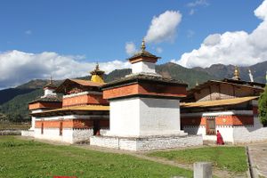
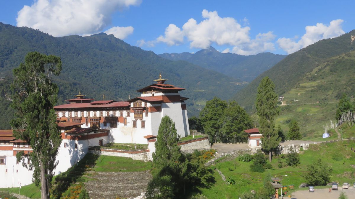
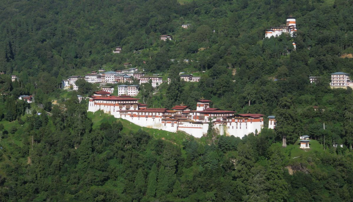
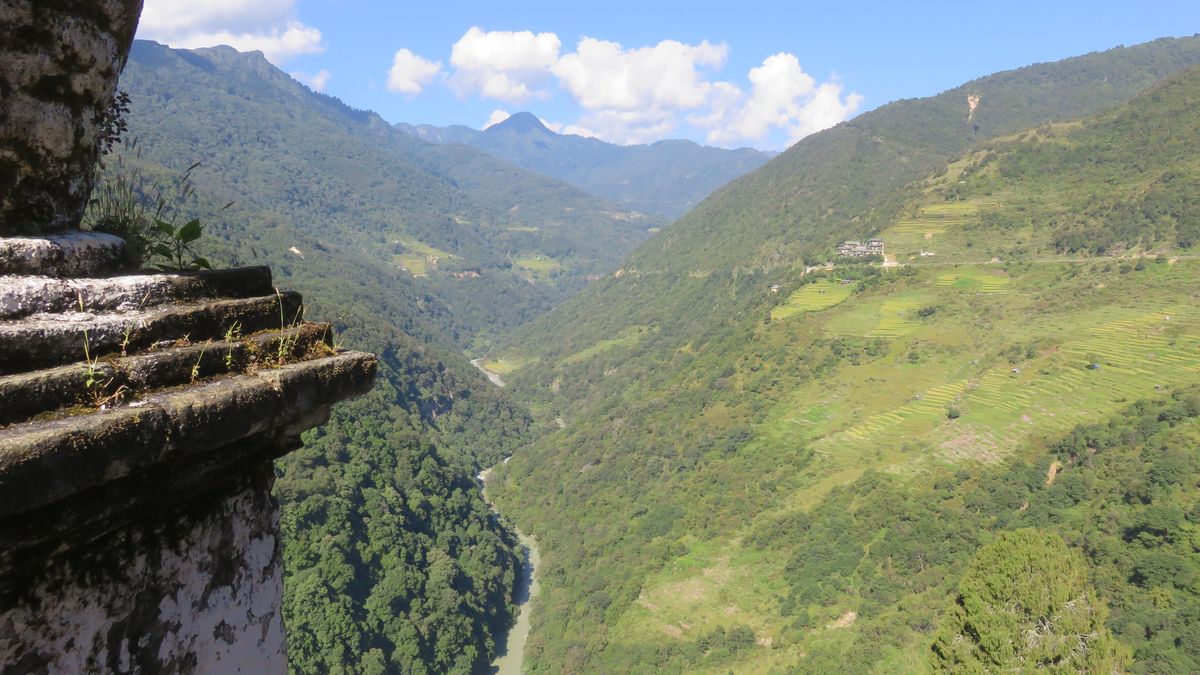
Trongsa Dzong was first built in 1647, and it was from this dzong (fortress) that the first two Bhutanese kings ruled the country. The structure is strategically located on a steep slope commanding an extraordinary view of the Mangde River, approximately in the middle of the Kingdom of Bhutan.

Narrow stone stairs, alleys, and corridors connect the buildings at all levels of the fortress, creating a veritable labyrinth on the slope. 

Within the walls of the dzong are 25 temples dedicated to Tantric deities, a watchtower (Ta Dzong) dating back to 1652, a printing shop producing religious texts following an ancient tradition, and a museum honoring the Wangchuck dynasty. In addition to its military importance, Trongsa Dzong was a major administrative and religious centre, still housing around 200 monks during the winter months. 

The historic fortress was badly damaged by an earthquake in 1897, and eventually restored in 1927 and 1999. It now annually hosts Trongsa Tsechu, a 5-day religious festival where traditional costumes and masks are deployed for the dances.  The date of the festival falls in December or January, in accordance with the Tibetan Lunar Calendar.

Related Tags

Fortresses History
Atlas Obscura Adventures

Festivals & Temples of Bhutan

Festivals, astrology, and epic landscapes in Bhutan.

Book Now

Community Contributors

Added By

Max Cortesi

Edited By

sarahnella

  • sarahnella

Published

January 30, 2018

Edit this listing

Make an Edit
Add Photos
Trongsa Dzong
Wangdue Phodrang - Trongsa Hwy
Trongsa
Bhutan
27.499688, 90.504963
Get Directions

Nearby Places

Chendebji Chorten

Trongsa, Bhutan

miles away

Jambay Lhakhang

Jakar, Bhutan

miles away

The Burning Lake

Bhutan

miles away

Explore the Destination Guide

Photo of Trongsa

Trongsa

Bhutan

Places 2

Nearby Places

Chendebji Chorten

Trongsa, Bhutan

miles away

Jambay Lhakhang

Jakar, Bhutan

miles away

The Burning Lake

Bhutan

miles away

Explore the Destination Guide

Photo of Trongsa

Trongsa

Bhutan

Places 2

Related Places

  • Stockbridge, England

    Danebury Hillfort

    One of the most studied Iron Age settlements in Europe.

  • Inside the overgrown castle

    Cessford, Scotland

    Cessford Castle

    The ruins of a 15th-century castle that has seen its fair share of bitter feuds.

  • Gardoš Tower

    Belgrade, Serbia

    Zemun Fortress

    Different sections of the Zemun Fortress were built in the 14th and 15th century as a response to the advance of the Ottoman Empire.

  • Fortaleza del Real Felipe

    Lima, Peru

    Fortaleza del Real Felipe

    Haunted by its violent past, this colonial bastion was the largest Spanish military installation in the Americas.

  • Napier Prison

    Napier, New Zealand

    Napier Prison

    New Zealand's oldest prison holds a dark history and the scars of a deadly earthquake.

  • Fortress of Bač

    Bač, Serbia

    Bač Fortress

    A well preserved medieval fortress in Vojvodina.

  • Borj Adoumoue.

    Salé, Morocco

    Borj Adoumoue

    The city walls of Salé lead to the ruins of this seaside "bastion of tears."

  • Newhaven Fort

    Newhaven, England

    Newhaven Fort

    A Victorian Fort built into the chalky cliffs that overlook the English Channel.

Aerial image of Vietnam, displaying the picturesque rice terraces, characterized by their layered, verdant fields.
Atlas Obscura Membership

Become an Atlas Obscura Member


Join our community of curious explorers.

Become a Member

Get Our Email Newsletter

Follow Us

Facebook YouTube TikTok Instagram Pinterest RSS Feed

Get the app

Download the App
Download on the Apple App Store Get it on Google Play
  • All Places
  • Latest Places
  • Most Popular
  • Places to Eat
  • Random
  • Nearby
  • Add a Place
  • Stories
  • Food & Drink
  • Itineraries
  • Lists
  • Video
  • Podcast
  • Newsletters
  • All Trips
  • Family Trip
  • Food & Drink
  • History & Culture
  • Wildlife & Nature
  • FAQ
  • Membership
  • Feedback & Ideas
  • Community Guidelines
  • Product Blog
  • Unique Gifts
  • Work With Us
  • About
  • FAQ
  • Advertise With Us
  • Advertising Guidelines
  • Privacy Policy
  • Cookie Policy
  • Terms of Use
Atlas Obscura

© 2025 Atlas Obscura. All Rights Reserved.