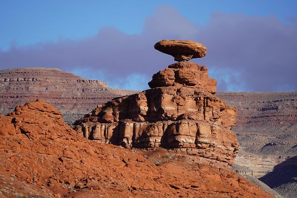
Trips Places Foods Stories Newsletters

Take your next trip with Atlas Obscura!

Our small-group adventures are inspired by our Atlas of the world's most fascinating places, the stories behind them, and the people who bring them to life.

Visit Adventures
Trips Highlight
Central Asia yurt night stars
Uzbekistan • 15 days, 14 nights
Central Asia Road Trip: Backroads & Bazaars
from
A view of Brașov’s Old Town.
Romania • 12 days, 11 nights
Legends of Romania: Castles, Ruins & Culinary Delights
from
View all trips
Top Destinations
Latest Places
Most Popular Places Random Place Lists Itineraries
Add a Place
Download the App
Top Destinations
View All Destinations »

Countries

  • Australia
  • Canada
  • China
  • France
  • Germany
  • India
  • Italy
  • Japan

Cities

  • Amsterdam
  • Barcelona
  • Beijing
  • Berlin
  • Boston
  • Budapest
  • Chicago
  • London
  • Los Angeles
  • Mexico City
  • Montreal
  • Moscow
  • New Orleans
  • New York City
  • Paris
  • Philadelphia
  • Rome
  • San Francisco
  • Seattle
  • Stockholm
  • Tokyo
  • Toronto
  • Vienna
  • Washington, D.C.
Latest Places
View All Places »
The Eye of God at Newchurch in Pendle
St. Govor’s Well.
St. Govor’s Well
Shivsrushti
Pierced domes of Hammam Seffarine.
Hammam Seffarine
Latest Places to Eat & Drink
View All Places to Eat »
Cacio e pepe lasagna combines two classics.
C'è pasta... E pasta!
Spaghetto taratatà is named for the sound of rattling sabers.
Giano Restaurant
The gnocchi here get blanketed in a sugo with braised oxtail.
Cesare al Pellegrino
Romans insist you should feel the cracked peppercorns and cheese grains on your tongue.
Flavio al Velavevodetto
Tripe is fried to a crisp.
L’Osteria della Trippa
Recent Stories
All Stories Video Podcast
Most Recent Stories
View All Stories »
Grasshopper Chapel and grounds.
How the Rocky Mountain Locust Plague Spawned Federal Disaster Relief
3 days ago
The Guy Bradley Visitor Center at Flamingo in Everglades National Park.
America’s First Game Warden Died Fighting for the Birds
3 days ago
Echo Park Time Travel Mart.
Atlas Obscura Presents: Traveling Back in Time for Coconut Cake With The Sporkful
4 days ago
One of the PATH’s many entrances.
A Supposedly Boring Mall I Might Actually Visit Again
5 days ago

No search results found for
“”

Make sure words are spelled correctly.

Try searching for a travel destination.

Places near me Random place

Popular Destinations

  • Paris
  • London
  • New York
  • Berlin
  • Rome
  • Los Angeles
Trips Places Foods Stories Newsletters
Sign In Join
Places near me Random place
All the United States Nevada Winnemucca Thousand Creek Gorge
AO Edited

Thousand Creek Gorge

A spectacular but little-known slot canyon in extreme northern Nevada, with sheer walls nearly 500 feet high and a perennial stream.

Winnemucca, Nevada

Added By
slgwv
Email
Been Here
Want to go
Added to list
Near eastern mouth of Thousand Creek Gorge.   slgwv / Atlas Obscura User
Thousand Creek Gorge.   slgwv / Atlas Obscura User
Looking northwest.   slgwv / Atlas Obscura User
Watch that first step…   slgwv / Atlas Obscura User
Looking out the eastern end.   slgwv / Atlas Obscura User
Looking back.   slgwv / Atlas Obscura User
Looking upstream.   slgwv / Atlas Obscura User
Pond at east end.   slgwv / Atlas Obscura User
West end of Thousand Creek Gorge   slgwv / Atlas Obscura User
Another pond at east end.   slgwv / Atlas Obscura User
Bottom of the gorge, near the east portal.   slgwv / Atlas Obscura User
View west along the gorge from the “official” viewpoint, accessible by 4wd vehicle.   slgwv / Atlas Obscura User
Around the first big bend from the east portal.   slgwv / Atlas Obscura User
Near the east portal.   slgwv / Atlas Obscura User
Boulder lodged in crack, telephoto view.   slgwv / Atlas Obscura User
Looking back upstream.   slgwv / Atlas Obscura User
Been Here
Want to go
Added to list

About

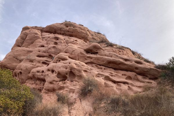
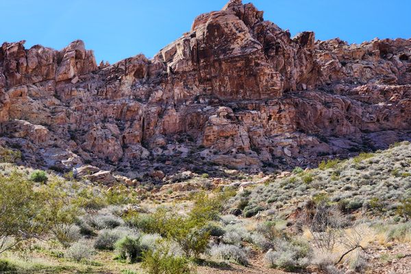
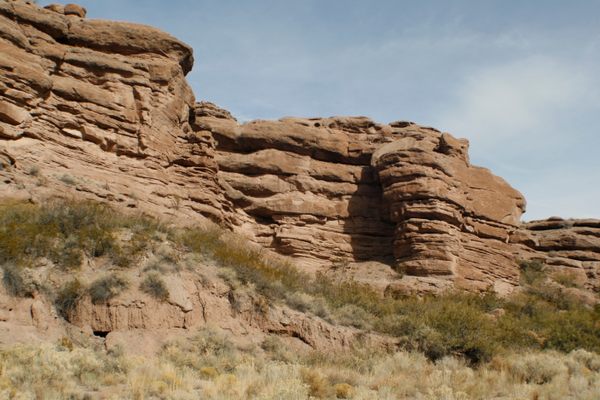
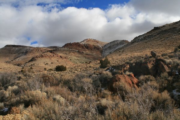
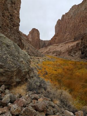
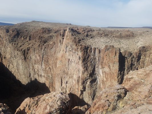
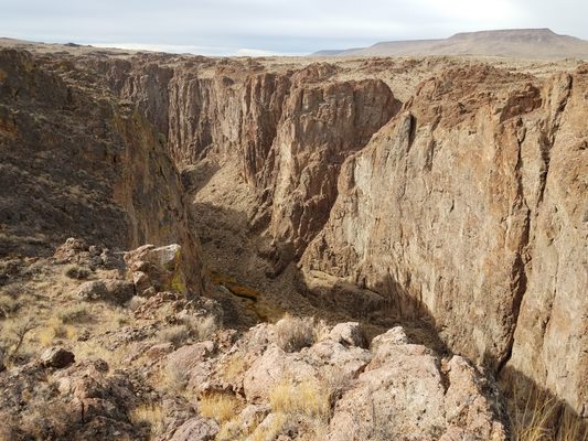
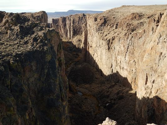
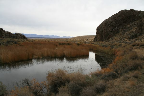
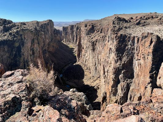
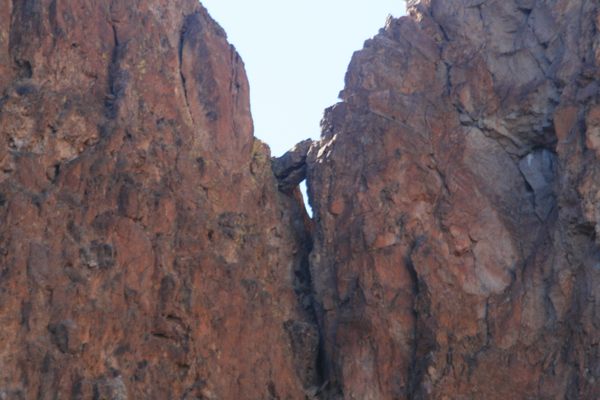
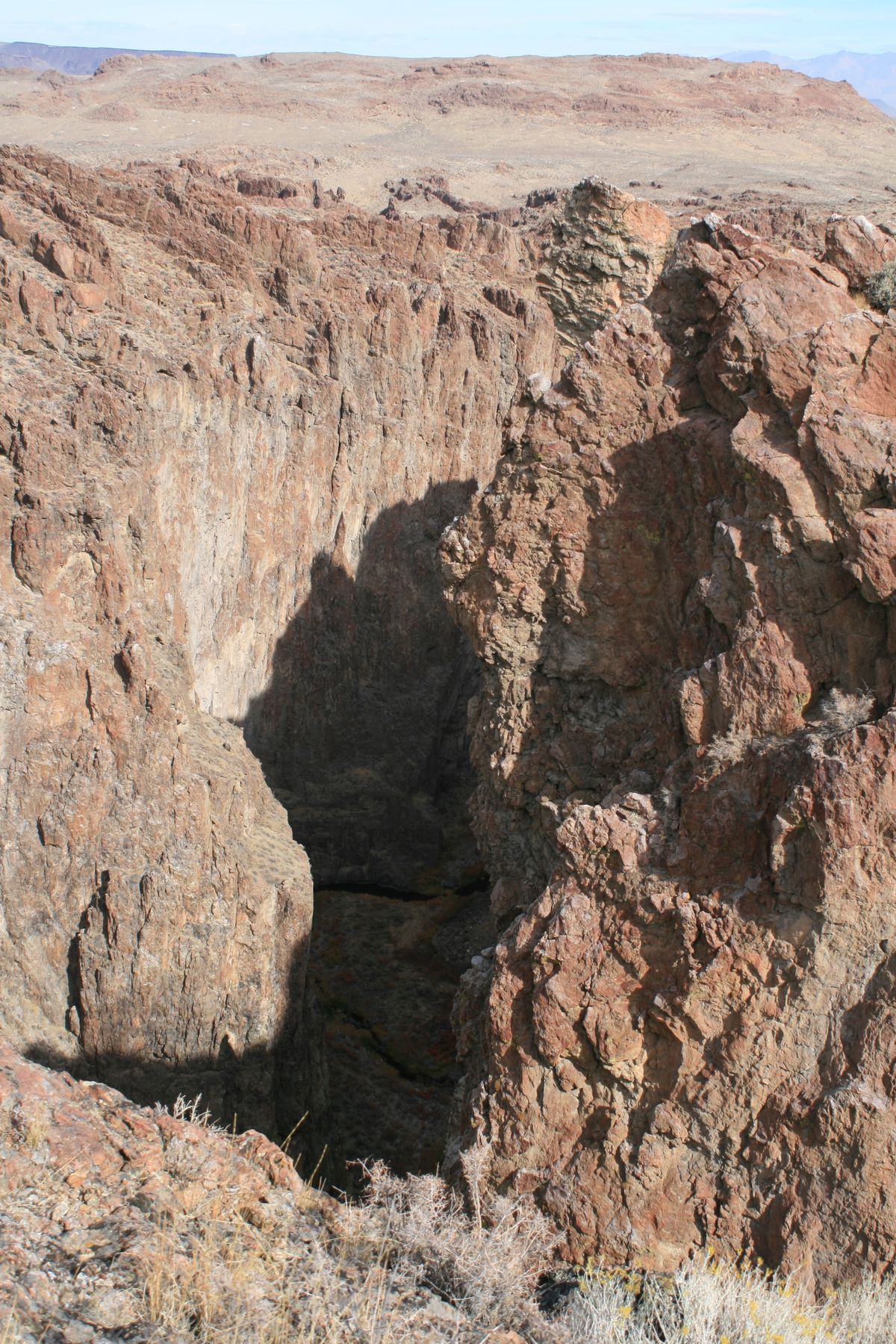
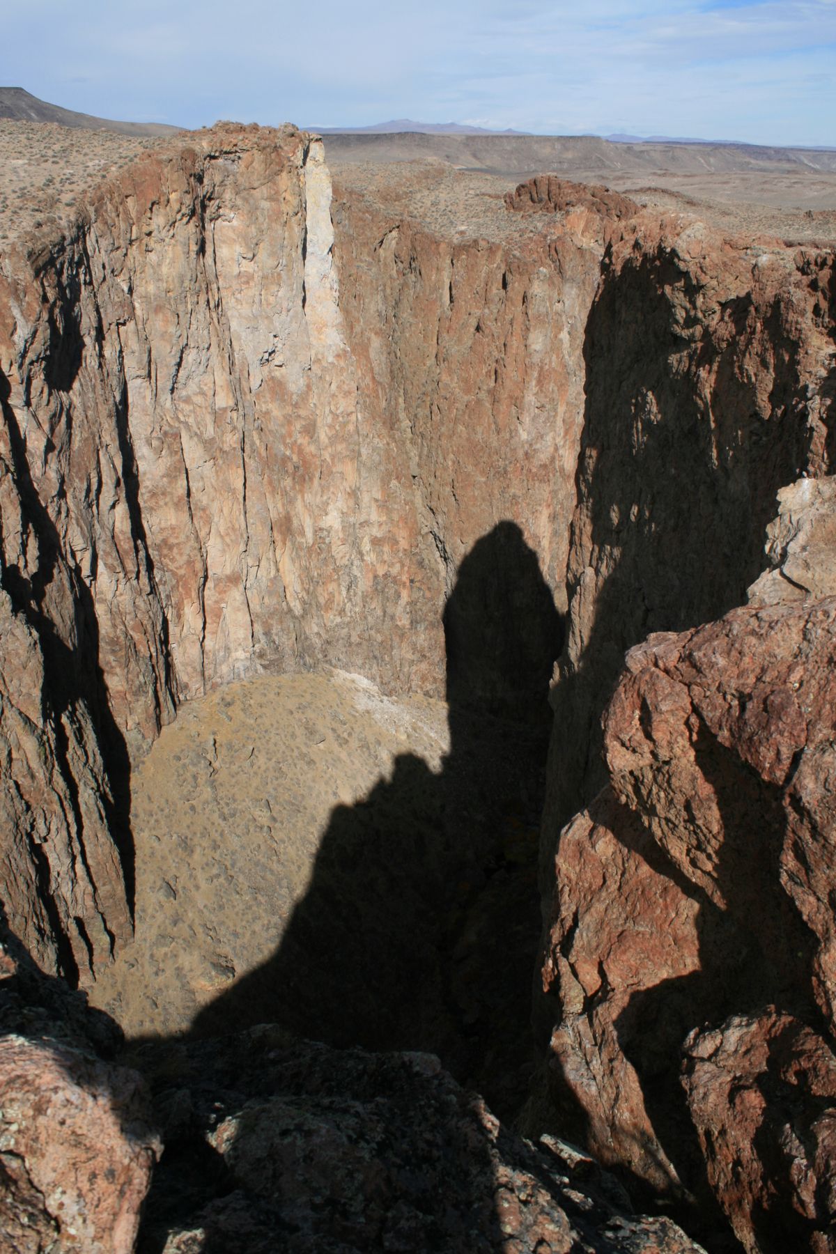
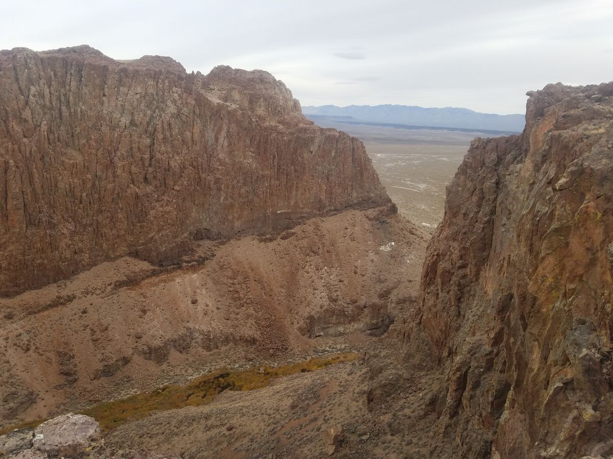
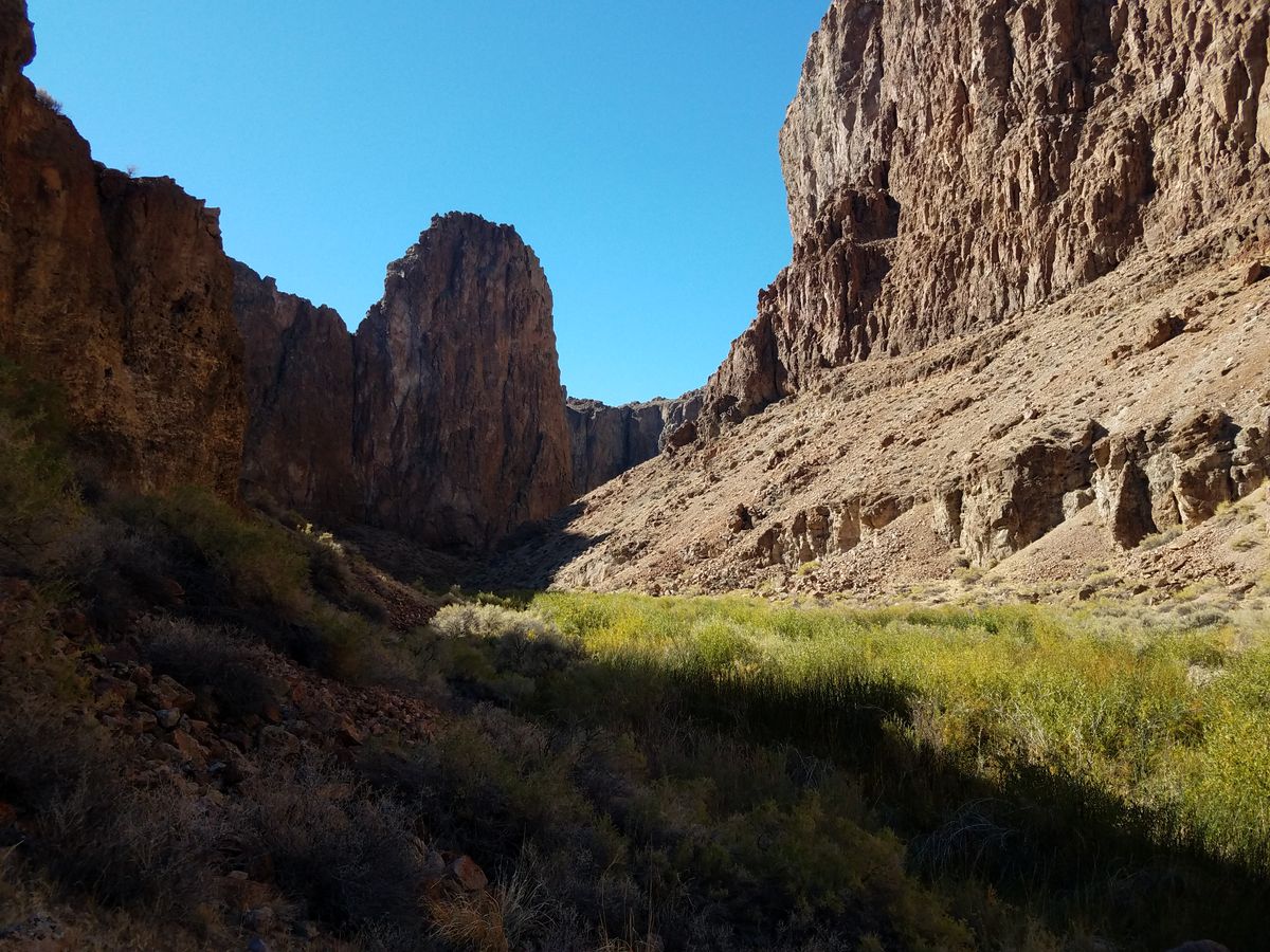
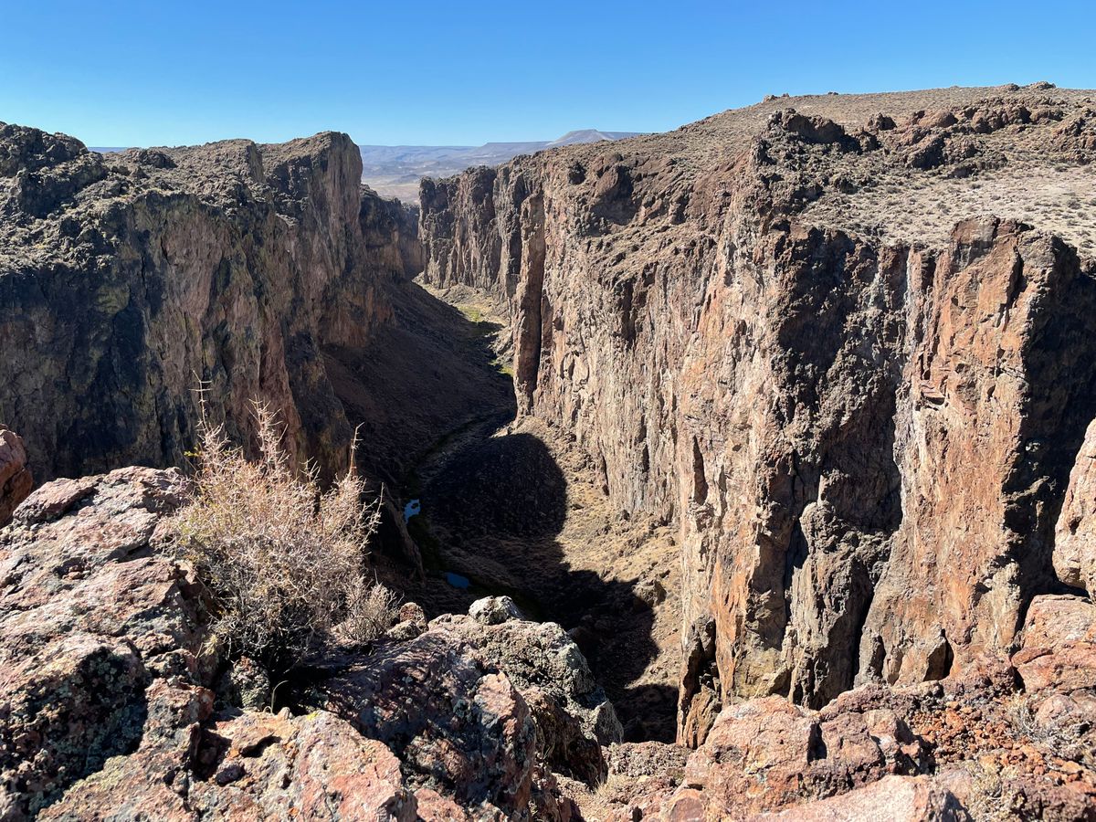
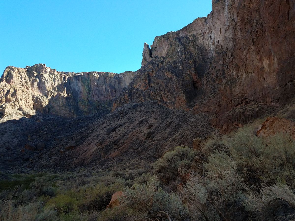
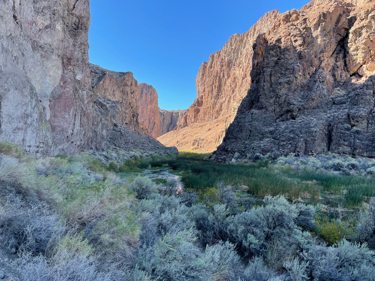
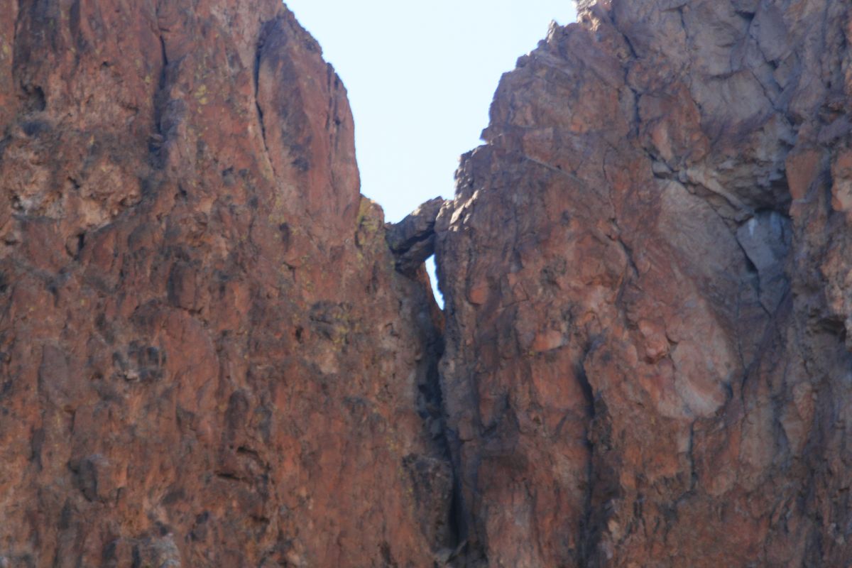
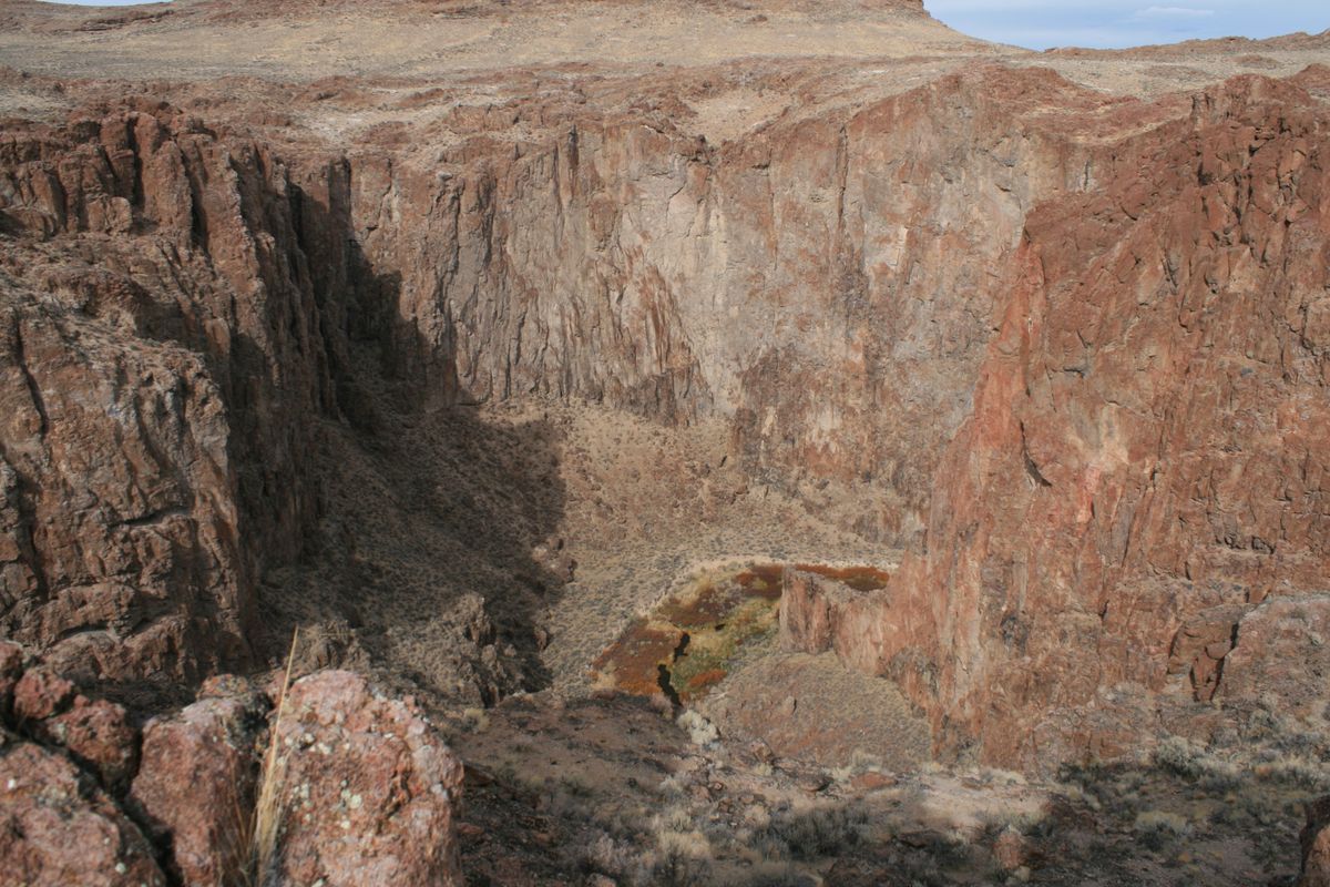
Thousand Creek Gorge is an improbable slot canyon, eroded through hard volcanic rock, in the Sheldon National Wildlife Refuge in far northern Nevada, next to the Oregon line. In places, the canyon walls are nearly 500 feet tall, while the canyon itself is barely wider. The whole canyon is only a few miles long as the crow flies.

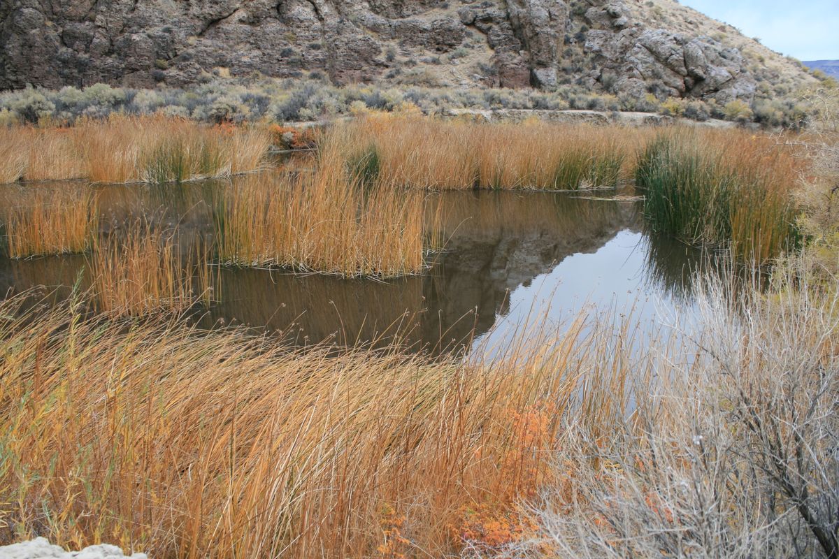
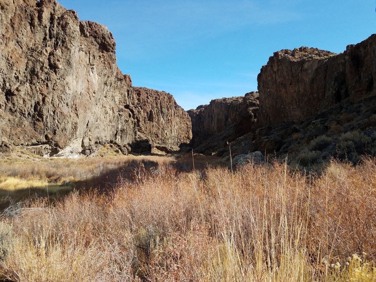
Although the trail through the canyon shown on old topographic maps has long since washed out, a day hike through the canyon is an attractive option. Be prepared for fords and some bushwhacking, however. The route is also slow because it's both convoluted and rough, and it will take much more time than you might expect from the few miles of linear distance it represents on the map. At least you're unlikely to be bothered by crowds!

Views of the gorge from above are also worthwhile and can be had without a lot of hiking with a high-clearance vehicle (see directions below).

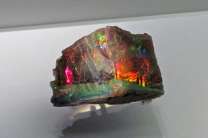
The area is also near the famous Virgin Valley opal mines of northern Nevada, one of the handful of places in the world where black opals are found. Some of the mines are open to the public during the summer season and are also worth a visit.

Related Tags

Canyons Geology Rocks Hiking

Know Before You Go

To the west (upstream) side: Go 25.2 miles west on Nevada SR-140 from Denio Junction and turn left on the well-marked graded road that goes to Dufureena ranger station and Virgin Valley Campground. This road should be passable to ordinary passenger cars in dry weather. From the campground, about 2.4 miles in, the road continues some 1.3 miles to the western mouth of the canyon. It may be passable to passenger cars if dry but high clearance is desirable.

About halfway along this road, a track climbs off to the right, for which high clearance is mandatory and 4wd desirable. This track tops out on the surface into which the canyon is incised. It's about 1.8 miles along this track to a turnoff to an overlook, but you can hike cross-country to the canyon rim most anywhere as the vegetation is so sparse. No bushwhacking is needed!

The track does go all the way to the eastern (downstream) mouth of the canyon, but four-wheel drive is mandatory on the descent to the canyon mouth. Getting to the east end is much easier from directly off SR-140. Turn left on an unmarked primitive road 19.1 miles from Denio Junction and follow it 1.5 miles to the downstream canyon mouth. High clearance is desirable on this road. As noted above, it continues as a 4wd track that climbs up to become the primitive road reached from the upstream side.

Community Contributors

Added By

slgwv

Published

June 30, 2021

Edit this listing

Make an Edit
Add Photos
Thousand Creek Gorge
Unnamed Road
Winnemucca, Nevada, 89445
United States
41.88795, -118.950741
Get Directions

Nearby Places

Royal Peacock Black Fire Opal Mine

Denio, Nevada

miles away

Sheldon National Wildlife Refuge

Gerlach, Nevada

miles away

Homer Verne (Adams) Mine

Denio Junction, Nevada

miles away

Explore the Destination Guide

Photo of Winnemucca

Winnemucca

Nevada

Places 5

Nearby Places

Royal Peacock Black Fire Opal Mine

Denio, Nevada

miles away

Sheldon National Wildlife Refuge

Gerlach, Nevada

miles away

Homer Verne (Adams) Mine

Denio Junction, Nevada

miles away

Explore the Destination Guide

Photo of Winnemucca

Winnemucca

Nevada

Places 5

Related Places

  • Lake Forest, California

    Red Rock Canyon

    A striking geological formation in Southern California.

  • Healy, Alaska

    Suntrana Canyon

    This often-overlooked canyon dazzles and intrigues with its many layers of colors, shapes and odd formations.

  • Colorful sandstone cliff just west of the Colorock Quarry.

    Moapa Valley, Nevada

    Buffington Pockets

    The rocks exposed at Valley of Fire State Park also occur in a much less known but equally spectacular area a few miles to the southwest.

  • San Lorenzo Canyon

    Alamillo, New Mexico

    San Lorenzo Slot Canyon

    One of the few slot canyons in New Mexico, this area is fantastic for hiking, camping, and stargazing.

  • Mexican Hat

    Mexican Hat, Utah

    Mexican Hat

    This balancing rock is one of Utah's most unusual geological formations.

  • Brady’s Rocks are the southernmost surface exposure of the massive Niagara Escarpment.

    Eagle, Wisconsin

    Brady's Rocks

    These modest Midwestern formations are kin to Niagara Falls' impressive cliffs, more than 600 miles away.

  • Rare foggy day

    Ojai, California

    Piedra Blanca

    Unusual white sandstone formations in the Los Padres National Forest.

  • Incandescent rocks.

    Sutcliffe, Nevada

    Incandescent Rocks

    Colorful outcrops and cliffs just north of Reno provide a scenic backdrop for hiking and mountain biking.

Aerial image of Vietnam, displaying the picturesque rice terraces, characterized by their layered, verdant fields.
Atlas Obscura Membership

Become an Atlas Obscura Member


Join our community of curious explorers.

Become a Member

Get Our Email Newsletter

Follow Us

Facebook YouTube TikTok Instagram Pinterest RSS Feed

Get the app

Download the App
Download on the Apple App Store Get it on Google Play
  • All Places
  • Latest Places
  • Most Popular
  • Places to Eat
  • Random
  • Nearby
  • Add a Place
  • Stories
  • Food & Drink
  • Itineraries
  • Lists
  • Video
  • Podcast
  • Newsletters
  • All Trips
  • Family Trip
  • Food & Drink
  • History & Culture
  • Wildlife & Nature
  • FAQ
  • Membership
  • Feedback & Ideas
  • Community Guidelines
  • Product Blog
  • Unique Gifts
  • Work With Us
  • About
  • FAQ
  • Advertise With Us
  • Advertising Guidelines
  • Privacy Policy
  • Cookie Policy
  • Terms of Use
Atlas Obscura

© 2025 Atlas Obscura. All Rights Reserved.