Trips Places Foods Stories Newsletters
Loading...
Loading...
Loading...
Loading...

No search results found for
“”

Make sure words are spelled correctly.

Try searching for a travel destination.

Places near me Random place

Popular Destinations

  • Paris
  • London
  • New York
  • Berlin
  • Rome
  • Los Angeles
Trips Places Foods Stories Newsletters
Sign In Join
Places near me Random place
All the United States Massachusetts Boston The Great Spring

The Great Spring

A tiny plaque marks the location of the water source that facilitated the birth of modern-day Boston.

Boston, Massachusetts

Added By
gobruen
Email
Been Here
Want to go
Added to list
CAPTION
Spring Lane, which was named after the Great Spring.   gobruen / Atlas Obscura User
The Great Spring plaque.   gobruen / Atlas Obscura User
A 1743 map of Boston by William Price, showing Spring Lane and its vicinity.   Boston Public Library/Public Domain
  Julius Spada / Atlas Obscura User
  jbulot / Atlas Obscura User
  e1savage / Atlas Obscura User
  e1savage / Atlas Obscura User
The plaque. Not so tiny.   rtiferet / Atlas Obscura User
  Deniseg2266 / Atlas Obscura User
  Julius Spada / Atlas Obscura User
Been Here
Want to go
Added to list

About

After the Puritans of England landed on the shores of Massachusetts in 1630, they had quite a hard time settling into their new home. They originally set up base in the area that is now Charlestown, but the poor water quality there led to many of them falling ill.

At this time, an early settler named William Blackstone told them of the bountiful fresh water from a spring in the Shawmut peninsula, where he had made his home. The piece of land was more like an island connected by a thin causeway. Surrounded by seawater and mixes of smelly brackish water, the spring, fed by the rich aquifers around it, was a critical resource for early residents, and this availability of water played a big role in the choice of the region for settlement.

A move to the peninsula followed, marking the genesis of modern-day Boston. The abundant water supply gradually dwindled as the settlement expanded, and the residents had to look outside the city for a more consistent supply, and more sophisticated water systems were put in place. The spring was covered up and later even paved over.

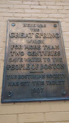
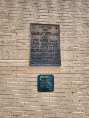
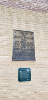
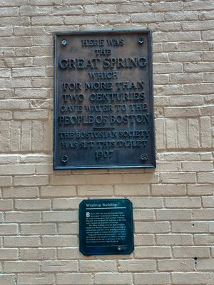
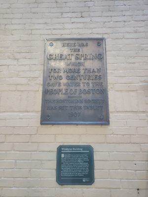
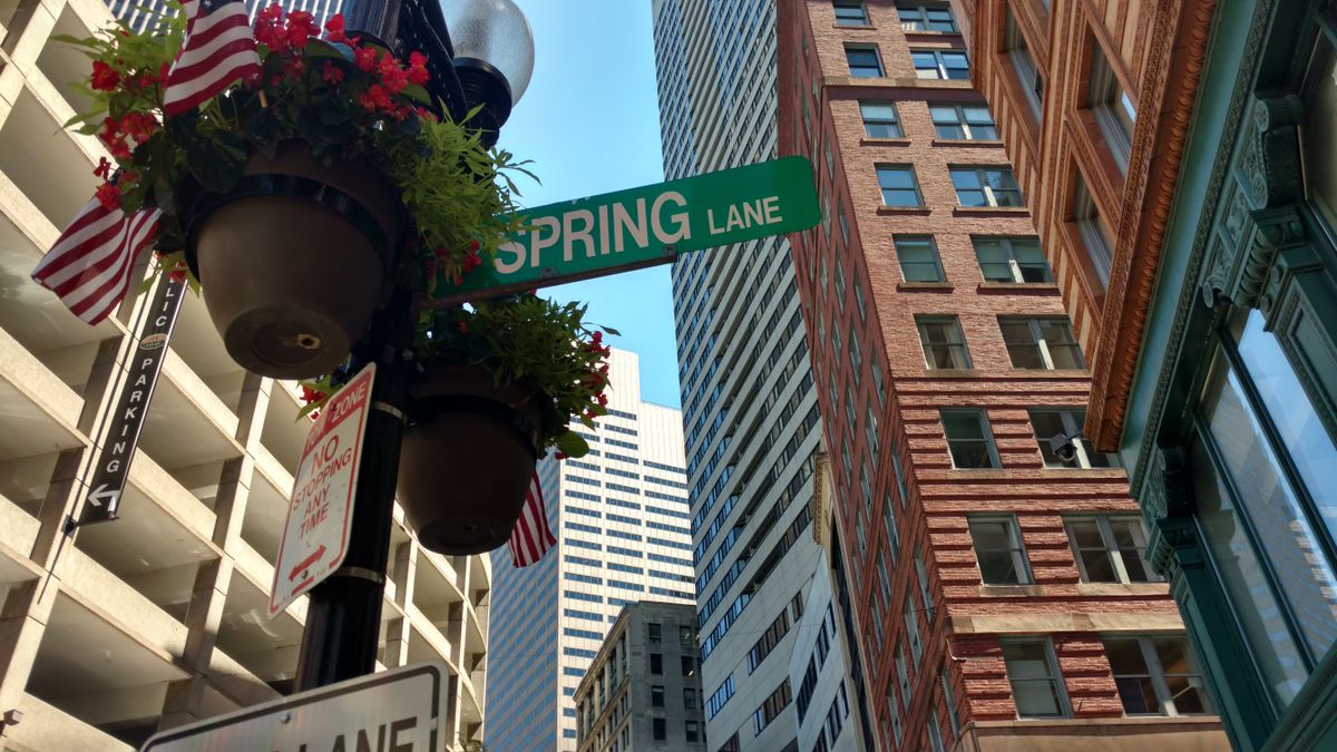
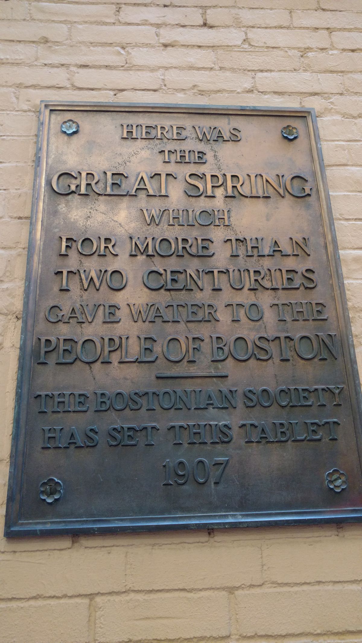
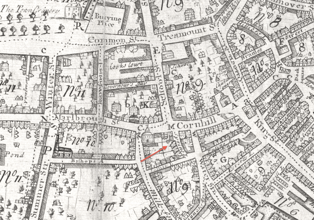
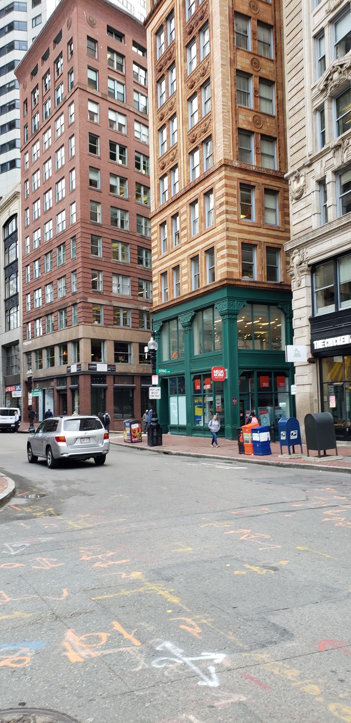
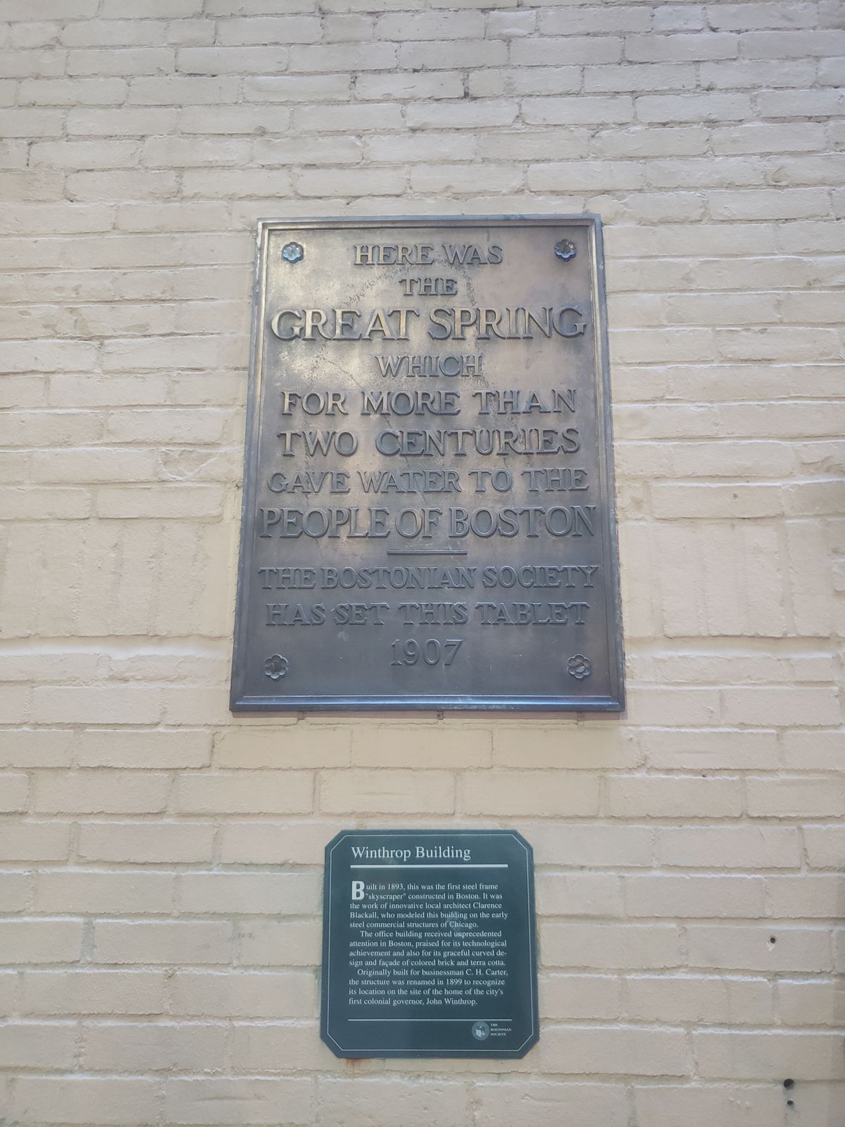
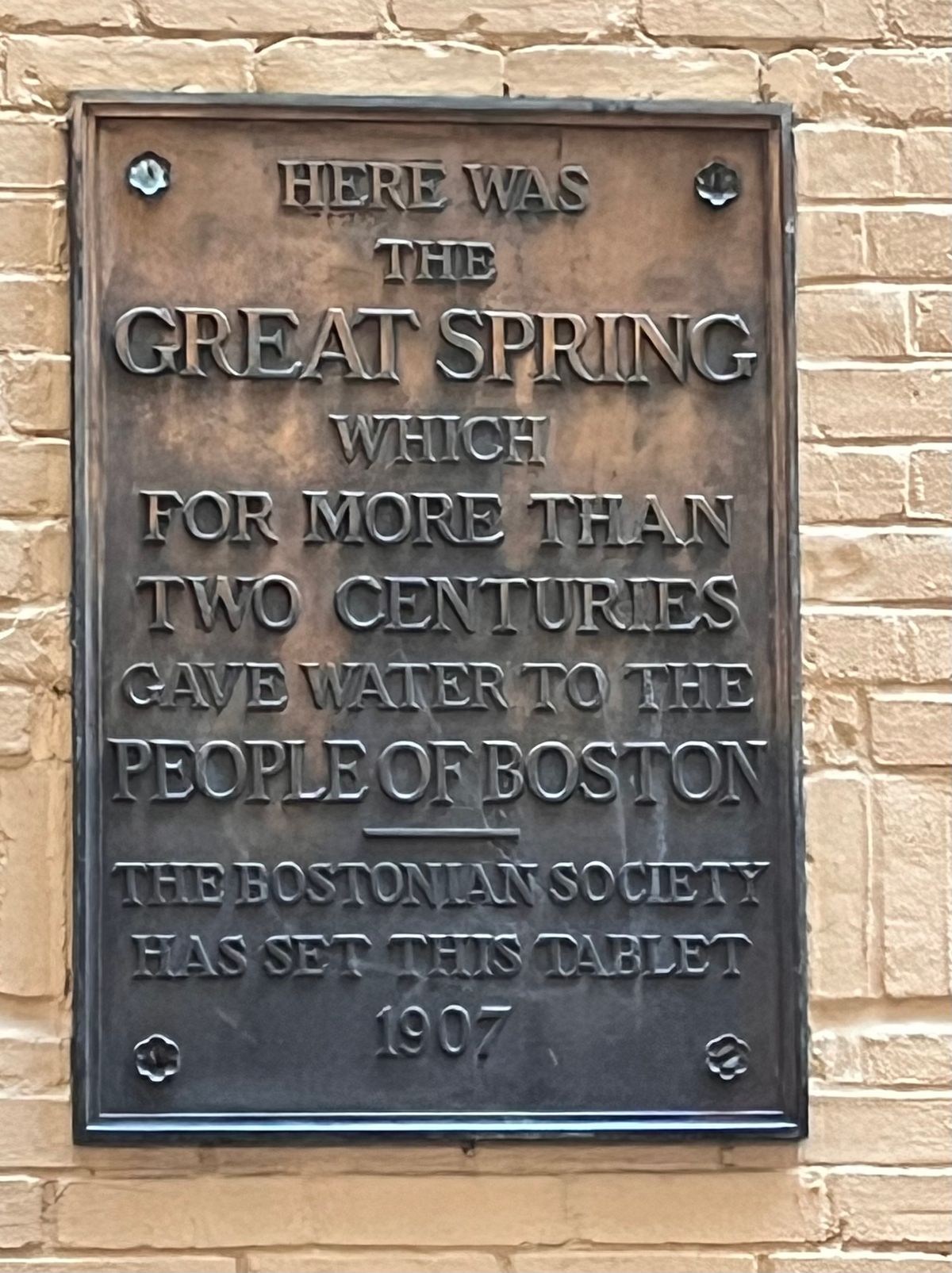
Many years later, at the start of the 20th century, the Bostonian Society installed a small plaque at the site of the spring, located in a dim alleyway named Spring Lane after the water source. The plaque reads, simply, “Here was the Great Spring which for more than two centuries gave water to the people of Boston." The city also put up a plaque on the Winthrop-Carter building, recognizing the crucial role the fresh spring water played in luring the Puritans to create the settlement that was a precursor to the modern city seen today. 

Related Tags

Spring Waterworks Water Cities History Urban Planning

Know Before You Go

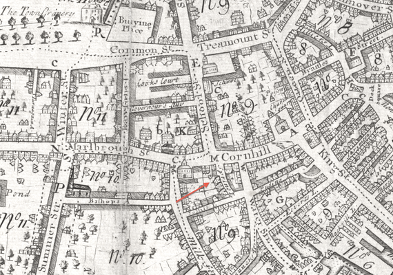
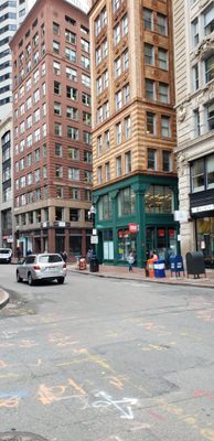
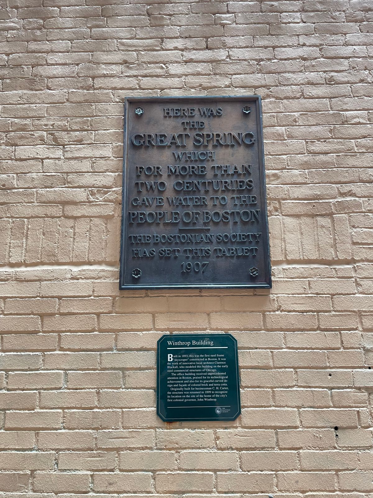
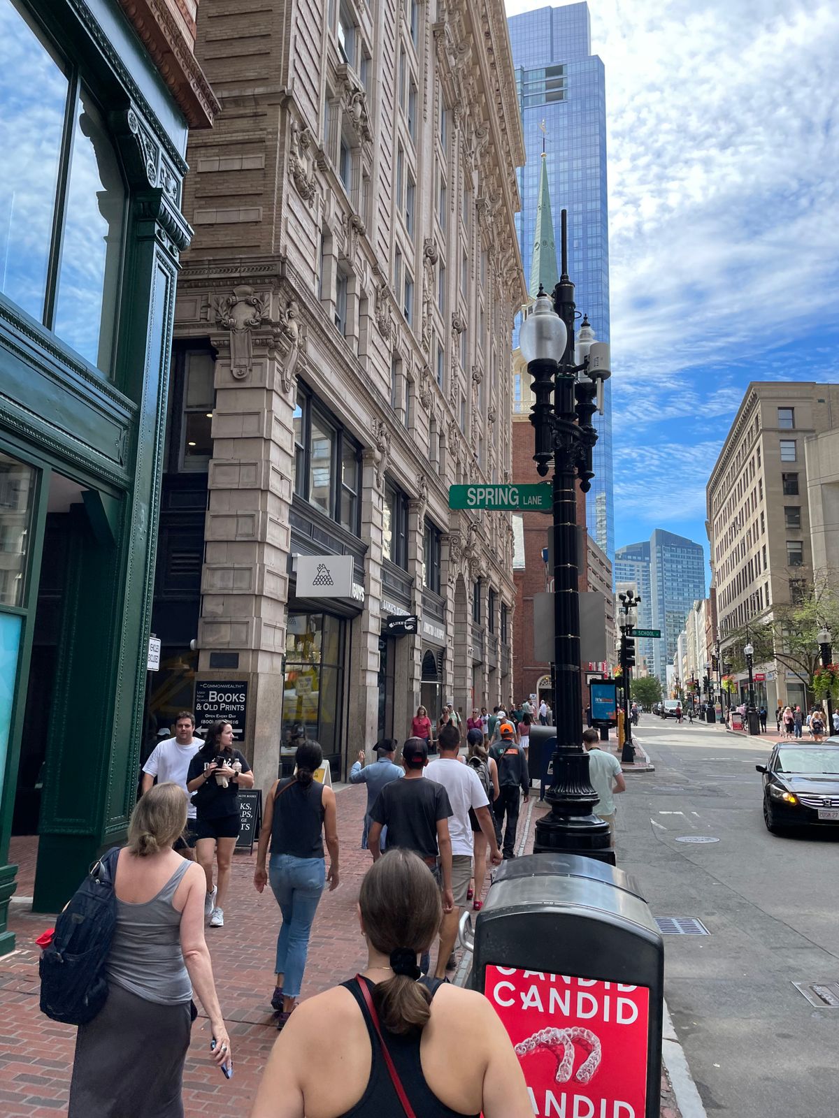
Spring Lane can be accessed from either Washington or Devonshire streets in Boston, running parallel to Water Street. Spring Lane appears almost invisible to busy pedestrians and is off-limits to cars. Look up and you should find the street sign for Spring Lane. Walk about halfway down and look on the wall. During busy tourist seasons and business hours a person could be easily overrun on the sidewalk in downtown Boston, but Spring Lane is often very quiet in the middle of the commotion.

Community Contributors

Added By

gobruen

Edited By

e1savage, Kavya Ram Mohan, rtiferet, jbulot...

  • e1savage
  • Kavya Ram Mohan
  • rtiferet
  • jbulot
  • Julius Spada
  • Deniseg2266
  • Ultimoed

Published

July 19, 2017

Edit this listing

Make an Edit
Add Photos
Sources
  • https://www.boston.com/uncategorized/noprimarytagmatch/2013/07/26/the-history-of-water-in-boston?pg=7
  • http://aknextphase.com/great-spring-bostons-spring-lane/
  • http://web.mit.edu/thecity/archive/projects13/downtown_boston_alampi/natural.html
  • https://www.britannica.com/place/Massachusetts-Bay-Colony
  • https://www.downtownboston.org/itinerary/view/explore-downtown-bostons-hidden-gem-historic-sites
  • https://www.downtownboston.org/itinerary/view/explore-downtown-bostons-hidden-gem-historic-sites
The Great Spring
Spring Lane
Boston, Massachusetts
United States
42.357432, -71.057795
Get Directions

Nearby Places

Boston Irish Famine Memorial

Boston, Massachusetts

miles away

Site of the Boston Massacre

Boston, Massachusetts

miles away

Democratic Donkey and Republican Footprints

Boston, Massachusetts

miles away

Explore the Destination Guide

Photo of Boston

Boston

Massachusetts

Places 127
Stories 32

Related Places

  • River Tyburn Conduit.

    London, England

    River Tyburn Conduit

    A plaque marks the underground site of one of London's "lost rivers."

  • Mumbai, India

    Flora Fountain

    An iconic fountain dedicated to the Roman goddess Flora stands in the heart of Mumbai.

  • A tiny remnant of the “vegas” for which Las Vegas was named.  The Boy Scout chimney is in the background.

    Las Vegas, Nevada

    Springs Preserve

    The birthplace of Las Vegas is now preserved as a historic and natural area.

  • Diokletian Aqueduct

    Split, Croatia

    Dioklecijanov Akvadukt (Diocletian Aqueduct)

    This ancient Roman aqueduct once funneled water to Diocletian's palace.

  • Old Wooden Water Pipes

    Edinburgh, Scotland

    Medieval Water Pipes

    These wooden pipes were crucial to providing water to Medieval Edinburgh.

  • The last remaining in situ Huddesteen in the Eenhoorn lock.

    Amsterdam, Netherlands

    Huddesteen

    The last of Amsterdam's original sea level markers remaining in place.

  • The underlying River Farset causes the clock tower to tilt.

    Belfast, Northern Ireland

    River Farset

    Belfast's namesake river still winds below the city center, hidden from sight.

  • Aerial view of Greenbelt, Maryland, 1939.

    Greenbelt, Maryland

    Greenbelt Historic District

    A relic of FDR's brief foray into utopian urban planning.

Aerial image of Vietnam, displaying the picturesque rice terraces, characterized by their layered, verdant fields.
Atlas Obscura Membership

Become an Atlas Obscura Member


Join our community of curious explorers.

Become a Member

Get Our Email Newsletter

Follow Us

Facebook YouTube TikTok Instagram Pinterest RSS Feed

Get the app

Download the App
Download on the Apple App Store Get it on Google Play
  • All Places
  • Latest Places
  • Most Popular
  • Places to Eat
  • Random
  • Nearby
  • Add a Place
  • Stories
  • Food & Drink
  • Itineraries
  • Lists
  • Video
  • Podcast
  • Newsletters
  • All Trips
  • Family Trip
  • Food & Drink
  • History & Culture
  • Wildlife & Nature
  • FAQ
  • Membership
  • Feedback & Ideas
  • Community Guidelines
  • Product Blog
  • Unique Gifts
  • Work With Us
  • About
  • FAQ
  • Advertise With Us
  • Advertising Guidelines
  • Privacy Policy
  • Cookie Policy
  • Terms of Use
Atlas Obscura

© 2025 Atlas Obscura. All Rights Reserved.