Trips Places Foods Stories Newsletters
Loading...
Loading...
Loading...
Loading...

No search results found for
“”

Make sure words are spelled correctly.

Try searching for a travel destination.

Places near me Random place

Popular Destinations

  • Paris
  • London
  • New York
  • Berlin
  • Rome
  • Los Angeles
Trips Places Foods Stories Newsletters
Sign In Join
Places near me Random place
All the United States Nevada Fallon Salt Cave

Salt Cave

Red ocher pictographs survive in this tufa rock shelter on the shore of an ancient lake.

Fallon, Nevada

Added By
slgwv
Email
Been Here
Want to go
Added to list
CAPTION
More enigmatic pictographs.   slgwv / Atlas Obscura User
Enigmatic pictographs.   slgwv / Atlas Obscura User
Tufa capping bedrock by the cave.   slgwv / Atlas Obscura User
Spot-like pictographs.   slgwv / Atlas Obscura User
Faded pictographs.   slgwv / Atlas Obscura User
Rosette-like pictographs on tufa.   slgwv / Atlas Obscura User
Soot covers the cave ceiling.   slgwv / Atlas Obscura User
Hand print?   slgwv / Atlas Obscura User
Alignments of ocher dots?   slgwv / Atlas Obscura User
Enigmatic pictographs near the cave floor.   slgwv / Atlas Obscura User
Salt Cave   slgwv / Atlas Obscura User
Weathered tufa near the cave mouth.   slgwv / Atlas Obscura User
Salt Cave and tufa.   slgwv / Atlas Obscura User
Salt Cave.   slgwv / Atlas Obscura User
Tufa near the cave mouth.   slgwv / Atlas Obscura User
Encrusting tufa over bedrock near cave mouth.   slgwv / Atlas Obscura User
Faded pictographs on tufa.   slgwv / Atlas Obscura User
Encrusting tufa draped by cave mouth.   slgwv / Atlas Obscura User
Pictographs near cave floor, in context.   slgwv / Atlas Obscura User
Weathered pictographs.   slgwv / Atlas Obscura User
Hand prints?   slgwv / Atlas Obscura User
Please don’t disturb the site.   slgwv / Atlas Obscura User
Looking southeast out the cave mouth.   slgwv / Atlas Obscura User
View south out the cave mouth.   slgwv / Atlas Obscura User
Been Here
Want to go
Added to list

About

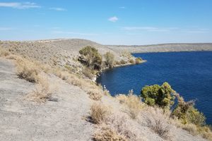
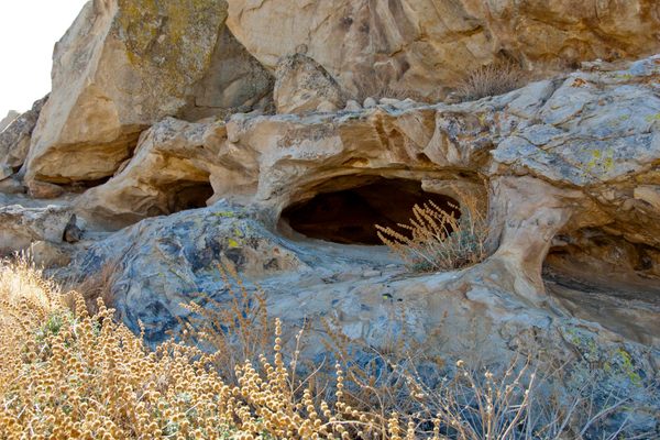
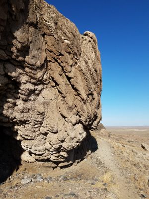
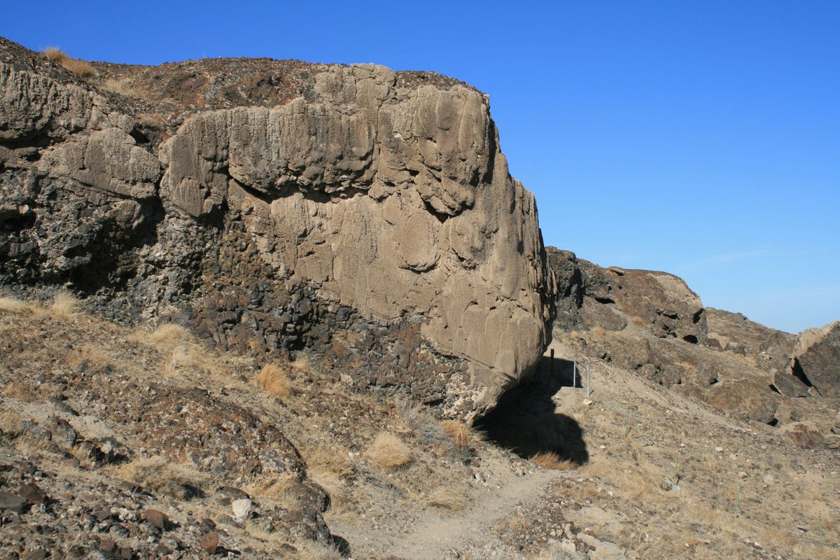
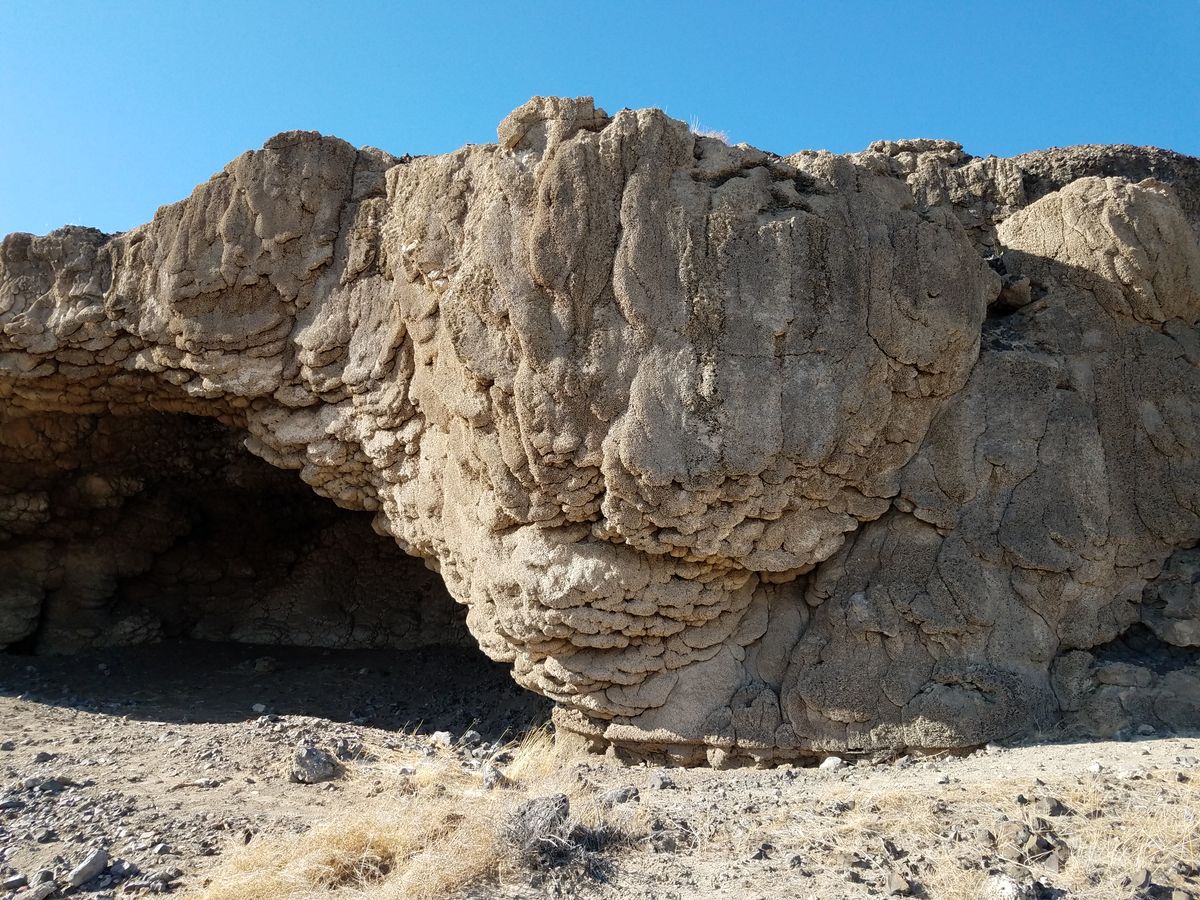
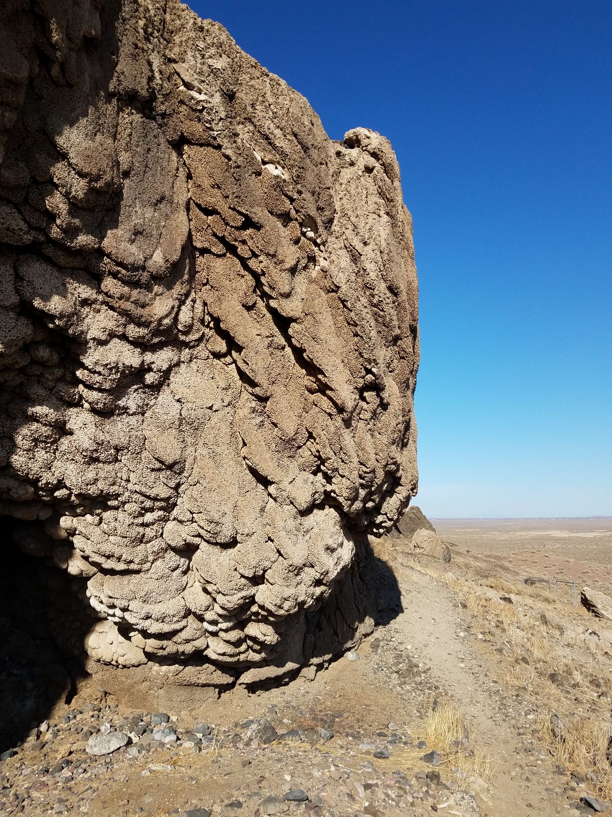
Pleistocene Lake Lahontan covered much of western Nevada, with a peak level around 15,000 years ago. As the lake level dropped over the ensuing millennia, wave action along the shore caused substantial erosion, as the lake was still large enough to generate surf.

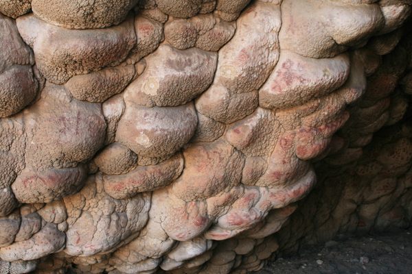
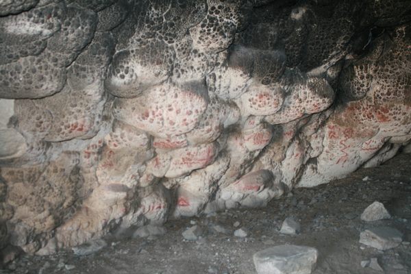
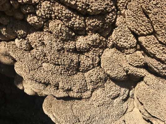
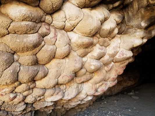
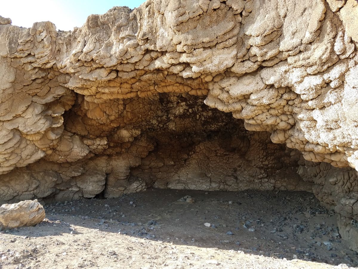
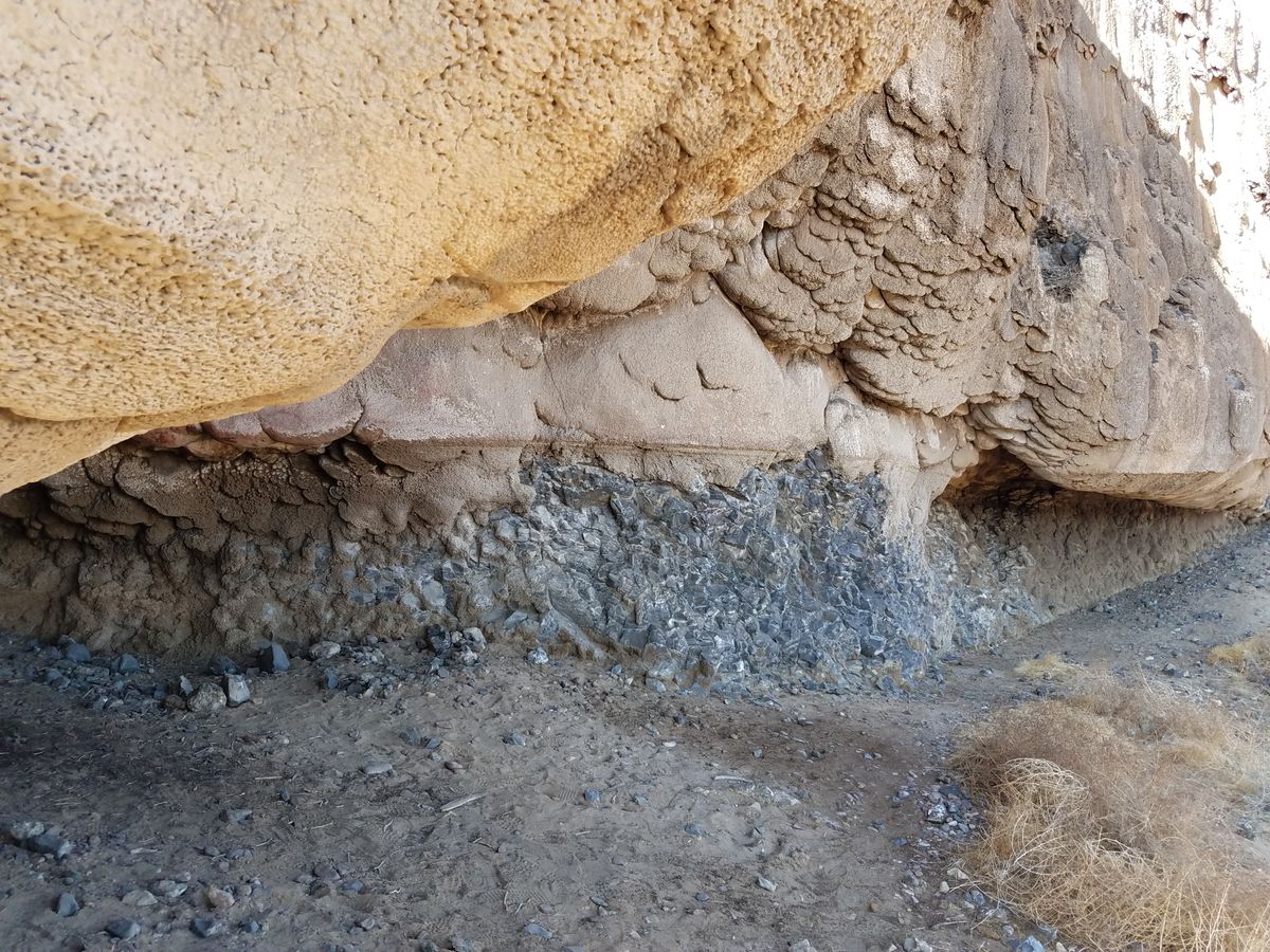
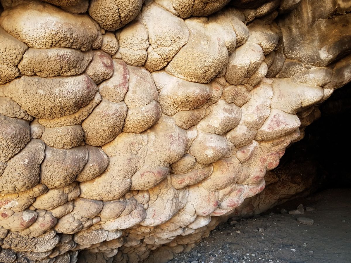
In some cases, the wave action carved out overhangs along the shore, as the surf dug into the material at the shoreline. In addition, due to the chemistry of Lake Lahontan, tufa, a freshwater limestone, was deposited abundantly around the lake, and tufa deposits encrusted the shoreline and were undercut and worn away by the surf.

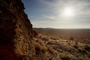
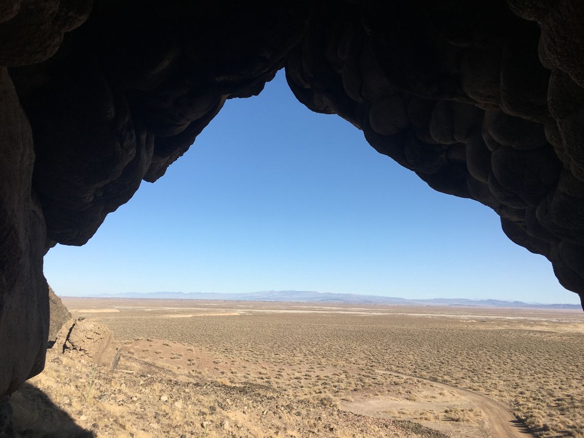
Early Indigenous inhabitants occupied these wave-cut shelters several thousand years ago when the lake still provided resources before it vanished. Salt Cave is one such shelter, consisting of an arch-like tufa-encrusted alcove. The Hidden Cave at Grimes Point, directly east across the basin from Salt Cave, is another example.

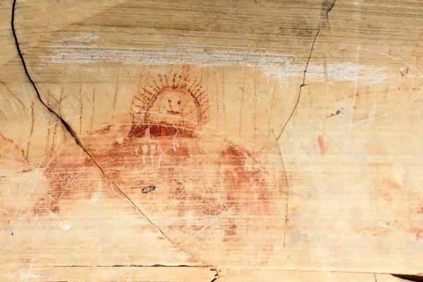
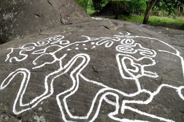
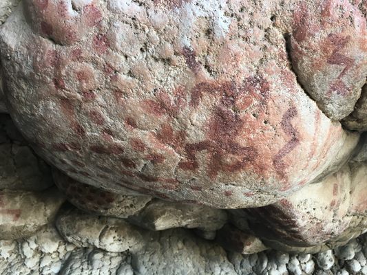
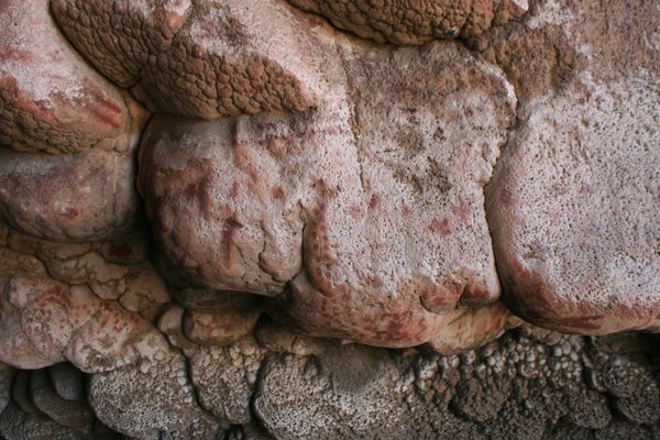
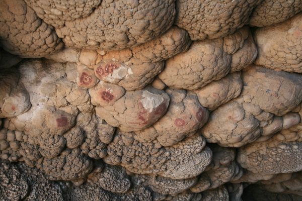
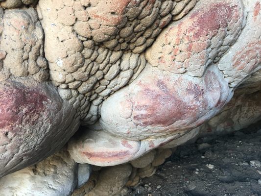
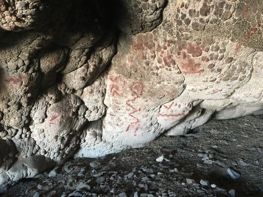
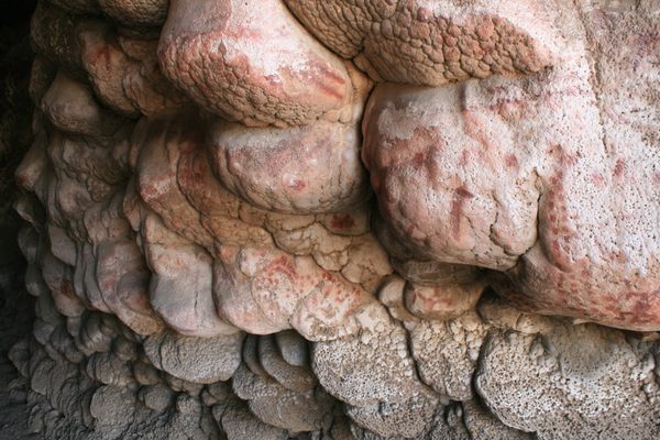
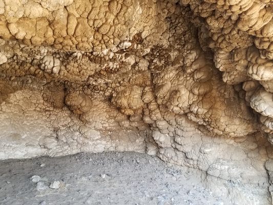
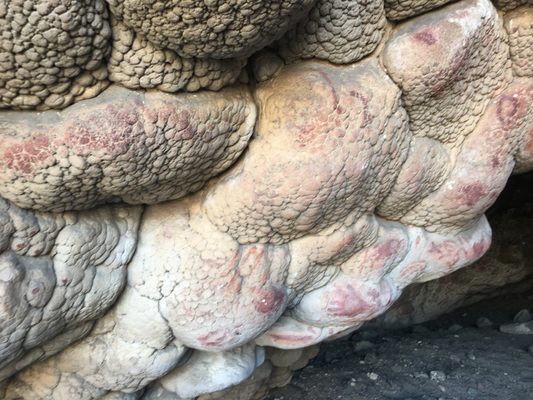
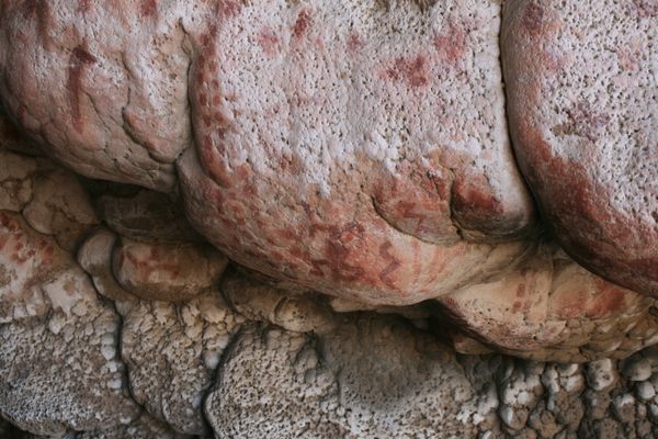
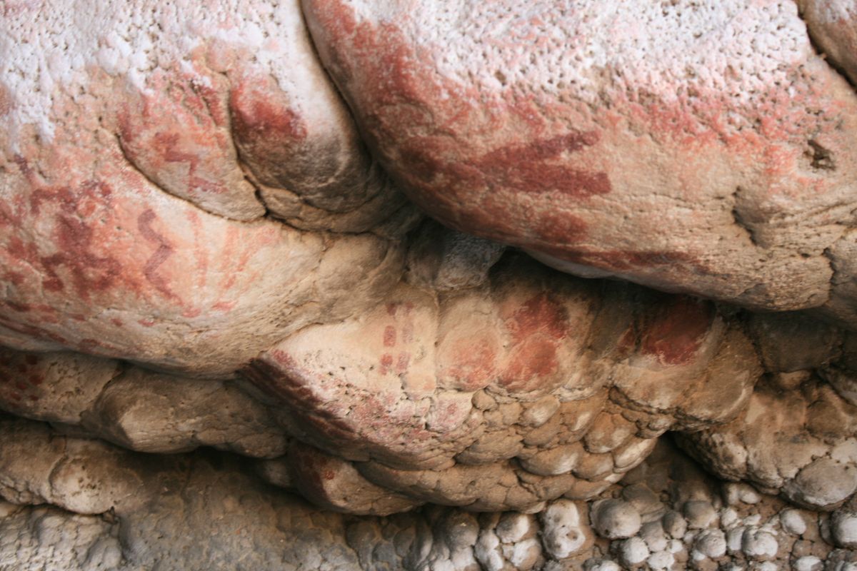
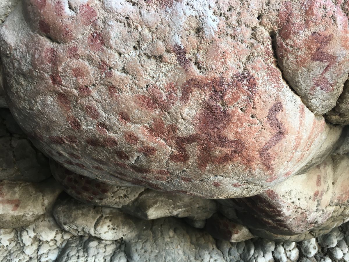
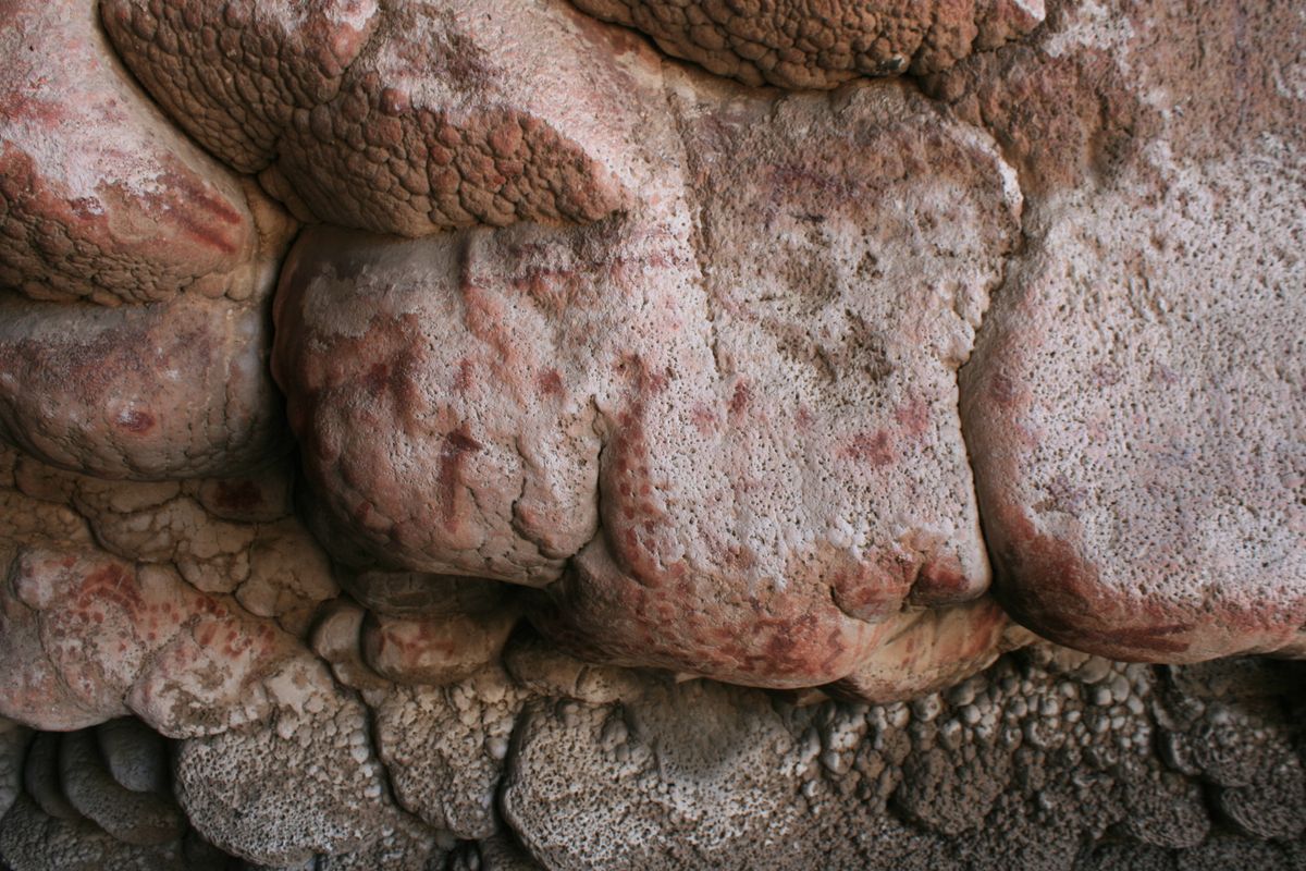
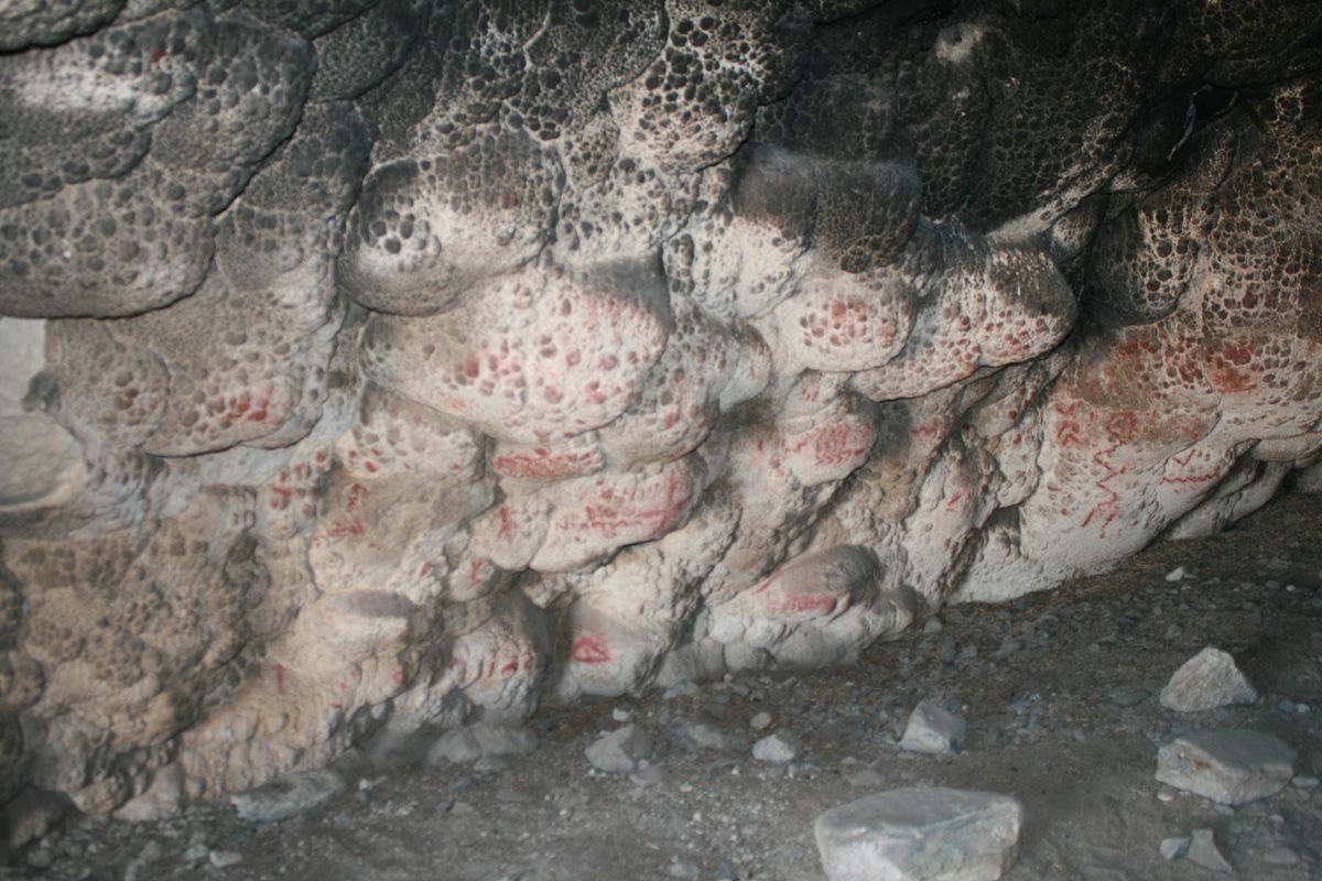
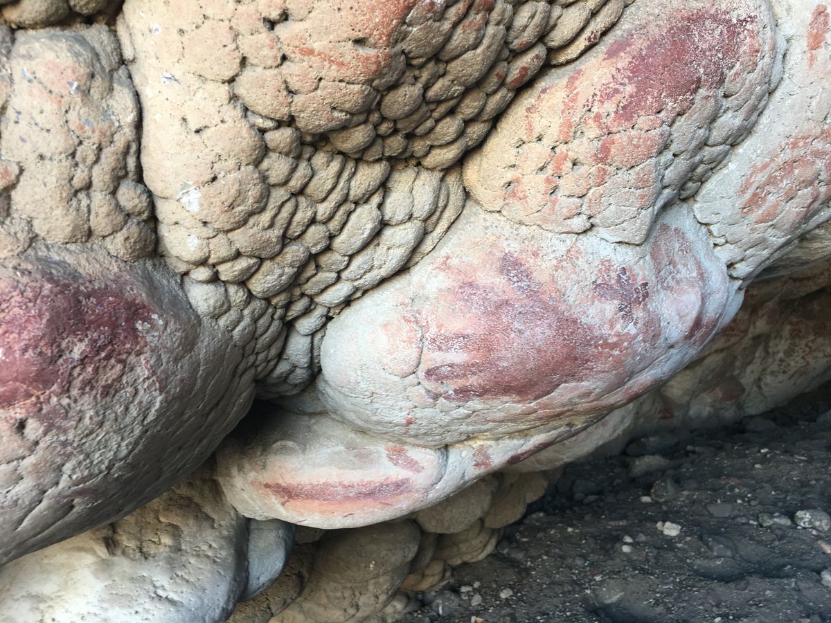
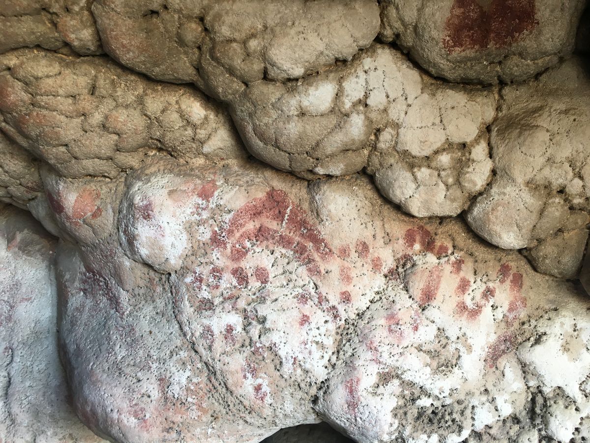
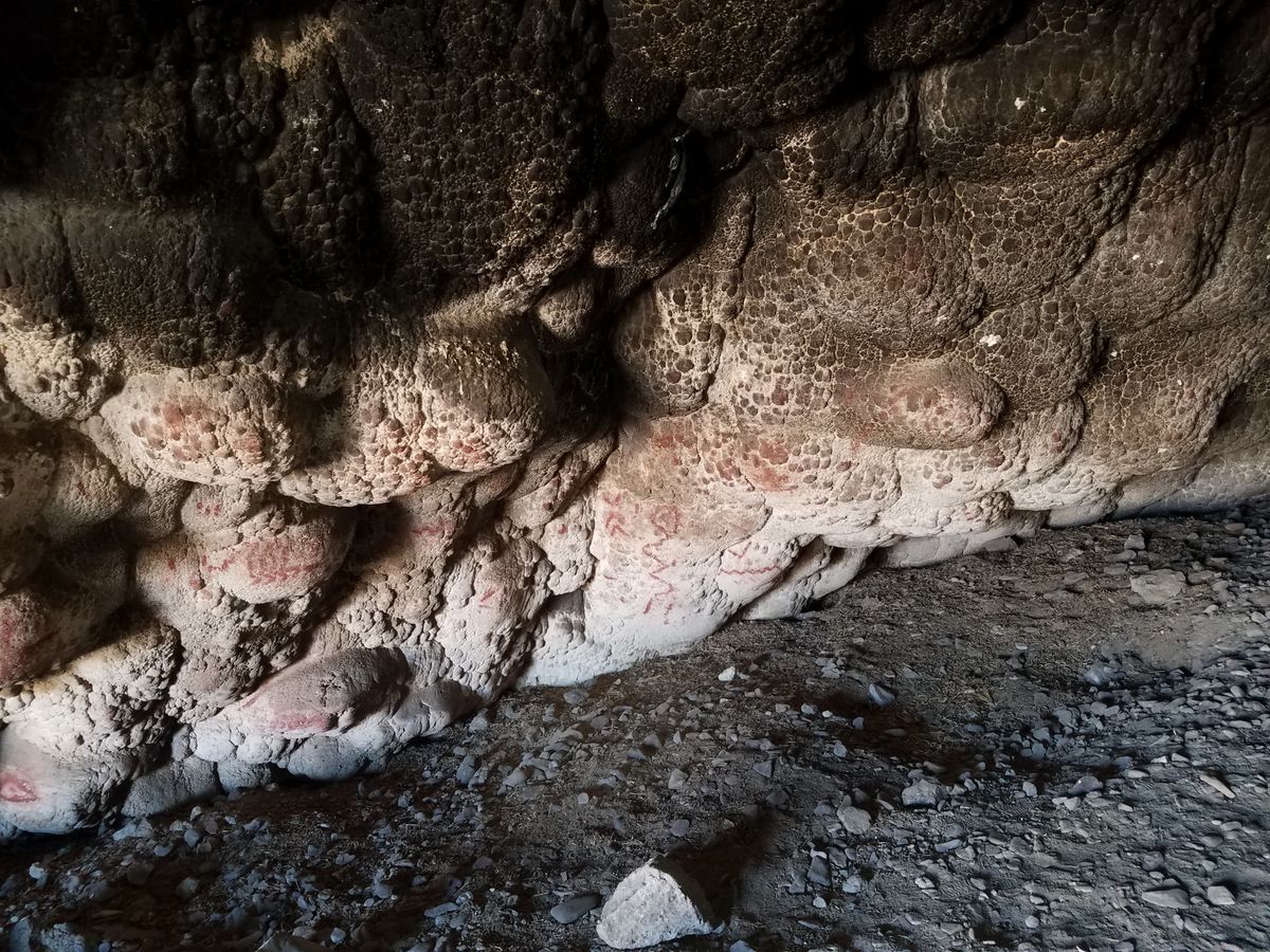
The tufa on the roof of Salt Cave is deeply soot-stained toward the back, both from the fires of early inhabitants and from those of later campers. Toward the entrance of the cave, where the tufa is whitish and largely free of soot, is an abundance of red ocher pictographs. Some are simply spots, while others are obvious hand prints, aligned dots, rosette-like features, wavy lines that may represent snakes or water, and even more enigmatic designs.

The white tufa may have been preferred as a substrate simply because the pictographs show up better, although some farther back may have later been covered by soot. Those nearest the entrance are faded and fragmentary due to weathering. The meaning of the pictographs is uncertain.

Related Tags

Geology Archaeology Petroglyphs History & Culture Art Caves

Know Before You Go

The easiest approach, from the east off farm roads around Fallon, is often not available because it crosses part of the Fallon Naval Air Station and may be closed for training exercises.

This road, Sand Canyon Road, starts from the corner (which is at about 39.40192 N, 118.83801 W) of Solias Road and Lone Tree Road, at the edge of the farmlands. From this corner Sand Canyon Road first heads south and then bends southwesterly.

After five miles go south (left) at an intersection at about 36.36631 N, 118.91219 W, and proceed for one mile to an intersection at around 39.35344 N, 118.90685 W. From here go west (right) 1.4  miles to pick up a dirt road along the low hills ahead. At the intersection with this road (at about 39.34436 N, 118.93024 W), go south about 0.4 miles. The cave is in the hills on the right (west). There is a small informal parking area off the road to the east. The cave is at about 39.33929 N, 118.93087 W.

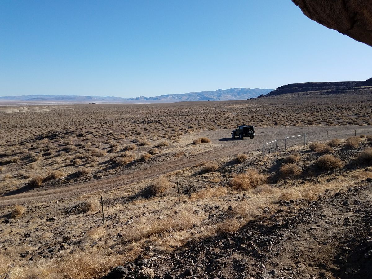
These roads should be passable to passenger cars in dry weather, but high clearance will probably be appreciated.

If the Sand Canyon Road is not available, you can come in from the west, but it will involve about 20 miles on dirt roads on which high clearance will be necessary and 4WD. 

In winter, when the old lakebed deposits are wet, the route may be impassible even to 4WD vehicles because of deep mud.

On Alternate US-95 about 0.8 miles south of Buckland Station, at the bridge over the Carson River, turn left (east) on the Simpson Road/Old Pony Express route, this junction being at about 39.28440 N, 119.24277 W. Proceed 10.7 miles, going generally eastward, to a junction at 39.27575 N, 119.04994 W and head north here.

(The site of the Hooten Wells Pony Express station is about 1/4 mile east of this junction and is marked with some ruins and an interpretive sign. It makes a worthwhile side trip on the way.)

The main road will bend generally northeasterly and finally east, winding around the low rocky hills to the south where the cave is located. Several side roads branch off, but at all junctions keep heading generally eastward.

After 9.2 miles take a shallow junction to the right (at 39.34409 N, 118.93197 W) and follow it for 0.1 mile, where you will join the road to the cave (this latter junction is at about 39.34354 N, 118.92979 W). Head south from this point as above.

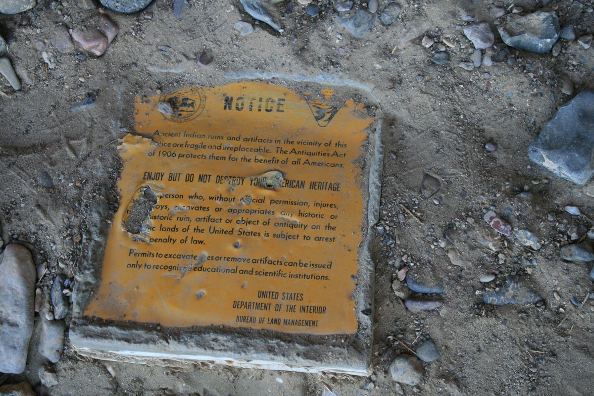
Pictographs are irreplaceable. Please don't touch them; photograph them only.

Community Contributors

Added By

slgwv

Published

February 8, 2024

Edit this listing

Make an Edit
Add Photos
Sources
  • Heizer, Robert F.; Baumhoff, Martin A. Prehistoric Rock Art of Nevada and eastern California, University of California Press Berkeley, 1962. p. 23.
  • https://desertexplorer.wordpress.com/2008/06/07/nevada-rock-art-grimes-point-and-salt-cave/
Salt Cave
Fallon, Nevada
United States
39.33994, -118.930565

Nearby Places

Lahontan Dam and the Newlands Project

Fallon, Nevada

miles away

Soda Lakes

Fallon, Nevada

miles away

Hidden Cave at Grimes Point

Fallon, Nevada

miles away

Explore the Destination Guide

Photo of Fallon

Fallon

Nevada

Places 10

Nearby Places

Lahontan Dam and the Newlands Project

Fallon, Nevada

miles away

Soda Lakes

Fallon, Nevada

miles away

Hidden Cave at Grimes Point

Fallon, Nevada

miles away

Explore the Destination Guide

Photo of Fallon

Fallon

Nevada

Places 10

Related Places

  • Painted Rock

    Santa Margarita, California

    Painted Rock

    The oldest pictographs on this decorated rock formation in California's Carrizo Plain date back as many as 4,000 years.

  • The Lioness of Gobedra

    Ethiopia

    Lioness of Gobedra

    According to one local legend, this image was created during a battle between a wild lioness and the archangel Michael.

  • Crow Canyon Petroglyphs.

    New Mexico

    Crow Canyon Petroglyphs

    One of the American Southwest's most extensive collections of Navajo rock art.

  • A pictograph at Bear Gulch.

    Forest Grove, Montana

    Bear Gulch Pictographs

    A scenic ravine with an astounding collection of rock art created by the Indigenous people of the Great Plains.

  • The “map” petroglyph

    San Martín, Peru

    Petroglyphs of Polish

    This set of mysterious petroglyphs in the Peruvian jungle could shed light on centuries-old activities in the region.

  • Inside the underground mosque of Shakpak-Ata.

    Ashchimuryn, Kazakhstan

    Shakpak-Ata

    A remote, centuries-old underground mosque with a lunar aesthetic.

  • Tham Nang Ene Cave lit up with colorful neon lights.

    Xiangliab, Laos

    Tham Nang Ene Cave

    Mythological depictions of Laos’ national animal make this cave sacred.

  • Ilulissat Icefjord

    Ilulissat, Greenland

    Ilulissat Icefjord Center

    A remote Arctic museum focusing on the science of icebergs and the archaeology of an ancient Inuit settlement which lies just outside its doors.

Aerial image of Vietnam, displaying the picturesque rice terraces, characterized by their layered, verdant fields.
Atlas Obscura Membership

Become an Atlas Obscura Member


Join our community of curious explorers.

Become a Member

Get Our Email Newsletter

Follow Us

Facebook YouTube TikTok Instagram Pinterest RSS Feed

Get the app

Download the App
Download on the Apple App Store Get it on Google Play
  • All Places
  • Latest Places
  • Most Popular
  • Places to Eat
  • Random
  • Nearby
  • Add a Place
  • Stories
  • Food & Drink
  • Itineraries
  • Lists
  • Video
  • Podcast
  • Newsletters
  • All Trips
  • Family Trip
  • Food & Drink
  • History & Culture
  • Wildlife & Nature
  • FAQ
  • Membership
  • Feedback & Ideas
  • Community Guidelines
  • Product Blog
  • Unique Gifts
  • Work With Us
  • About
  • FAQ
  • Advertise With Us
  • Advertising Guidelines
  • Privacy Policy
  • Cookie Policy
  • Terms of Use
Atlas Obscura

© 2025 Atlas Obscura. All Rights Reserved.