Trips Places Foods Stories Newsletters

Take your next trip with Atlas Obscura!

Our small-group adventures are inspired by our Atlas of the world's most fascinating places, the stories behind them, and the people who bring them to life.

Visit Adventures
Trips Highlight
Puglia Italy - Matera
Italy • 8 days, 7 nights
Southern Italy: Castles, Caves & Coastal Treasures in Puglia
from
Turkmenistan Gates of Hell Darvaza crater
Turkmenistan • 10 days, 9 nights
Turkmenistan & the Gates of Hell
from
View all trips
Top Destinations
Latest Places
Most Popular Places Random Place Lists Itineraries
Add a Place
Download the App
Top Destinations
View All Destinations »

Countries

  • Australia
  • Canada
  • China
  • France
  • Germany
  • India
  • Italy
  • Japan

Cities

  • Amsterdam
  • Barcelona
  • Beijing
  • Berlin
  • Boston
  • Budapest
  • Chicago
  • London
  • Los Angeles
  • Mexico City
  • Montreal
  • Moscow
  • New Orleans
  • New York City
  • Paris
  • Philadelphia
  • Rome
  • San Francisco
  • Seattle
  • Stockholm
  • Tokyo
  • Toronto
  • Vienna
  • Washington, D.C.
Latest Places
View All Places »
The Murderer’s Birds!
Elgin Public Museum
Tynemouth Castle.
Tynemouth Priory and Castle
Fresco on the ceiling of the chapel.
Cappella Sistina
View southwest from the trilobite quarry out to Cadiz Valley.
Marble Mountains Trilobite Quarry
Loading...
Recent Stories
All Stories Video Podcast
Most Recent Stories
View All Stories »
Su filindeu doesn’t cook in strands, it cooks in sheets.
How the ‘Su Filindeu’ (or ‘Threads of God’) Pasta Recipe Was Almost Lost to Time
Eroded rocks of the badlands in the Painted Desert and Petrified Forest National Park.
Arizona’s Petrified Forest Is Changing What We Know About the Dawn of the Dinosaurs
You could probably take some of that stuff out.
Dear Atlas: How Do I Pack Light for a Long Trip?
Ripples in the land are remnants of the field walls that once held rows of native sugarcane and sweet potatoes.
Unearthing the Mysteries of Hawai'i's Ancient Agriculture

No search results found for
“”

Make sure words are spelled correctly.

Try searching for a travel destination.

Places near me Random place

Popular Destinations

  • Paris
  • London
  • New York
  • Berlin
  • Rome
  • Los Angeles
Trips Places Foods Stories Newsletters
Sign In Join
Places near me Random place
All the United States California Santa Monica Route 66 End of the Trail Sign

Route 66 End of the Trail Sign

A sign at the end of the Santa Monica Pier marks the traditional end of the legendary American highway.

Santa Monica, California

Added By
Rachel James
Email
Been Here
Want to go
Added to list
CAPTION
End of the Trail   Giuseppe Milo / CC BY-SA 2.0
  prayitnophotography / CC BY-SA 2.0
  breaingram / Atlas Obscura User
Peace   parideodierna / Atlas Obscura User
  Fred Cherrygarden / Atlas Obscura User
Sign at night.   starvira / Atlas Obscura User
  Julius Spada / Atlas Obscura User
  Julius Spada / Atlas Obscura User
Been Here
Want to go
Added to list

About

Possibly the most famous roadway in the United States, Route 66 is the stuff of legend.

The popular East-to-West migration path brought people out west during the Dust Bowl era, supported economies all along its twists and turns when rough times were upon us, and 85% of the original roadway still manages to survive despite the emergence of the Interstate Highway System.

Even if you've never had the pleasure of traveling its rambling route, you probably know the path it takes due to the popular song that lists all of its stops. But despite being able to sing a list of the cities it services, little thought is given to where it ends, as it's so often thought to be a sunbaked desert highway.

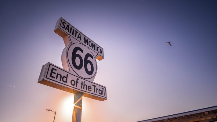
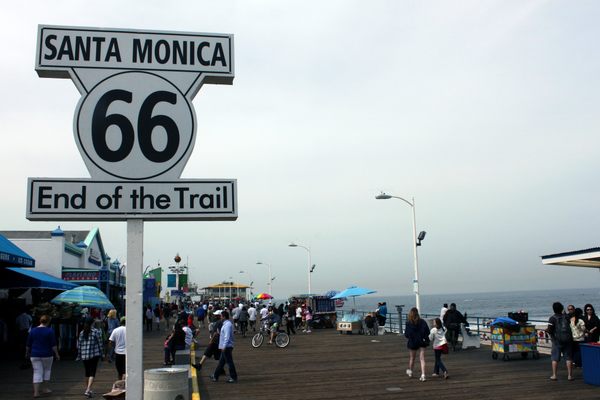
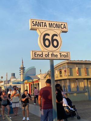
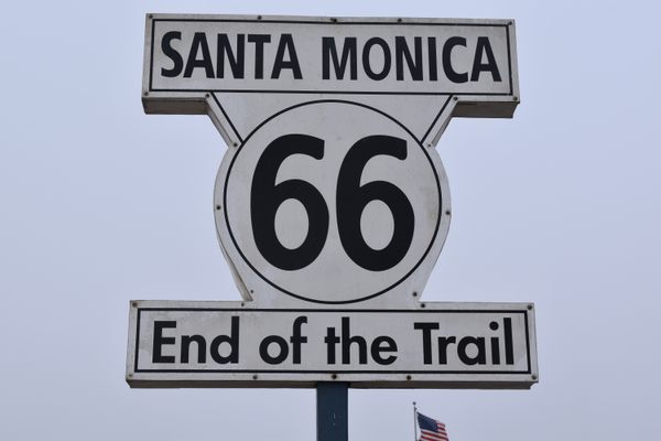
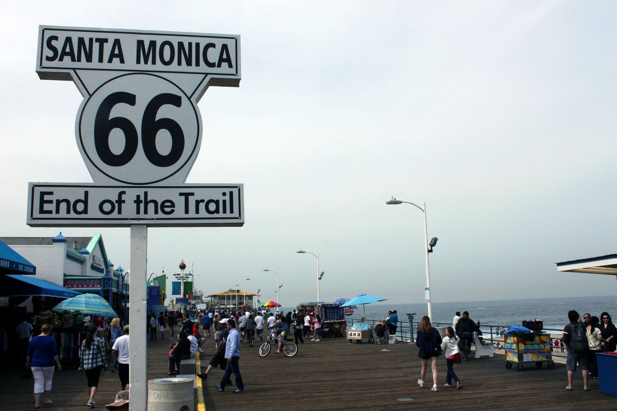
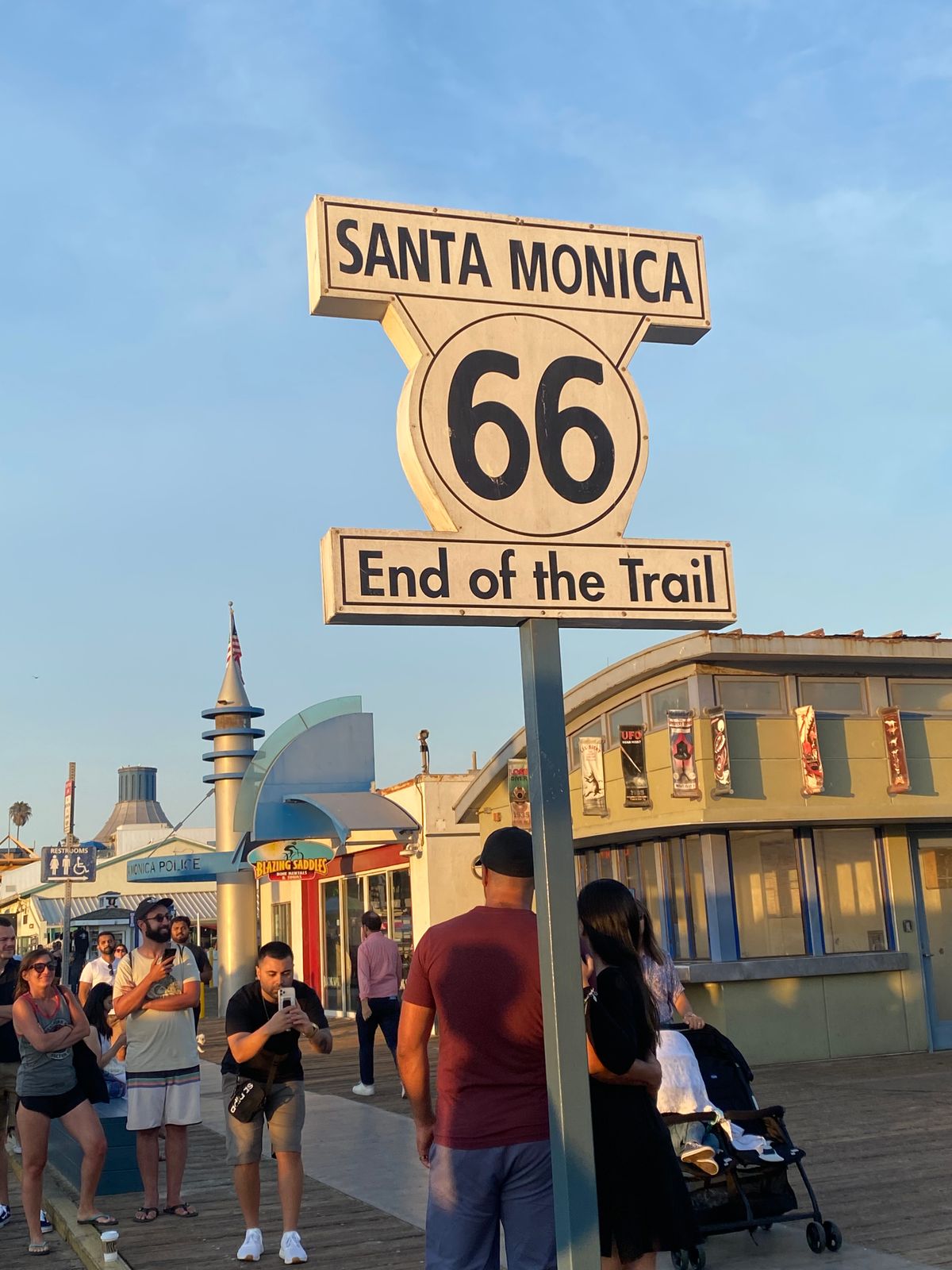
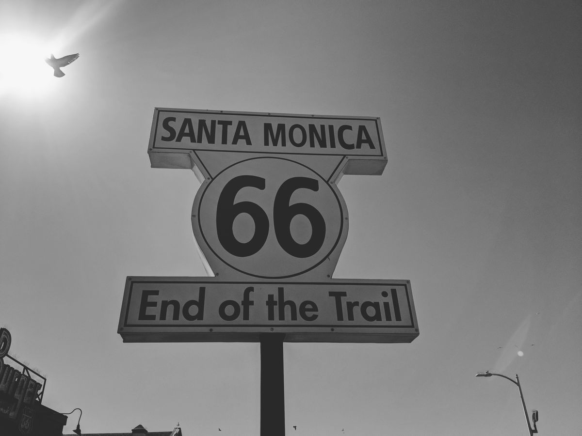
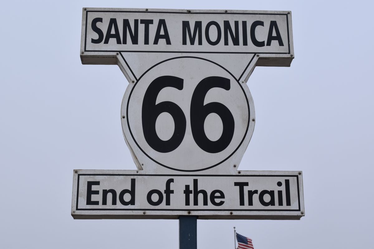
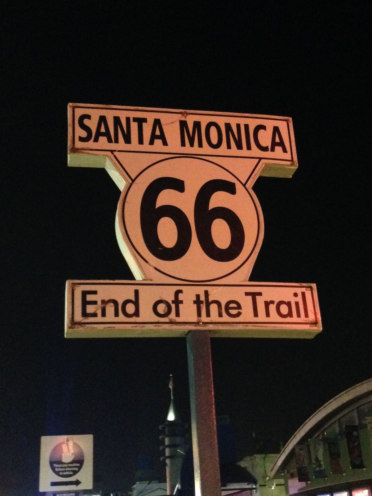
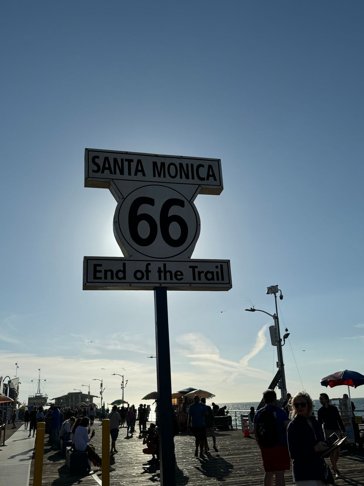
Many simply imagine it just runs right into the Pacific Ocean. And while it officially had to end at a highway intersection (originally with El Camino Real at 7th and Broadway in downtown LA and later at Lincoln and Olympic to reach Pacific Coast Highway without plunging over the edge of the Palisades), the travelers, many of whom came from far inland, kept going until they could touch the Pacific. In an effort to end the epic highway on a high note, Dan Rice of 66 to Cali (who bought the logo to raise awareness of 66 through a souvenir shirt company and had created temporary end signs several months earlier), the Route 66 Alliance and the Santa Monica Pier Restoration Corp. got together and on the 83rd anniversary of the highway's inception, dedicated the sign to mark the long tradition of journey's end at Santa Monica Pier.

Rumors had abounded about a movie prop sign left behind decades earlier, and an image surfaced purporting to show the original placed in Palisades Park.

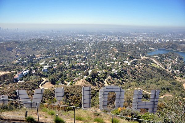
When the pier was recognized (US Highway 66 was officially decommissioned in 1985) as journey's end for Route 66, it only made sense for a replica of the long-missing sign to be erected  looking out over the Pacific in a symbolic display of what was the destination of so many travelers over the last century. Both sides are labeled "End" so that visitors ask "If it ends here, where does it go?". After all, 66 today is about the journey as much as the destination. 

It is now believed the rumors referred to the Will Rogers Highway placard at Santa Monica and Ocean Boulevards, which was placed as part of a promotional tour for The Story of Will Rogers (1952) that ran from Chicago to Santa Monica. The image that was the source of the sign's design is now believed to have been a photo collage of murky origin. 

Though it isn't an official highway sign — you don't want to run highway traffic into the ocean — the End of the Trail sign serves as an inspiration to thousands of visitors each year that 66 is more than a relic of what used to be; it's a journey through the heart of the country where the meals are homemade and the neon still glows that still kicks 35 years after being officially decommissioned.  

Related Tags

Monuments Marvelous Maps And Measures Architectural Oddities Signs Roads Roadside Attractions Architecture

Know Before You Go

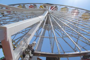
Drive west onto Colorado Ave. until it dead ends at Santa Monica Pier. Then walk straight out on the pier for 200 feet. The sign is just past the Bubba Gump shrimp franchise and the 66-to-Cali Route 66 info kiosk and just before the Playland arcade.

Community Contributors

Added By

Rachel

Edited By

66toCali, breaingram, parideodierna, starvira...

  • 66toCali
  • breaingram
  • parideodierna
  • starvira
  • Michelle Cassidy
  • Fred Cherrygarden
  • Julius Spada

Published

July 25, 2010

Edit this listing

Make an Edit
Add Photos
Sources
  • https://www.66tocali.com/ourstory
  • https://www.independent.co.uk/news/world/americas/end-of-the-road-for-route-66-1819937.html
  • Dan Rice, owner, 66-to-Cali, Inc.
  • Ian Bowen, highway historian and photographer, www.ianbowenstudio.com
  • "Finding the End of the Mother Road" by Scott Piotrowski (out of print)
Route 66 End of the Trail Sign
9 Santa Monica Pier
Santa Monica, California, 90401
United States
34.009372, -118.497336
Get Directions

Nearby Places

Pacific Park Solar Ferris Wheel

Santa Monica, California

miles away

Santa Monica Looff Hippodrome

Santa Monica, California

miles away

International Chess Park

Santa Monica, California

miles away

Explore the Destination Guide

Photo of Santa Monica

Santa Monica

California

Places 18
Stories 1

Related Stories and Lists

California, Through Your Eyes

nature

Sponsored by Visit California

The Most Interesting Camel in the World

military history

By Cara Giaimo

Related Places

  • The restroom at night.

    Gildeskål, Norway

    Uredd Rest Area (Ureddplassen)

    Norway has built what may be the world's most beautiful public toilet.

  • The kiln.

    London, England

    'Potteries and Piggeries' Bottle Kiln

    A relic from one of London's worst 19th-century slums.

  • Cumberland, Maryland

    LaVale Toll Gate House

    Maryland's first (and last standing) toll house on America's first federal road established the state as the "Gateway to the West."

  • Bedford, Pennsylvania

    Koontz Coffee Pot

    This titanic java kettle is one of the many kitschy landmarks located along America's OTHER famous highway.

  • Downtown Tinseltown

    Los Angeles, California

    Hollywood Sign

    Hollywood's most famous landmark, the "temporary" sign that has stood for decades longer than intended.

  • The pack of life-sized fiberglass animals.

    Hong Kong

    Noah's Ark, Hong Kong

    A biblically accurate ark located beneath a Hong Kong bridge is fun for the whole Christian family.

  • Drumheller, Alberta

    The World's Largest Dinosaur

    As if T-rex wasn't big enough, this Canadian monument is four times larger than the real thing.

  • Petrópolis, Brazil

    Belvedere do Grinfo

    This spaceship-like structure was once a popular roadside restaurant.

Aerial image of Vietnam, displaying the picturesque rice terraces, characterized by their layered, verdant fields.
Atlas Obscura Membership

Become an Atlas Obscura Member


Join our community of curious explorers.

Become a Member

Get Our Email Newsletter

Follow Us

Facebook YouTube TikTok Instagram Pinterest RSS Feed

Get the app

Download the App
Download on the Apple App Store Get it on Google Play
  • All Places
  • Latest Places
  • Most Popular
  • Places to Eat
  • Random
  • Nearby
  • Add a Place
  • Stories
  • Food & Drink
  • Itineraries
  • Lists
  • Video
  • Podcast
  • Newsletters
  • All Trips
  • Family Trip
  • Food & Drink
  • History & Culture
  • Wildlife & Nature
  • FAQ
  • Membership
  • Feedback & Ideas
  • Community Guidelines
  • Product Blog
  • Unique Gifts
  • Work With Us
  • About
  • FAQ
  • Advertise With Us
  • Advertising Guidelines
  • Privacy Policy
  • Cookie Policy
  • Terms of Use
Atlas Obscura

© 2025 Atlas Obscura. All Rights Reserved.