


About
Few people that pass through Portslade, even locals, notice this important piece of local history located alongside a busy road.
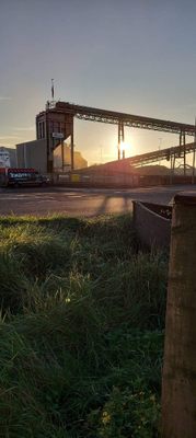
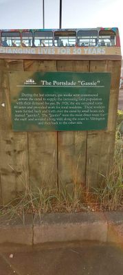
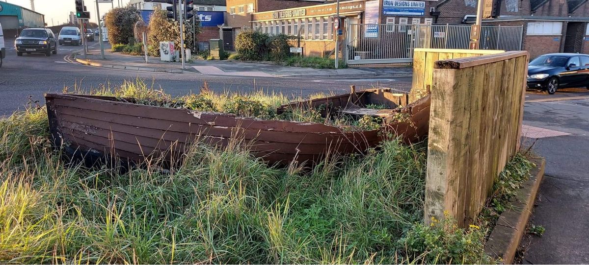
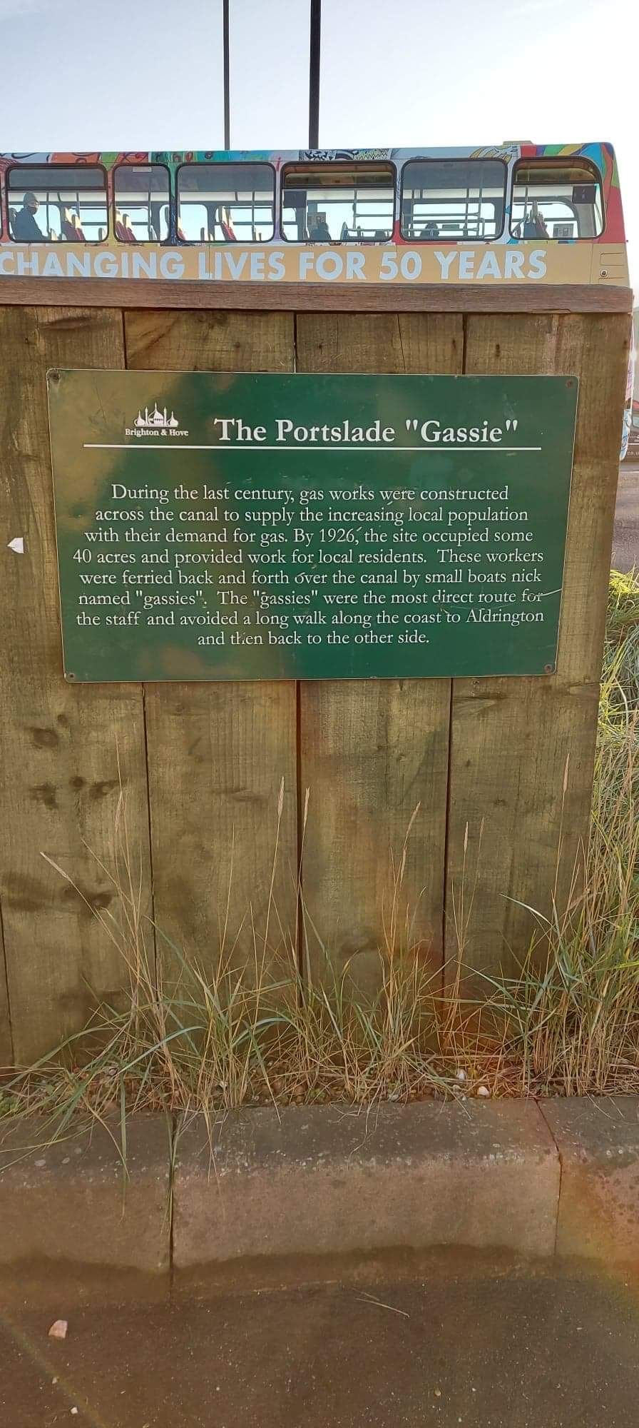
On the corner of Church Road and Wellington Road is a small, run-down wooden "gassie" boat covered in weeds. During the 20th-century, gas works were constructed across the canal, now Shoreham Harbour, to supply the increasing local population with their demand for gas.
By 1926, the site occupied some 40 acres and provided work for local residents. These residents were ferried across the canal in small "gassie" boats, such as the one tucked away in the weeds. These boats saved people time by providing them with a direct route across the canal, rather than the long walk along the coast to Aldrington.
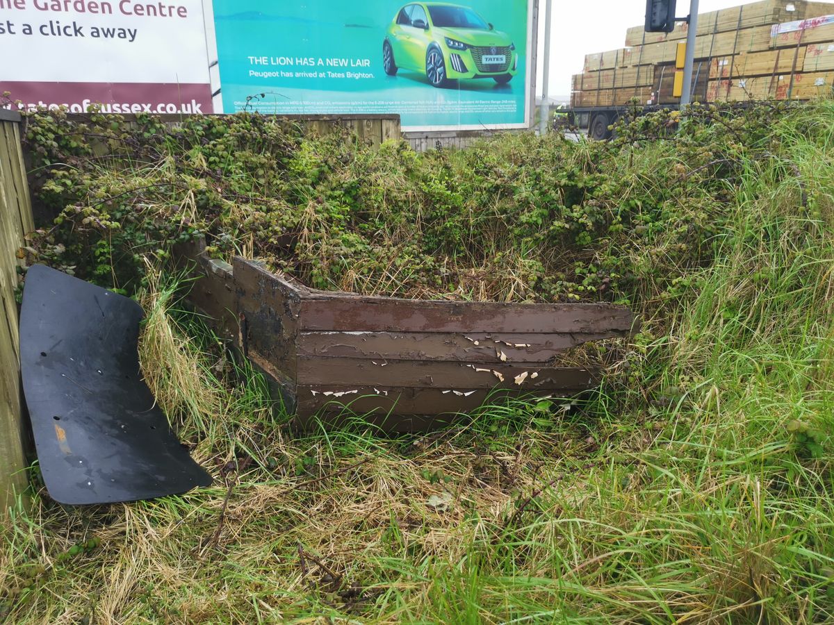
Update as of January 2023: Unfortunately, the boat has sunk even further into neglect in its desolate location alongside modern heavy industry, and it is hard to make out amongst the grass and brambles that now largely cover it.
Related Tags
Know Before You Go
On the corner of Church Road and Wellington Road, the nearest postcode is BN41 1DZ, which takes you to Portslade Studios, less than a minute walk from the boat.
Walking along Shoreham Harbour to Carats Cafe Bar and the beach on a nice day is also recommended.
Published
December 24, 2020