Trips Places Foods Stories Newsletters

Take your next trip with Atlas Obscura!

Our small-group adventures are inspired by our Atlas of the world's most fascinating places, the stories behind them, and the people who bring them to life.

Visit Adventures
Trips Highlight
Central Asia yurt night stars
Uzbekistan • 15 days, 14 nights
Central Asia Road Trip: Backroads & Bazaars
from
Caucasus - Geghard Monastery, Armenia
Armenia • 15 days, 14 nights
Caucasus Road Trip: Azerbaijan, Georgia & Armenia
from
View all trips
Top Destinations
Latest Places
Most Popular Places Random Place Lists Itineraries
Add a Place
Download the App
Top Destinations
View All Destinations »

Countries

  • Australia
  • Canada
  • China
  • France
  • Germany
  • India
  • Italy
  • Japan

Cities

  • Amsterdam
  • Barcelona
  • Beijing
  • Berlin
  • Boston
  • Budapest
  • Chicago
  • London
  • Los Angeles
  • Mexico City
  • Montreal
  • Moscow
  • New Orleans
  • New York City
  • Paris
  • Philadelphia
  • Rome
  • San Francisco
  • Seattle
  • Stockholm
  • Tokyo
  • Toronto
  • Vienna
  • Washington, D.C.
Latest Places
View All Places »
Midas Tümülüsü (Tumulus MM)
The Devil's Column
Weightlifting Hall of Fame
The khao soi at Gedhawa comes with a rich, coconutty broth.
Gedhawa
Latest Places to Eat & Drink
View All Places to Eat »
The khao soi at Gedhawa comes with a rich, coconutty broth.
Gedhawa
At Nai Mong Hoi Thod, the oyster omelet is worth waiting for.
Nai Mong Hoi Thod
In this deceptively simple dish, top-quality ingredients are paramount.
Kor Panich
Customize your bowl with sliced pork, pork balls, fish cake, and offal.
Rung Rueang
Pasties are an Upper Michigan tradition dating back to mining days.
Lehto’s Pasties
Recent Stories
All Stories Video Podcast
Most Recent Stories
View All Stories »
For Aguilar-Carrasco, nature is a powerful reminder of the interconnectedness of all life.
How Can National Parks Be Made Accessible to All? AO Wants to Know.
2 days ago
Podcast: Finding ‘The Great Gatsby’ in Louisville
3 days ago
Here’s which treats you can safely lug home without risking a fine.
Dear Atlas: What International Food Can I Legally Bring Into the U.S.?
4 days ago
Cely’s map is not only accurate, but captures the unique characteristics of Congaree’s trees and waterways.
How One Biologist Drew a Hyper-Accurate, Ranger-Approved Map of Congaree National Park
5 days ago

No search results found for
“”

Make sure words are spelled correctly.

Try searching for a travel destination.

Places near me Random place

Popular Destinations

  • Paris
  • London
  • New York
  • Berlin
  • Rome
  • Los Angeles
Trips Places Foods Stories Newsletters
Sign In Join
Places near me Random place
All Equatorial Guinea Malabo Pico Basilé
AO Edited

Pico Basilé

It's been nearly a century since this volcano, the tallest mountain in Equatorial Guinea, erupted.

Malabo, Equatorial Guinea

Added By
hutchinsonmoniquen
Email
Been Here
Want to go
Added to list
Pico Basilé   David Degner/Getty Images
Pico Basilé - On a clear day   hutchinsonmoniquen / Atlas Obscura User
The cloudy road up Pico   hutchinsonmoniquen / Atlas Obscura User
The road up Pico   hutchinsonmoniquen / Atlas Obscura User
Pico Basilé   hutchinsonmoniquen / Atlas Obscura User
Been Here
Want to go
Added to list

About

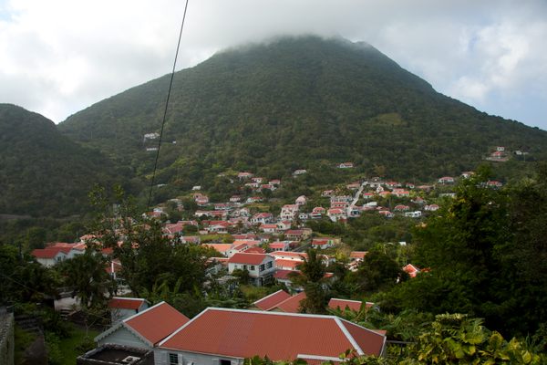
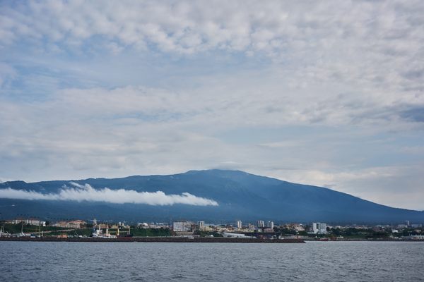
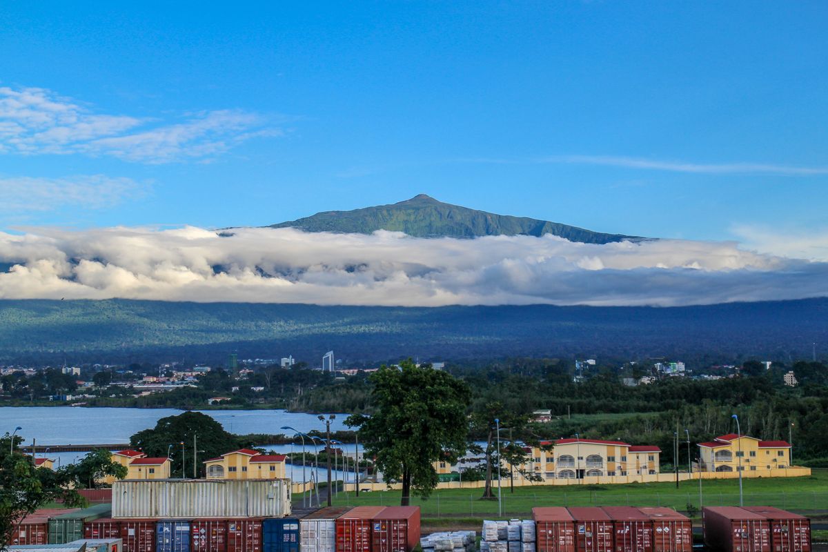
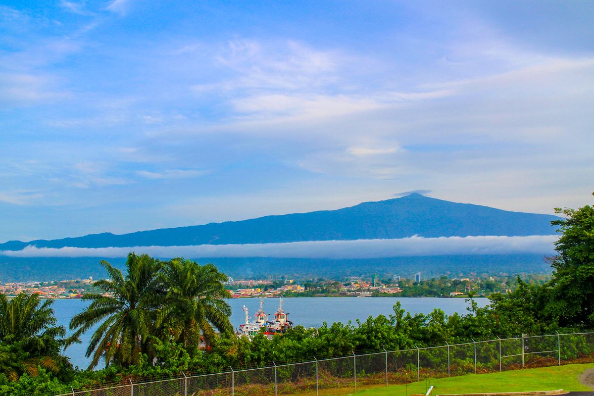
Standing 3,011 meters (9,878 feet) tall, Pico Basilé is the volcano king of Bioko Island. The summit of the shield volcano, which last erupted in 1923, is often hidden by clouds. You might catch a glimpse of its peak, but the full extent of its grandeur will only appear on a clear, cloudless day. And clear, cloudless days don’t tend to happen that much around here.

In the dry season, you’d be forgiven for forgetting that Pico Basilé is even there, lurking quietly behind a wall of dust. Late November to early March is when the annual phenomenon known as Harmattan occurs, in which sand from the Sahara Desert blows across the sea. It coats the island in dust so thick that visibility is reduced to not much more than 50 meters (160 feet). 

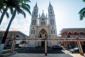
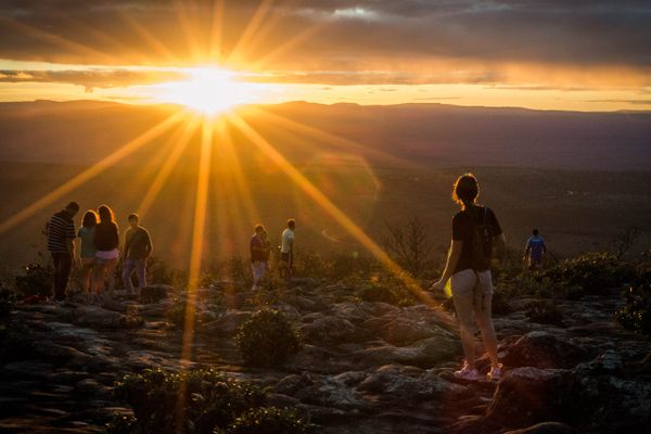
Your best bet for a full Pico viewing is after a rainstorm. As soon as the rain has washed away the clouds (or the dust), finally Pico will appear in all its glory, presiding majestically over Equatorial Guinea's capital city of Malabo. 

Pico Basilé is the tallest mountain in Equatorial Guinea. It’s a volcano. And it’s there. So of course you want to stand on the top. After all, isn’t that what mountains are for? If you want to reach the top, you have three options: Driving up the paved road in the comfort of an air-conditioned vehicle (preferably one with four-wheel drive); Cycling up on your fancy road bike; Walking up (but probably not back down).

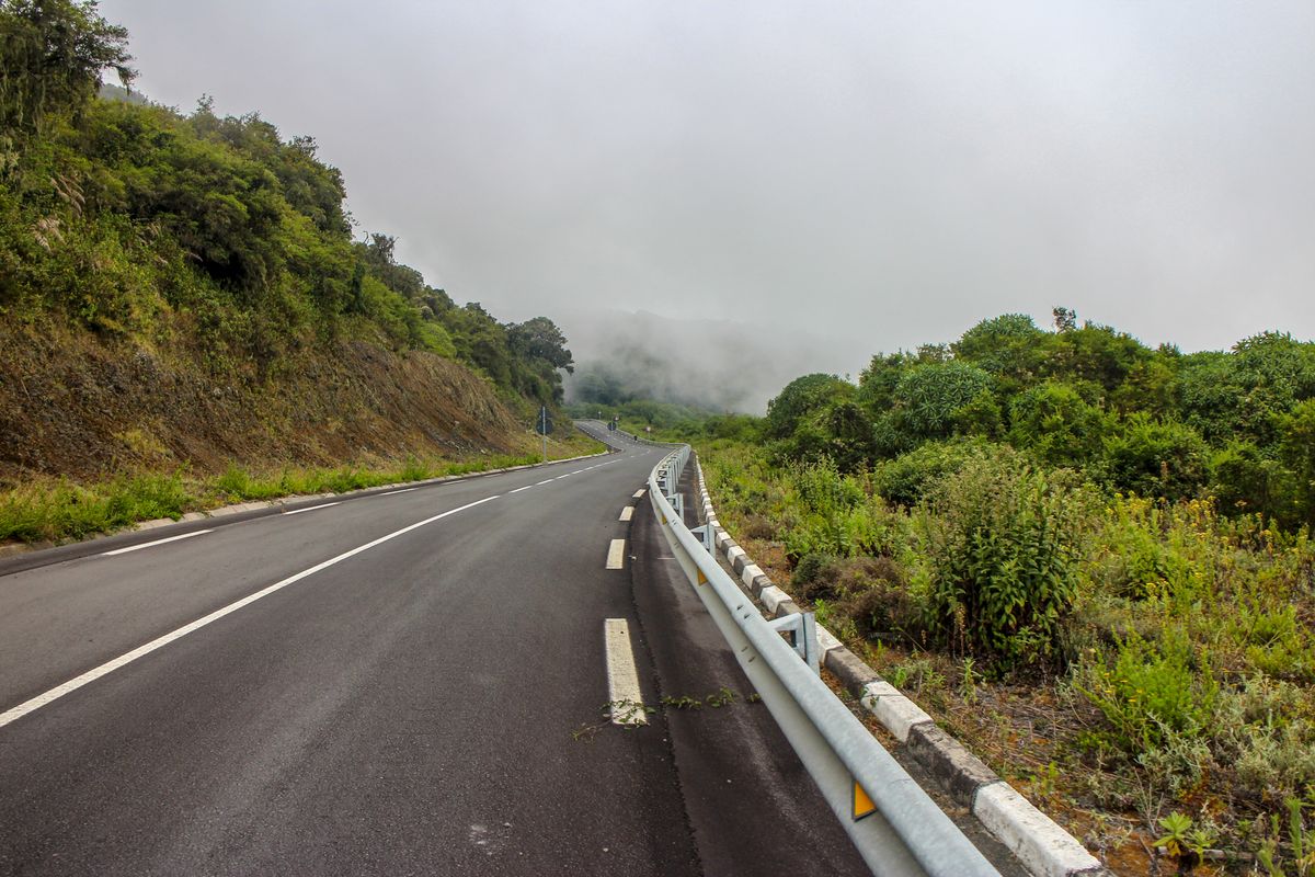
The road is asphalt and surprisingly well-maintained, but it is, horrendously steep. Don’t be fooled by those 10 percent gradient road signs. If you’re driving, make sure your driver knows how to drive a stick and is comfortably staying in first gear—especially on the way back down.

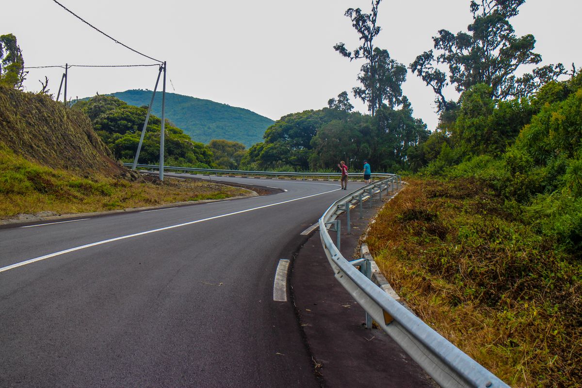
The fact that the road is well-maintained, and not heavily trafficked, can also make it an enticing challenge for keen cyclists. But again with the steepness. Even the most experienced hill-climbing cyclists will find they need to step off and walk in certain sections. 

If you choose to walk, remember that this road was made for vehicles, not hiking. You will be walking 30 kilometers, straight up. And there aren’t a lot of views along the way. And there is certainly no guarantee of a view at the top. (You might just find yourself surrounded by a chilly cloud.)

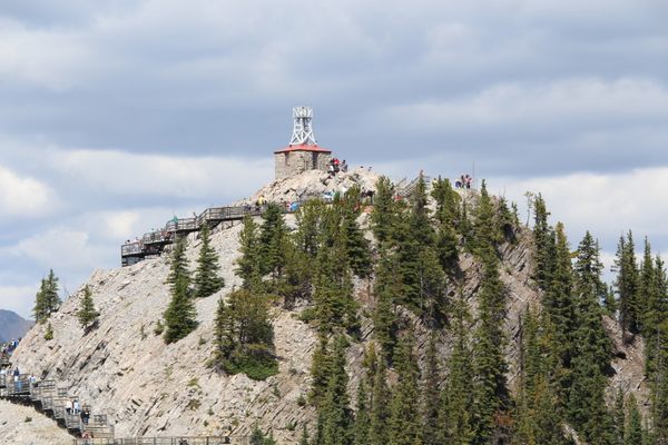
Let’s be frank—it’s likely that you won’t see much more than a telecommunications tower and a couple of security guards at the top. But remember—it’s about the journey, not the destination! Right? Or you could just wait for a rainstorm and admire the view from sea level.

Related Tags

National Parks Volcanoes Mountains

Know Before You Go

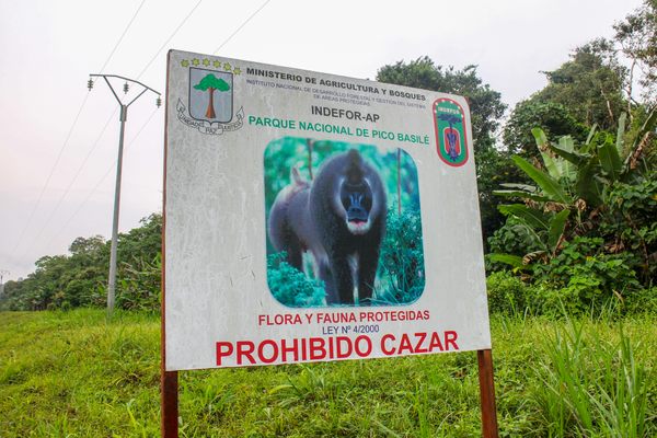
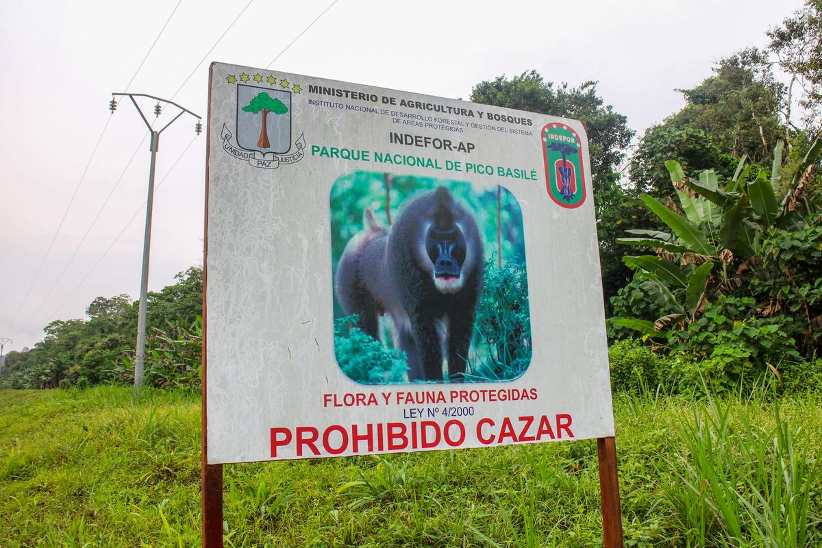
As with most tourist attractions in EG, you will need a permit. You need to apply, pay for it and receive a copy ahead of time.

The road is about 30km up. If driving, make sure your driver is comfortable with being in first gear and can recognize the smell of burning brake pads.

If you’re walking up, arrange a ride for the trip down. Walking 30km straight up asphalt takes about 6 hours and it hurts. It’s not worth walking back down. Take plenty of water and snacks. A support vehicle is a good idea if you can arrange it.

Take a sweatshirt or jacket for the top. Don’t be deceived by the humidity down below. It’s chilly up there.

The security guards at the peak may want to see your permit. They also appreciate token gifts like soft drinks, etc. Their shifts up there are long.

Community Contributors

Added By

hutchinsonmoniquen

Edited By

Michelle Cassidy

  • Michelle Cassidy

Published

May 18, 2022

Edit this listing

Make an Edit
Add Photos
Sources
  • https://trek.zone/en/equatorial-guinea/places/289409/pico-basile-national-park-bioko
Pico Basilé
Malabo
Equatorial Guinea
3.589666, 8.759131

Nearby Places

Catedral de Santa Isabel

Malabo, Equatorial Guinea

miles away

Playa de Arena Blanca

Luba, Equatorial Guinea

miles away

Ureka

San Antonio de Ureca, Equatorial Guinea

miles away

Explore the Destination Guide

Photo of Malabo

Malabo

Equatorial Guinea

Places 2

Nearby Places

Catedral de Santa Isabel

Malabo, Equatorial Guinea

miles away

Playa de Arena Blanca

Luba, Equatorial Guinea

miles away

Ureka

San Antonio de Ureca, Equatorial Guinea

miles away

Explore the Destination Guide

Photo of Malabo

Malabo

Equatorial Guinea

Places 2

Related Places

  • View over Windwardside and Mt Scenery on Saba island.

    Saba, Caribbean Netherlands

    Mount Scenery

    The highest point in the Kingdom of the Netherlands is on a remote Caribbean island atop a dormant volcano.

  • Aktau Mountains

    Kazakhstan

    Aktau Mountains

    These rugged, color-stained mountains hold the secrets of the Kazakh desert.

  • The creek lays at the feet of a series of dramatic sand dunes.

    Alamosa, Colorado

    Medano Creek

    A picturesque (all-natural!) beach in a landlocked state.

  • Sunset at Morro do Pai Inácio

    Palmeiras, Brazil

    Morro do Pai Inácio

    This peak in Chapada Diamantina National Park offers the most stunning sunsets.

  • Sulphur Mountain Cosmic Ray Station.

    Banff, Alberta

    Sulphur Mountain Cosmic Ray Station

    Since its original beginnings as a weather observatory mountaintop, this facility played an instrumental role in gathering atmospheric data for almost 100 years.

  • Winona, Missouri

    Rocky Falls

    A 40-foot waterfall flows into this unique natural swimming hole.

  • The summit of Mt. Katmai, a volcano six miles away from Novarupta, collapsed when the nearby eruption drained its magma chamber.

    King Salmon, Alaska

    Valley of 10,000 Smokes

    In 1912, this idyllic Alaska landscape was blown apart in the largest volcanic eruption of the 20th century.

  • Gros Piton

    Soufriere, Saint Lucia

    Gros Piton

    The larger of two volcanic peaks rising out of the crystalline waters of the Caribbean.

Aerial image of Vietnam, displaying the picturesque rice terraces, characterized by their layered, verdant fields.
Atlas Obscura Membership

Become an Atlas Obscura Member


Join our community of curious explorers.

Become a Member

Get Our Email Newsletter

Follow Us

Facebook YouTube TikTok Instagram Pinterest RSS Feed

Get the app

Download the App
Download on the Apple App Store Get it on Google Play
  • All Places
  • Latest Places
  • Most Popular
  • Places to Eat
  • Random
  • Nearby
  • Add a Place
  • Stories
  • Food & Drink
  • Itineraries
  • Lists
  • Video
  • Podcast
  • Newsletters
  • All Trips
  • Family Trip
  • Food & Drink
  • History & Culture
  • Wildlife & Nature
  • FAQ
  • Membership
  • Feedback & Ideas
  • Community Guidelines
  • Product Blog
  • Unique Gifts
  • Work With Us
  • About
  • FAQ
  • Advertise With Us
  • Advertising Guidelines
  • Privacy Policy
  • Cookie Policy
  • Terms of Use
Atlas Obscura

© 2025 Atlas Obscura. All Rights Reserved.