


About
In ancient Egypt, the behavior of the Nile could mean life or death each harvest season. So, long before the Aswan Dam was constructed to manage the flooding of the great river, Egyptians invented an instrument to measure the waters in order to predict the Nile’s behavior: the nilometer.
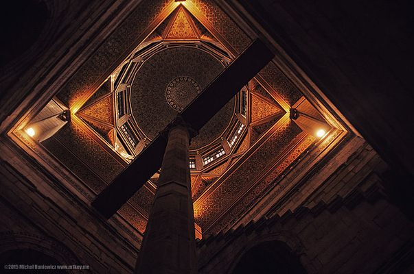
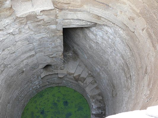
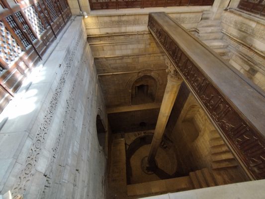
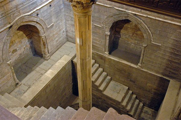
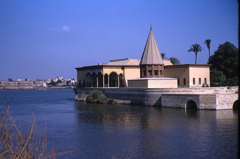
There were three kinds of nilometers, and examples of all three can still be seen around Egypt. The simplest was a tall column housed in a submerged stone structure called a stilling well. One of these nilometers can be seen on Rhoda (or Rawda) Island in Cairo, an octagonal marble column held in place by a wooden beam at the top that spans the width of the well. The stilling well included a staircase so that priests, who were in charge of monitoring the nilometers, could walk down and examine the column.
Nilometers were used for measuring water levels as early as 5,000 years ago. The nilometer on Rhoda Island dates back to 861, when it was built where an older nilometer had been, based on a design by Afraganus, a famous astronomer. The massive measuring stick had markings on it to indicate where the water level was at any given time, information the priests would use to determine what conditions the future held: drought, which would mean famine; desirable, which would mean just enough overflow to leave good soil for farming; or flood, which could be catastrophic.
Only priests and rulers, whether pharaohs or later, Roman or Arab leaders, were allowed to monitor the nilometers, and their ability to predict the behavior of the Nile was used to impress the common people. (And to determine how much money would be collected in taxes.) This is why so many nilometers were built in temples, where only priests would be able to access the mysterious instrument.
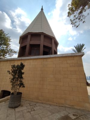
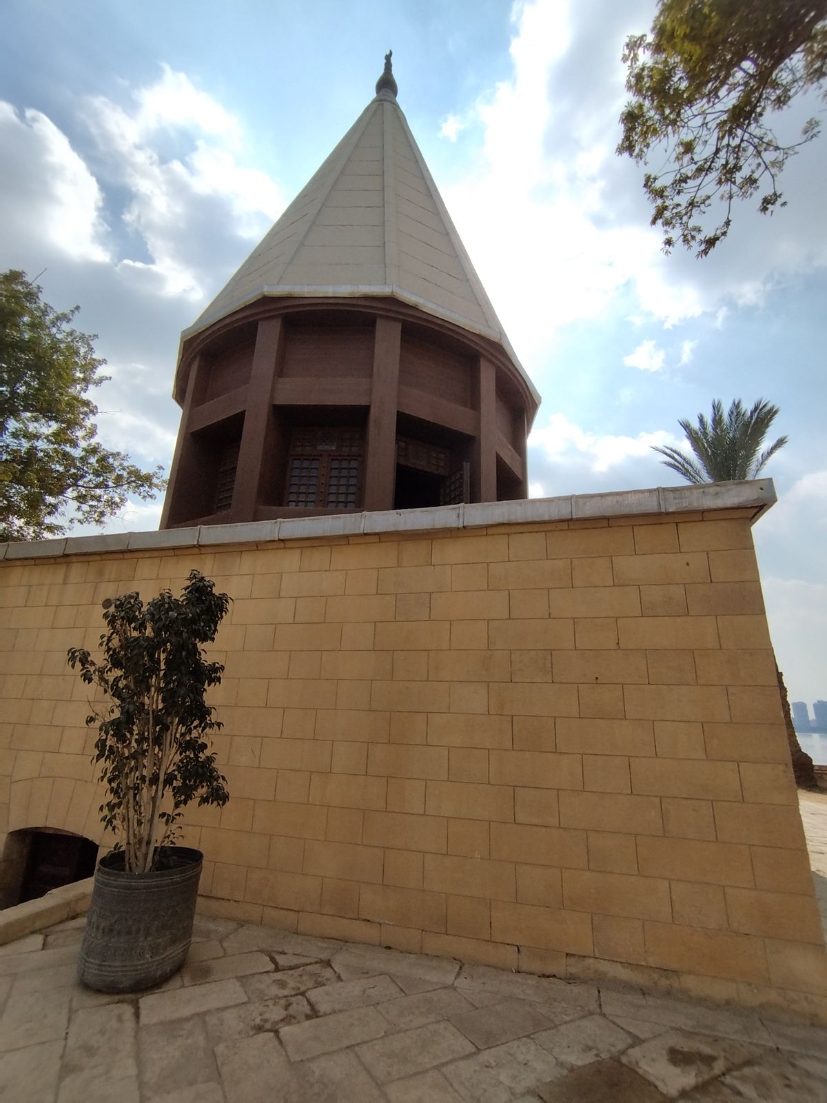
The nilometer on Rhoda Island is today housed in a modernized building. The conical roof replaced an older dome that was destroyed in 1825 during the French occupation. The interior is ornately carved, and three tunnels that once let water into the stilling well at different levels have been filled in, so visitors can walk all the way down.
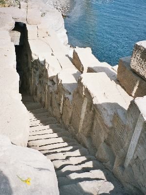
Another type of nilometer, like the one that can be seen on Elephantine Island in Aswan, had evenly spaced steps that lead straight down to the Nile, and indicator markings on the walls at different levels for each step. This one was often the first to indicate what conditions to expect, being located near Egypt’s southern border. The third kind, an example of which can be seen at Temple of Kom Ombo, a little further north, brought the water away from the Nile by way of a canal that deposited it into a cistern. And again, the indicating markers were carved into the wall, accessible by staircases for the priests and rulers who predicted the fate of the Egyptian crop.
Related Tags
Treasures of Egypt: Hidden Tombs, Ancient Pyramids & Old Cairo
Explore pyramids, tombs, and local cuisine with your Egyptologist guide.
Book NowPublished
May 9, 2017
Sources
- https://en.wikipedia.org/wiki/Nilometer
- http://www.messagetoeagle.com/5000-year-old-tradition-of-nilometer-water-measurement-device-from-pharaonic-times/
- http://www.sciencechannel.com/tv-shows/what-the-ancients-knew/videos/what-the-ancients-knew-i-shorts-nilometer/
- http://egypt.mrdonn.org/irrigation.html
- http://www.amusingplanet.com/2015/05/nilometer-ancient-structures-used-to.html
- http://www.waterhistory.org/histories/cairo/
- https://egyptvacationtours.com/2021/01/29/the-nilometer-in-rhoda-island/