


About
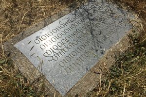
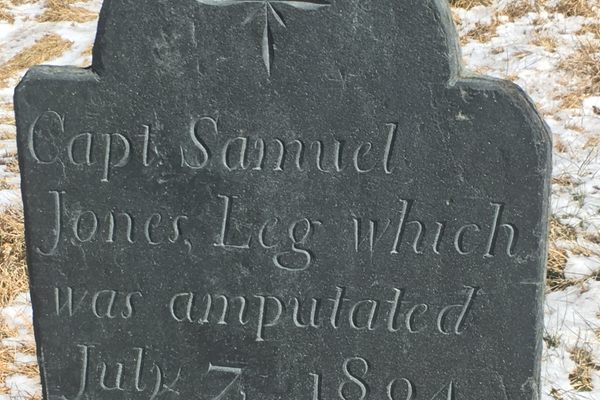
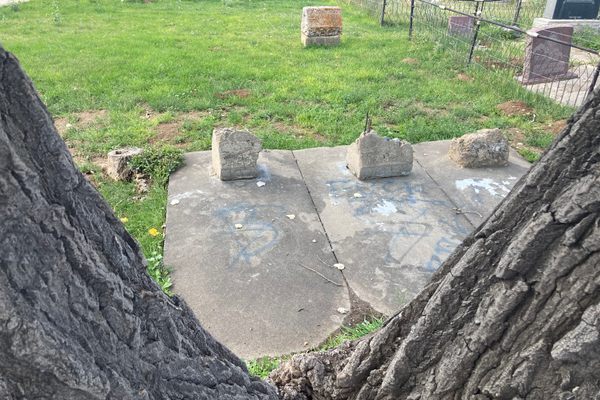
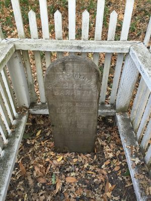
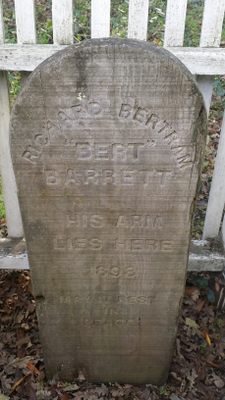
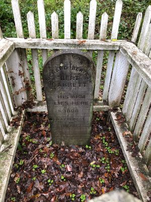
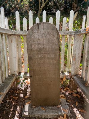
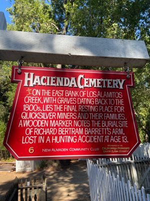
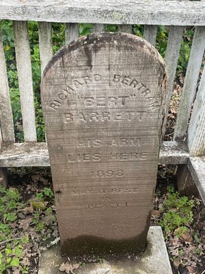
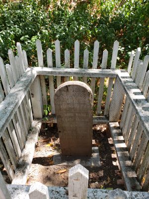
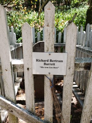
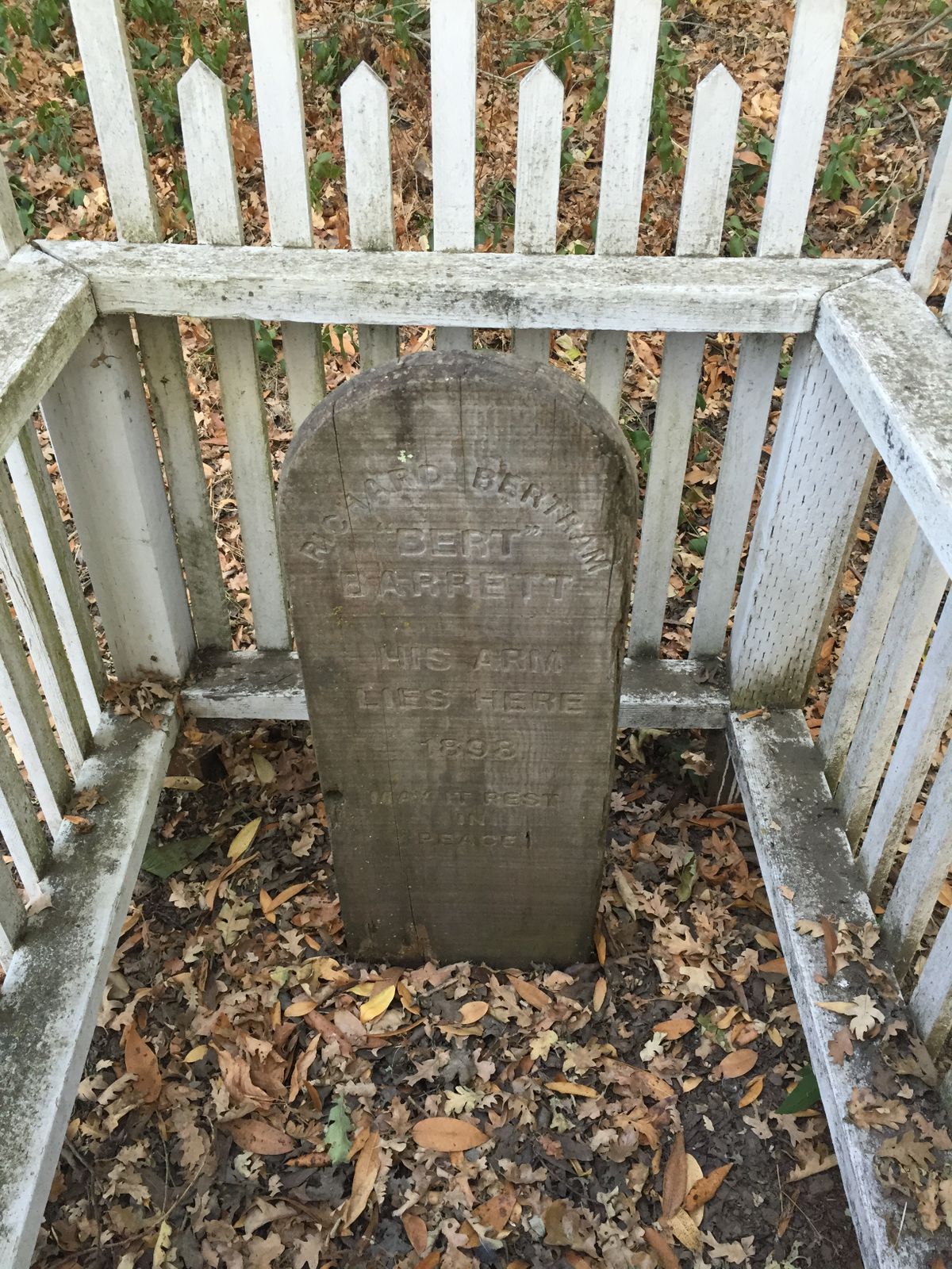
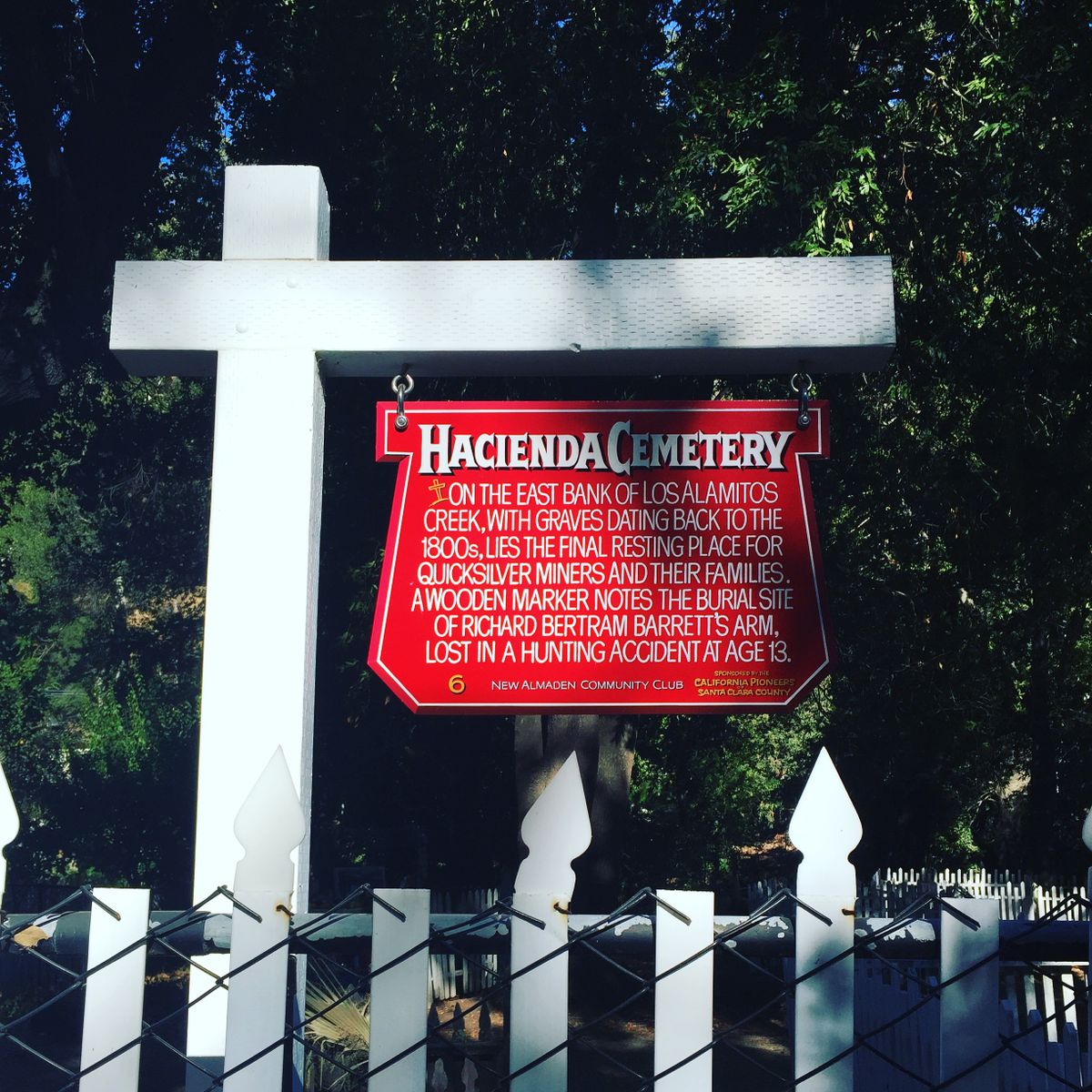
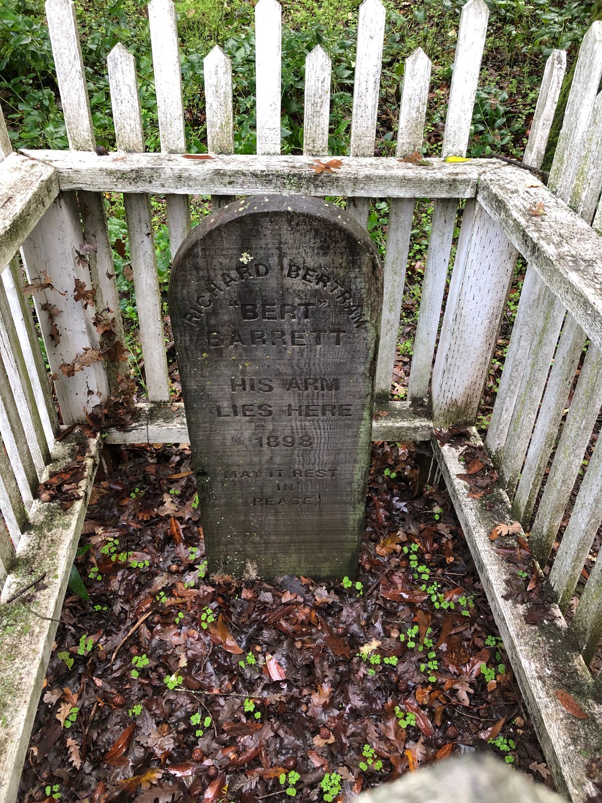
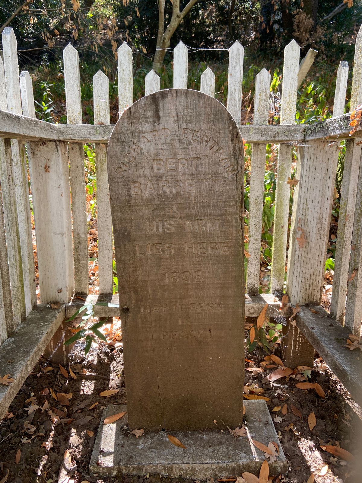
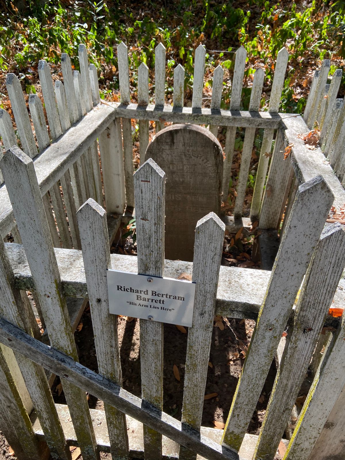
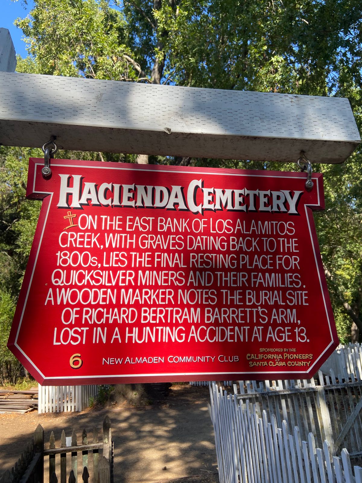
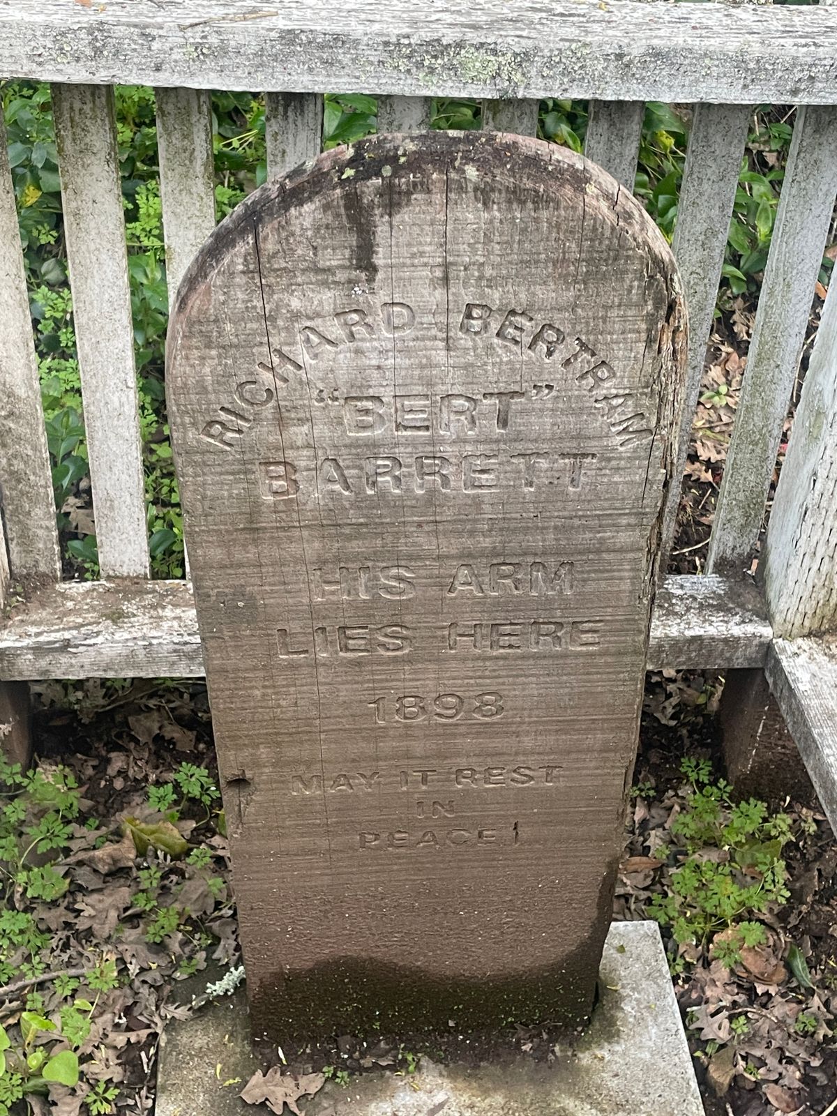
The most notable grave in San Jose's Hacienda Cemetery is not that of an entire person, but his limb. Specifically, the left arm of a man named Richard Bertram Barrett. While Barrett's left arm was buried here in 1898, the rest of him lived another 61 years and was buried elsewhere.
In 1898, when Bert Barrett was 13 years old, a shotgun blew off almost half of his left arm in a terrible hunting accident. In compliance with the laws of the time, he buried his severed appendage. The marker reads simply: “His arm lies here. May it rest in peace.” The rest of Bertram’s body is buried 11 miles away at Oak Hill Memorial Park, and his story is the source of local campfire tales.
After his amputated limb was interred at Hacienda Cemetery, the rest of Richard Bertram Barrett went on to live a very successful life. He went on to become the Chief of Sanitation for the Santa Clara County Health Department, and the road that bisects the cemetery in which his arm is buried is named for him. In 1959, he passed away at the ripe old age of 74. Though the man rests in peace, local legend tells that Bertram’s left arm comes alive on Halloween night to seek out the rest of him, buried 11 miles away from the verdant pioneer cemetery.
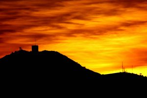
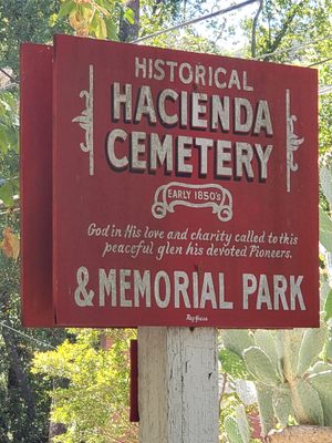
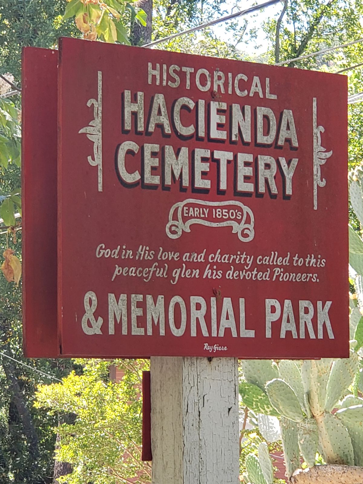
Hacienda Cemetery is situated in the historic San Jose community of New Almaden, located at the southern tip of the urban sprawl that today is Silicon Valley. While this community is part of present-day San Jose, it was once a bustling mining town in one of the wildest parts of the Wild West, where bandits, mountain lions, wildfire, and the constant dangers of mercury mining were typical of the area.
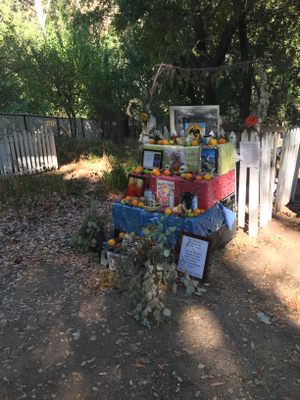
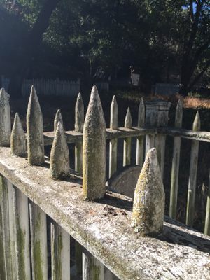
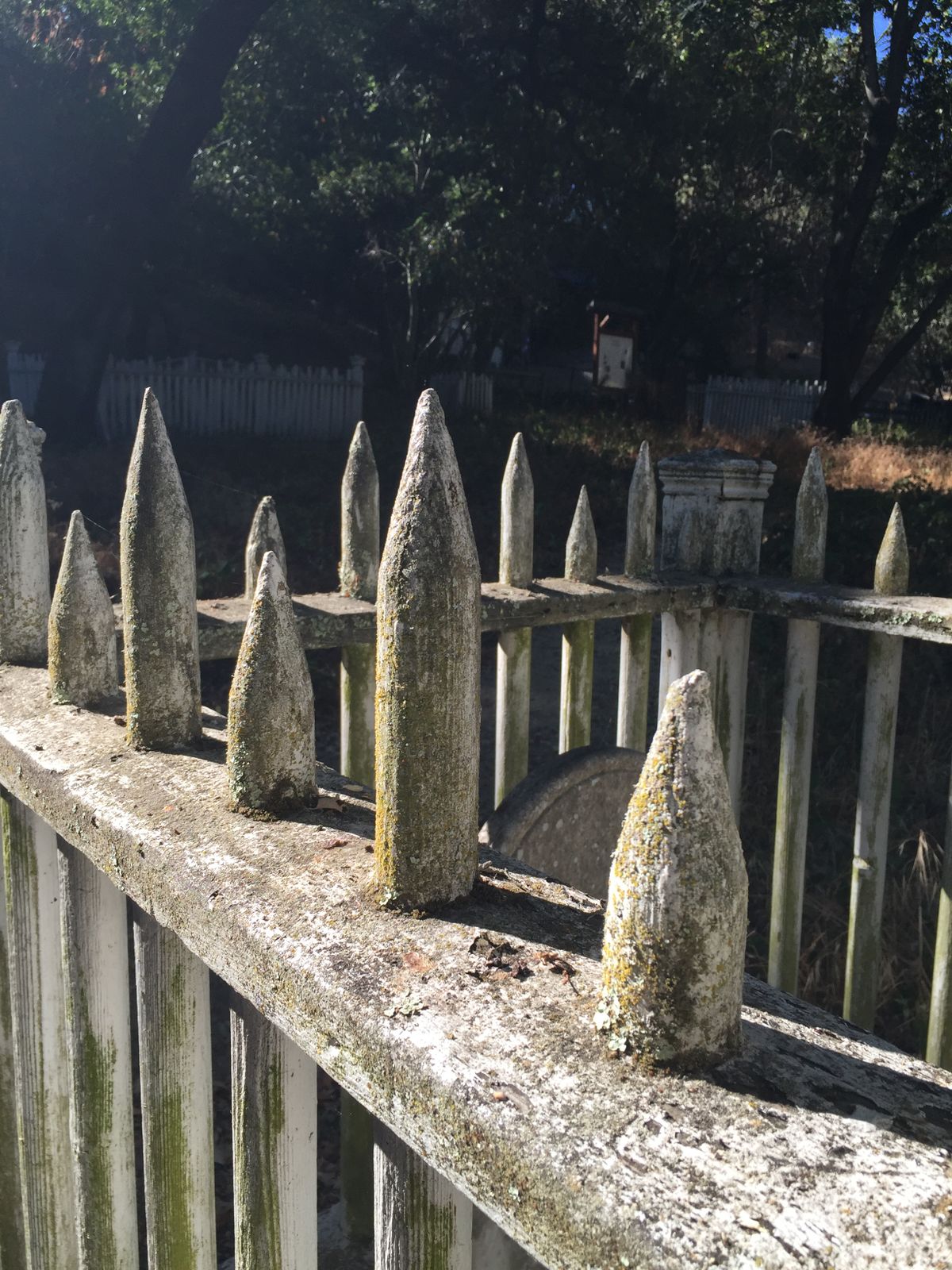
Hacienda holds the mortal remains of the New Almaden Quicksilver miners and their families who lived nearby from the 1850s to the 1920s. At one time, Almaden Quicksilver was the largest mercury mine in the world. Around 50 graves, both marked and unmarked, speck the wooded landscape. Many grave sites are marked with graying white picket fences.
Related Tags
Know Before You Go
Parking is sparse around Hacienda Cemetery, but some street parking is available. The grave is located in the southern (uphill) portion of the cemetery. Cemetery visitors can cross over the Arroyo de Los Alamitos Creek by bridge and check out the display of mining equipment and hiking trails at nearby Almaden Quicksilver County Park.
Community Contributors
Added By
Published
January 12, 2017