Trips Places Foods Stories Newsletters
Loading...
Loading...
Loading...
Loading...

No search results found for
“”

Make sure words are spelled correctly.

Try searching for a travel destination.

Places near me Random place

Popular Destinations

  • Paris
  • London
  • New York
  • Berlin
  • Rome
  • Los Angeles
Trips Places Foods Stories Newsletters
Sign In Join
Places near me Random place
All the United States Rhode Island Jamestown Fort Wetherill

Fort Wetherill

Abandoned Coast Artillery fort now serves as a graffiti canvas and sightseeing vantage point.

Jamestown, Rhode Island

Added By
adumont72
Email
Been Here
Want to go
Added to list
CAPTION
the entrance to the fort   amber dumont
overlooking the cliff behind the fort   amber dumont
1921 map of Fort Weatherill   Wikicommons
the overgrown tunnel leading from the fort to the cliffs.   amber dumont
view from the top   amber dumont
graffiti on the floor   amber dumont
more graffiti   amber dumont
cliffs behind the fort  
  BZEWE97 / Atlas Obscura User
  BZEWE97 / Atlas Obscura User
Main gun line 1970s   Unknown
WWII Barracks shortly before demolition in 1972   Unknown
Battery Crittenden   J Malcolm / Atlas Obscura User
Battery Varnum 1970s   Unknown
Barracks foundations 1970s   Unknown
Battery Wheaton before fill   Unknown
Interior of WWII barracks   Unknown
Aerial overview of the fort by the ocean   CruFro / Atlas Obscura User
  e1savage / Atlas Obscura User
  e1savage / Atlas Obscura User
  e1savage / Atlas Obscura User
  e1savage / Atlas Obscura User
  e1savage / Atlas Obscura User
  e1savage / Atlas Obscura User
  e1savage / Atlas Obscura User
  ickaimp / Atlas Obscura User
  missingfilm / Atlas Obscura User
  missingfilm / Atlas Obscura User
  TheKopasClan / Atlas Obscura User
  TheKopasClan / Atlas Obscura User
  TheKopasClan / Atlas Obscura User
  TheKopasClan / Atlas Obscura User
  TheKopasClan / Atlas Obscura User
Inside Fort Wetherill   jesshartleylowe / Atlas Obscura User
Old Window at Fort Wetherill   jesshartleylowe / Atlas Obscura User
uploading for my dad! taken 06/2007!  
  adriannezee / Atlas Obscura User
uploading for my dad! taken 06/2007!  
  BZEWE97 / Atlas Obscura User
  BZEWE97 / Atlas Obscura User
  BZEWE97 / Atlas Obscura User
  BZEWE97 / Atlas Obscura User
Been Here
Want to go
Added to list

About

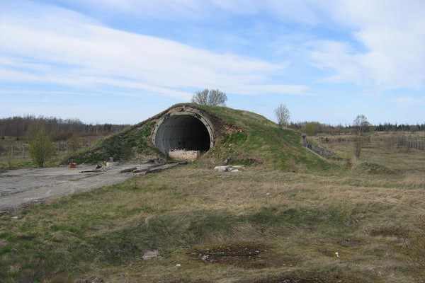
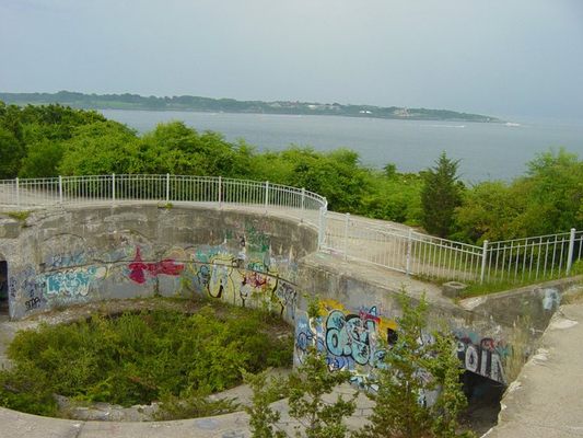
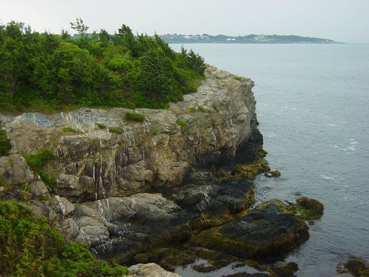
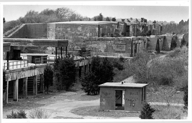
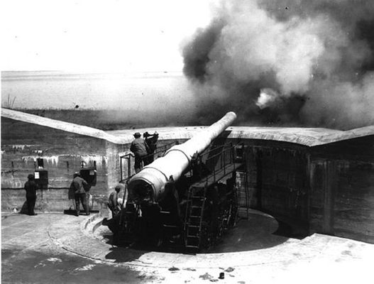
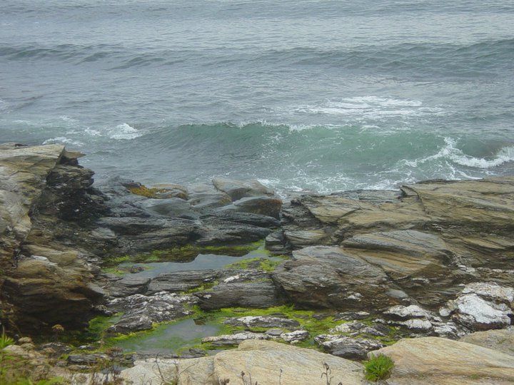
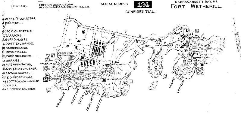
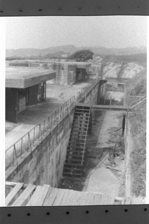
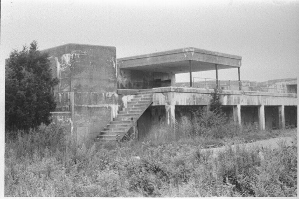
Overlooking the entrance to Narragansett Bay, Fort Wetherill was the perfect vantage point during the Revolutionary War. Formerly called Dumpling Rock, the fort was eventually named after Captain Alexander Macomb Wetherill, a Jamestown native who was killed in action during the Battle of San Juan Hill. Construction on the concrete bunkers started in 1898 and was completed by 1905.

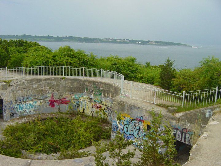
After the threat of WWII had passed, the U.S. military ceased operations here. Once a heavily armed and one of the best lines of defense for the coast of New England, the site remained abandoned for a quarter of a century.

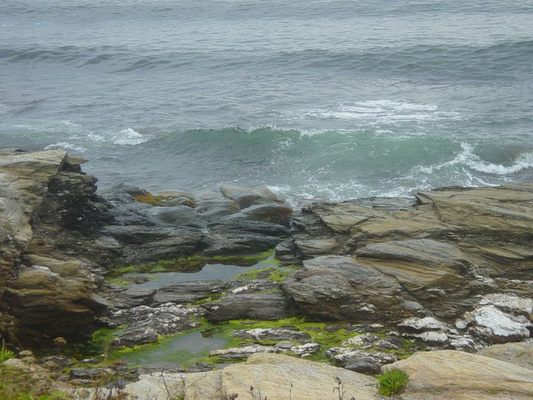
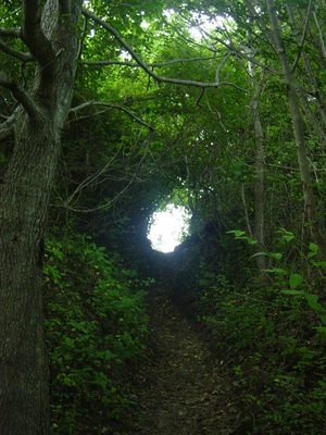
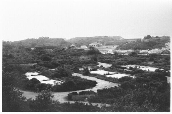
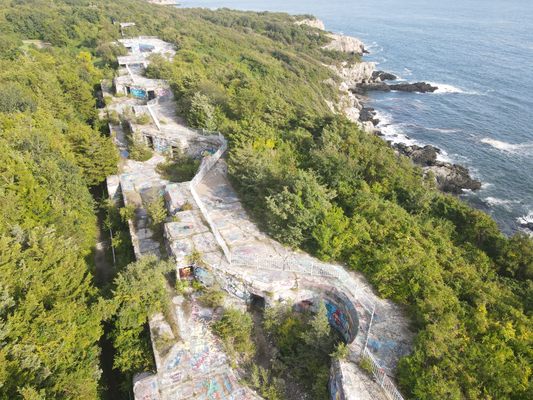
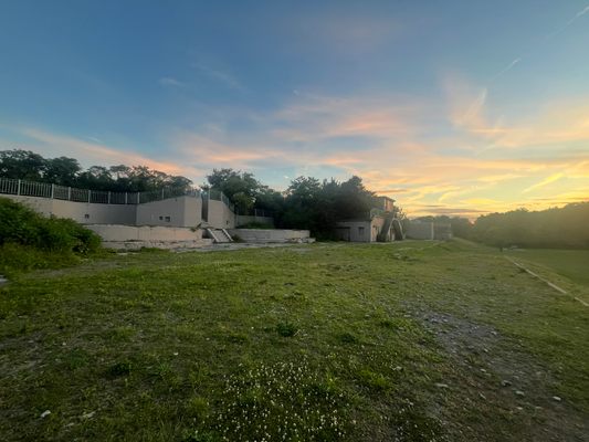
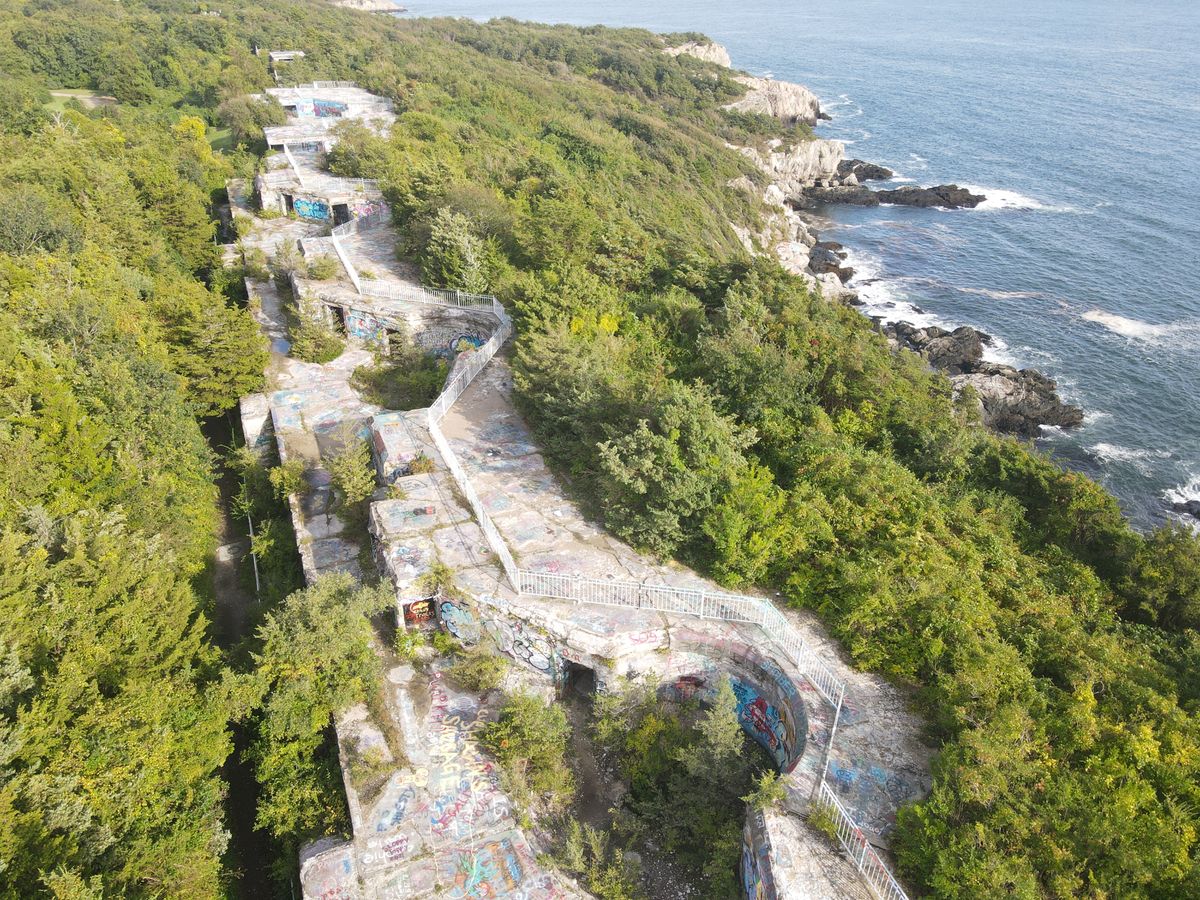
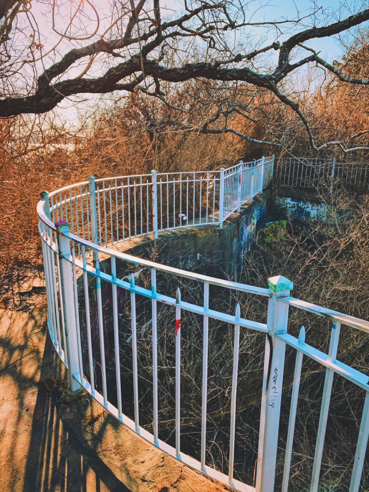
In 1972, the State of Rhode Island acquired the fort and reconfigured the site to support public use as a state park. Recreational uses include hiking trails along the coast, viewing of special events like firework displays and boat shows, and is a popular site for scuba diving.

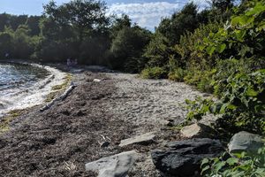
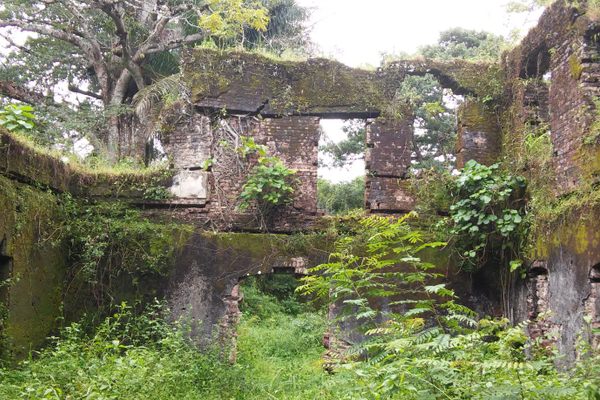
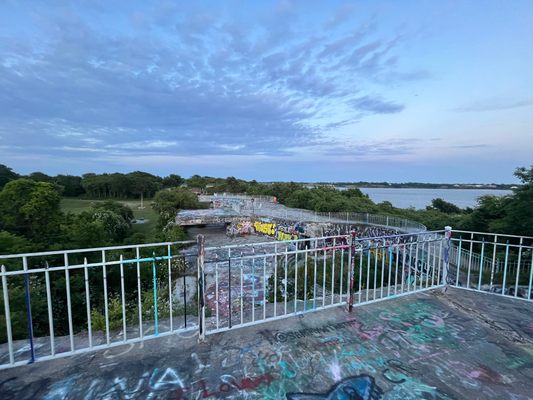
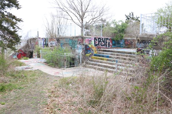
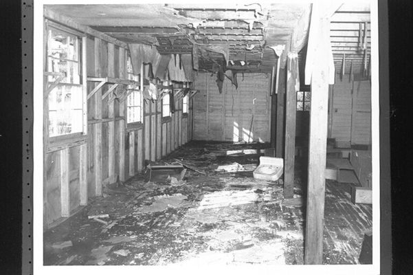
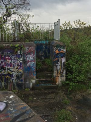
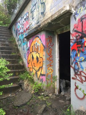
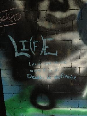
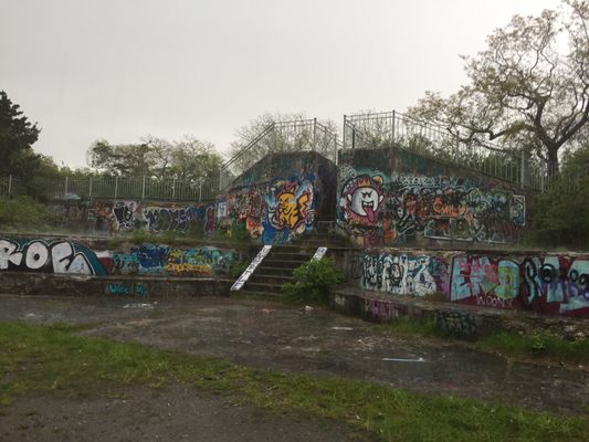
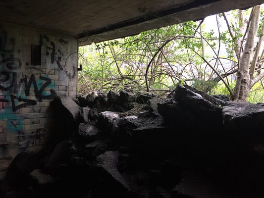
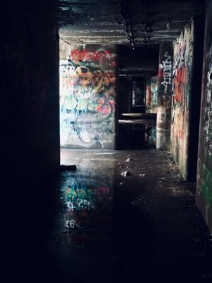
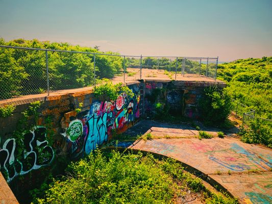
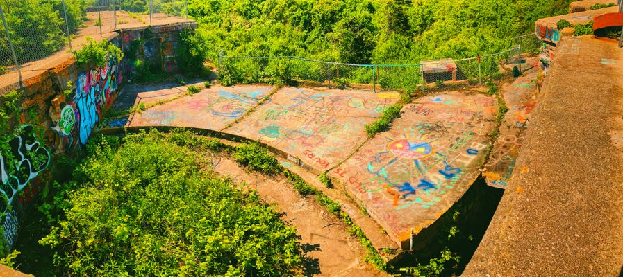
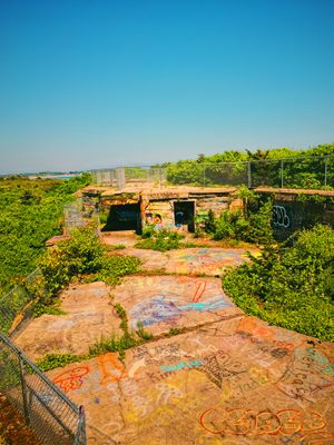
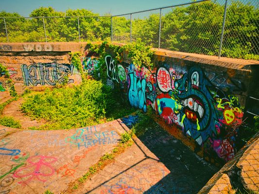
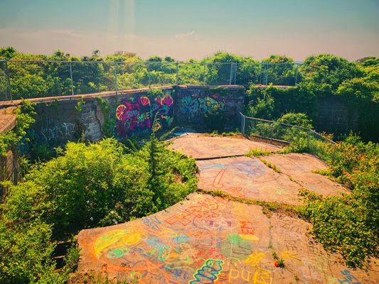
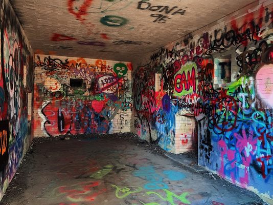
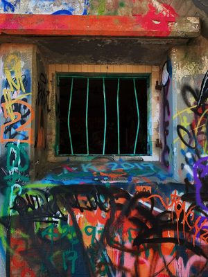
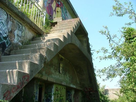
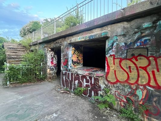
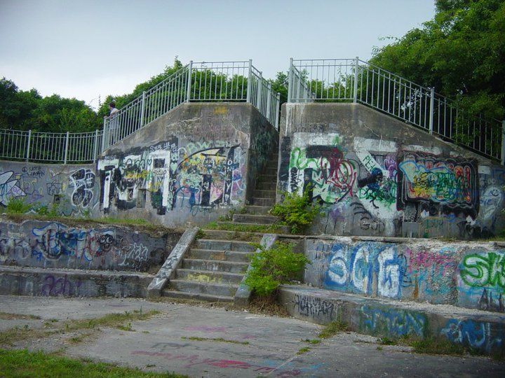
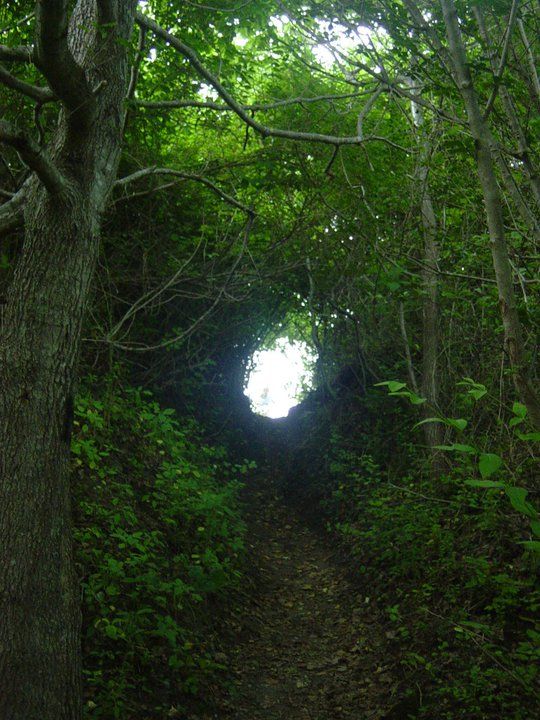
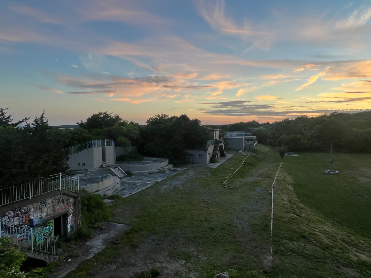
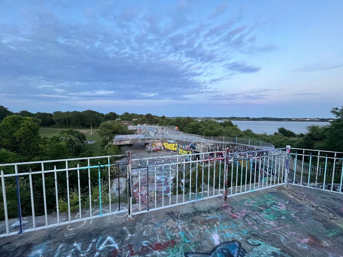
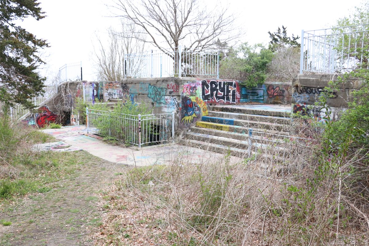
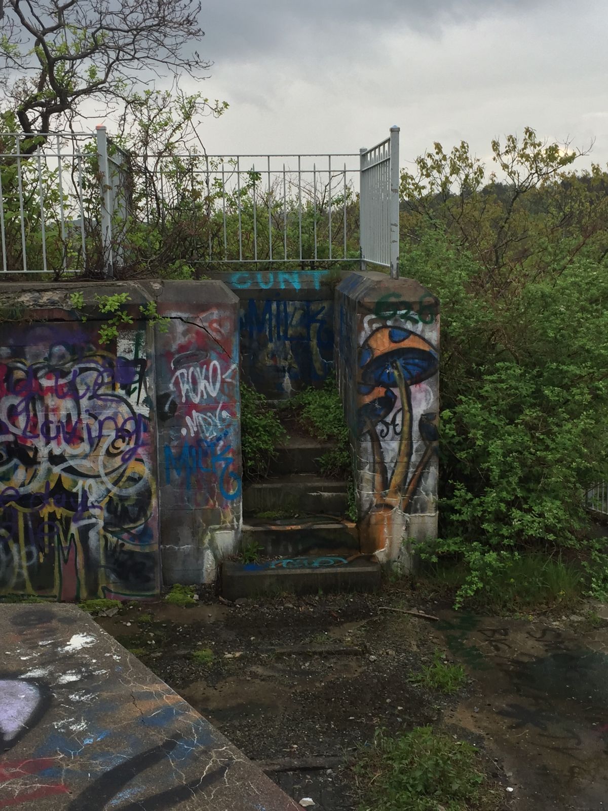
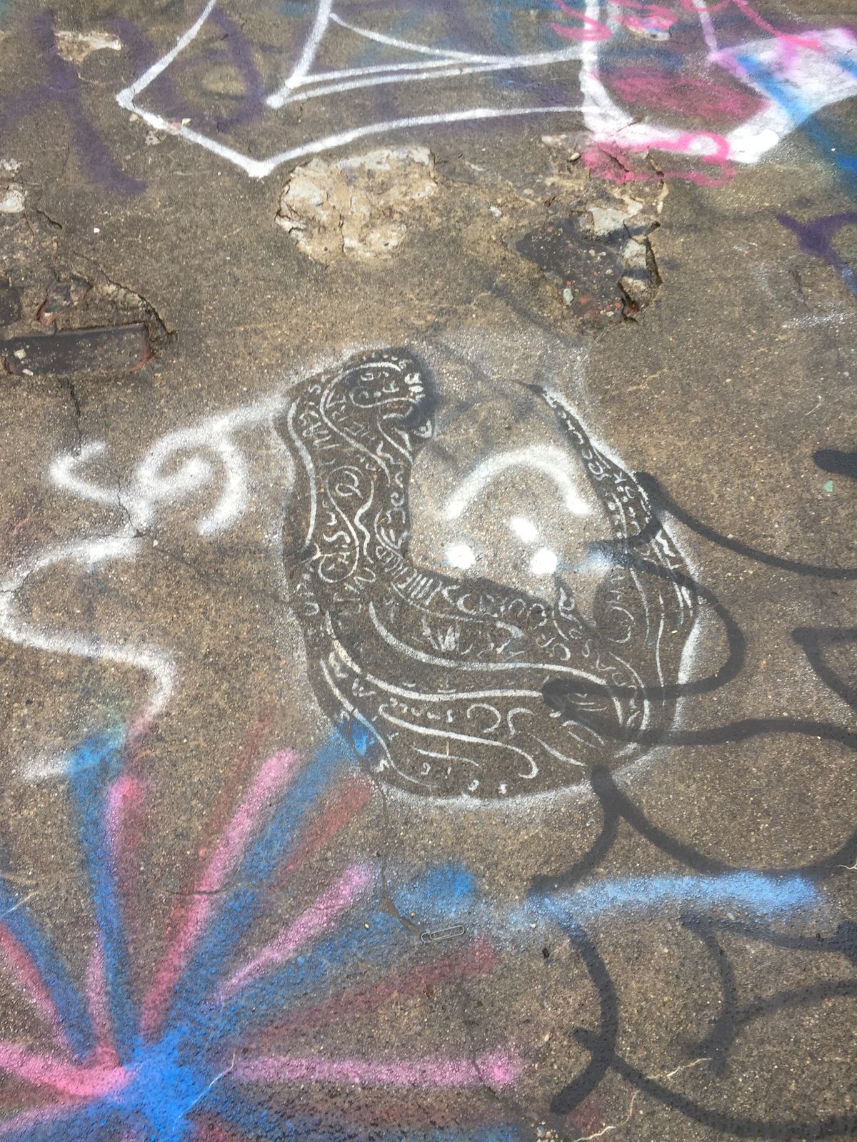
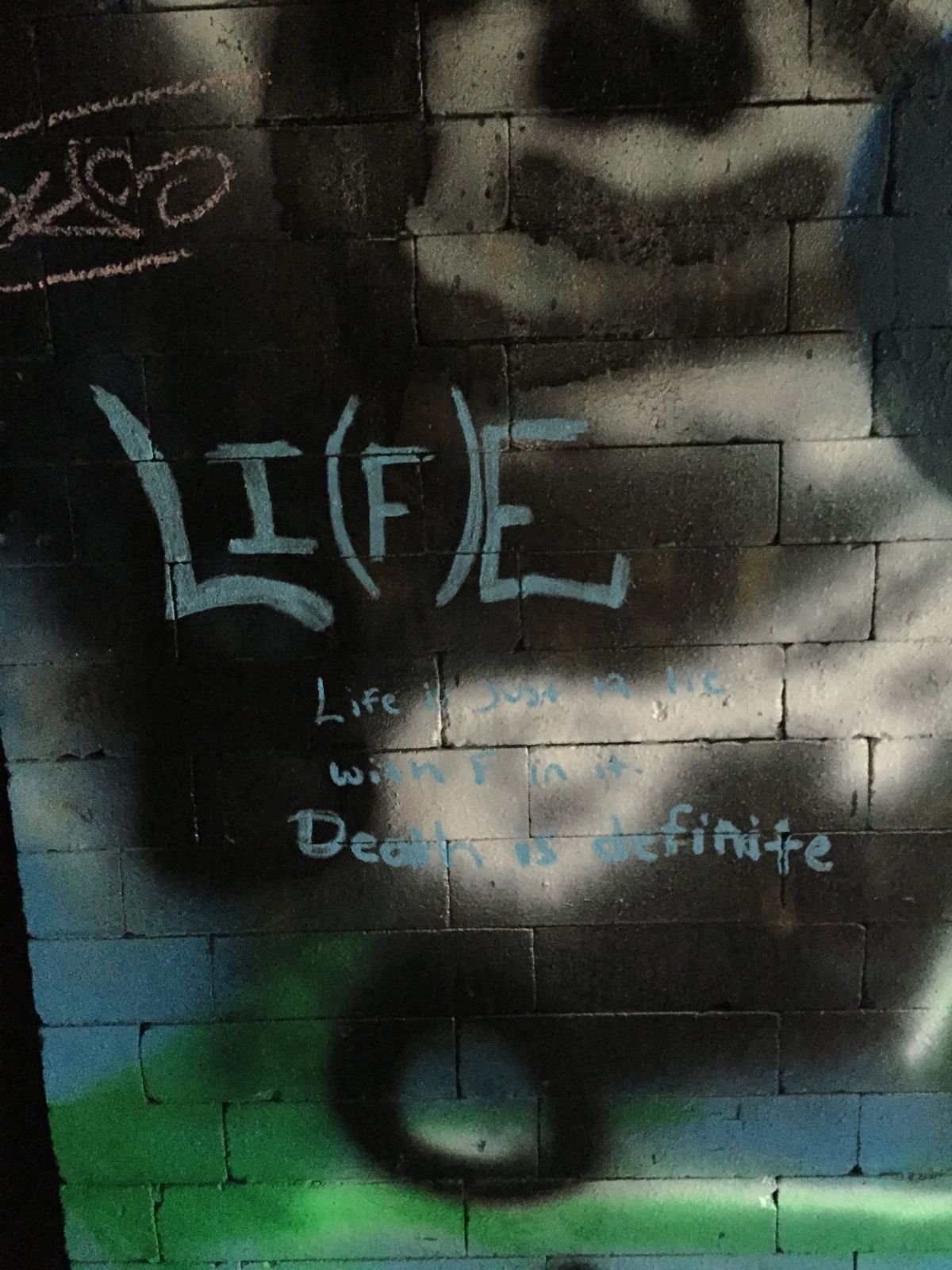
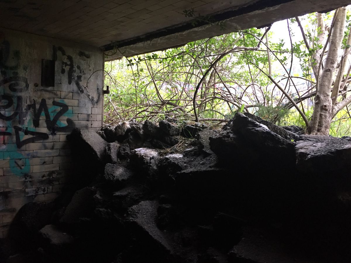
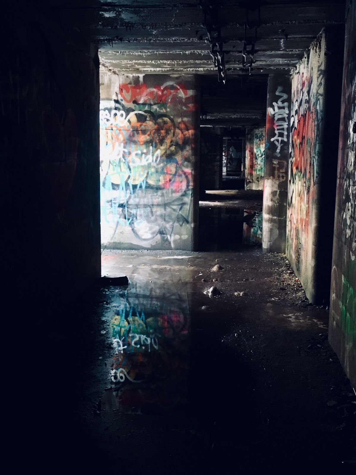
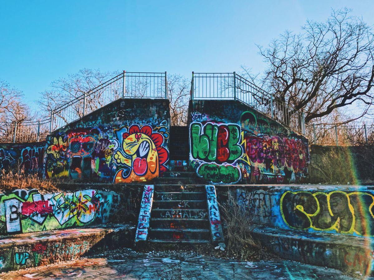
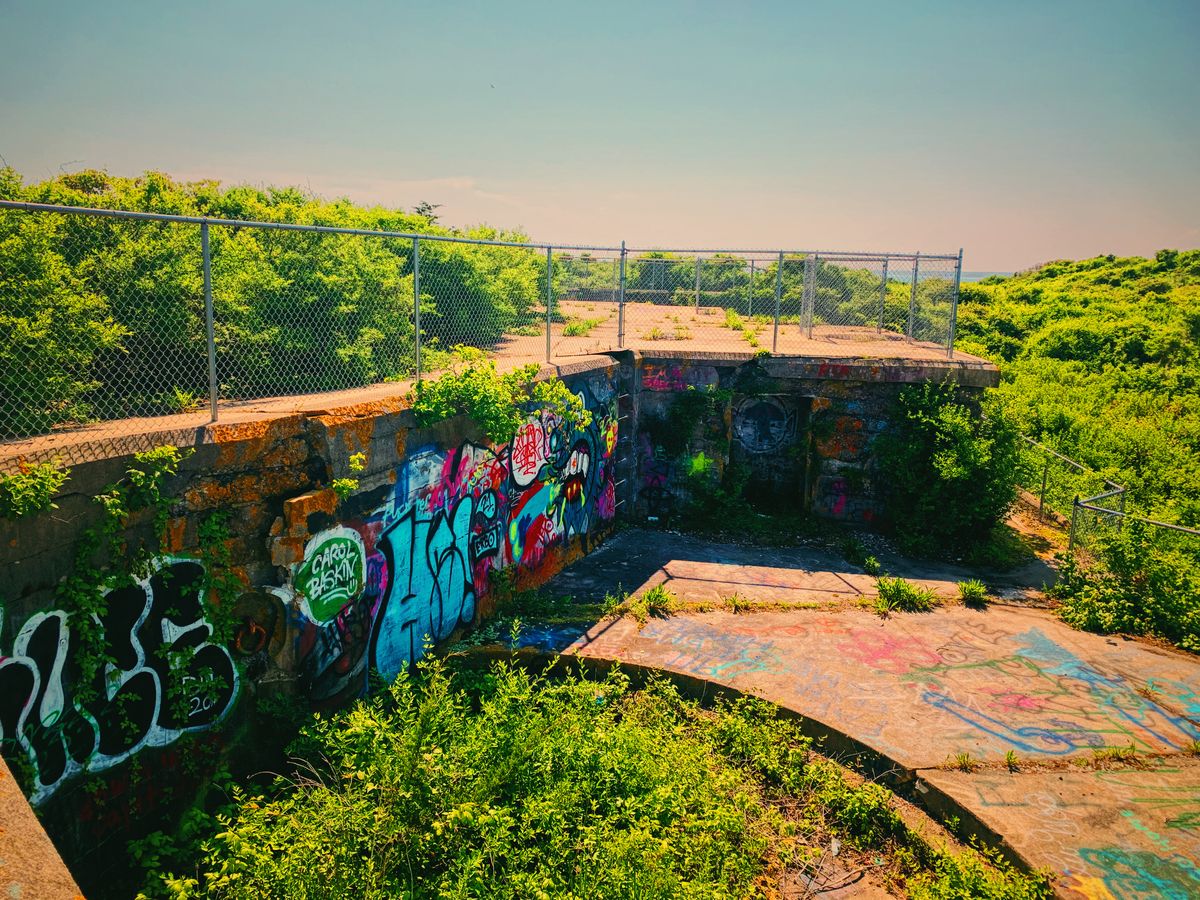
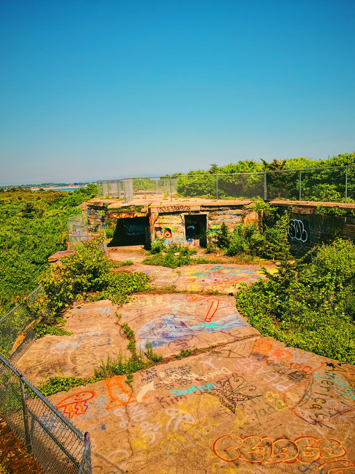
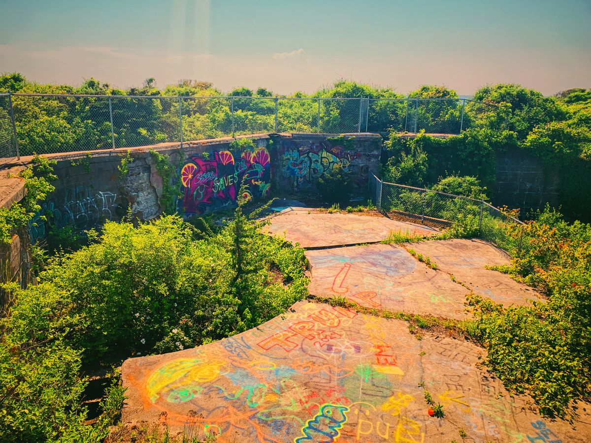
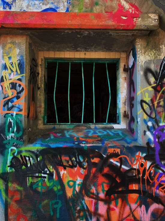
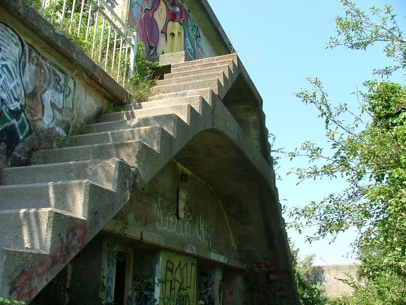
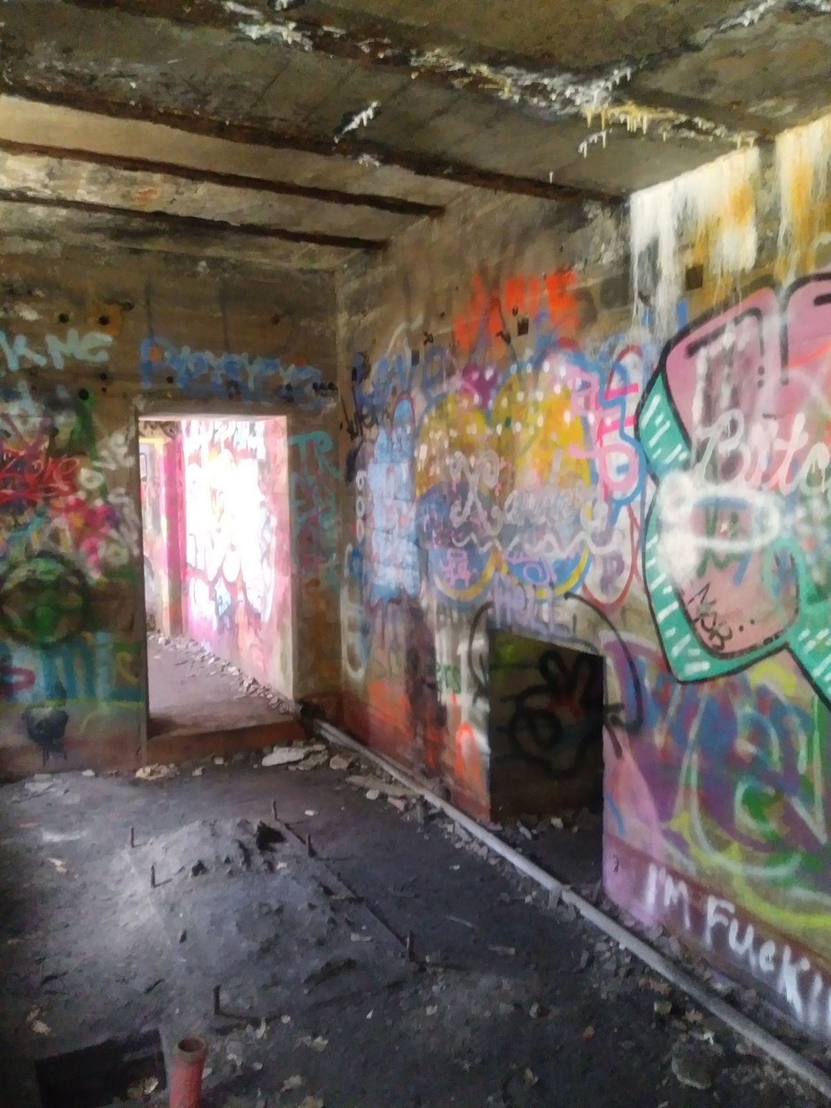
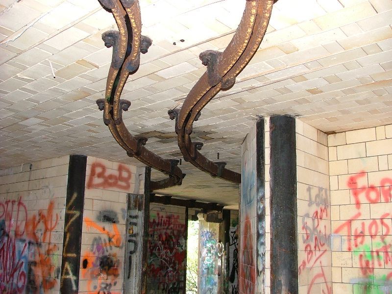
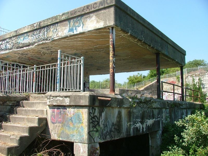
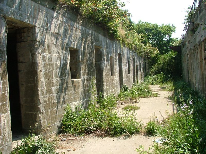
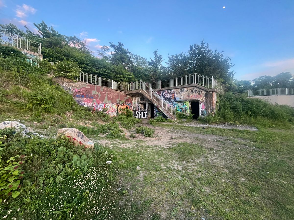
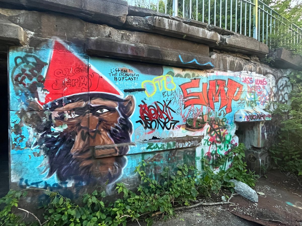
One of the less mainstream adventures the area offers is exploring the ruins of the abandoned fort. A shell of its former glory overgrown with vegetation and covered in graffiti, the tunnels, and concrete walls remain, with holes in the structures and the ground where cannons and 12-inch guns used to line extensive batteries. Remains of tram tracks trail off into the brush, reminiscent of a submarine mining operation during the world wars, and gun emplacements sit empty except for their colorful new artwork by local taggers.

While many of the areas are fenced off, it seems to be mostly for show, as paths lead to holes in the fence that rarely see repair. The park is popular and crowded in the summer due to all of the water-related events, but in the off-season, one can indulge in exploration practically undisturbed. The interior of the Fort is currently off-limits to the public. 

Related Tags

Abandoned Graffiti Water Architectural Oddities Ruins American Revolution Architecture Military

Know Before You Go

Take Interstate Rte. 95 South, to Rte. 4 South, to Rte.1 South, to Rte. 138 East, to Canonicus Avenue, to Walcott Avenue, to Fort Wetherill Road.

Community Contributors

Added By

adumont72

Edited By

SummerSkye10, e1savage, J Malcolm, Rachel...

  • SummerSkye10
  • e1savage
  • J Malcolm
  • Rachel
  • ickaimp
  • CruFro
  • missingfilm
  • TheKopasClan
  • jesshartleylowe
  • adriannezee
  • benson24
  • BZEWE97

Published

April 12, 2012

Edit this listing

Make an Edit
Add Photos
Sources
  • http://en.wikipedia.org/wiki/Fort_Wetherill
  • http://www.yelp.com/biz/fort-wetherill-state-park-jamestown
  • http://www.riparks.com/Locations/LocationFortWetherill.html
Fort Wetherill
Fort Wetherill Road
Jamestown, Rhode Island, 02835
United States
41.480071, -71.361794
Visit Website
Get Directions

Nearby Places

'Moonrise Kingdom' Beach

Jamestown, Rhode Island

miles away

Clingstone House

Jamestown, Rhode Island

miles away

Rose Island Lighthouse

Newport, Rhode Island

miles away

Explore the Destination Guide

Photo of Jamestown

Jamestown

Rhode Island

Places 4

Nearby Places

'Moonrise Kingdom' Beach

Jamestown, Rhode Island

miles away

Clingstone House

Jamestown, Rhode Island

miles away

Rose Island Lighthouse

Newport, Rhode Island

miles away

Explore the Destination Guide

Photo of Jamestown

Jamestown

Rhode Island

Places 4

Related Places

  • This is the right side of the complex. From here you can see one of the few remaining structures and for some reason a city bus.

    Chatsworth, California

    LA-88 Nike Missile Site

    Abandoned anti-ballistic missile base.

  • Kupr, Sierra Leone

    Bunce Island

    Home of the ruins of a British slave castle.

  • Missile Hanger as seen from the outside.

    Türisalu, Estonia

    Turisalu Missile Hangar

    Abandoned Soviet base once stocked with short and medium range missiles pointed at western Europe.

  • Giant Pyramid near Nekoma, North Dakota

    Nekoma, North Dakota

    The Pyramid of North Dakota

    The remnants of an early American attempt at missile defense.

  • Antuni

    Castel di Tora, Italy

    Ruins of Antuni

    A semi-abandoned village destroyed by U.S. bombings during World War II dominates the valley of Turano.

  • Camber Castle.

    Rye, England

    Camber Castle

    Henry VIII's forgotten castle was built by the gunpowder-obsessed king to be defended solely by cannons.

  • A aerial view of the Masada fortress.

    Masada, Israel

    Masada

    This daunting 1st century fortress was purportedly the site of one of the most dramatic revolts of the Jewish-Roman wars.

  • Waugoshance Lighthouse

    Carp Lake, Michigan

    Ruins of the Waugoshance Light Station

    During WWII the U.S. Navy conducted primitive drone strikes on this Lake Michigan lighthouse.

Aerial image of Vietnam, displaying the picturesque rice terraces, characterized by their layered, verdant fields.
Atlas Obscura Membership

Become an Atlas Obscura Member


Join our community of curious explorers.

Become a Member

Get Our Email Newsletter

Follow Us

Facebook YouTube TikTok Instagram Pinterest RSS Feed

Get the app

Download the App
Download on the Apple App Store Get it on Google Play
  • All Places
  • Latest Places
  • Most Popular
  • Places to Eat
  • Random
  • Nearby
  • Add a Place
  • Stories
  • Food & Drink
  • Itineraries
  • Lists
  • Video
  • Podcast
  • Newsletters
  • All Trips
  • Family Trip
  • Food & Drink
  • History & Culture
  • Wildlife & Nature
  • FAQ
  • Membership
  • Feedback & Ideas
  • Community Guidelines
  • Product Blog
  • Unique Gifts
  • Work With Us
  • About
  • FAQ
  • Advertise With Us
  • Advertising Guidelines
  • Privacy Policy
  • Cookie Policy
  • Terms of Use
Atlas Obscura

© 2025 Atlas Obscura. All Rights Reserved.