Trips Places Foods Stories Newsletters
Loading...
Loading...
Loading...
Loading...

No search results found for
“”

Make sure words are spelled correctly.

Try searching for a travel destination.

Places near me Random place

Popular Destinations

  • Paris
  • London
  • New York
  • Berlin
  • Rome
  • Los Angeles
Trips Places Foods Stories Newsletters
Sign In Join
Places near me Random place
All the United States Utah Dry Fork Flume Site
AO Edited

Dry Fork Flume Site

This hiking trail is scattered with the remains of a failed attempt to provide water to farmers in Dry Fork Canyon.

Naples, Utah

Added By
egamalfi
Email
Been Here
Want to go
Added to list
CAPTION
Remains of the flume supports   egamalfi / Atlas Obscura User
Flume Support Pillar   egamalfi / Atlas Obscura User
Signage near flume site with photos of the original flume   egamalfi / Atlas Obscura User
Been Here
Want to go
Added to list

About

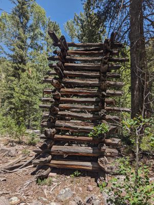
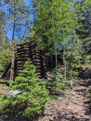
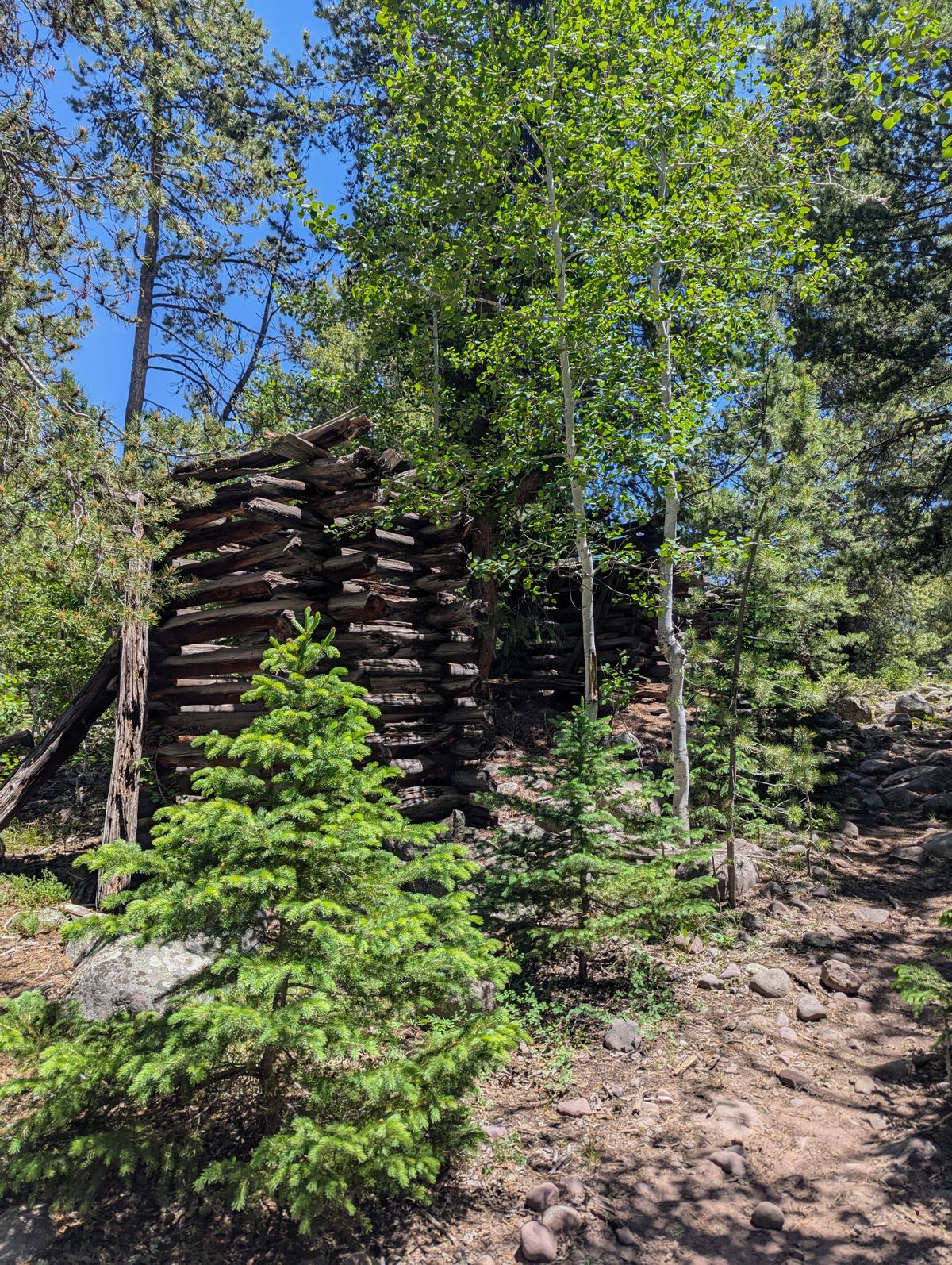
Dry Fork Canyon has been historically difficult to farm. These ruins of an old flume mark one failed attempt to bring water to the agricultural community.

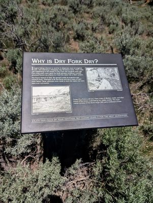
Despite Dry Fork Creek running through the region, the area is rampant with sinkholes that absorb and divert creek water, leaving many homesteaders without a way to care for their crops. In 1893, the Uintah Milling & Flume company set out to build a permanent wooden flume to carry water from the creek to the community.

Unfortunately, the flume had some major issues. When completed in 1897, it leaked profusely, washing away some of the support pillars and causing the chute to collapse. Ultimately, the project was abandoned.

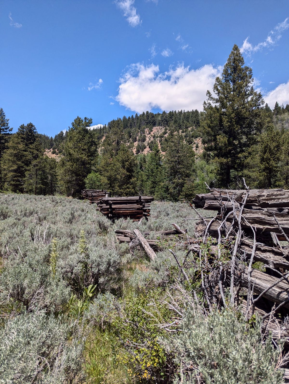
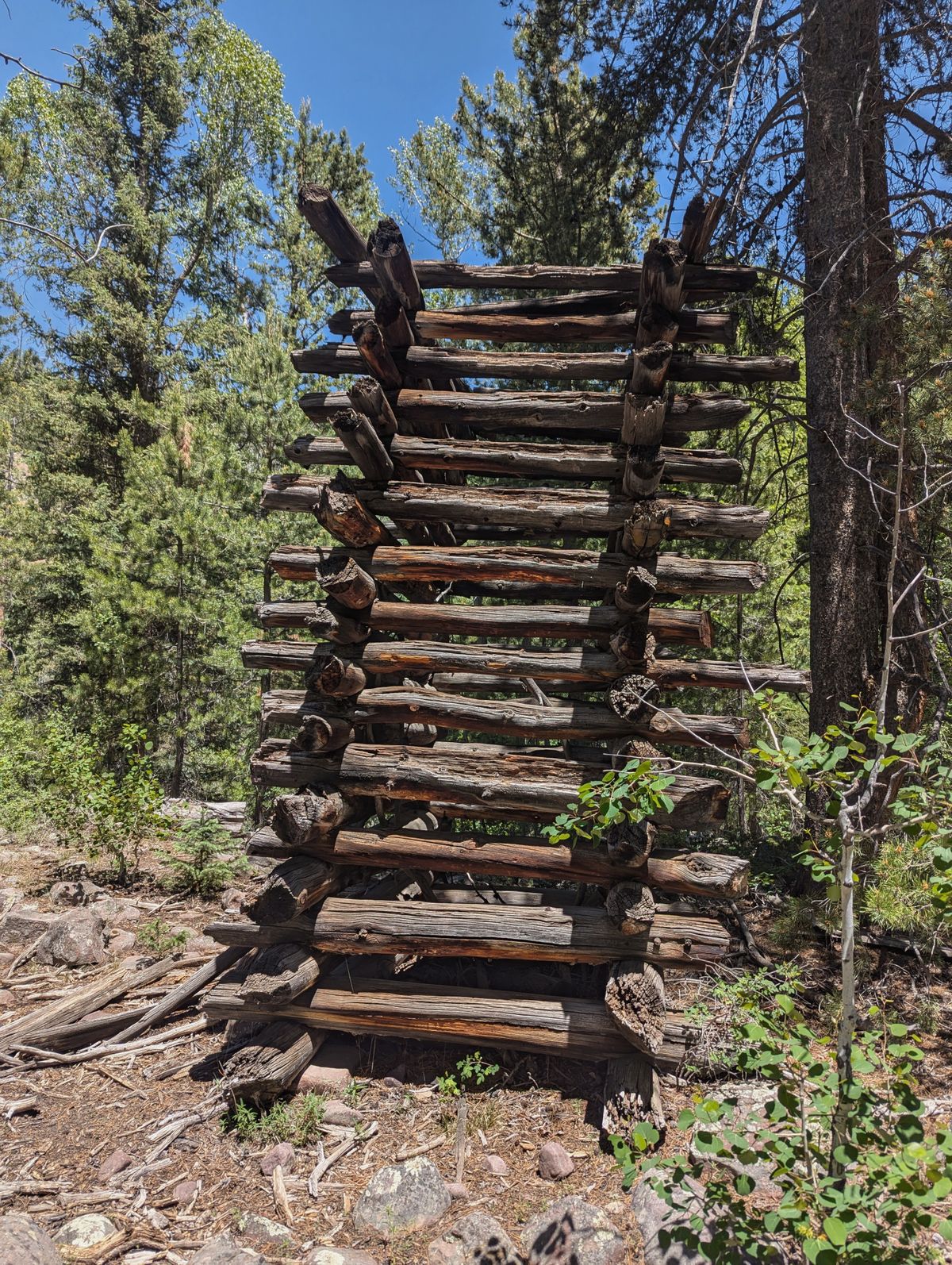
While the main chute has been removed, the remaining wooden supports of the flume are still visible today. The forest nearby is still littered with felled trees that the original builders intended to use as timber for the project.

Related Tags

Abandoned Architecture History Trails Hiking Sinkhole Agriculture Water

Know Before You Go

The Flume Site is part of a larger trail with multiple trailheads accessible from the road.

For easiest access, visitors can park at the upper trailhead and hike 1.5 miles to the site. The uppermost trailhead has no formal marking, but does have a parking area. The road is unpaved and four-wheel-drive vehicles are encouraged, but not necessary in dry conditions.

Visitors can also park at the middle trailhead parking lot and hike approx. 3.5 miles to the flume site. The flume site is located at mile 6 from the lowest trailhead.

Community Contributors

Added By

egamalfi

Published

July 22, 2024

Edit this listing

Make an Edit
Add Photos
Sources
  • https://www.fs.usda.gov/detail/ashley/learning/history-culture/?cid=fsm9_002394
  • Settlements of Uintah County: Digging Deeper, by Doris Karen Burton (published 1998 by Uintah County Library)
  • Signage at location
  • Signage in the area
Dry Fork Flume Site
Naples, Utah, 84078
United States
40.623563, -109.792938
Visit Website

Nearby Places

McConkie Ranch Petroglyphs

Vernal, Utah

miles away

First Lady Dolls

Vernal, Utah

miles away

Dinah the Pink Dinosaur

Vernal, Utah

miles away

Explore the Destination Guide

Photo of Utah

Utah

United States

Places 155
Stories 29

Nearby Places

McConkie Ranch Petroglyphs

Vernal, Utah

miles away

First Lady Dolls

Vernal, Utah

miles away

Dinah the Pink Dinosaur

Vernal, Utah

miles away

Explore the Destination Guide

Photo of Utah

Utah

United States

Places 155
Stories 29

Related Places

  • Neemrana baori.

    Neemrana, India

    Neemrana Baori

    This abandoned stepwell is one of the largest, deepest, and certainly one of the creepiest in India.

  • Water rushes through the upper reaches of the scar.

    Westmorland and Furness, England

    Ewbank Scar

    Water demonstrates its carving power along a Cumbrian trail.

  • Mumbai, India

    Flora Fountain

    An iconic fountain dedicated to the Roman goddess Flora stands in the heart of Mumbai.

  • Cachoeiras do Horto (Horto Waterfalls)

    Rio de Janeiro, Brazil

    Cachoeiras do Horto (Horto Waterfalls)

    A trio of waterfalls inside the world’s largest urban forest.

  • One of the front entrances of the barn

    Bradford-on-Avon, England

    Tithe Barn

    One of the largest medieval barns in England and architecturally one of the finest.

  • View of the Jumbo Tower from Balkerne Gate

    Colchester, England

    Jumbo Water Tower

    The largest Victorian water tower in Britain.

  • Réservoir de Lavardens

    Bordeaux, France

    Réservoir de Lavardens

    A very uncommon water tank standing in the middle of the grapevines in Bordeaux nearly a century after its construction.

  • Granary in Jankowo up close

    Jankowo, Poland

    Walter Gropius's 1906 Spichlerz

    A Bauhaus co-founder designed this quirky, abandoned granary.

Aerial image of Vietnam, displaying the picturesque rice terraces, characterized by their layered, verdant fields.
Atlas Obscura Membership

Become an Atlas Obscura Member


Join our community of curious explorers.

Become a Member

Get Our Email Newsletter

Follow Us

Facebook YouTube TikTok Instagram Pinterest RSS Feed

Get the app

Download the App
Download on the Apple App Store Get it on Google Play
  • All Places
  • Latest Places
  • Most Popular
  • Places to Eat
  • Random
  • Nearby
  • Add a Place
  • Stories
  • Food & Drink
  • Itineraries
  • Lists
  • Video
  • Podcast
  • Newsletters
  • All Trips
  • Family Trip
  • Food & Drink
  • History & Culture
  • Wildlife & Nature
  • FAQ
  • Membership
  • Feedback & Ideas
  • Community Guidelines
  • Product Blog
  • Unique Gifts
  • Work With Us
  • About
  • FAQ
  • Advertise With Us
  • Advertising Guidelines
  • Privacy Policy
  • Cookie Policy
  • Terms of Use
Atlas Obscura

© 2025 Atlas Obscura. All Rights Reserved.