


About
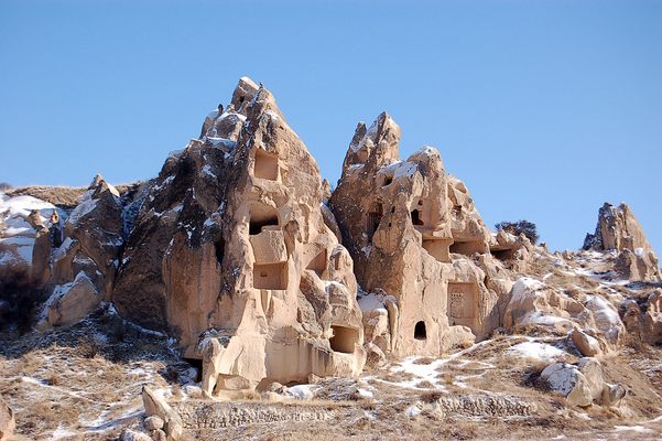
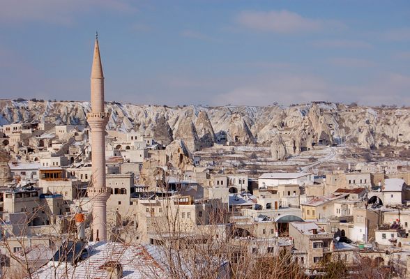
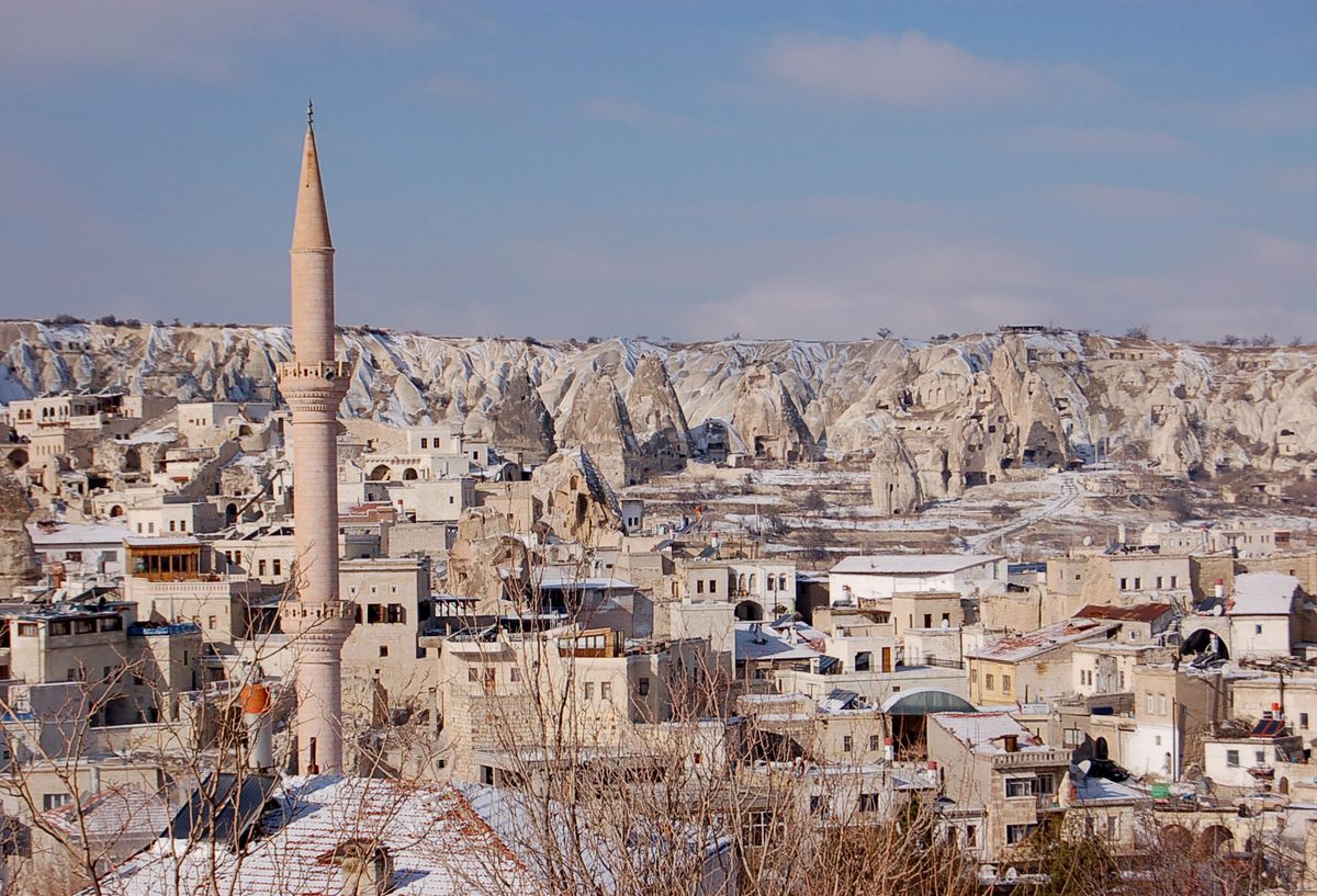
Located in the Nevşehir Province in the Central Anatolian region of Turkey, Cappadocia is an area where entire cities have been carved into the rock.
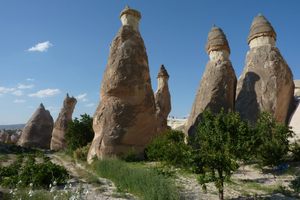
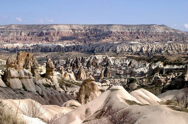
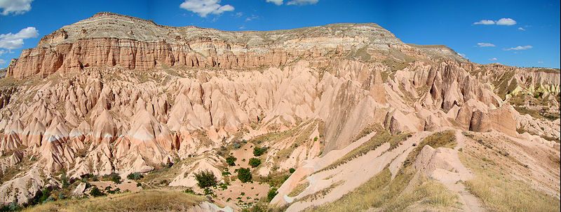
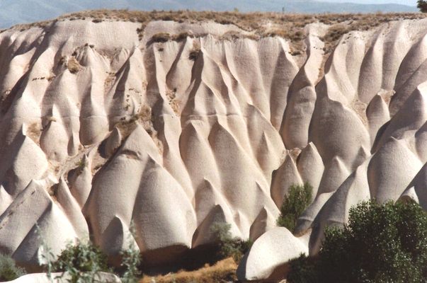
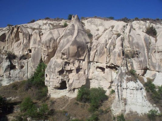
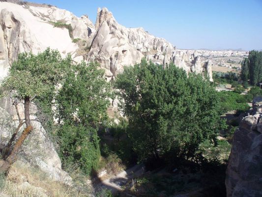
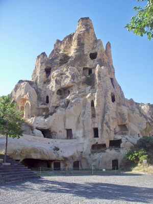
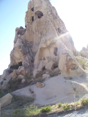
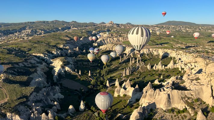
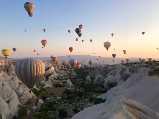
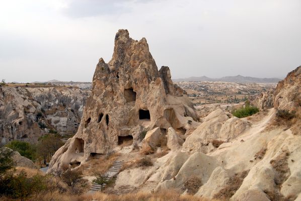
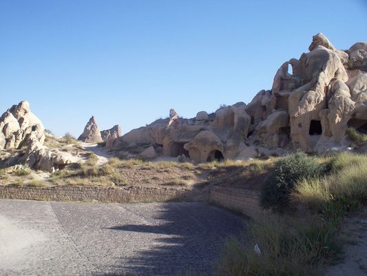
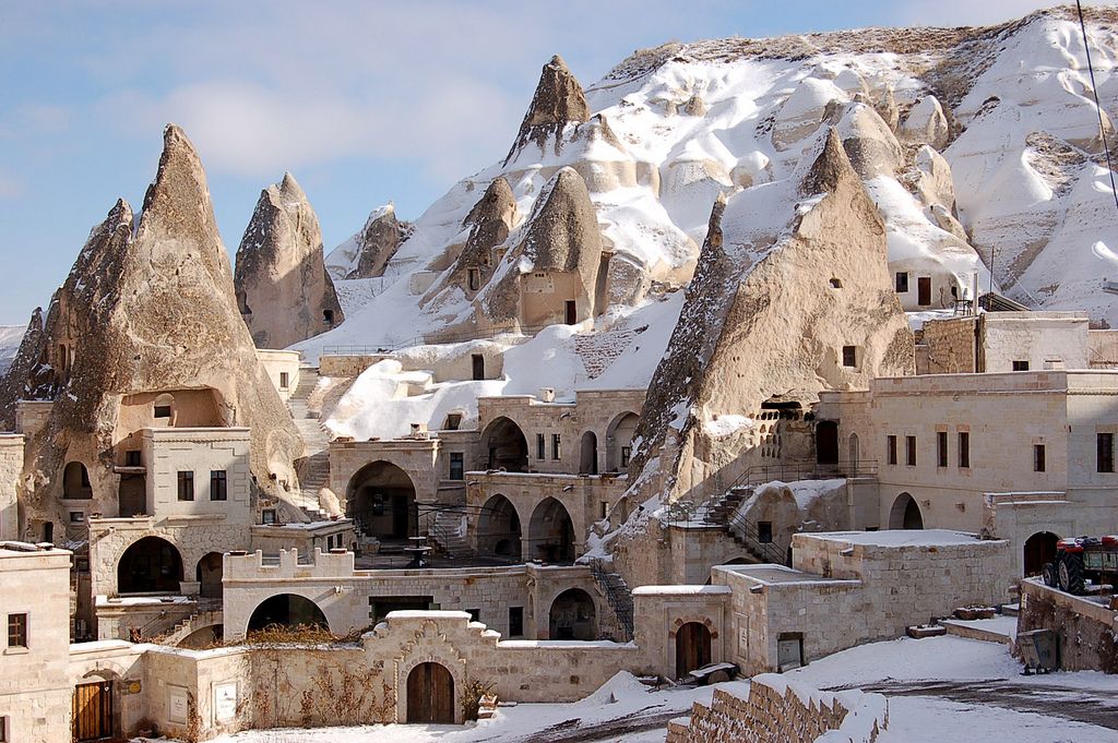
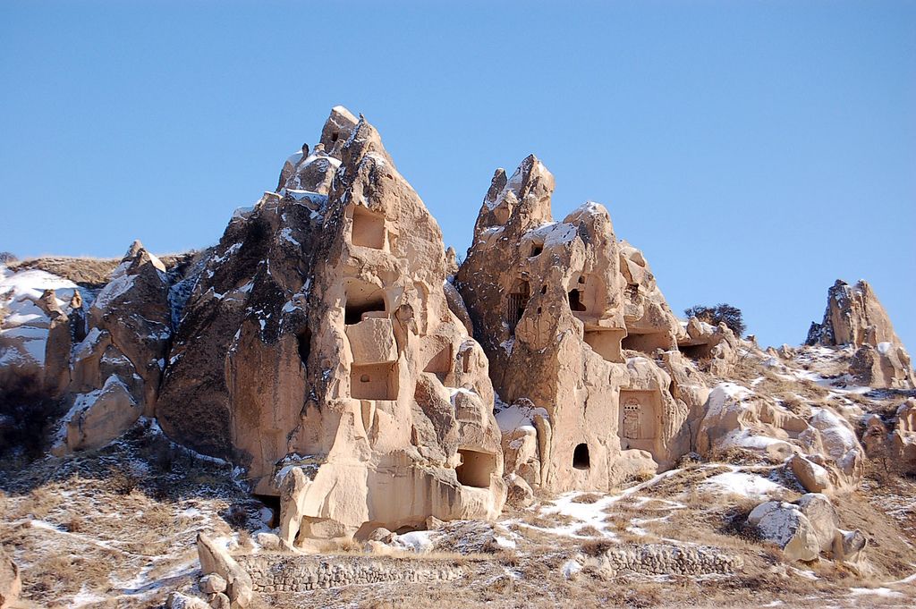
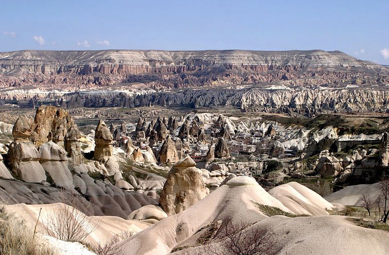
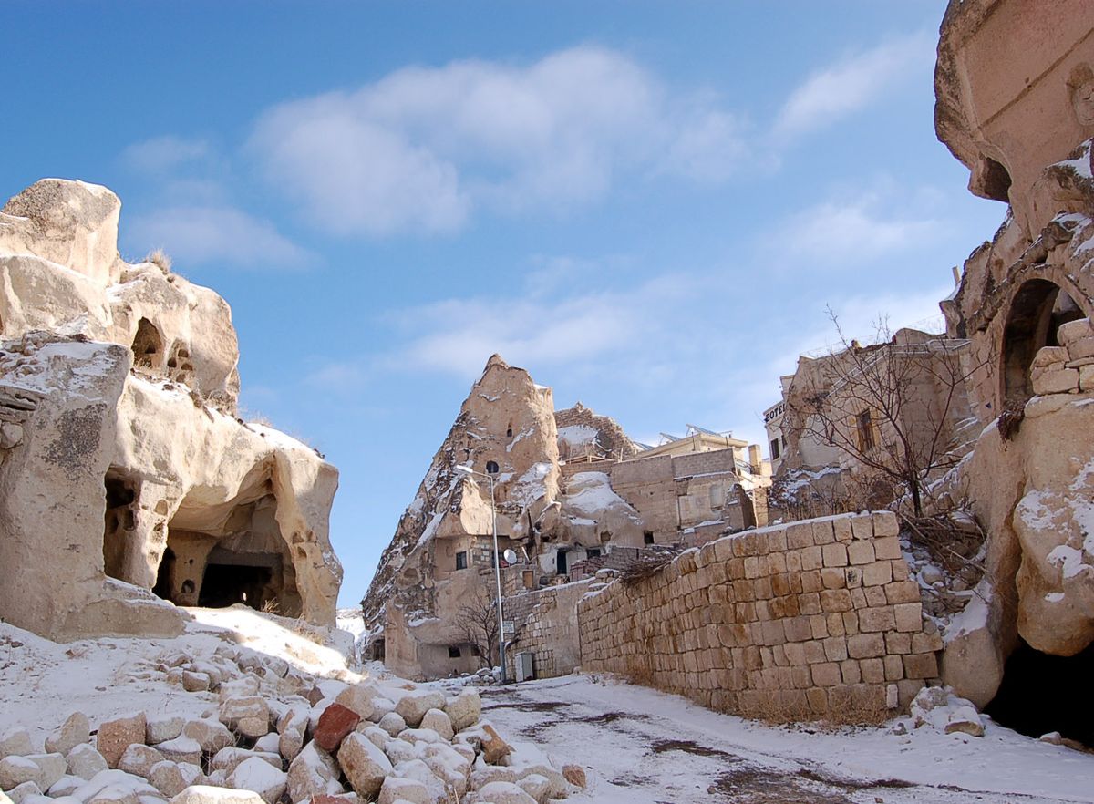
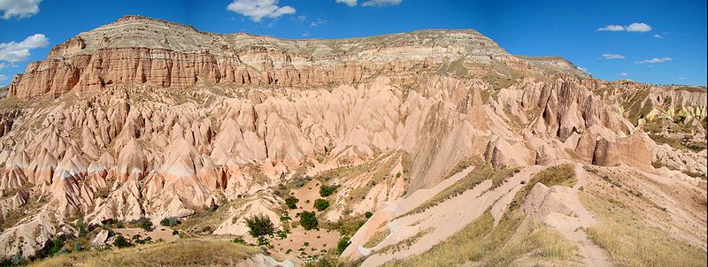
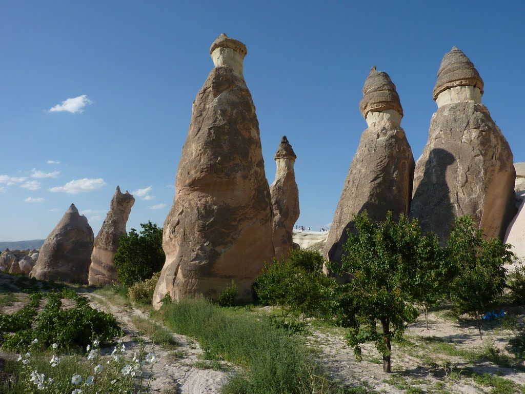
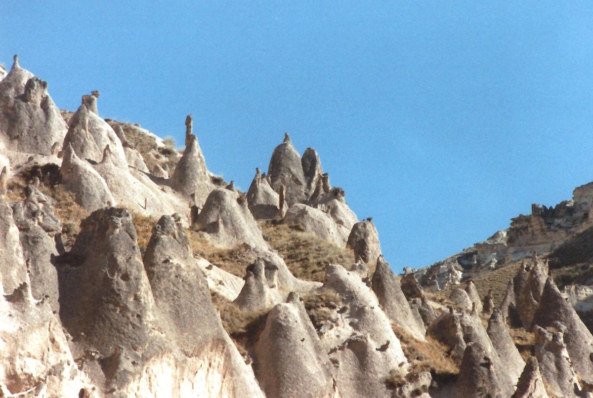
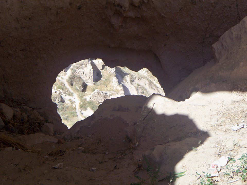
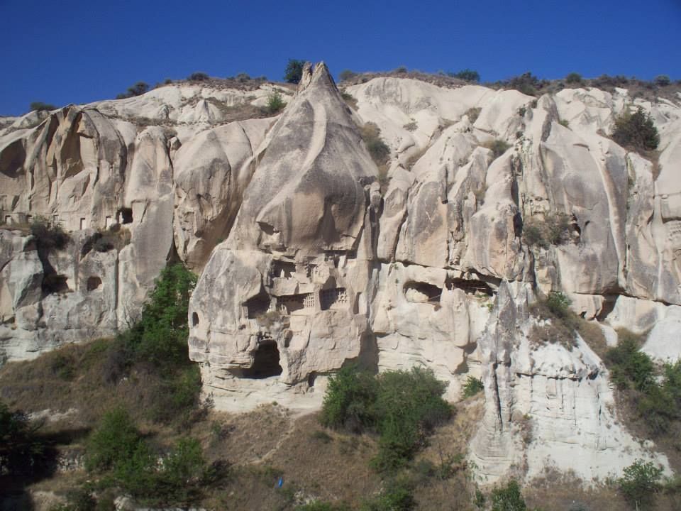
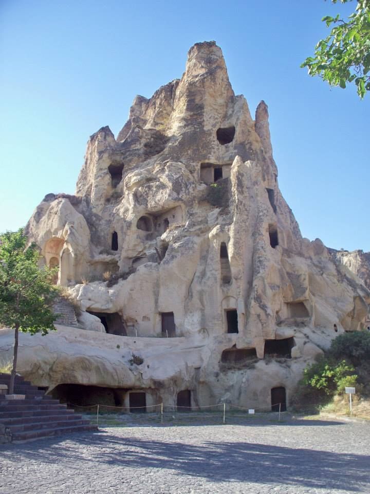
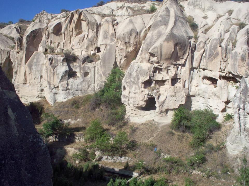
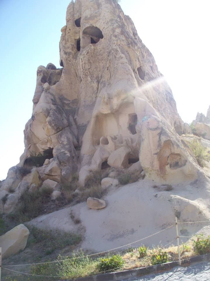
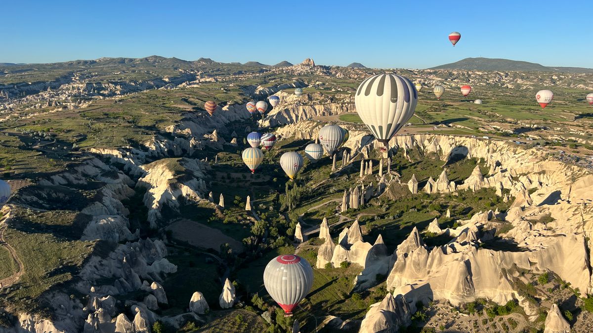
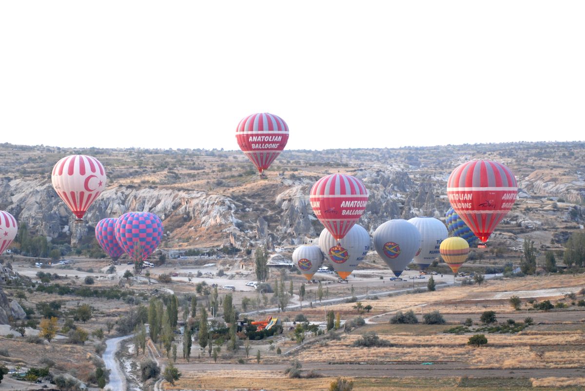
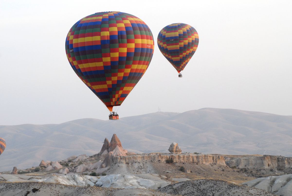
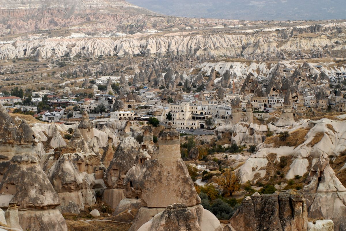
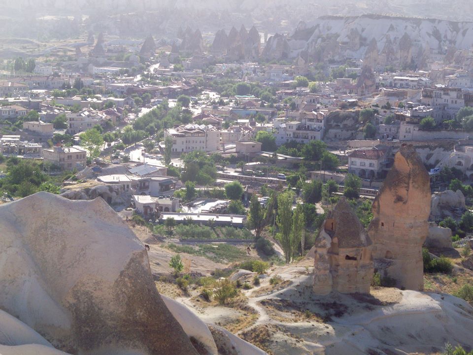
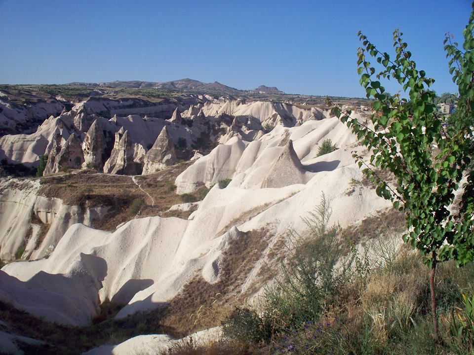
An area with history so abundant and far-reaching as to render entire centuries as footnotes at first glance, the landscape appears as an abandoned alien desert with fields that look like waves frozen in time, and rocky spikes and spires protruding from the landscape like some sort of meringue set in stone.
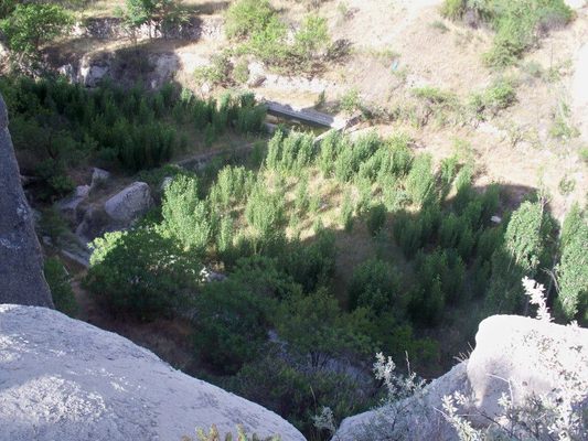
The rock formations that makeup Cappadocia were created by volcanic eruptions, erosion, and wind. Over three million years ago a volcanic eruption deposited a blanket of ash across the 1,500 square mile landscape which formed into a soft rock. This rock, slowly eaten away by wind and time, has created some spectacular forms. But the human history of the area is as compelling as the geological one.
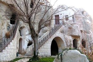
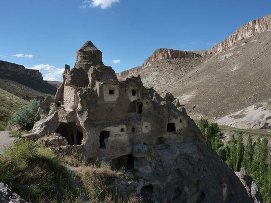
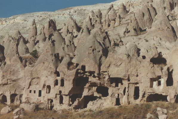
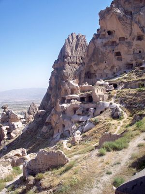
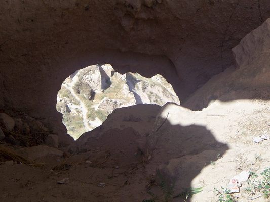
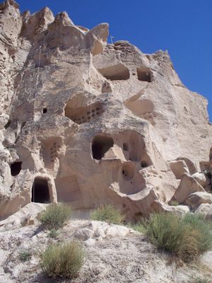
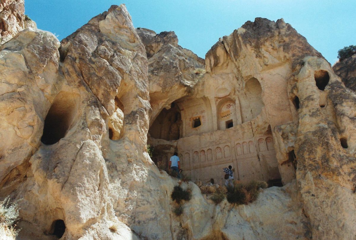
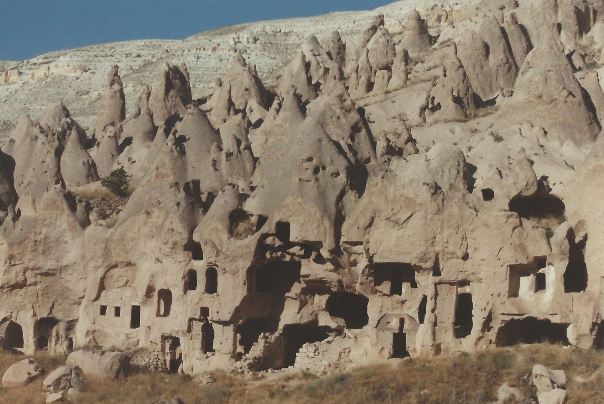
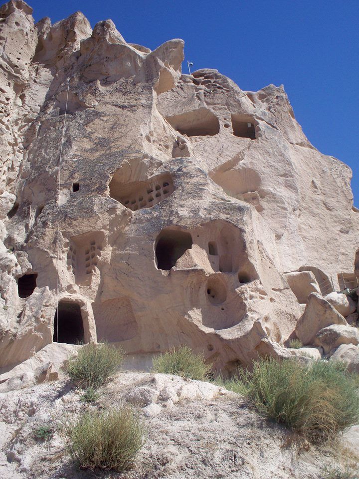
With rock soft enough that you can easily dig right into it, part of what adds to Cappadocia’s strange appearance is that carved into every hillside, spire, and boulder is a home complete with windows, bedrooms, kitchens, and multiple stories connected by ladders or steps.
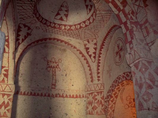
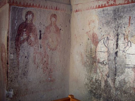
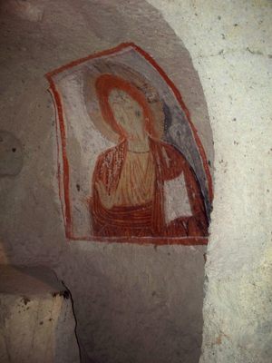
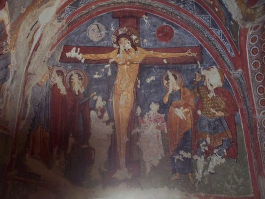
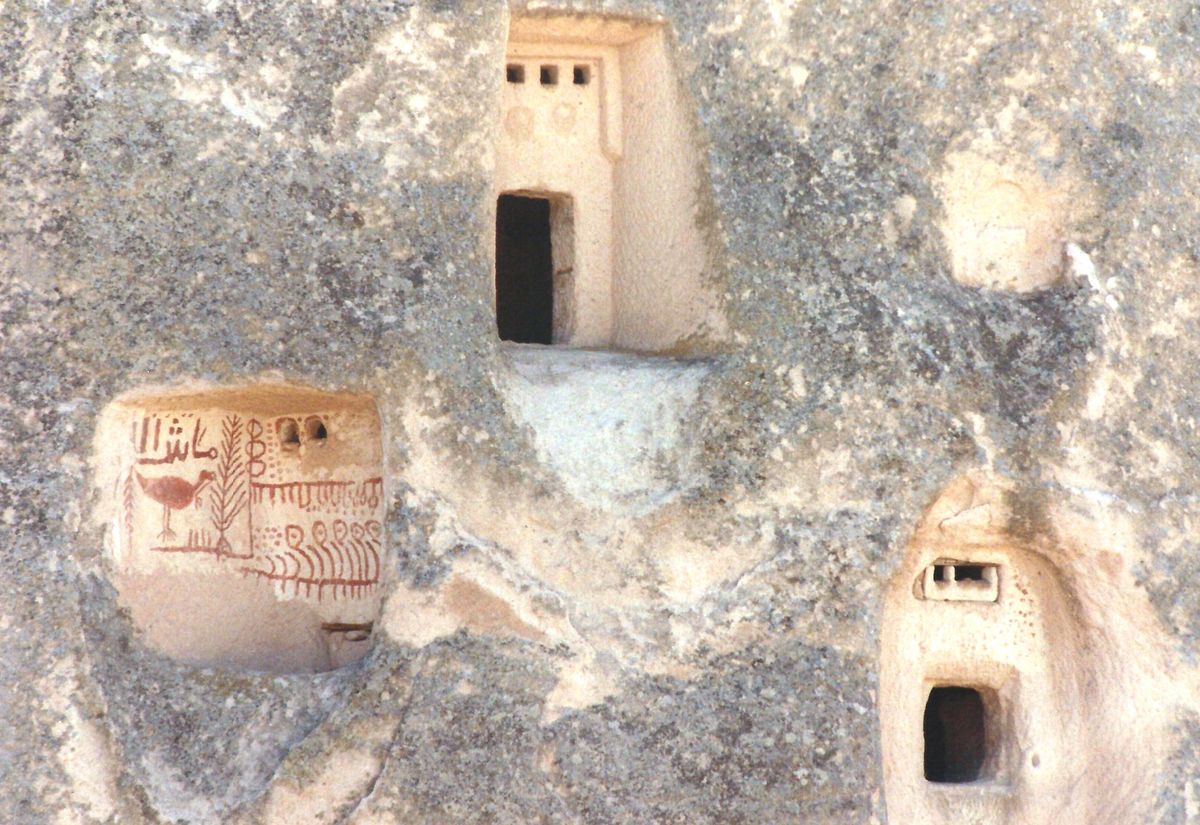
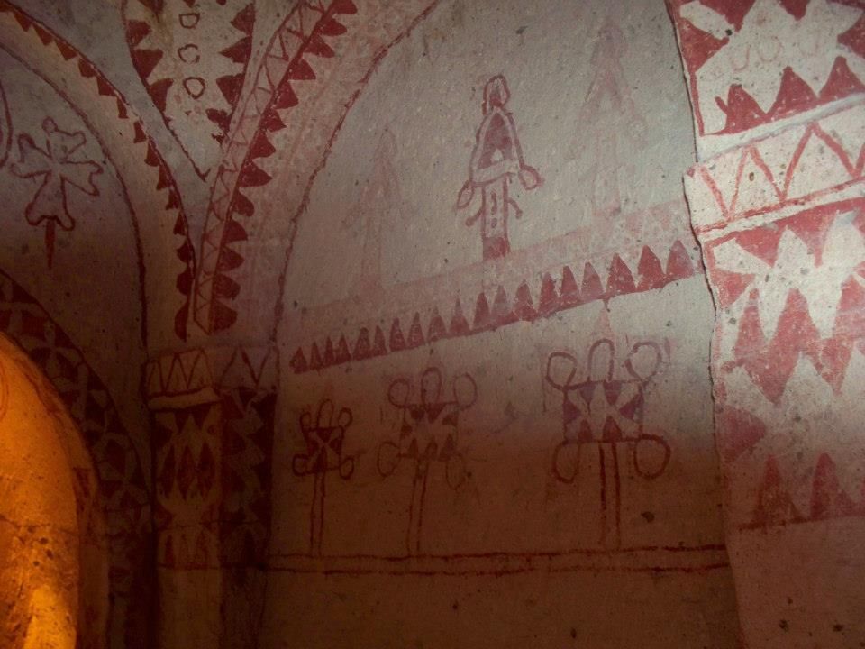
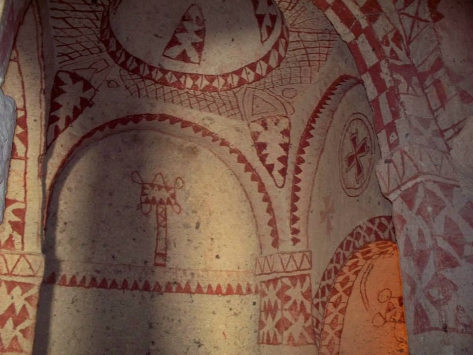
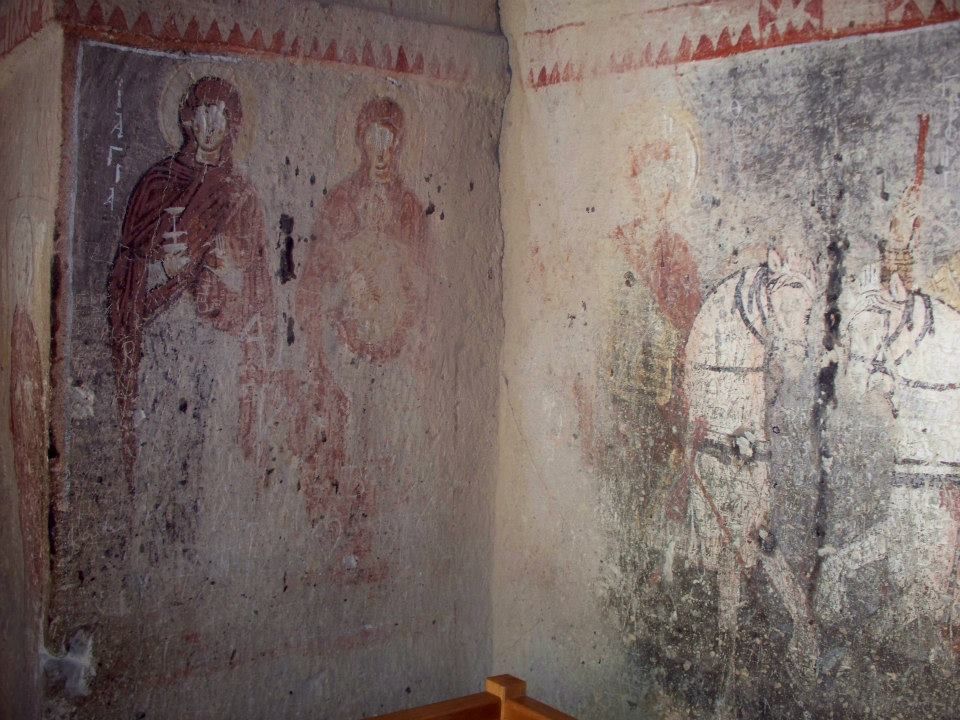
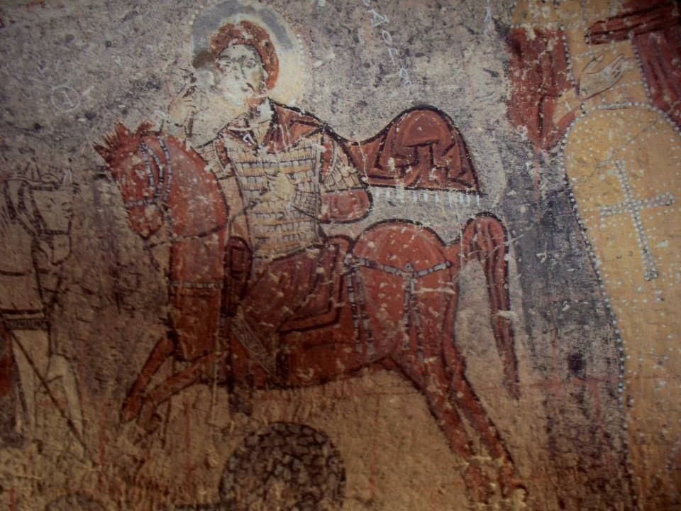
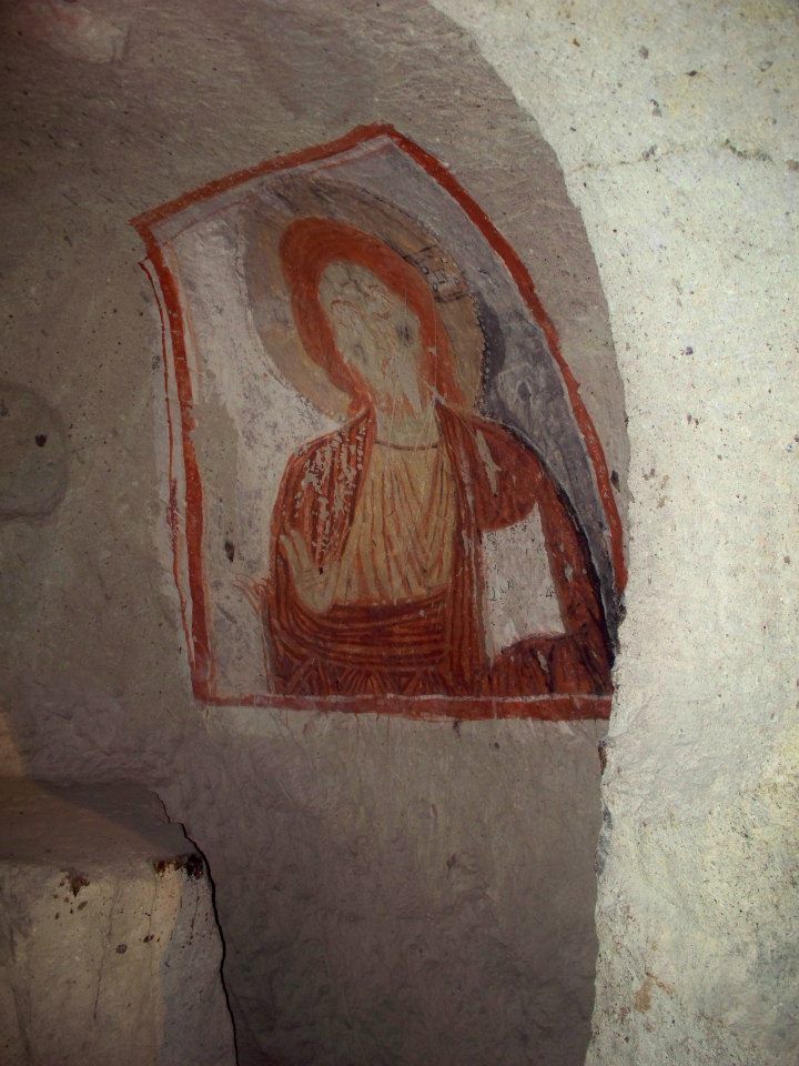
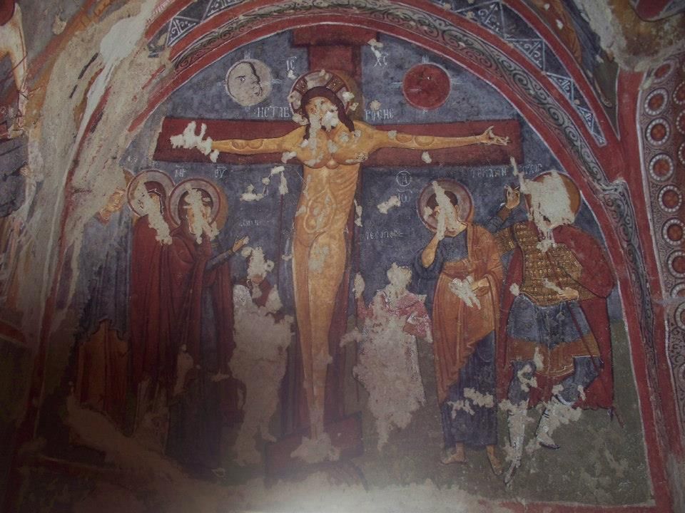
The pathways and structures carved from the rock hold a long history of struggle and resistance. As early as the 3rd century, the caves and tunnels within the rock formations were being used as a hiding place by Christians escaping persecution by the Romans. By the 10th and 11th centuries, Byzantine Christian monks were building hundreds of small churches—each beautifully painted and decorated—into the hillsides as monasteries and training grounds for early Christian missionaries.
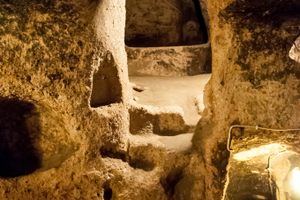
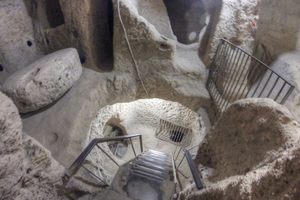
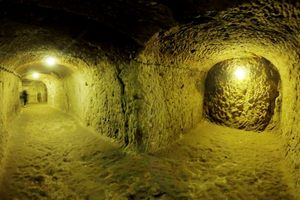
Nowhere else is the soft pliability of the landscape, and the ingeniousness of the ancient architecture more visible than in the nearby subterranean cities of Derinkuyu and Kaymakli.
Derinkuyu is 11 stories deep, has dozens of miles of tunnels connecting it to other underground cities, and can accommodate many thousands of people. It is truly an underground city, with areas for sleeping, stables for livestock, pits for cooking, bathrooms, praying, even for being buried. Today, the tops of the tombs have eroded, exposing the narrow, empty graves.
Some 200 underground structures have been discovered in Cappadocia, many of them connecting to each other via tunnels. Most people didn’t live in the underground cities full time. Underneath the cities was a vast network of tunnels, connecting each home in the area to the city. When the area came under attack, families would flee to their basements, rush through the dark tunnels, and gather in the underground city.
The boundaries of historical Cappadocia are vague, particularly towards the west. To the west, Cappadocia is bounded by historical regions of Galatia and Lycaonia. To the south, the Taurus Mountains separate Cappadocia from Cilicia and the Mediterranean Sea. Roughly, the area is about 250 miles from east to west and 160 miles from north to south.
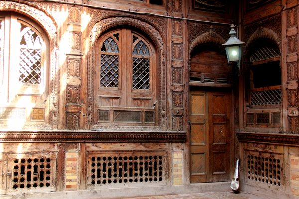
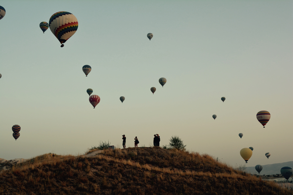
The name Cappadocia has been co-opted by the tourism industry to refer to any place where natural wonders and geology provide the main forms of entertainment and attraction. Those wishing to enjoy an overnight in the region should visit Gamirasu Cave Hotel and check out the Byzantine King Suite.
Related Tags
Community Contributors
Added By
Published
June 5, 2011
Sources
- https://travelturkeyguide.com/cappadocia/
- https://theworldtravelguy.com/cappadocia-turkey-travel-guide/
- Wikipedia: Cappadocia: http://en.wikipedia.org/wiki/Cappadocia
- Adventures Great and Small: Unusual Places/Cultures: Cavetowns and Gorges of Cappdocia: http://www.great-adventures.com/destinations/turkey/cappadocia.html
- The New York Times: Captivating Cappdocia: http://www.nytimes.com/slideshow/2007/09/05/travel/20070909_NEXT_SLIDESHOW_index.html
- Drifter Planet: Cappadocia is the Most Magical Place on Earth: https://drifterplanet.com/cappadocia-is-the-most-magical-place-on-earth/
- https://gezideler.com/kapadokya-gezilecek-yerler-listesi-gezi-rehberi/