


About
Travelers starting in the New York City area and making their way to western New York State -- perhaps to a resort in the Catskills or to Binghamton University -- may end up stopping at the Roscoe Diner.
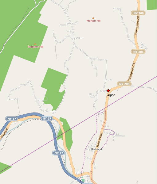
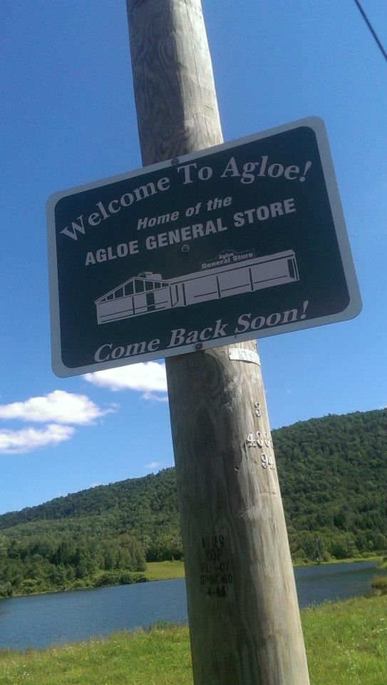
The diner sits on Route 17, one of the main thoroughfares between the city and points westward. It has a reputation which extends for miles, in part because you can get some generally very good (and thick) french toast there. But otherwise, you are kind of in the middle of nowhere. Roscoe, the town (and it’s not really a town, but a “census designated place”), has only 900 or so residents. And the nearby municipality of Agloe, circled on the map below, has even fewer. No one lives there.
But that’s because it only kind of exists.
If two companies make a map of the same area, but do so independent of each other, the maps should have some identical data. Towns and roads and bodies of water need to be represented accurately or drivers and others using the maps to navigate their surroundings will certainly get lost. Sure, you can add a little bit of creativity when it comes to choice of colors, fonts, or line thickness, but the locations of things have to be right or the map won’t be very useful.
As a consequence of this, it’s very easy for a third party to start making maps -- they simply have to copy the data from any other reliable map and reproduce it. To some degree, copyright law should prevent this, but outright copying isn’t so easy to prove. As a solution, some mapmakers add fake streets (called “trap streets”) or even fake towns (often called “paper towns”) into their maps. If someone came by and copied their work, they’d also copy the fictional creation unique to the original map maker’s craft.
According to novelist and YouTube celeb John Green in a TEDx talk (video here, transcript here), the General Drafting Company in 1937 did just this with the town of Agloe, creating it out of thin air at the intersection of two dirt roads just a few miles from Roscoe. (Green later used Agloe as well -- as one of the locations for his novel, and the inspiration for its title, "Paper Towns.") And a few decades later, Agloe appeared again, but this time in a map made by a different, unrelated company -- Rand McNally. General Drafting thought they had caught Rand McNally red-handed, but Rand McNally had an incredibly good and surprising defense:
The county clerk’s office had given them the information.
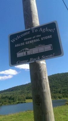
It turns out that, in the early part of the 1950s, someone armed with the General Drafting map went to visit Agloe. Seeing nothing there, they figured that opportunity had knocked. This lost-to-history fellow, likely figuring that others would also come to Agloe -- it was on the map, after all! -- would expect to find something there. So he opened a small shop and called it the “Agloe General Store.” Over the next forty years, the fictional town of Agloe grew. As Green notes, at its largest, Agloe had a gas station, the general store, and two houses. Most importantly, at least as far as Rand McNally was concerned, Agloe had something else -- the attention of the county administrators. They considered Agloe a real place, and therefore, so did Rand McNally’s team of cartographers.
Today? Agloe is sadly gone. The buildings are abandoned if not destroyed, and the mapmakers of the world no longer recognize its existence.
Text used with permission from Now I Know, a free daily email newsletter sharing an interesting fact and the story behind it every weekday. Subscribe now! And check out the book Now I Know: The Revealing Stories Behind the World's Most Interesting Facts.
Related Tags
Published
February 12, 2013