Tufa Cave
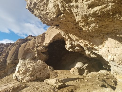
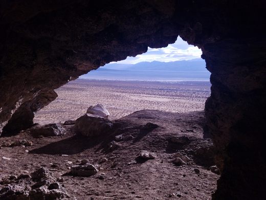
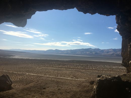
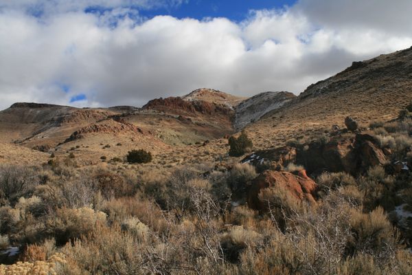
A large wave-cut shelter, a major archeological site, overlooks the dry basin of Winnemucca Lake.

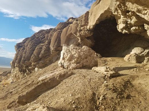
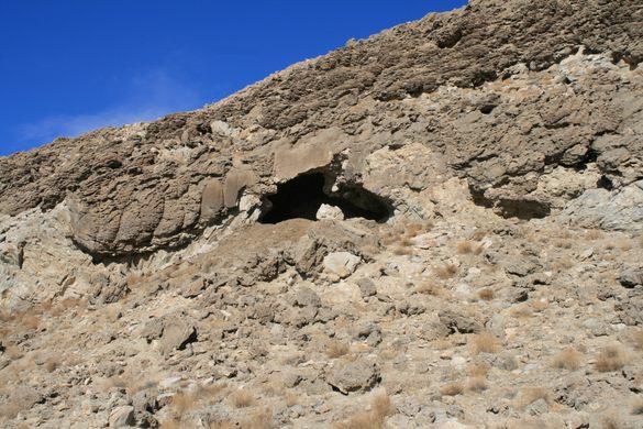
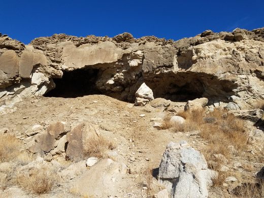
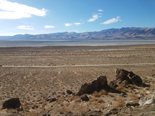
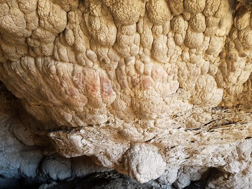
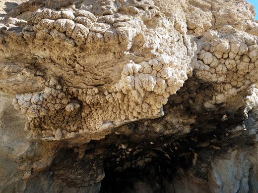
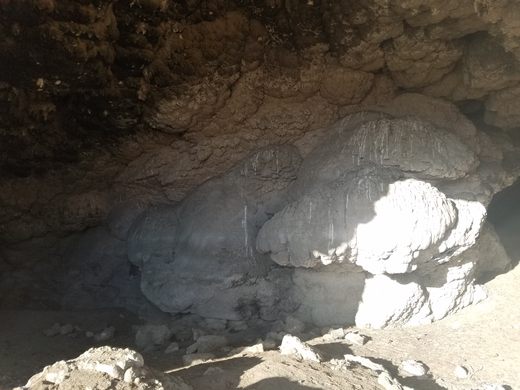
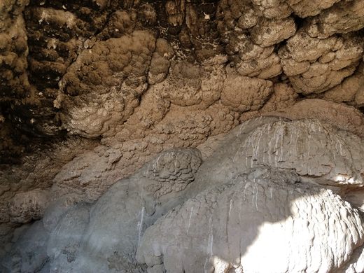
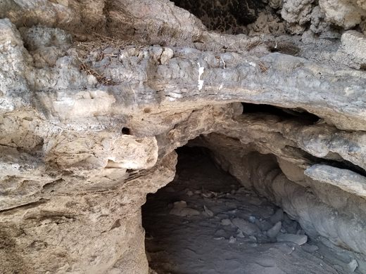
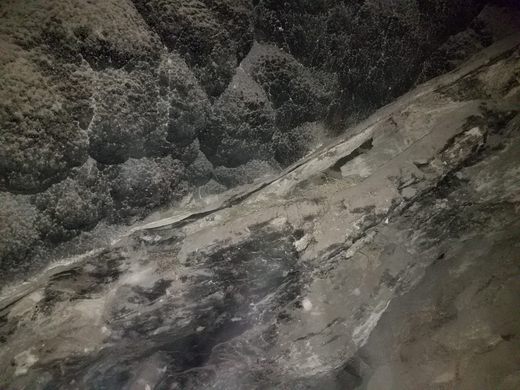

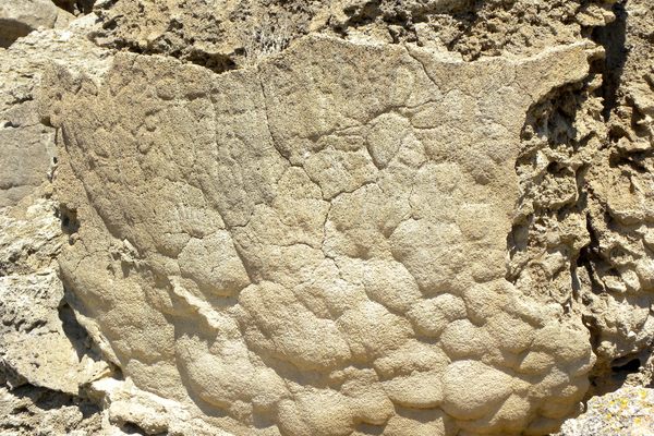
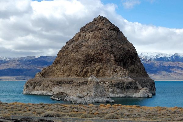
Tufa is a freshwater limestone widely deposited around ancient Lake Lahontan due to the water chemistry, and tufa encrustations on the shore and lakebed are ubiquitous. As the lake dwindled over the millennia, surf action carved out overhangs and caves along the shore, with the tufa acting as cement and a substrate.
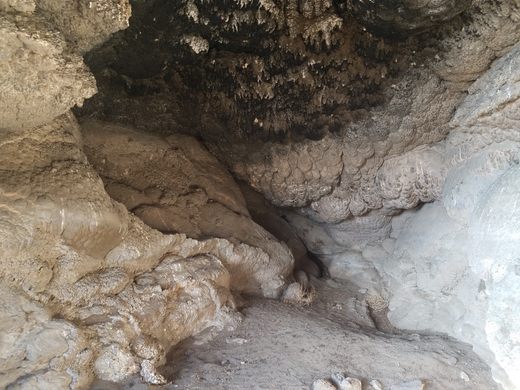
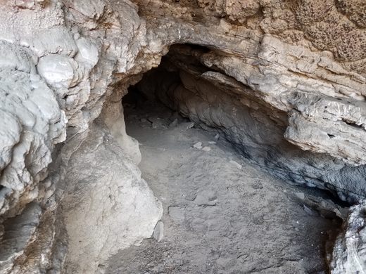
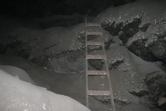
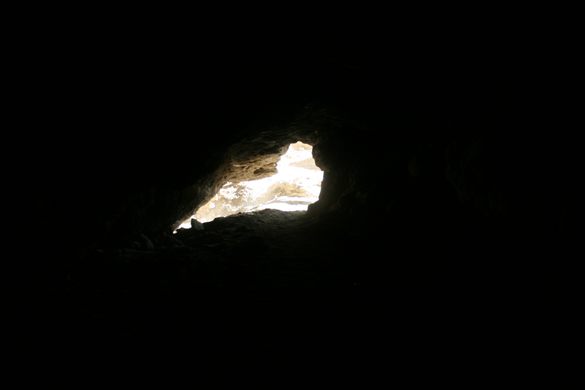
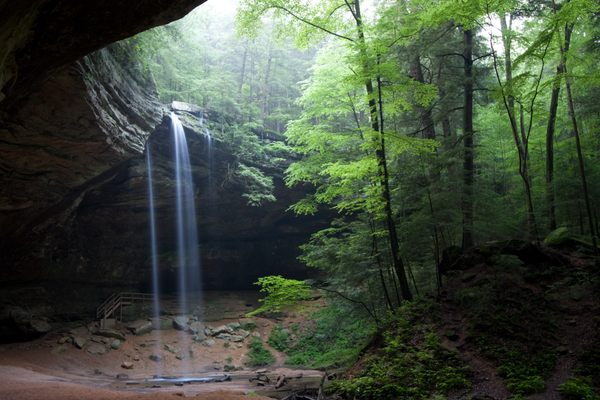
As expected, these wave-cut features were once shelters for early Indigenous inhabitants and are important archeological sites. Tufa Cave is the largest of such caves, being much larger than an alcove. A low entrance leads into a large room that is amply tall enough to stand upright. There is even a “second story,” an upper ledge inside the cave.
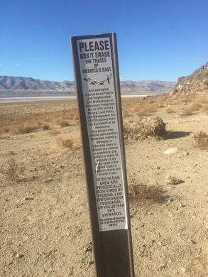
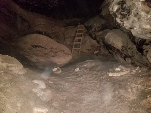
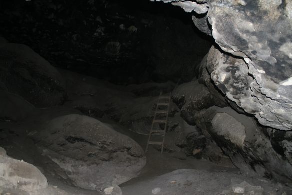
The cave was excavated professionally in the 20th century. The artifacts found are attributed to the Lovelock Culture, ranging from about 1,000 to 4,000 years ago. All recovered artifacts have been removed, but don’t disturb anything you happen to find. The ladder inside the cave was left by archeological expeditions and was used to access the upper ledge.
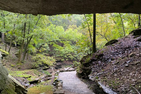
Unlike many other cave sites, Tufa Cave has little in the way of rock art. There are a few vague red possible pictographs on white tufa near the cave entrance.
Know Before You Go
Access to Tufa Cave is not straightforward. Although the powerline road described below is graded and may be passable to passenger cars, the rest of the route will require high clearance and locally 4wd.
Follow Nevada State Route 447 38.2 miles north from its intersection with SR 446 in Nixon and turn right at an intersection at roughly 40.34832 N, 119.33921 W.
This intersection will be easily recognized as it is on a prominent high-voltage powerline. Follow this powerline road for 8.9 miles and then turn south (right) at an intersection around 40.24669 N, 119.25377 W. You will cross a low pass about 0.3 miles before this intersection. The prominent drainage, where you turn, is Stonehouse Canyon.
Go south 0.3 miles down Stonehouse Canyon, then take a shallow right at a vague intersection at about 40.24194 N, 119.25334 W. (Note: at this point, you leave the routes that Google recognizes.) Proceed about 1/4 mile to the bottom of the drainage, and then follow the drainage road down Stonehouse Canyon for about 2.6 miles. At this point (40.21939 N, 119.28634 W), you cross a road extending along the range front. Turn left (south) here.
Note: Google Maps shows this range-front road extending north from this point to intersect the powerline road, and if you ask Google for directions it tries to route you that way. However, that road is extremely soft and passable only to extreme 4WD vehicles. The route described here, down Stonehouse Canyon, although requiring 4WD in places is not nearly as extreme.
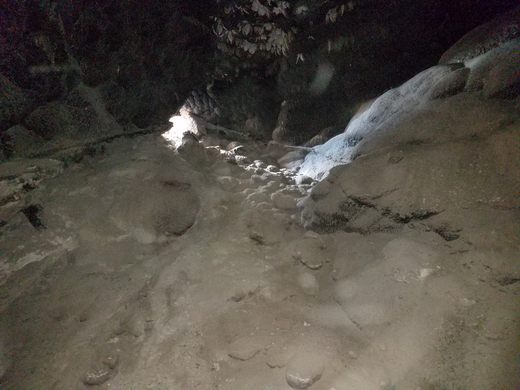
Now follow the range-front road 1.4 miles south, where there will be a turnoff onto a primitive track on the left (east), with the cave visible on the slope above. It is about 900 feet along this track to an informal parking area. High clearance and 4WD are essential here, but in any case, it's now an easy hike.
The cave is about 40.20165 N, 119.28020 W. Please don't disturb the cave features.

Plan Your Trip
The Atlas Obscura Podcast is Back!


Follow us on Twitter to get the latest on the world's hidden wonders.
Like us on Facebook to get the latest on the world's hidden wonders.
Follow us on Twitter Like us on Facebook