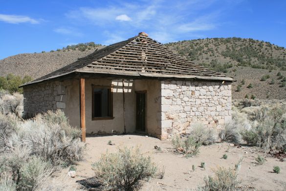
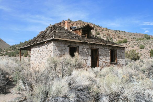
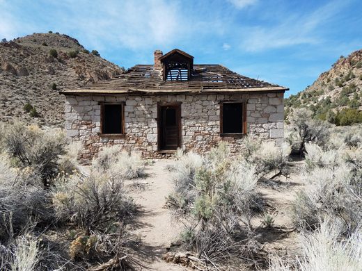
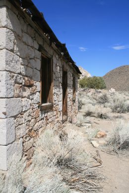
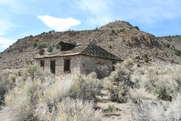
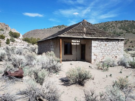
Pritchard's Station
A remarkably well-preserved stage stop from the late 19th century in a remote part of Nevada.


Nevada and the rest of the West were generally crisscrossed by stagecoach lines during the latter 19th century and even into the early 20th. It was a dusty, difficult, time-consuming, and an uncomfortable way to travel—but if there was no railroad, there were few alternatives.
Many of these old lines were ephemeral, with little trace left today. Other routes are now followed by modern highways. In a surprising number of cases, however, the line persisted for a decade or more, but the route is still about as remote as it was back when the stages were thundering. Sometimes the original destinations became ghost towns. Sometimes the modern highway takes a route that was impractical in the old days, through being too steep for horse-drawn vehicles, or simply being too expensive for the resources at the time, as by requiring prohibitive amounts of excavation, or bridges that were beyond the state of engineering.
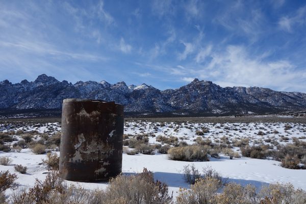
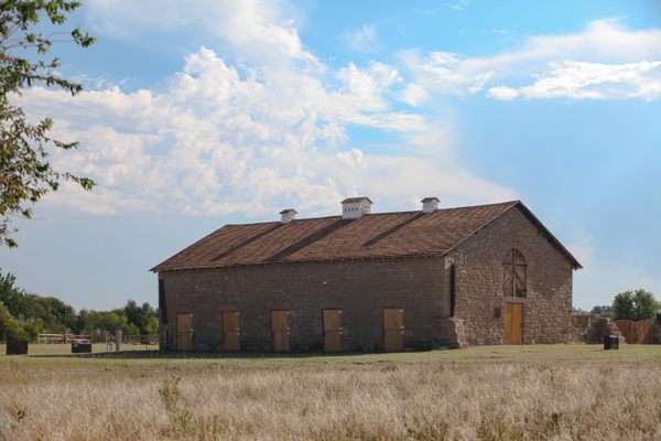
Pritchard’s station lies on one of these abandoned routes. It was on the Belmont-Tybo-Eureka stage line from the 1870s into the 1880s. It even had a post office briefly in 1874. The ruin consists of a sturdy building with stone block walls on the outside, the remnants of a wooden roof, and some dilapidated interior wooden walls. Although a few foundations, probably from stables and pens, also occur just north of the station, it now appears as an incongruous lone building out in the desert.
Know Before You Go
As befits its remoteness, access is not straightforward. The easiest access is probably off US Highway 6 to the south. One way is to take the graded road that led to the Project Faultless site.
It intersects US 6 at about 38.479947 N, 116.097973 W, about 2.5 miles west of the turnoff to Lunar Crater. It is now 12 miles to the intersection by the Project Faultless site (38.630899, -116.181636).
Instead of going to Project Faultless, take a shallow right and proceed generally northward on the graded road along the large drainage (Moore's Station Wash). In 9.7 miles, just past a large tributary wash (Pritchard's Canyon) on the right is a junction, at about 38.763007 N, 116.201603 W. Turn right here.
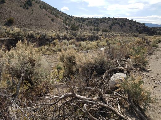
This road climbs up a ridge and then winds around before dropping down to the right into Pritchard's Canyon. After about 2.5 miles Pritchard's Station will appear on the left, at about 38.77749 N, 116.17543 W. This part of the route will require high clearance and possibly 4wd.
A spring occurs at the bottom of Pritchard's Canyon just before the station itself. This spring was a critical source of water, for both humans and horses, but in wet conditions, it can also make the road impassible.
(Note: Google Maps shows a road going directly up Pritchard's Canyon, but it has long since washed out.)

Plan Your Trip
The Atlas Obscura Podcast is Back!


Follow us on Twitter to get the latest on the world's hidden wonders.
Like us on Facebook to get the latest on the world's hidden wonders.
Follow us on Twitter Like us on Facebook