AO Edited
Gantouw Pass Wagon Trail
These 250-year-old wagon tracks are a lasting sign of Dutch migrants crossing the mountains.

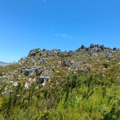


The Wagon Pass has a rich history that dates back centuries, serving as a vital connection between regions and bearing witness to the struggles and perseverance of early travelers. Originally, the path was used by migratory elands, elephants, and the indigenous Khoi people, who called it T’kanna Ouwe or Gantouw.
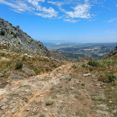
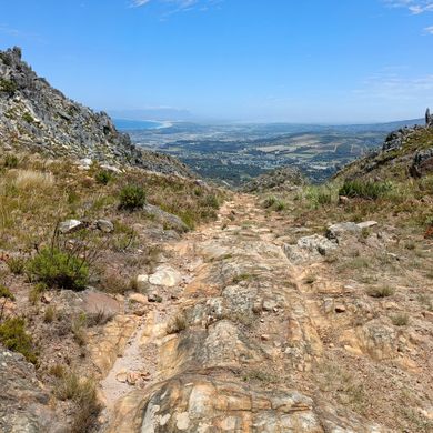
The English explorer, author, and artist Thomas Baines first traveled to South Africa in the 1840s. In one of his later accounts of traveling through the country, he described this pass. “At the first part of it, the road is not very steep,” he wrote, “but as soon as the traveller enters the hollow way of the Roode Hoogte (the Red Heights) the difficulty of the ascent begins.” He described the “barren, reddish, clayey, ferruginous earth” and the rocky mountain.” Despite the difficult terrain, wagons were attempting to navigate the road, with its steep inclines and precipitous drop-offs.
In the 1660s, cattle buyers like Hendrik Lacus and Jeronimus Cruse were possibly the first Europeans to brave the path over the kloof. By the early 19th century, ox wagons began to traverse the pass, facing the steep inclines and treacherous rocks that challenged even the most skilled drivers. The route was so dangerous that more than a fifth of the wagons were damaged, forcing travelers to devise creative solutions, such as disassembling their wagons and reassembling them at the summit.
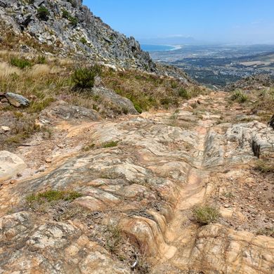
The grooves etched into the rocks along the pass serve as a testament to the hardships that early travelers encountered. These marks were created by the brake drag-shoes of the ox wagons as they descended the path. Over time, maintenance crews used shaped stones to fill in the deep grooves, but the passage of time and the elements have worn down even these newer additions.
Throughout its history, the pass has undergone various improvements. In the 1820s, Lt-General Sir Gailbraith Lowry Cole initiated efforts to create a new road with easier gradients. This road did not lie on the old pass, but a few km away. The road was widened and tarred in the 1930s, and again in the 1950s. By 1984, the upper parts of the pass were expanded to four lanes through reinforced concrete construction at a cost of R4.5 million.
The Wagon Pass remains untouched to this day, standing as a testament to the determination and ingenuity of those who traversed its challenging terrain, and the grooves in the rocks serve as a reminder of the path’s storied past.
Know Before You Go
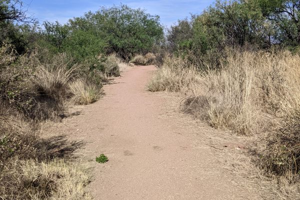
There is a semi-paved dirt road right after the curve when coming from Cape town. This road is marked on Google maps and easy to go into, but it becomes a bit risky for passenger cars after that due to the large amount of trash that is dumped on it. The best thing to do is to park your car and walk towards the point by foot.
This is a roughly 40 min hike which is very easy to do. The only difficulty is that you have to cross the tracks at one point, but after that it is just following Google's directions.
The pass can get windy which is a nice way to cool down after the walk.


Plan Your Trip
The Atlas Obscura Podcast is Back!


Follow us on Twitter to get the latest on the world's hidden wonders.
Like us on Facebook to get the latest on the world's hidden wonders.
Follow us on Twitter Like us on Facebook