AO Edited
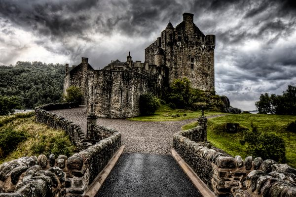
Caisteal Maol
This ruined castle is said to be the legendary keep of a Viking princess.

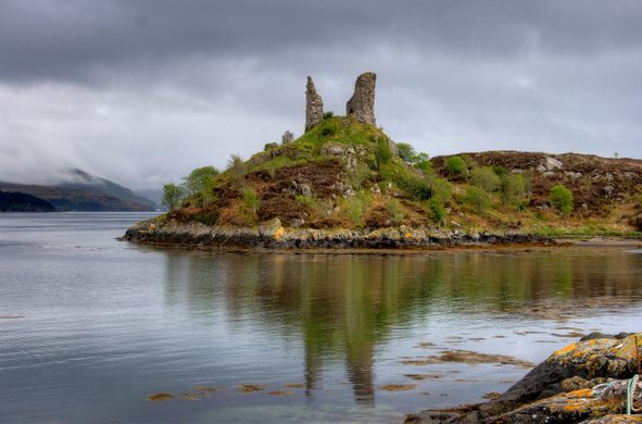
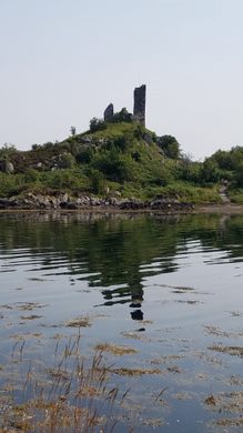

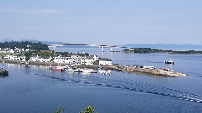
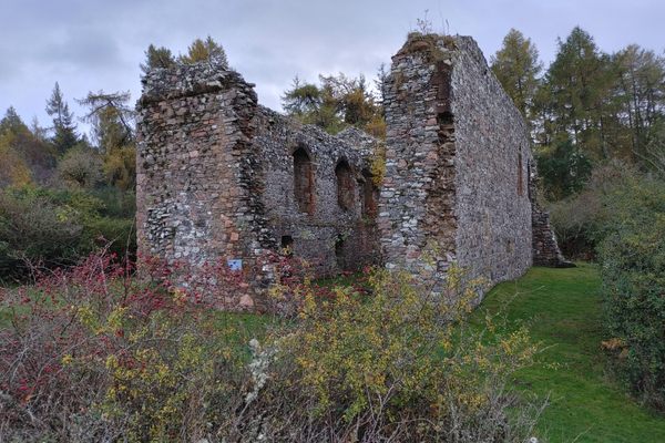
Abandoned castles come in all shapes, sizes, and states of disrepair, but few could argue that poor Caisteal Maol (Scots Gaelic for the “bare castle”) is one of Scotland’s most decrepit examples. Protruding from atop a promontory like a pair of fangs, the castle ruins brood over Kyleakin Harbor on the Isle of Skye. The remaining fragments of the castle’s walls continue to decay from harsh weather.
The ruins of Caisteal Maol probably date to the late 15th century, though Vikings may have built an even older structure on the site in the 9th century. The 15th-century castle was essentially a squarish three-story keep built to control the strait of Kyleakin between the Scottish mainland and the Isle of Skye. Ship captains far preferred passing through the strait to avoid the treacherous waters of The Minch, the sea between the western coast of Skye and the Outer Hebrides.
According to one legend, a 10th-century Norse princess known as Saucy Mary and her family controlled the keep. When Mary married Findanus, the 4th chief of Clan Mackinnon, the property was part of her dowry and the castle subsequently came under the control of the clan. Legend says, the newlyweds stretched a chain across the strait and levied a toll on ships and cargo.
Later history supports this Norse connection. Haakon IV Haakonsson, King of Norway, is believed to have gathered his fleet of longships in the strait before the Battle of Largs in 1263. The town of Kyleakin would eventually take its name from him: kyle, or “strait,” of Haakon. Even today, Caisteal Maol is known by some as Dun Haakon or Dunakin Castle (literally “fort of Haakon”).
Clan Mackinnon controlled the castle throughout the Middle Ages. Sometime during King James IV of Scotland’s reign between 1488 and 1513, the clan rebuilt the keep.
Caisteal Maol was likely abandoned in the early 17th century. The centuries-old building was likely too drafty and uncomfortable to serve as a residence.
A short hike to the site at low tide affords an opportunity to see all that remains up close. Seriously compromised by storm-related deterioration in 1949, 1989, and most recently in a lightning storm in 2018, what little is left has been consolidated and stabilized for safety. On a clear day, visitors can see the harbor and the village of Kyleakin, the Skye Bridge, and the Scottish mainland from the castle ruins.
Know Before You Go
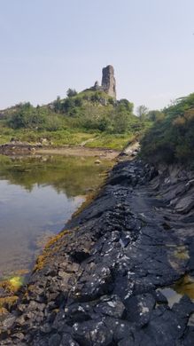
Whether you are taking the Skye Bridge on or off the island, it is worth the very short detour into the charming village of Kyleakin. To reach the castle, take the South Obbe Road across a narrow land bridge, and follow it till it dead-ends at a tiny parking area with room for just a couple of cars. The trail to the ruin is marked by a new signpost that displays a map of the hike and how to reach the ruin at low tide.
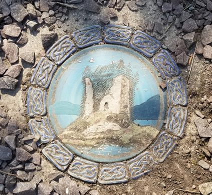
Be sure to look down and notice the ceramic tile embedded at the start of the trail, bearing an image of what the castle may have looked like back in the day. The trail got a long-overdue facelift back in 2021; in addition to new interpretive signs, greenery was cut back and new gravel was brought in.
As you make your way around the inlet toward the castle, you'll pass by the Johan, a wreck of a fishing boat. Beware the tides and take care: The path will lead you onto stones that will be slippery.
Once you reach the base of the hill beneath the castle, footpaths lead up to the ruins. There's even a handy bench facing back toward town, a perfect place to catch your breath and take some more photos of the lovely scenery.


Plan Your Trip
The Atlas Obscura Podcast is Back!


Follow us on Twitter to get the latest on the world's hidden wonders.
Like us on Facebook to get the latest on the world's hidden wonders.
Follow us on Twitter Like us on Facebook