AO Edited
The Fairview Lift Bridge
A railroad lift bridge that was only lifted once and became obsolete before construction was finished.

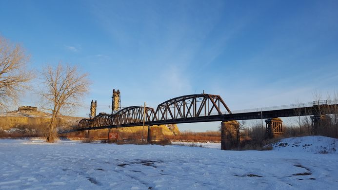
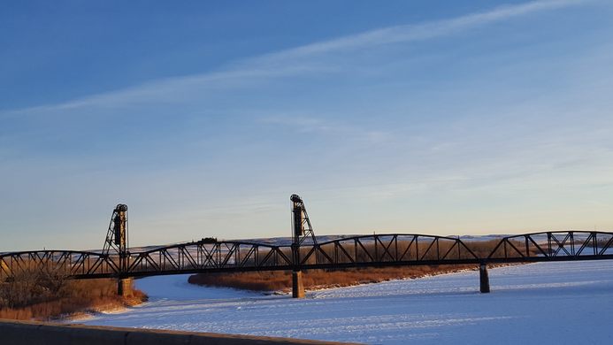
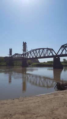
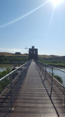
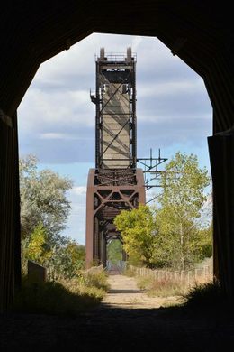

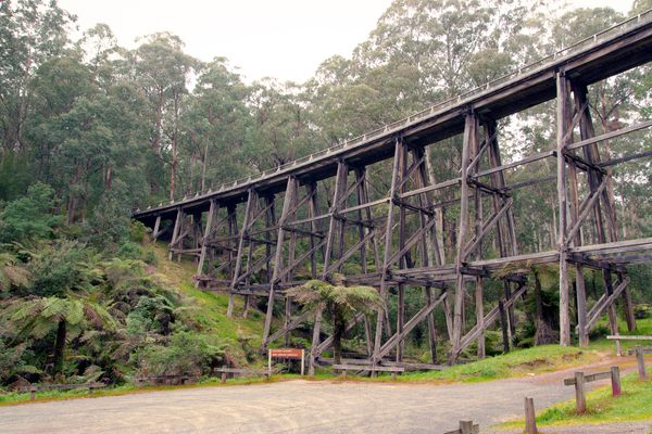
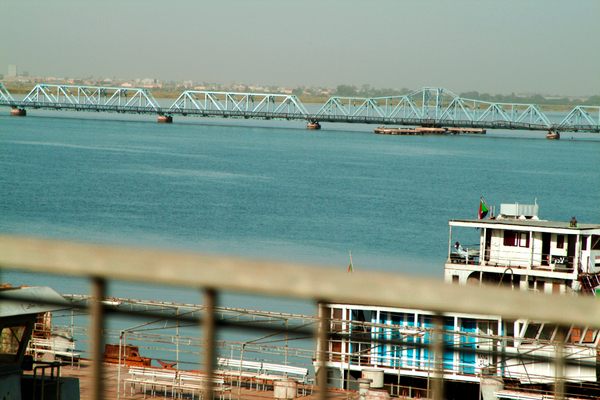
The Fairview Lift Bridge is a railroad bridge spanning the Yellowstone River, and is the only lift bridge in North Dakota (although it does have a twin located nine miles north and crossing the Missouri River in Montana). Its complicated lifting mechanism was only used a single time, before the bridge was even technically complete.
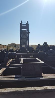
Named after the town of Fairview, Montana located five miles to the west, construction on the bridge and its twin, started in 1912 and was completed in the fall of 1913. Because the Yellowstone River is considered navigable by the United States government, a lift mechanism was required to accommodate steamboat traffic on the river. The lift span needed to clear an average river level by 80 feet. The bridge was lifted once in a test, rising 43 feet in 30 minutes, but the lift mechanism was never used again because steamboat traffic on the lower Yellowstone River ceased in 1912.
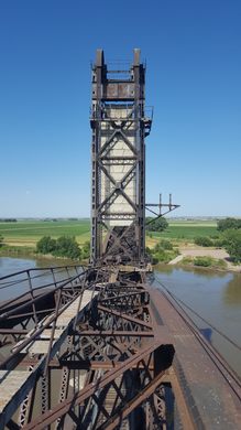
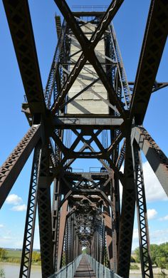
Lift machinery, located on top of the lift span, included a three-cylinder kerosene engine that was aided by counterweights containing 343 cubic yards of concrete. The weights are connected to the lift span, via the lift towers, by cables two inches in diameter. The lift span weighs 1.14 million pounds and measures 271 feet long; the lift towers are 106 feet tall. The entire lift structure is 1,320 feet long. Including a long wooden trestle on the west end, the bridge was 2,994 feet long, but in 1969 the trestle was filled over with 80,000 cubic yards of earth and gravel. Approximately 4.5 million pounds of steel were used in the bridge construction, which cost nearly $500,000.
The bridge also served as an automobile bridge soon after its completion, although crossing the bridge and the long trestle to the west was difficult. In 1926, the bridge was modified to accommodate both automobiles and trains, with wooden planking covering the deck and access routes constructed at each end. The dual-use was still hazardous though, so a watchman was employed to operate a swing gate and telephone system to allow automobiles to travel across. The railroad operated the bridge as a toll bridge until 1937, when the North Dakota State Highway Department assumed maintenance and the watchman’s salary. Cars continued to use the bridge until 1955, when a vehicle bridge was built a few hundred yards north.
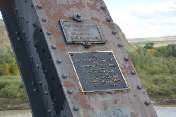
The last train crossed the bridge on June 5, 1986. Currently, the bridge is open for use as a walking path, along with the adjacent Cartwright Tunnel.
Know Before You Go
From Cartwright, ND head west on ND-200. Immediately after crossing the Yellowstone River, turn left into Sundheim Park. The bridge is located at the south end of the park.
From Fairview, MT head east on MT-200, which becomes ND-200 as it crosses the state line. Just before the highway crosses the Yellowstone River, turn right into Sundheim Park. The bridge is located at the south end of the park.
Community Contributors
Added by

Plan Your Trip
The Atlas Obscura Podcast is Back!


Follow us on Twitter to get the latest on the world's hidden wonders.
Like us on Facebook to get the latest on the world's hidden wonders.
Follow us on Twitter Like us on Facebook