AO Edited
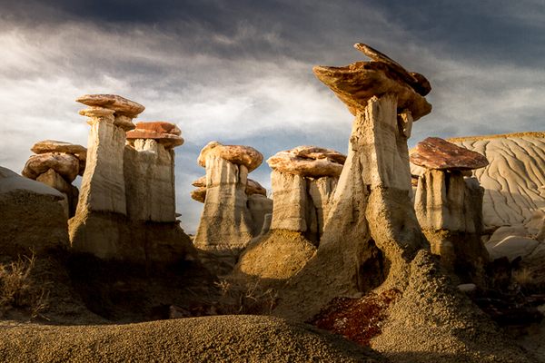
Ah-Shi-Sle-Pah Wilderness Study Area
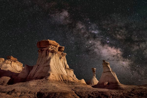
The land is full of geologic eye candy, such as otherworldly spires, mushroom-shaped hoodoos, and prehistoric fossils.

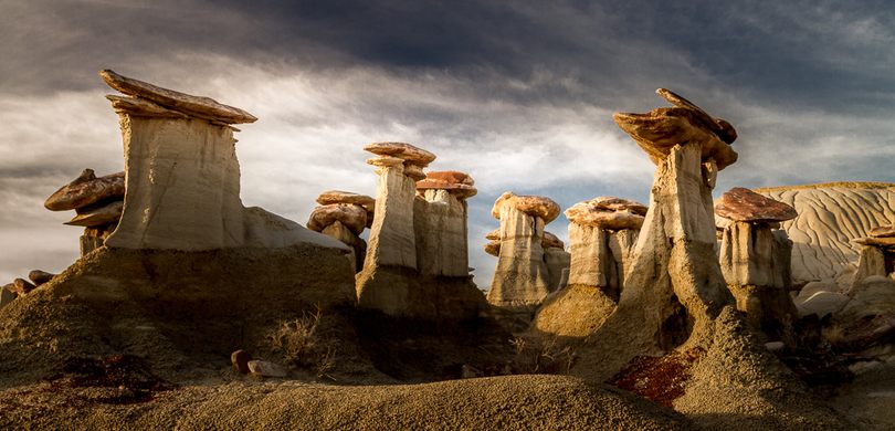
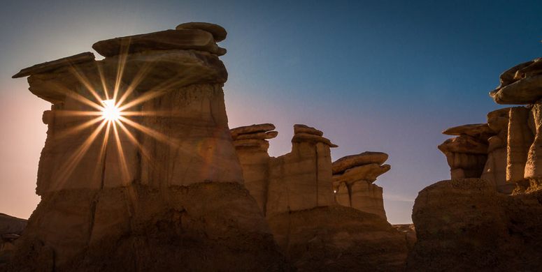
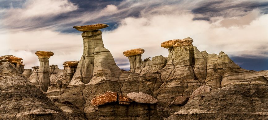
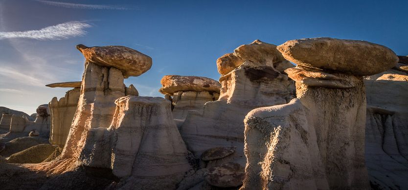
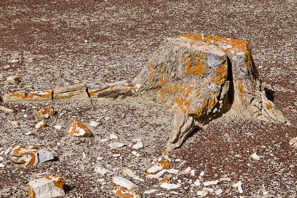
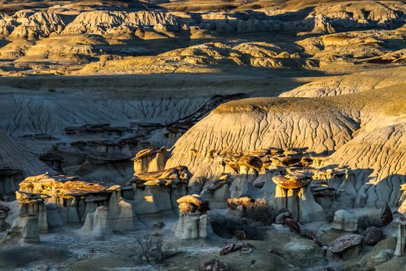
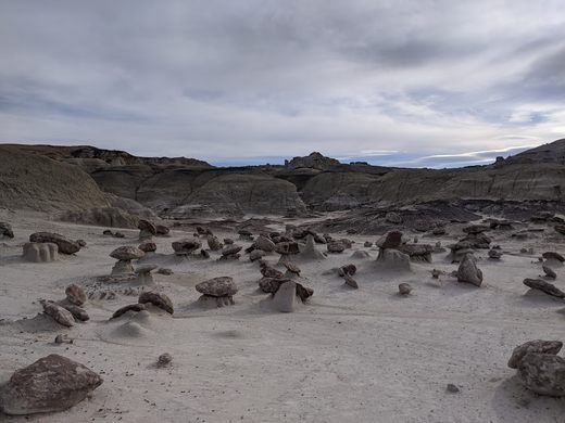
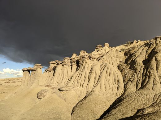
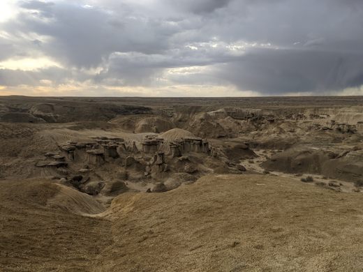
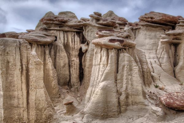

With its muted colors and striking geology, this unusual landscape feels like a martian planet. Pale, mushroom-shaped hoodoos loom above the rocky earth like enormous alien trees. Petrified tree stumps and ancient bones speckle the badlands like prehistoric markers of its long-gone inhabitants.
Located in the arid San Juan Basin of northwest New Mexico, the Ah-Shi-Sle-Pah Wilderness Study Area is located on 6,563 acres of public Bureau of Land Management land. It’s a hidden wonder of weathered rock formations often referred to as hoodoos (not to be confused with witchcraft or the evil eye), tent rocks, fairy chimneys, earth pyramids, or mushrooms.
Geologically, the area is comprised of layers of sandstone, shale, mudstone, and bituminous coal that were deposited 75 million years ago during the late Cretaceous era. A whopping 75,000 millennia of wind, water, and ice weathering and eroding the layers are responsible for the surreal and alien-esque landscape.
Because of its geologic age and climate, the area is rich with animal and plant fossils. The remains of prehistoric crocodiles, turtles, fish, and dinosaurs are sprinkled throughout the land. You’ll also see petrified wood, including numerous upright tree stumps with roots. Fossils are not allowed to be collected.
While it’s somewhat challenging to get there, visitors are rewarded with a tranquil, if not dreamlike, environment which is easy to navigate. Although the formations extend for six miles along the Ah-Shi-Sle-Pah Wash, the most accessible and picturesque formations are within one to two miles of the parking area and can be seen within half a day of easy walking along the generally flat terrain.
Know Before You Go
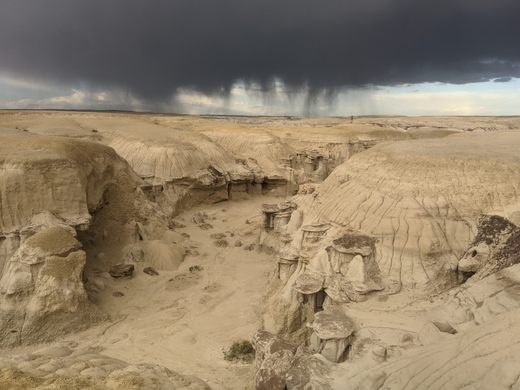
This is relatively obscure and remote. It's unlikely you'll encounter more than a handful of other visitors if any. The drive there includes almost 15 miles of unpaved road.
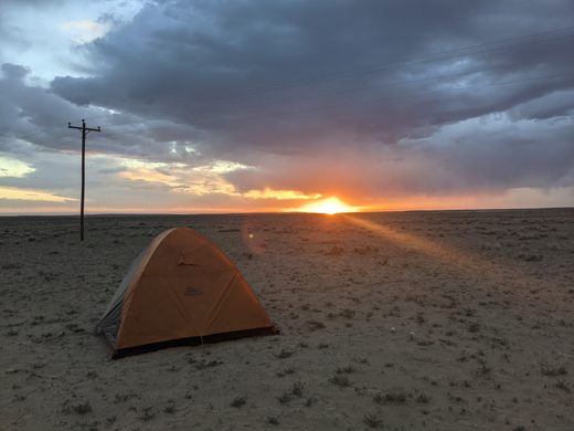
No running water and no toilets and no staff so come prepared with food and water and, if staying for a while, toilet paper and either a plastic bag for packing it out or a shovel for burying. Camping is allowed and it's free, but no campfires.
From Bloomfield, New Mexico, take US 550 south to Nageezi. Turn right on 7820 and left on 7786. Do not take 57 - it is an unmaintained and treacherous gravel road. Follow the GPS/Google Maps directions, but when it's time to park, keep going until you reach a small parking area on the right (marked by a massive Ah-Shi-Sle-Pah Wilderness sign). If you park exactly where the GPS tells you to stop, you'll be on the side of the road. At the trailhead, the 2-track road is blocked off so follow it on foot to the starting point.
This is the Bureau of Land Management land. A good GPS might be helpful in finding your way back to the car. The dirt roads and clay you will be hiking on becoming very slick when wet, so be mindful of the weather. You are pretty much out in the middle of nowhere (it’s 20 miles to the US highway), and there is very little cell coverage.
Community Contributors
Added by


Plan Your Trip
The Atlas Obscura Podcast is Back!


Follow us on Twitter to get the latest on the world's hidden wonders.
Like us on Facebook to get the latest on the world's hidden wonders.
Follow us on Twitter Like us on Facebook