Learn a New Climate Change Phrase: ‘Heat Dome’
As the Southwest faces scorching temperatures, this phrase is dominating weather discussions.
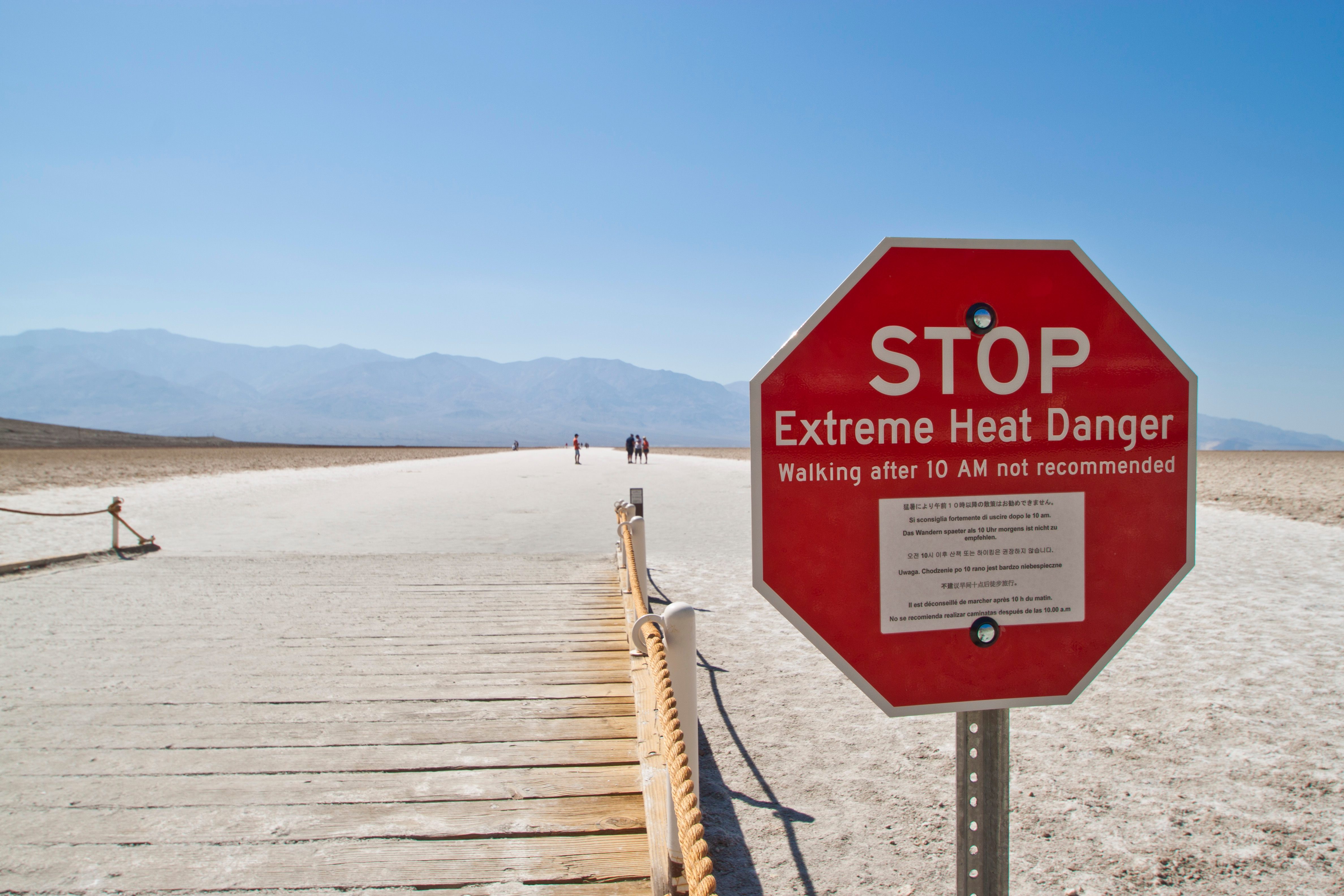
An extreme heat warning in Death Valley. (Photo: Graeme Maclean/CC-BY-2.0)
If you’re in the American Southwest, you’re probably already aware that your weekend has been dominated by what may become a record-breaking heat wave in the area, with temperatures hitting the triple-digits across the region.
The National Weather Service has issued Excessive Heat Warnings, and local officials are encouraging citizens to avoid going outdoors while preparing first responders to help particularly vulnerable groups.
To paraphrase a pop music hit, “Welcome to summer, it’s been waiting for you.”

Temperature forecast for 5PM Sunday; temperatures are expected to peak on Monday, the first day of summer. (Image: National Weather Service)
What’s behind the high-temperature summer kickoff? An increasingly common meteorological phenomenon dubbed the “heat dome.” Basically, heat domes are created when a high-pressure system forms in the mid- to upper-atmosphere; the air pressure pushes warm air down towards the surface and traps it there, resulting in higher — often much higher — than normal temperatures. The term first came into heavy use in 2011, according to a New York Times investigation into its growing popularity, although many meteorologists quibble with its descriptive accuracy. As Oklahoma City weatherman Gary England told the Times, “I’ve used ‘heat dome’ off and on over the years, but I think it’s a little bit misleading; it’s not shaped like that.”
“Heat bubble,” actually better describes the shape, according to experts, but it also lacks the apocalyptic connotations that many suffering through temperatures over 100º probably feel is warranted.
Indeed, it’s difficult to understate the extremity of a heat dome’s effects; last year, a heat dome over the Middle East resulted in a heat index of 165º — the second-highest heat index ever recorded anywhere — in Iran.
This weekend’s heat dome has the potential for similar record-shattering effects. The intensity of the high pressure ridge that creates a heat dome is measured by “geopotential height,” and computer models are placing the geopotential height of this heat dome well outside the normal climate range. As the Washington Post explains, this means the models “predict this ridge will be more extreme than anything observed in this particular climate data set that dates back to 1979.”
Already, the heat has caused power outages in Orange County, California, and officials are worried the temperatures could make the still-burning Sherpa fire in Santa Barbara county even worse, warning of the potential for “extreme fire behavior” or spreading.
As with many other extreme weather events around the world, climate change may be making heat domes more common than ever. Earlier this week, the Washington Post detailed the findings of meteorologist Ryan Maue, who examined climate data going back to 1953 and concluded that heat domes are getting both more frequent and more extreme. Maue believes the overall rise in global temperatures due to climate change has created an environment more conducive to extreme weather, including heat domes. “I’d surmise that the [6,000-meter] threshold — while an arbitrary big round number — is now more easily exceeded,” he told the Post.
Since 1958 only 3 other events w/max height over W USA > 6005 m (Sun forecast)
— Ryan Maue (@RyanMaue) June 15, 2016
July 7, 1989: 6020 m
Aug 7, 2001: 6011 m
Aug 15, 2003: 6008 m
In 2013, National Climatic Data Center scientist Jake Crouch made a similar assertion, explaining to Livescience that while individual weather events can’t really be linked to long-term trends, the overall increase in average temperature does increase the frequency of events like heat domes. In the same article, University Corporation for Atmospheric Research scientist Jeff Weber pointed out that as the Arctic warms, the jet stream — which is “powered” by the differences in polar and equatorial temperatures — grows weaker, meaning the high-pressure systems behind heat domes stay in place longer. So, not only can we look forward to more heat domes, they may last longer as well.
It’s certainly not what Arizonans, who face potential highs of 120º tomorrow, hoped to hear. If you’re living under the dome right now, make sure to stay hydrated, limit time outdoors, and keep an eye on pets and neighbors. Currently, temperatures are expected to start falling on Tuesday.


Follow us on Twitter to get the latest on the world's hidden wonders.
Like us on Facebook to get the latest on the world's hidden wonders.
Follow us on Twitter Like us on Facebook