The Struve Geodetic Arc
A historic scientific breakthrough that crosses nine borders.


It took Friedrich Georg Wilhelm von Struve 39 years to measure the Earth. He started in 1816 at the Dorpat Observatory in Estonia. From there, under his leadership, a team of scientists triangulated a line up to Hammerfest in Norway, and down to the Black Sea.
When he finished in 1855, Struve had the first accurate measurement of a meridian and was able to calculate the exact size and shape of the Earth. It was a huge leap forward for science and helped cartographers to make more precisely scaled maps.
The line stretches farther than 1,700 miles, a chain of survey triangulations across 256 measure points. It traverses 10 countries, currently linking 34 markers that are all recognized as World Heritage Sites.
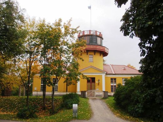
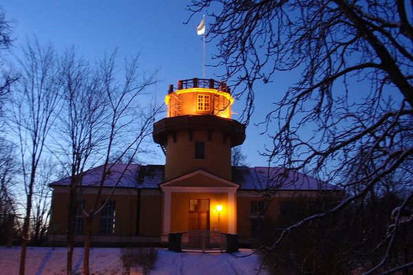
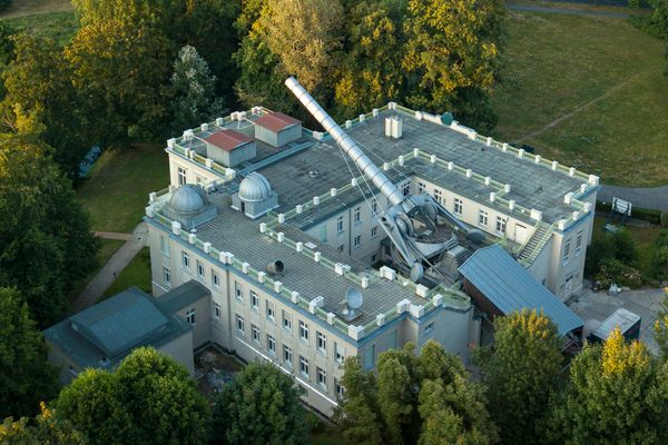
The Dorpat Observatory where Struve started is now the Tartu Old Observatory, part of the University of Tartu. The last scientific measurements there happened around 1985―it had been used mostly for office space since 1964 when a larger observatory was built nearby in Tõravere. In 2010 the University reconstructed the observatory and it has served as a museum since.
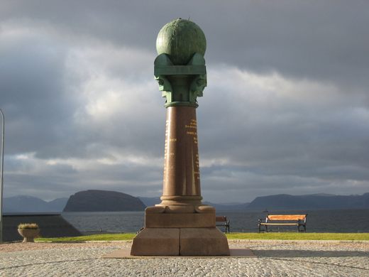
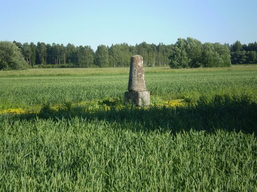
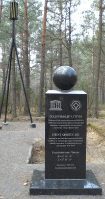
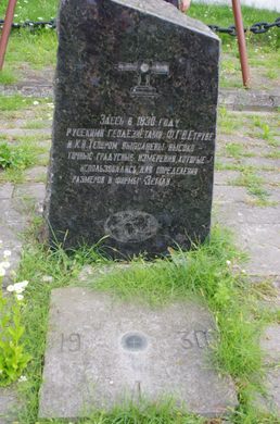
The markers vary greatly. There’s a monument at the northernmost point in Hammerfest, and various plaques along the way, but some are as simple as a small hole drilled in a rock or engraved markings on a stone in the middle of an otherwise empty field.
Know Before You Go
The Wikipedia article (https://en.wikipedia.org/wiki/Struve_Geodetic_Arc) details where to find the 34 points in the Struve Geodetic Arc.


Plan Your Trip
The Atlas Obscura Podcast is Back!


Follow us on Twitter to get the latest on the world's hidden wonders.
Like us on Facebook to get the latest on the world's hidden wonders.
Follow us on Twitter Like us on Facebook