The Road through Naypyidaw
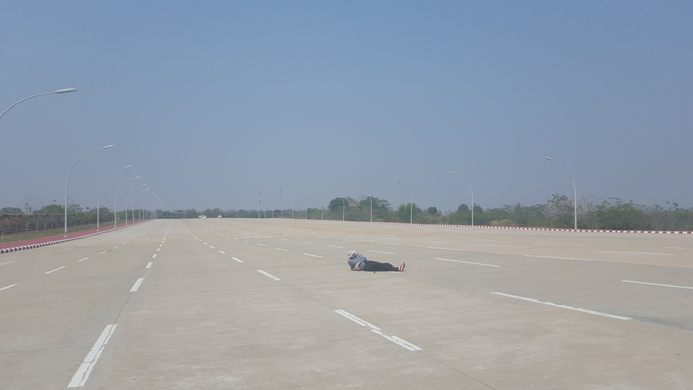
A deserted 20-lane highway runs through Myanmar's empty capital city.
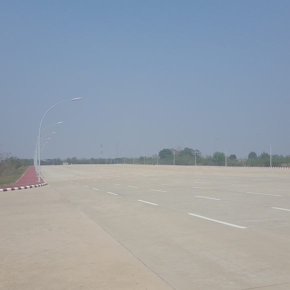
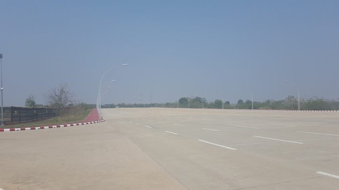
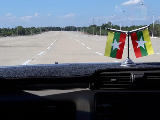

Few people visit Myanmar’s new capital city of Naypyidaw, despite the government’s claim that it houses one million inhabitants. Fewer still can be seen driving along the often empty streets. When these streets include a 20-lane highway which leads to the parliamentary buildings, one could be forgiven for wondering why such a gargantuan road, or the city itself, was necessary.
Some reports suggest that the nervous president overseeing the construction of this new capital–for the entire thing was custom-built over an unknown number of years, in previously uninhabited jungle–insisted on the giant boulevard so that it could act as a runway for planes in case of riots.
The reasons the government chose to relocate the capital from Rangoon (the previous capital) to a patch of previously uninhabited jungle 200 miles north remains equally unclear. Naypyidaw translates as the “abode of kings” and is six times larger than all of New York City. The project has been explained away as an “act of vanity,” the result of an astrologers warning, and as a way to cement power through sheer scale and geography. Naypydaw has also been described as the world’s largest ghost town.
There aren’t many capital cities in the world which boast 20-lane highways and fewer still where it’s possible to lie in the middle of the road and take photos.
Know Before You Go
Regular trains run from Yangon (Rangoon) to Naypyitaw, but from the station onwards, the only way to travel around the sprawling, empty city is by car or taxi.
Community Contributors
Added by


Plan Your Trip
The Atlas Obscura Podcast is Back!


Follow us on Twitter to get the latest on the world's hidden wonders.
Like us on Facebook to get the latest on the world's hidden wonders.
Follow us on Twitter Like us on Facebook