Found: A Hand-Drawn Map of Detroit from 1790
There are no robocops to be seen.
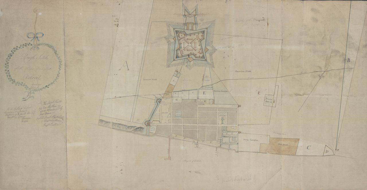
Ah, Detroit. (Photo: Courtesy of the William L. Clements Library)
Detroit just ain’t what it used to be. Especially according to a centuries-old, hand drawn map that was recently discovered in an Ontario, Canada home.
As the Detroit Free Press is reporting, the map was discovered by an Ontario family, having been originally purchased by one of the family members back in the 1930s. The 21-x-40-inch map paints the borders of the city of Detroit as they would have been in 1790. The strip of America had been claimed by the founder of Detroit, Antoine Laumet de La Mothe Cadillac back in 1701, and the historic map shows the east and west boundaries of the parcel he knew as the “Domain.”
In addition to being delicately illustrated and lovely, the map depicts an otherwise unknown period in the history of the city, just before the British were to evacuate, leaving the land to the burgeoning United States. The thin-lined map also shows locations of planned military fortifications that never saw fruition, but the plans for which, hint at the defensive mindset of the Detroit citizens of the day.
Now the map resides in the collection of the William L. Clements Library at the University of Michigan, where it will stay, to remind us of heritage of one of America’s most historic cities.


Follow us on Twitter to get the latest on the world's hidden wonders.
Like us on Facebook to get the latest on the world's hidden wonders.
Follow us on Twitter Like us on Facebook